BROKEN HAND PEAK
(13,573’)Sept. 2, 2017
By Tim Briese
11.5 miles, 4100’ elevation gain, 10:30 roundtrip time
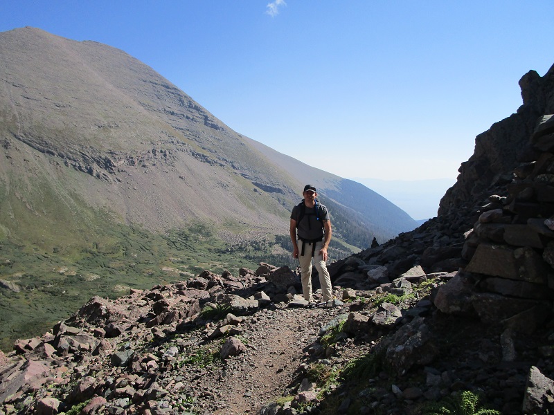
I picked up my son-in-law Rod at 430 am and we drove to the South Colony Trailhead on a beautiful Saturday morning. There were about a dozen vehicles parked at the lower 2WD trailhead and we continued two and a half miles up the 4WD road to the upper parking lot at 9900’. The road was not as bad as the national forest guy had made it sound on the phone, if you have the right vehicle and drive it well. The road required high clearance for sure, and 4WD at a tricky spot where a culvert was partially washed out on a steep grade about a mile(?) before the upper trailhead. Some vehicles that couldn’t negotiate this spot were parked off the side of the road below this crux. We knew it would be very busy here on this Labor Day weekend but we chose to go today anyway because it worked best in our schedules and with the weather. Sure enough the upper trailhead was jammed with vehicles but we managed to find a spot to squeeze off the side of the road about 50 yards below the parking lot. At 710 we left the trailhead and headed up the nice trail, which used to be the old South Colony 4WD road. We clipped off 2.6 miles up to a trail junction at 11,100’ in just over an hour, and turned right onto the trail that leads directly up to the South Colony Lakes. We took a nice break at a scenic spot above the lower lake at 11,700’, then made the rough haul up the rocky trail over a lot of talus to 12,900’ Broken Hand Pass.
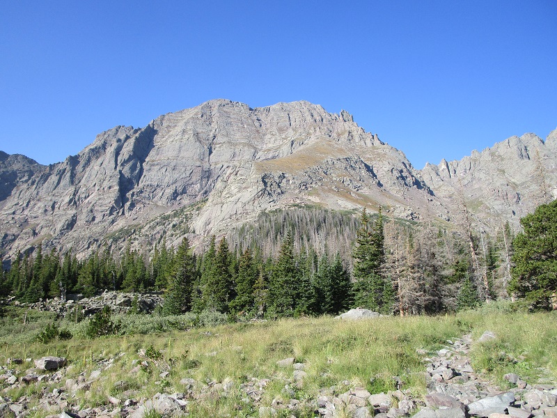
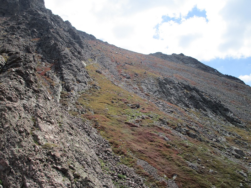
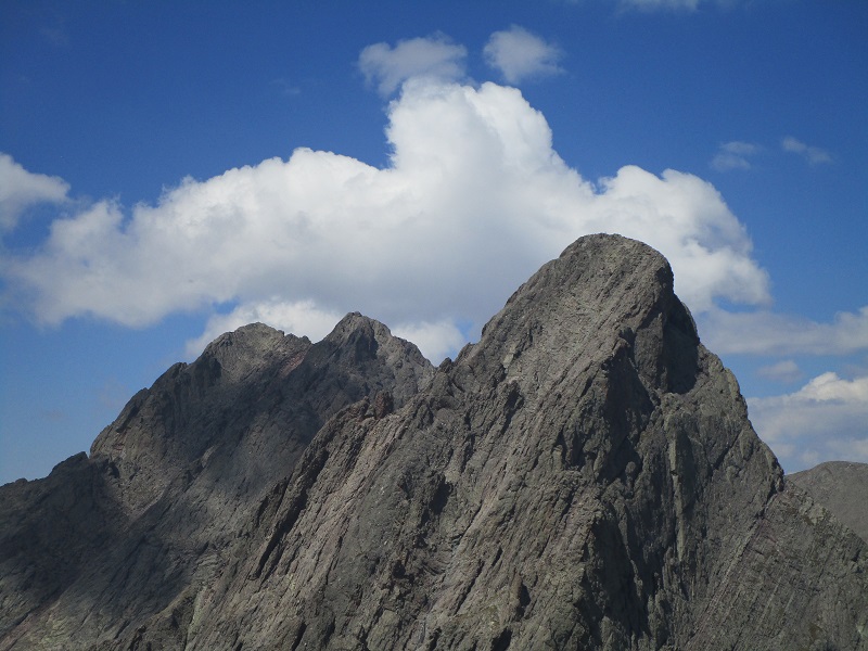
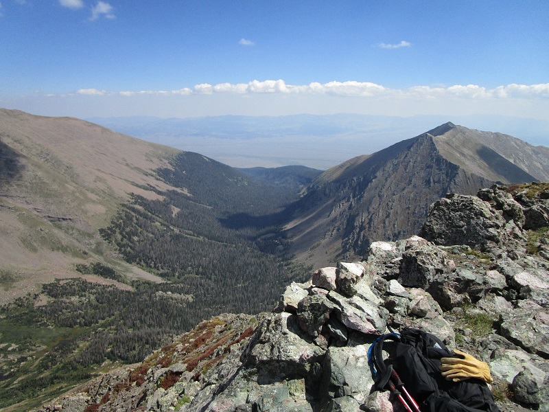
view of broken hand peak from south colony basin
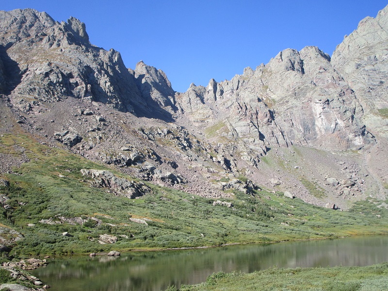
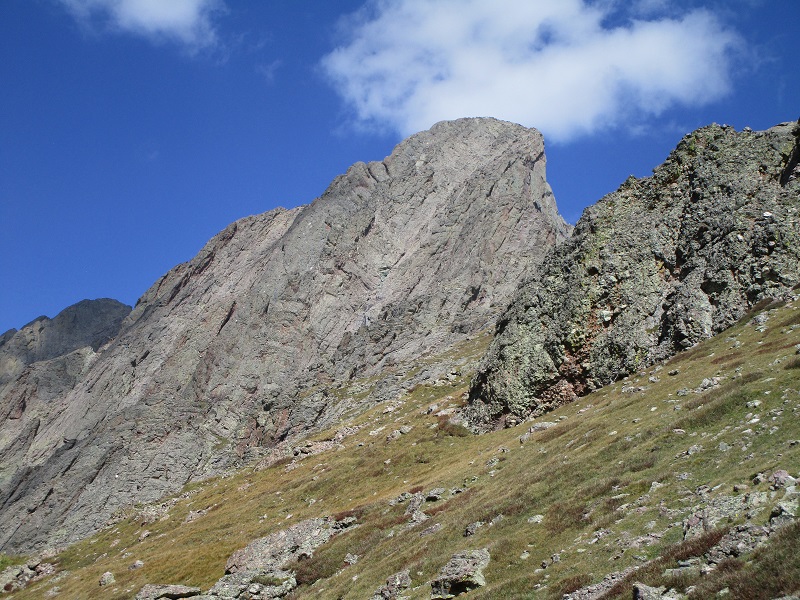
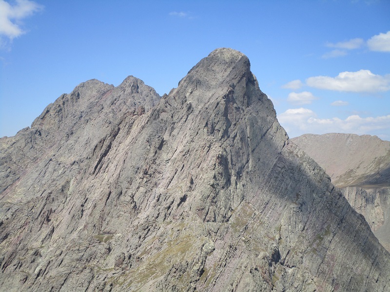
south colony lake. the saddle on the skyline above is broken hand pass, our next objective.
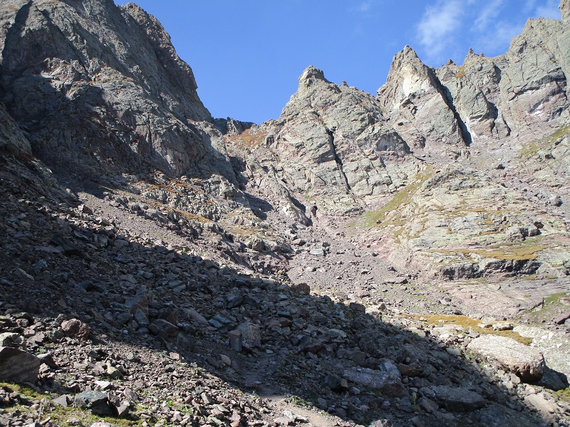
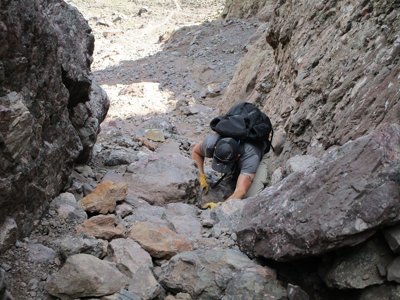
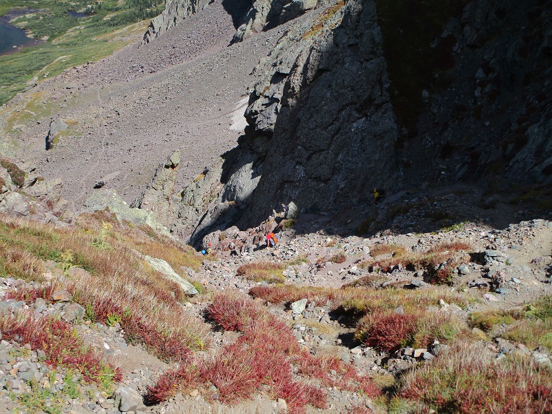
The trail up to the pass involved a lot of typical Sangre rocky footing and a fun class 3 scramble about 200 feet below the pass.
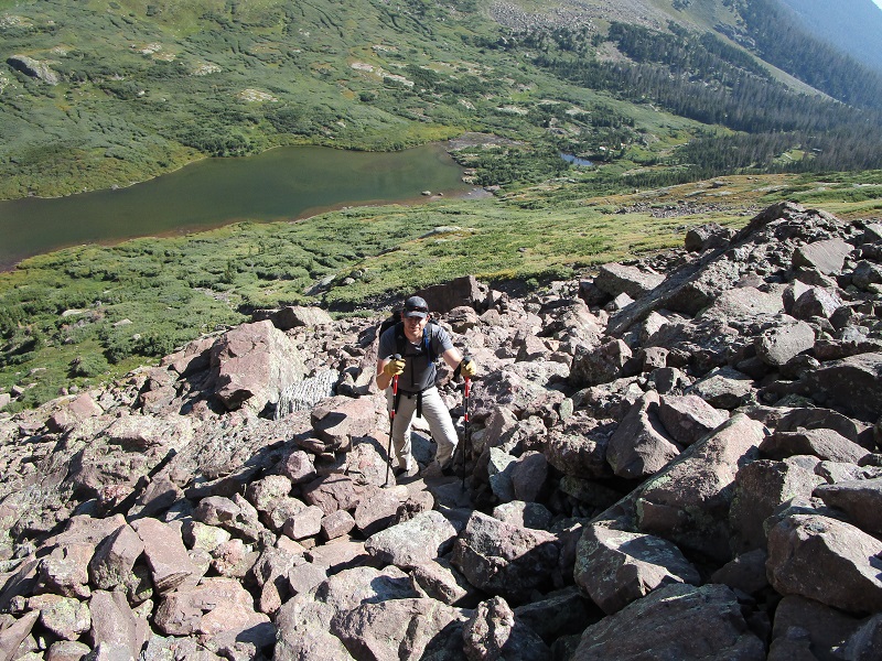
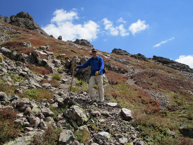
rod coming up the trail to broken hand pass
the rugged upper part of the route to the pass
rod on the trail, with humboldt peak at the upper left
the class 3 section
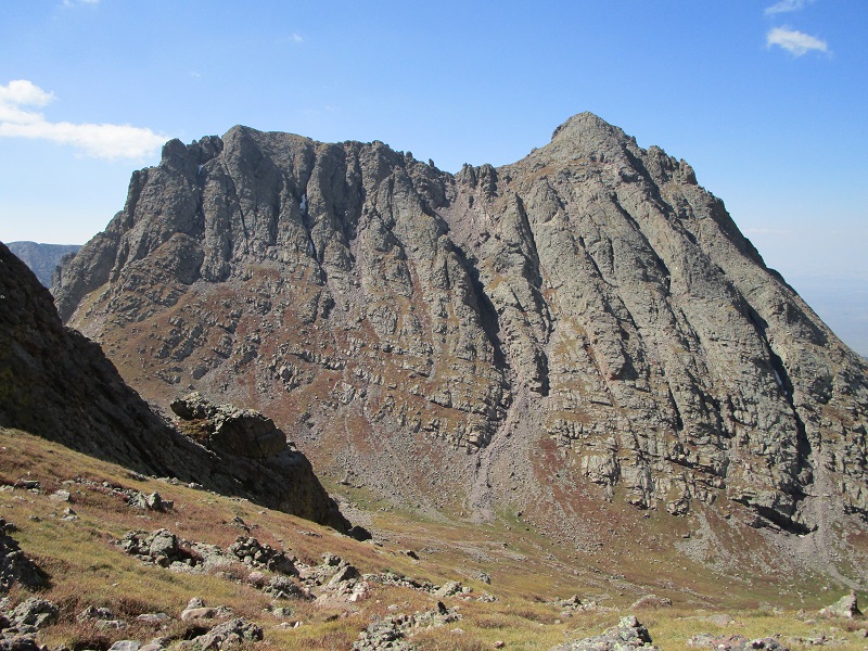
We arrived at the pass at 1120. There was a nice view of "Crestolita" to enjoy while we took a short rest there. A fellow who had climbed the Crestone Needle asked us about the way to Broken Hand Peak.
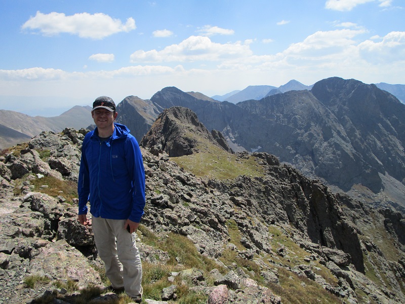
"Crestolita" (13,270'), a nearby lower 13er that was not on our agenda today
We saw scores of other climbers today, predominantly younger fellows in their 30’s or 20's, climbing 14ers Crestone Peak or Crestone Needle. One guy told us he counted 43 climbers going to Crestone Peak! Another said there were about 30 climbers on top of the Needle! Crowds and rockfall are a dangerous mix on those peaks. And another told of a harrowing and dangerous traverse from one peak to the other without ropes. No wonder climbers get killed on those peaks once in a while. We saw only 2 or 3 climbers going after 13er Broken Hand Peak today.
From the pass we dropped about 150’ down the steep trail on the west side of the pass that goes to Cottonwood Lake, in order to drop below a rocky buttress, then left the trail and turned left and angled south then southeast up toward Broken Hand Peak. We managed to pick a nice route up to our peak, mostly on very steep grass with a little scree, around outcroppings and gullies, with a slight trail to guide us in some places. We were able to keep the climb at class 2 all the way from the pass to the summit.
from the pass we dropped down to get around this large buttress on the left
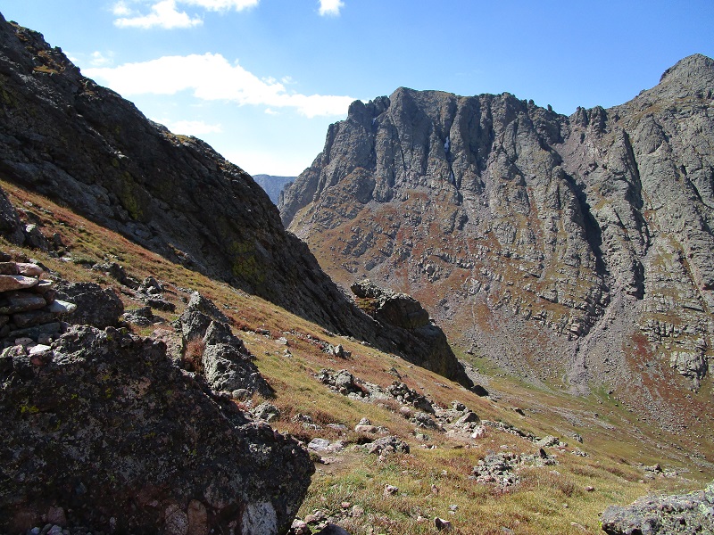
after bypassing another buttress or two we headed southeast up this slope toward our summit
a view of crestone needle as we ascended the slope toward broken hand peak
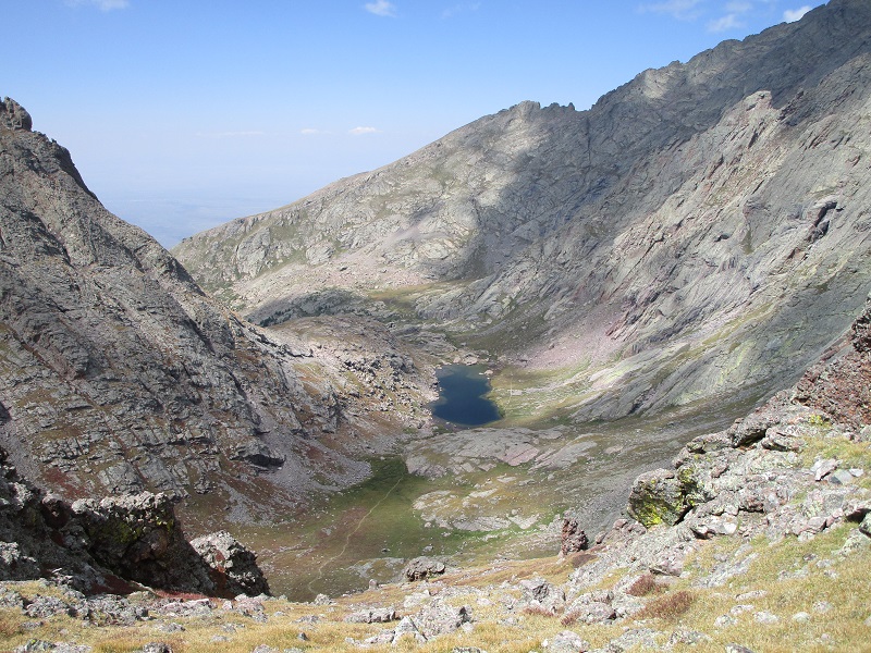
cottonwood lake in the basin below
We stepped on top at 1215 and sat and enjoyed the magnificent views for about 40 minutes. The point blank view of Crestone Needle was stunning from this vantage point. What a beautiful day to be here, too, with pleasant and nearly calm conditions.
me on the summit, with crestone needle and crestone peak beyond at the left
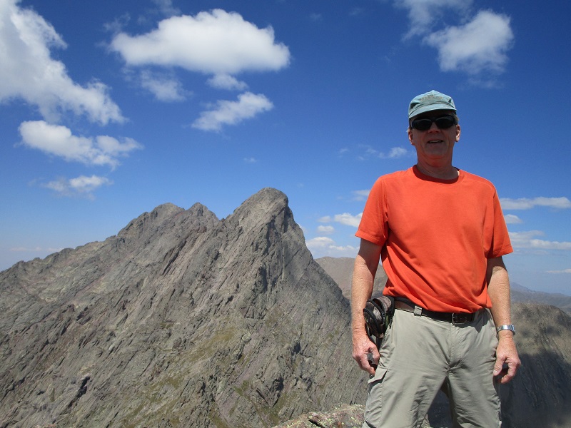
views of the crestones don't get any better than this
rod on the summit
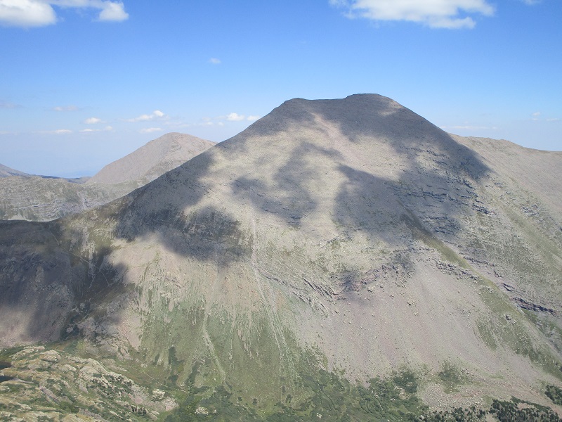
humboldt peak
the south colony creek drainage that we hiked up
We left the top just before 1 and carefully made a slow and easy descent back down the steep slopes to the pass.
heading down from the summit
There were a lot of other climbers from the Crestones going over the pass and we let a large group go first down through the class 3 section so we wouldn’t have to worry about rockfall from them above us.
heading down the loose slope from broken hand pass
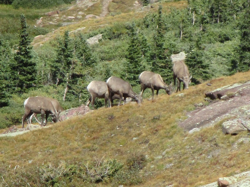
When we got lower we saw 7 bighorns grazing on a tundra meadow above the lake.
the bighorns
We took the longer southern trail from the lake that circles around the basin back to the 11,100’ junction for a change of scenery and then made the haul back down the final miles to the trailhead, where we arrived at 540. We gave two fellows a ride part way back down the road to their Subaru. Several vehicles were coming up the narrow road and getting past them was difficult at best, with many of the other drivers young males who were not prone to yielding the right of way. There was a traffic jamb at the culvert crux, with another Subaru spinning out trying to make it up, other hikers and vehicles parked all over or waiting, and some folks on horses trying to come up past all of this. The drive down the road was a "rodeo", as Rod described it. When we finally made it down to the 2WD trailhead there were now about 30 vehicles parked there. Ah, the joys of climbing on holiday weekends! But what a beautiful climb it was, in one of Colorado’s spectacular places.