CAMP MUIR, MT. RAINIER, WA
September 10, 2016
By Tim Briese
8.8 miles, 4700’ elevation gain, 9:00 roundtrip time
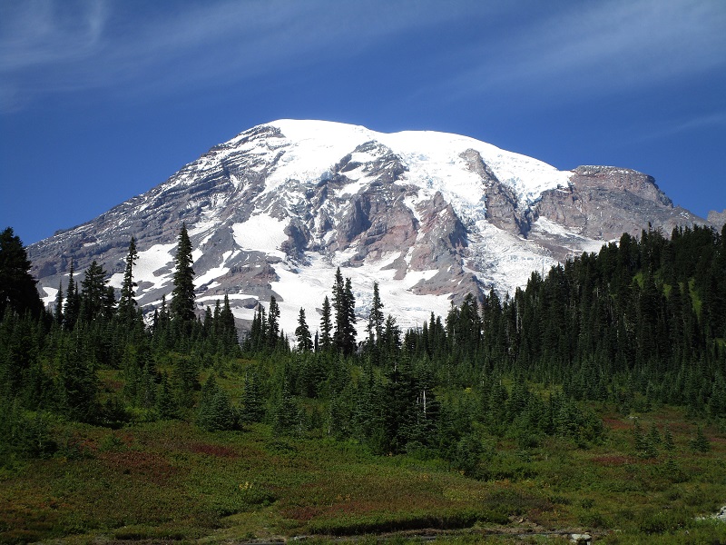
Teresa and I drove to Mt. Rainier National Park the afternoon before the hike and checked into our room at the Paradise Inn. It is difficult to get rooms at this historic and rustic old national park lodge because they book up way in advance but we were fortunate to get a reservation a few weeks ahead of time due to a cancellation. Paradise lies in a spectacular setting, with Mt. Rainier looming impressively to the north.
mt. rainier from paradise. the mighty peak towers 9000 feet above paradise.
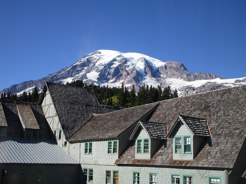
room with a view! this is the view from our room at the paradise inn.
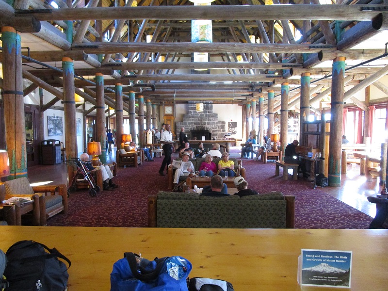
the main lodge inside the inn
We proceeded to hike around and take photos on some of the trails to the north on this beautiful clear September afternoon. Our nephew Andrew and his wife Kelyn arrived from Tacoma about dusk and we enjoyed a wonderful evening with them.
Our plan was to hike up to Camp Muir on the slopes of Rainier the next day. Camp Muir is a popular base camp for climbers of Rainier, and is as far up the mountain as hikers like us could go without a permit. It takes a serious hike to get there, with considerable elevation gain and a lot of travel on snowfields. The weather can be very fickle on the mountain and we were going to attempt this hike only if the weather were good enough, which it promised to be. Teresa decided to stay around Paradise and relax while the other three of us hiked to Muir, since her knee was bothering her a bit after all the hiking we had done in Oregon on the previous days.
We rose early the next morning and had a wonderful buffet breakfast in the dining room at the inn.
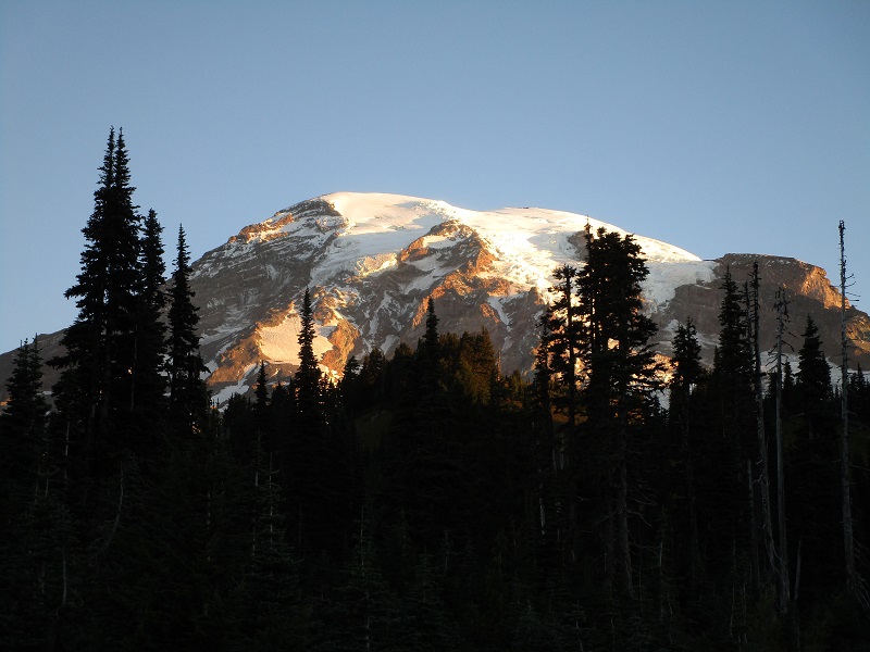
sunrise on mt. rainier
teresa, andrew, and kelyn
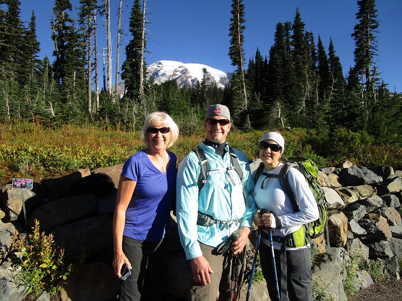
At 820 Andrew, Kelyn, and I embarked on the Skyline Trail, a popular trail that climbs steeply up from Paradise and is actually paved with asphalt for perhaps a half mile or so. The elevation at Paradise where we started is about 5400 feet. There were numerous other hikers on the trail on this beautiful clear morning. Gorgeous views opened up all around.
on the skyline trail
a view back to the south as we climbed higher

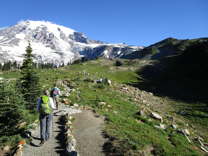
After going about two miles and climbing 1200 feet we turned left onto a trail to Pebble Creek. After a while we crossed the creek and the trail became somewhat rougher and soon all but disappeared as we reached the start of the Muir Snowfield, at about 7200 feet elevation and 2.7 miles from Paradise.
on the trail to pebble creek
crossing pebble creek
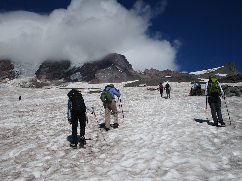
we are about to begin hiking up the muir snowfield
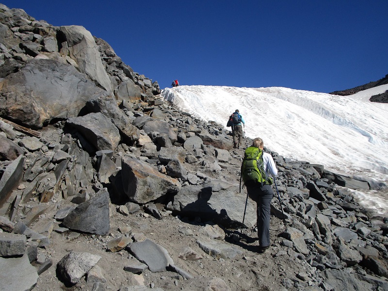
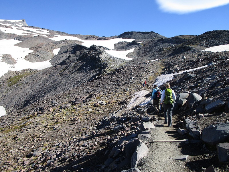
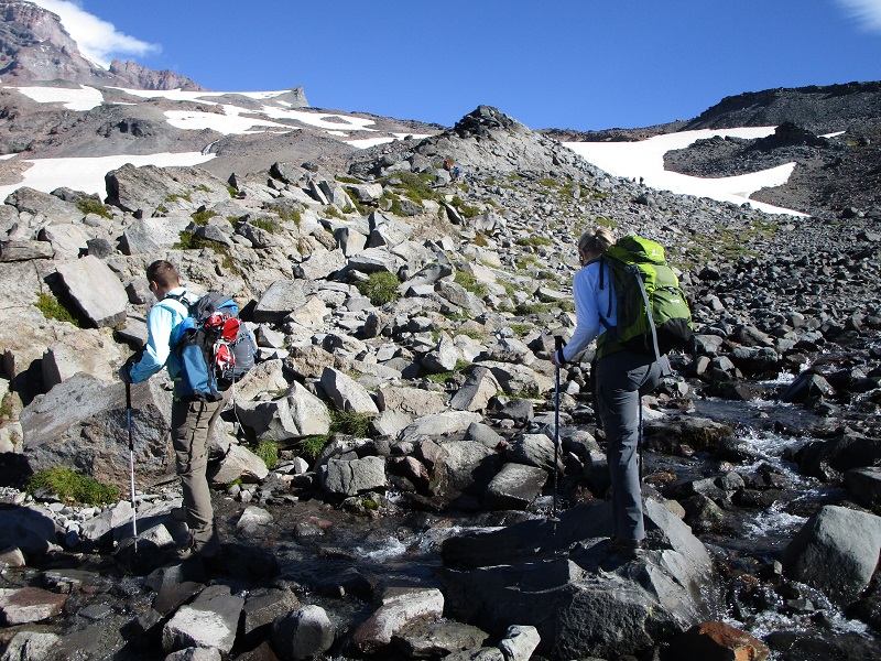
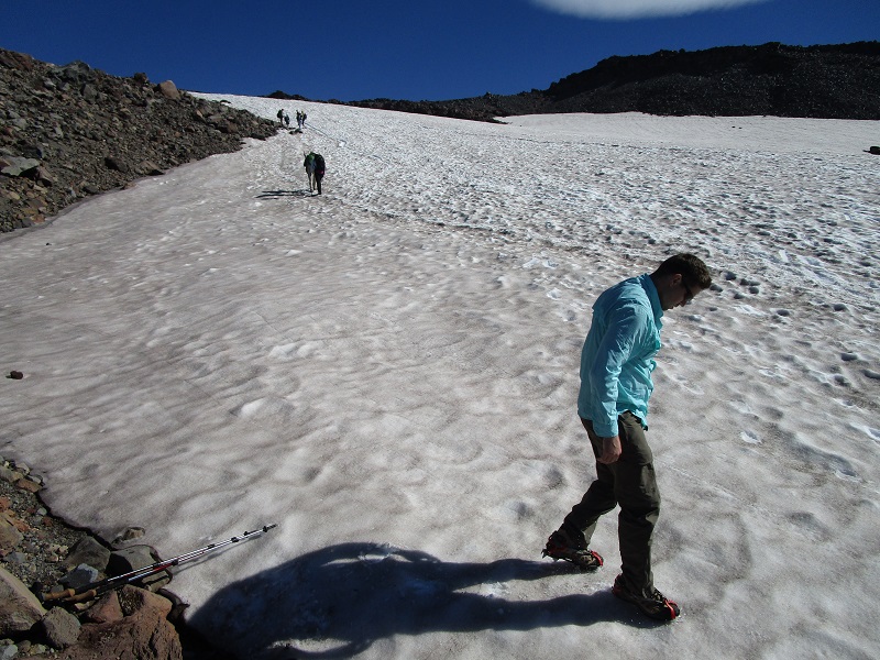
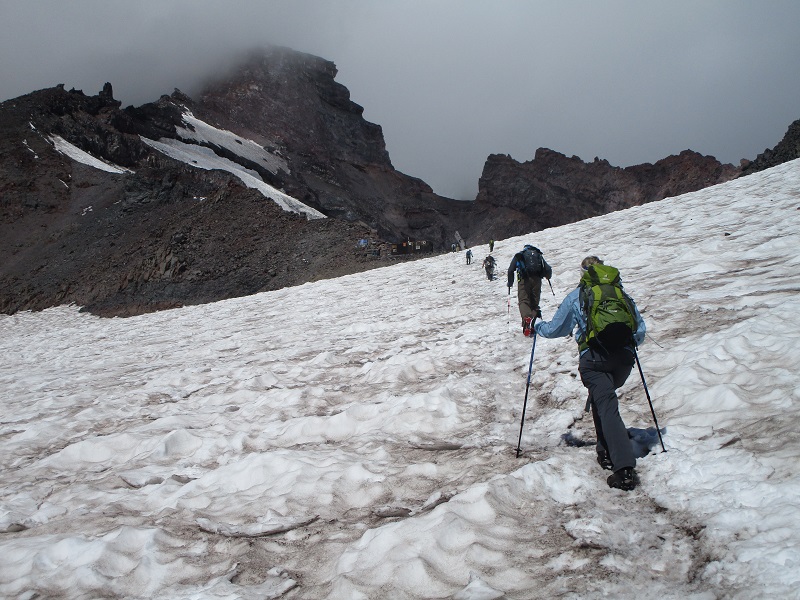
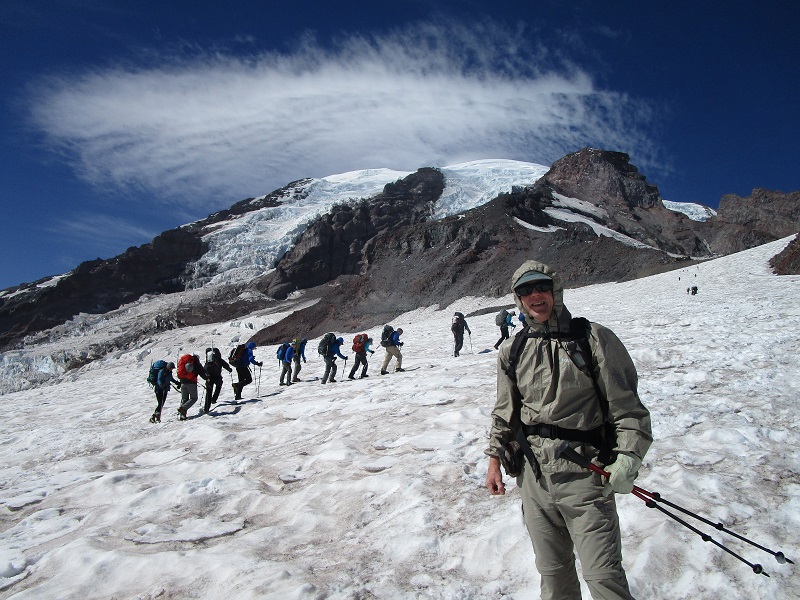
Now the serious hiking began, as we had ahead of us 2900 feet of elevation gain in 2.2 miles up to Camp Muir, all on the snowfield. There were multiple paths up the snowfield made by the hordes of hikers who make this trek. We probably saw 100-200 other day hikers going up to Camp Muir today. The surface of the snow was quite uneven, perhaps best described as a scalloped surface, and the relentless grade undulated from modest to rather steep. Andrew led the way for our small party, with Kelyn next setting a nice methodical and even pace, and I generally brought up the rear. After a while we stopped and they put on crampons for better traction. I did not have any along and hiked the entire snowfield with my hiking boots alone, which many, or maybe even most other hikers did as well. This was doable because the surface of the hardpacked snow was just soft and melted enough for reasonable traction. If the surface had been icier this could have been a problem.
andrew trying out his crampons
andrew and kelyn
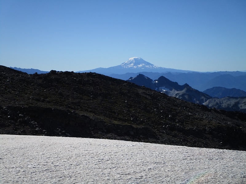
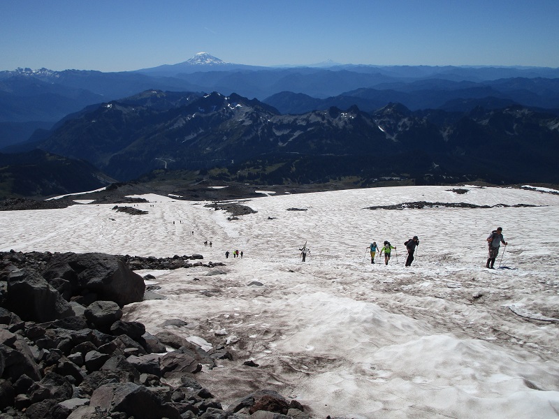
mt. adams
hiking up the snowfield
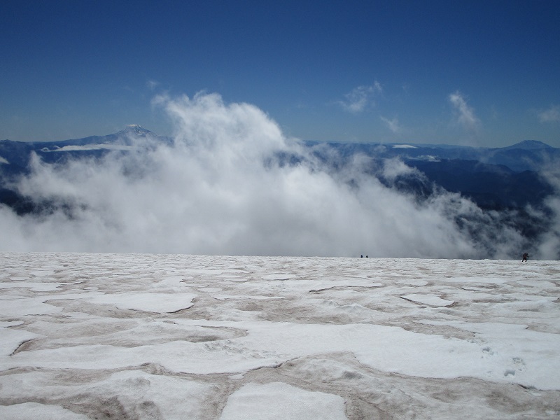
hikers coming up the snowfield. mt. adams and mt. hood can be seen in the distance.
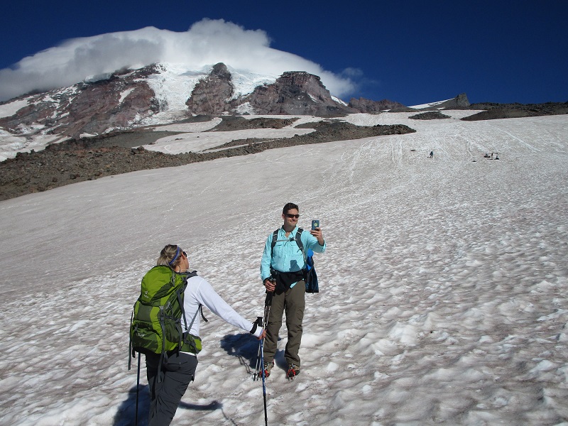
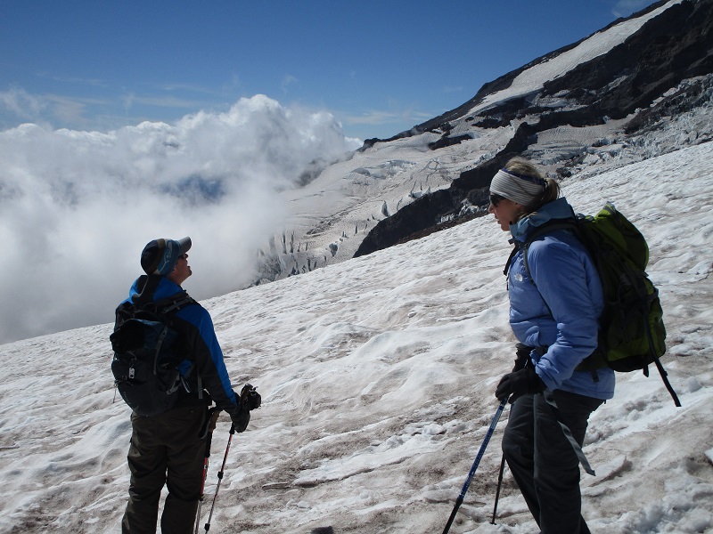
Some clouds were swirling around the summit in advance of a weather disturbance on the way. It got much windier and colder as we climbed higher and we had to put on warmer clothing. Some clouds started to swirl across the slopes below us now too. We could see Camp Muir from a considerable distance below but it was a long uphill haul to get there, taking more time than it seemed that it should. I was pleased that the climb seemed fairly easy aerobically at the slow steady pace we were going.
a route marker placed by the national park service can be seen at the right
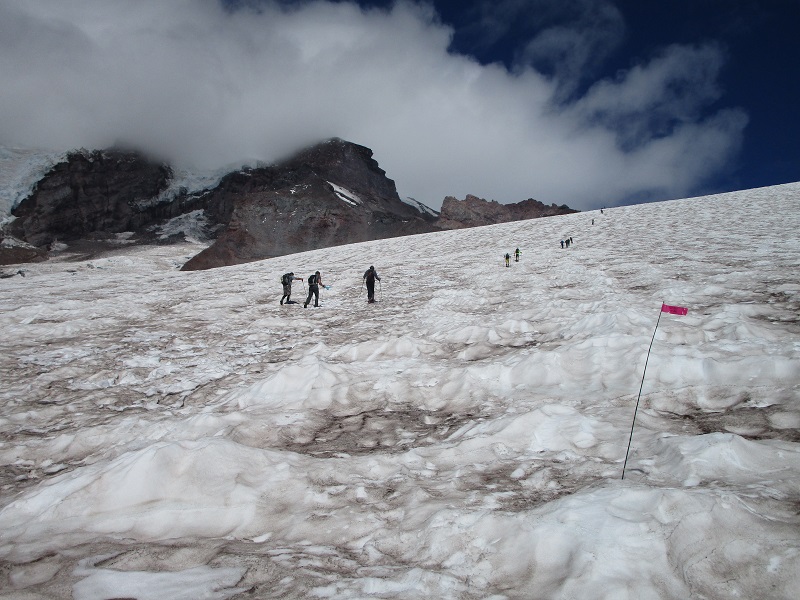
camp muir is visible in the center of the photo, but it was quite a haul to get there yet
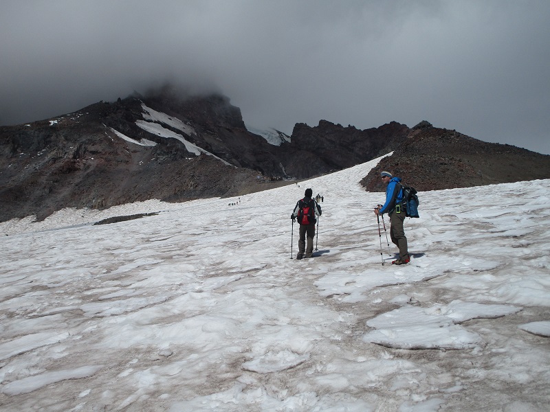
clouds began to swirl over the slopes below
the final push to camp muir
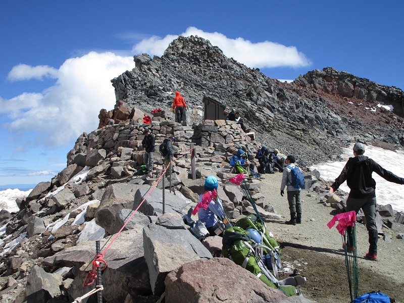
We reached Camp Muir at 120 pm and found a couple of dozen other hikers milling about. It was certainly a thrill to get there. There was a National Park Service shack, a guide service shack, crude bathrooms, and campers’ tents on the snow. It was cold and windy, about 40 degrees.
camp muir
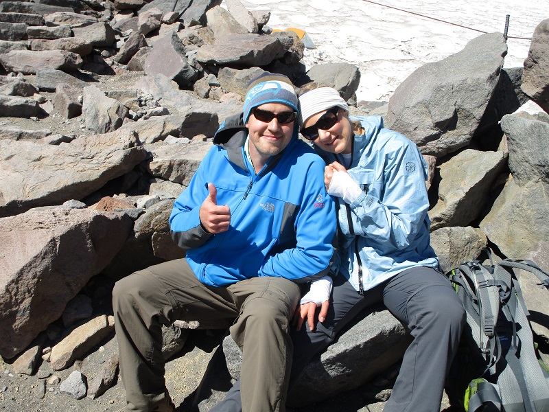
andrew and kelyn
the national park service and guide shacks
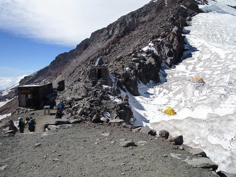
a group of mountain climbers beyond camp muir

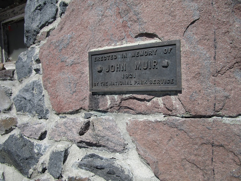
a plaque on one of the buildings
It was certainly a thrill to be there, but it seemed a forlorn and uninviting place to me, a place I would not care to stay too long. The elevation was about 10,100 feet, and it seemed like a very lofty place compared to Paradise from where we had come. Yet the summit of Rainier was still more that 4000 feet higher! This mountain is indeed massive. At 2 pm we headed down. It was not too bad going down on the snowfield without crampons, but I had to maintain intense concentration to avoid slipping and falling. It reminded me of boot skiing on slippery scree slopes. My legs really felt it later. We saw several guided groups of mountain climbers coming up. Several hikers glissaded down the snowfield in some places but the surface of the snow was too uneven for this to suit me.
me on the descent, with a group of mountain climbers beyond
andrew and kelyn taking a break
More clouds swirled on the slopes around us and we were sometimes in dense fog. We had to pay close attention to tracks in the snow and to other hikers to stay on route. This hike can be quite dangerous when visibility is poor. Many a poor hiker has become disoriented and strayed off to the west onto the Nisqually Glacier or to the east to the Cowlitz Glacier, with sometimes disastrous results. The National Park Service sometimes places markers, or small poles in the snow to mark the route but inattentive hikers could easily miss these.
a bank of clouds below that we were about to enter

It was nice to eventually drop back down out of the clouds and reach the lower end of the snowfield and return to a dry trail. We hiked on down the easy trail in the company of a multitude of casual hikers and returned to Paradise at 520 pm. We found Teresa relaxing in the lodge and all of us had much to share. We loaded up our vehicles and drove to Tacoma to Andrew and Kelyn’s house that night.
Over the years I have sometimes considered making an attempt to climb Mt. Rainier but have never carried through. The modest success rate due to vagaries of weather has discouraged me from attempting it, among other things. In truth I will probably never climb it. This hike to Camp Muir, however, gave me at least a taste of what is involved.