CLARK PEAK
(13,580’)August 18-19, 2011
By Tim Briese
Backpack to camp, Aug. 18: 6.5 miles, 2800’ elevation gain, 5:20 time
From camp to summit and back, Aug. 19: 4.5 miles, 2400’ elevation gain, 8:00 time
Pack out from camp, Aug. 19: 6.5 miles, 300’ elevation gain, 4:05 time
Total: 17.5 miles, 5500’ elevation gain
Clark Peak was the greatest remaining challenge among the Bicentennial peaks that Brian and I had left to climb, and I was a little uneasy about climbing it. Garrett and Martin say, "Its remoteness and the rugged climb make its ascent a jewel for experienced mountaineers." I wasn’t sure what those eloquent words meant, but it sounded like a tough one! At one point we had considered doing the climb from the Capitol Lake approach per G & M directions but after reading several trip reports decided it would be easier to do it via Moon Lake in order to avoid the difficulties of the so-called spur ridge.
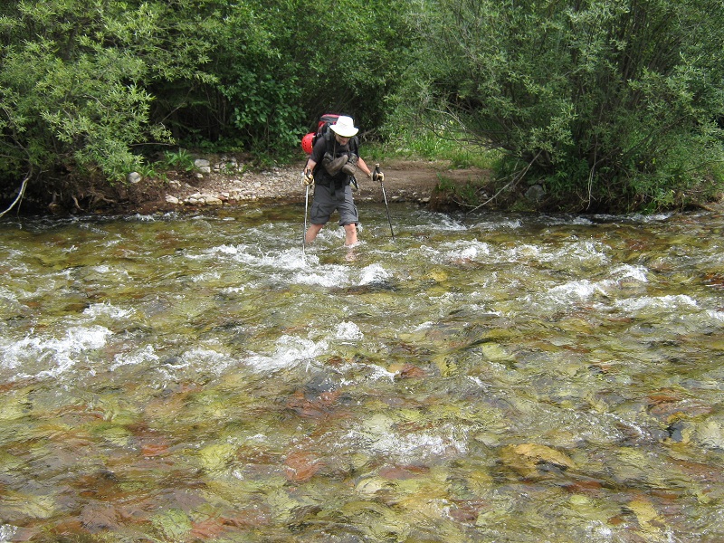
I met Brian at the Maroon Snowmass Trailhead at 1:30 p.m. and we struck off up the excellent trail at 2:00. This trail is heavily used by horses and backpackers. After hiking about 1.3 miles we looked for the turnoff for the West Snowmass Trail and decided instead to take a shortcut trail down a steep slope to the right to Snowmass Creek where we picked up the trail we sought. We found it necessary to ford the cold and fast-moving water of the creek.
brian fording snowmass creek
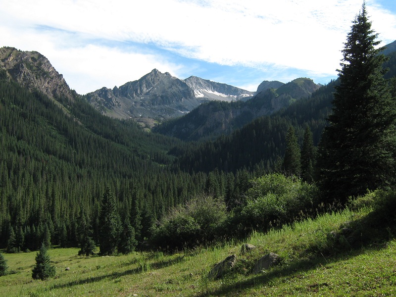
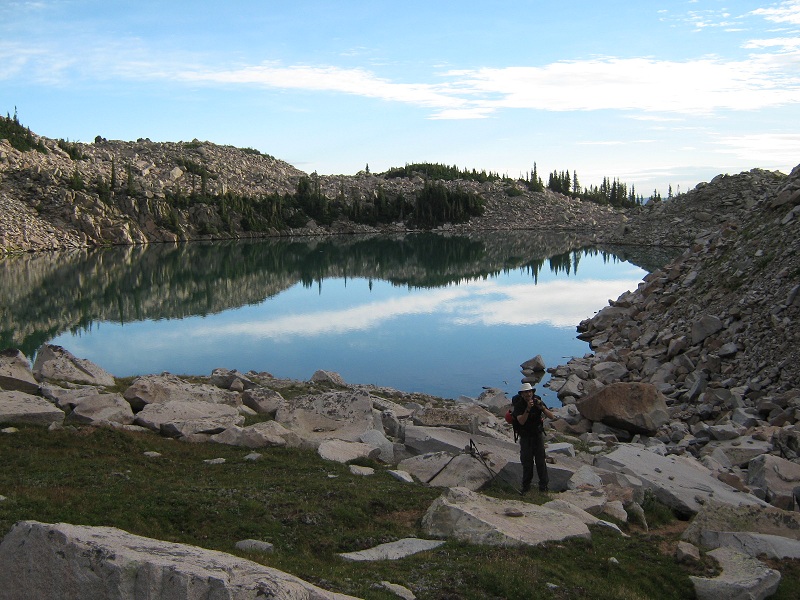
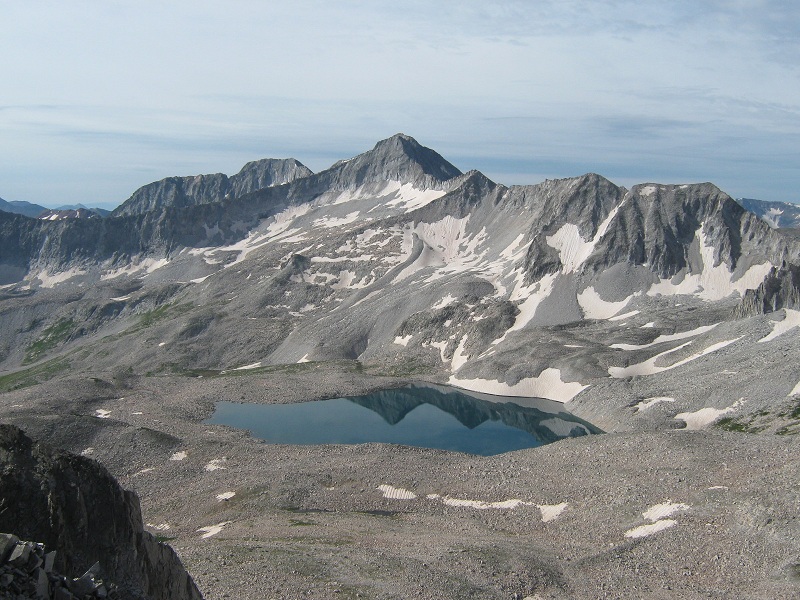
Then we continued up the West Snowmass Trail through a meadow on the west side of the creek. We did not see anyone on the remainder of the route. The trail climbed steadily up the drainage along West Snowmass Creek. About four miles from the trailhead we reached a scenic meadow at about 10,000 feet where we got our first view of Clark Peak.
clark peak is the summit above the snow. we followed a climbers trail up this drainage
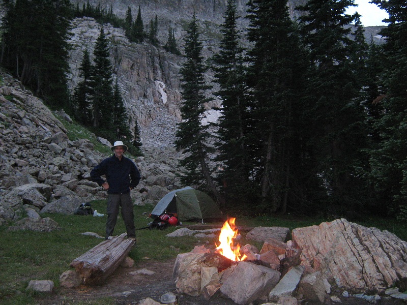
At this point the main trail starts to climb to the right up out of the drainage. There is also a solid trail that goes down to the left to the creek to an apparent horse staging area. We wanted to find a climbers trail that continues up the drainage. The best way to find it is to take neither the trail to the right nor to the left but to drop down south into the meadow and after going a couple of hundred yards look for a slanting trail going up a grassy slope at the southwestern end of the meadow. Finding this trail is the key to avoiding a bushwhacking disaster. This trail climbed high above the creek on the western side of the drainage for a while before eventually crossing the creek at about 10,400 feet. Then it climbed steeply up a flowery slope on the east side of the creek before eventually leveling off and crossing a talus slope. At 11,200 feet we came across a splendid camping spot and decided to camp here for the night. It was a pleasure to sit around a nice campfire as darkness ensued.
our campsite
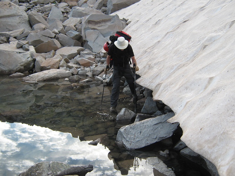
At 6:30 the next morning we left camp and headed up a climbers trail on steep grass and then talus to Moon Lake. It took about 40 minutes to climb 600 feet in 0.6 miles to the lake. After a break we skirted around a lingering bank of snow on the south end of the lake.
skirting the snow along the lake
moon lake (looking back as we were leaving it)
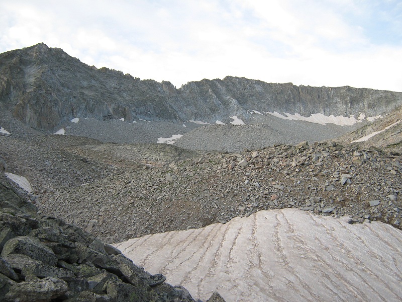
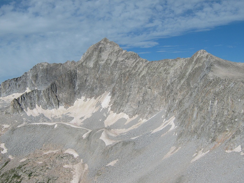
From the lake we could see Clark’s ominous west ridge that we would be climbing.
clark peak and its west ridge. we headed toward a saddle that is off the photo to the right
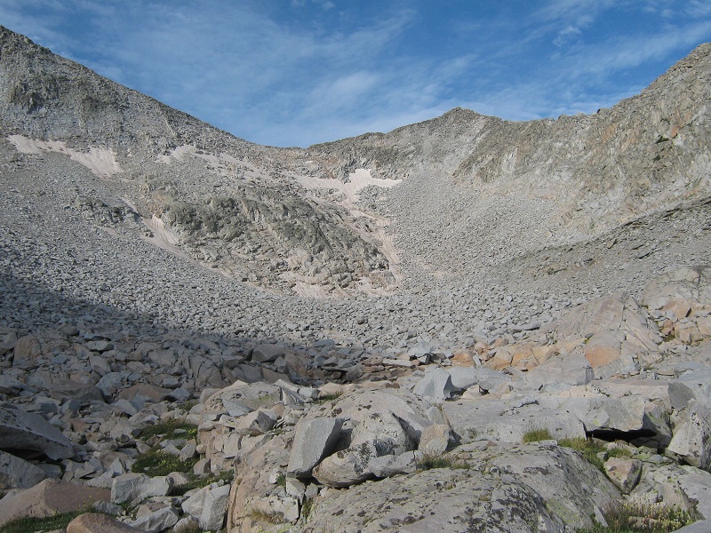
We headed up the rugged drainage south of the lake toward the saddle on Clark’s west ridge. We managed to climb on grassy slopes for a while but then it was talus the rest of the way. There was still a fair amount of snow on the steep slope below the saddle so we skirted around to the left of it as best we could on steep loose talus.
we picked our way up this slope to the ridge a little to the left of the saddle
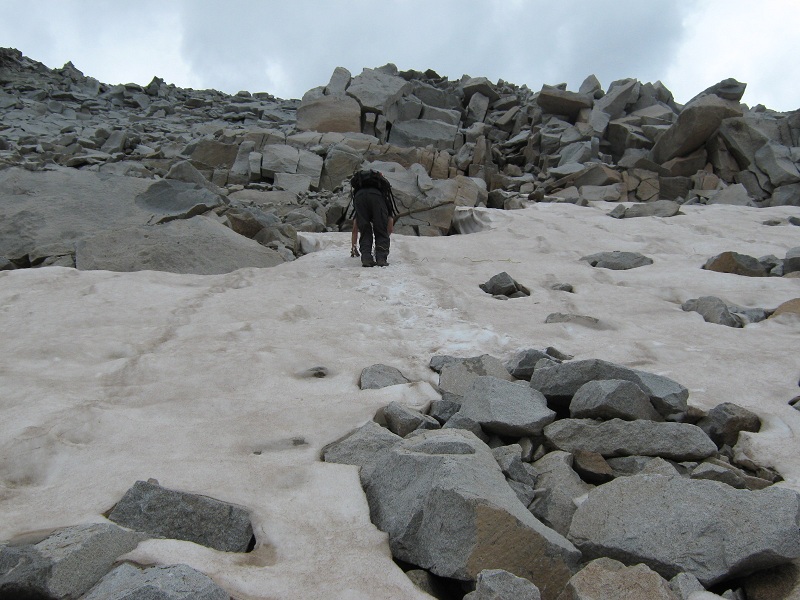
We found it necessary to climb about 25 feet up a steep snow slope and shared my ice axe to do so because Brian’s had fallen off his pack and was lost.
the snow is a lot steeper than it looks in this photo
Above the snow we made a tedious climb on very loose talus to the ridge at 13,250 feet, a short distance to the east of the 13,140 foot saddle. The slope directly below the saddle looked like it might have been a little easier to climb but there was more steep snow over there than we cared to deal with. When we reached the ridge we took a break and enjoyed the nice surrounding views.
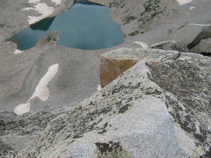
a picturesque view of snowmass mountain and one of the pierre lakes
capitol peak
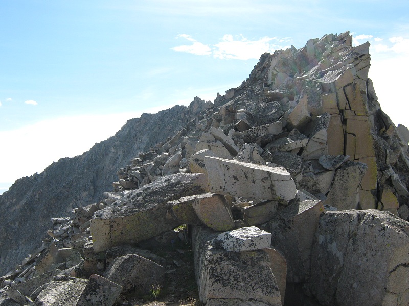
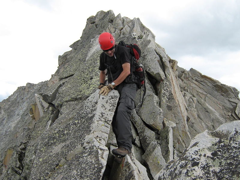
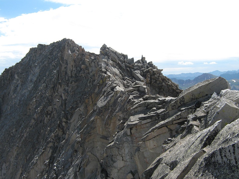
After the break we left at 10 a.m. to engage the extremely rugged ridge. It took us fully an hour to climb 0.3 miles on the ridge to summit, with hand and foot rock scrambling most of the way! On the first third of the ridge we stayed to the left of the crest, traversing very carefully across steep and sometimes loose talus blocks. This was the most dangerous part of the ridge in my opinion because of the danger of falling rock.
we went along the left side of the ridge at first
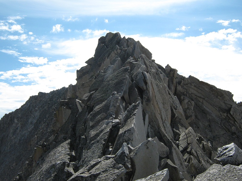
On the middle third of the ridge we crawled spiderlike along the very crest because the slopes were sheer on both sides and there was no other choice.
no place to go but on top of the crest
brian climbing on the crest of the ridge (photo taken on the descent)
the sheer north side of the ridge
The exposure was severe. The mental focus required was intense.
exposure on the south side of the ridge
exposure on the north side of the ridge (photos taken at the same spot)
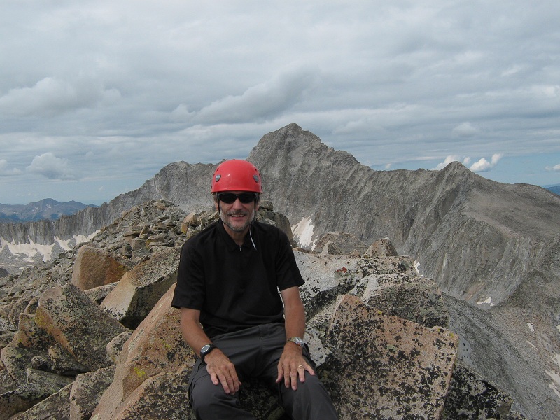
Thank goodness the rock was very solid. This middle section of the ridge involved mostly class 3 scrambling, with a couple of class 4 spots, especially at a notch. The difficulty eased somewhat on the final third of the ridge where we were able to climb along the right side of the crest on mostly class 2 terrain. The ridge was actually quite a bit of fun, at least in nice dry weather like we had. It is remarkable that the ridge is so doable, as rough and sheer as it is. With one slip of Nature, such as a nasty gap here or there, the peak would hardly be climbable, at least without extreme difficulty. We arrived on the summit at 11:00. What a rush of victorious exhilaration! We sat on top taking a well-earned break for a while, enjoying the spectacular views all around.
brian on the summit, with capitol peak beyond
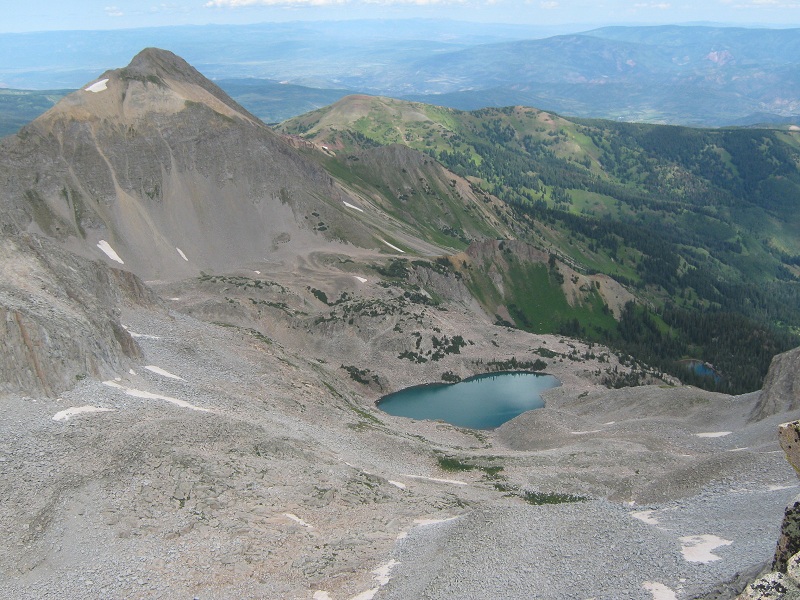
mt. daly and moon lake. the valley we came up is to the right
The clouds were building and we certainly didn’t want to be engaging the ridge and all the talus below in wet conditions, so we left after about twenty minutes. There are many lichens on the talus blocks on the ridge that could be very treacherous when wet. It took just as long going back down the ridge as it did to come up, about an hour. Then we carefully retraced our route down the dangerously steep and loose slope below the ridge. We used a cord Brian had along to shuttle my ice axe up and down the snow slope. We eventually made our way back down to the lake and then down the talus slope to our camp, where we arrived at 2:30. It was only four and a half miles roundtrip from camp to the summit but it took us eight hours because of the very rough terrain. We estimated that perhaps two thirds of the entire route involved either boulder-hopping across talus or rock scrambling! This adventure took a lot out of me and I was very tired at this point. After resting for a while we packed up and left camp at 3:40 to pack out. The trail out seemed ridiculously long and we finally tramped back to the trailhead at 7:45. I had expected to be out earlier today and planned to drive home, but I was deliriously tired now so we got a room in Snowmass Village, ate a nice dinner, and crashed for the night.