COMANCHE PEAK
(13,277’)SPRING MOUNTAIN
(13,244’)VENABLE PEAK
(13,334’)June 23, 2011
By Tim Briese
13.8 miles roundtrip, 5400’ elevation gain, 11:15 roundtrip time
My goal today was to do a long loop hike in the Sangre de Cristos, up the Comanche Trail, across the Phantom Terrace, and back down the Venable Lakes Trail, while picking up three thirteeners along the way. Ambitious? For me, yes, especially since I wasn’t feeling well, but I couldn’t resist the lure of a wonderful mountain adventure on a beautiful sunny day so off I went.
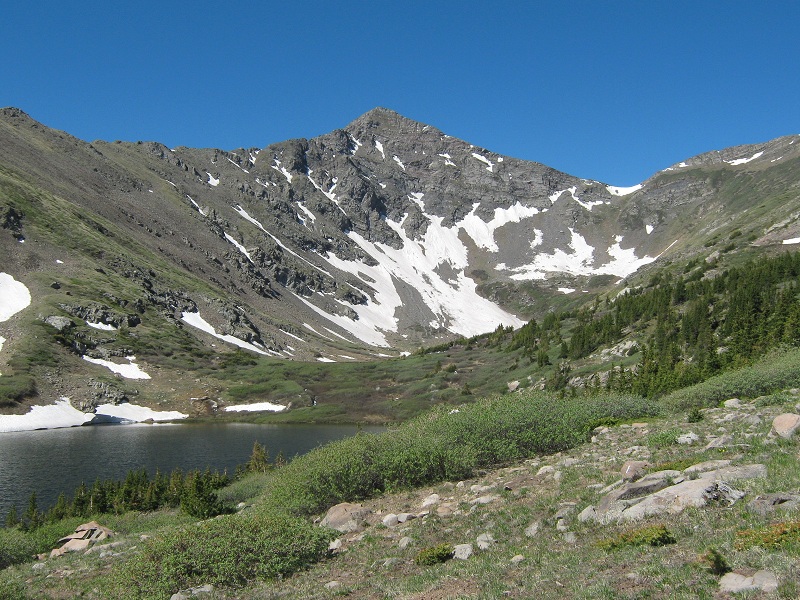
I left the Comanche/Venable Trailhead at 7:05 and headed up the trail with my new lab Abby. I climbed steadily up the fine trail and after 4 miles reached sparkling Comanche Lake at 9:55. The lake sits right at timberline at 11,700 feet and here I was afforded a nice view of Comanche Peak at the head of the valley.
comanche peak and the lake. comanche pass is the saddle at the right
At the lake I met the first of several backpacking parties I encountered today, perhaps eight to ten different parties in all. Oddly though, I met no dayhikers today. Several of the backpackers told me they were in the Sangres because the range was mostly snowfree while most other mountain areas of the state were still locked in snow. That was a big reason I was here too. I continued another mile up the trail to 12,600 foot Comanche Pass.
approaching comanche pass. comanche peak is at the left
I met a large group of Outward Bound backpackers taking a lunch break at the pass. After exchanging a few pleasantries with these young folks who hailed from all over the United States I headed up the grassy slope immediately to the south to the summit of Comanche Peak.
the slope up to comanche peak
I arrived on top at 11:35. The 700 foot climb from the pass took me just over half an hour. I took a fifteen minute break on the summit while enjoying the fine views of the Sangres all around.
view to the south from the summit of comanche
view of comanche lake below. pikes peak lies in the distance

I left the top and scooted back down the grassy slope to the saddle.
heading back down to the saddle
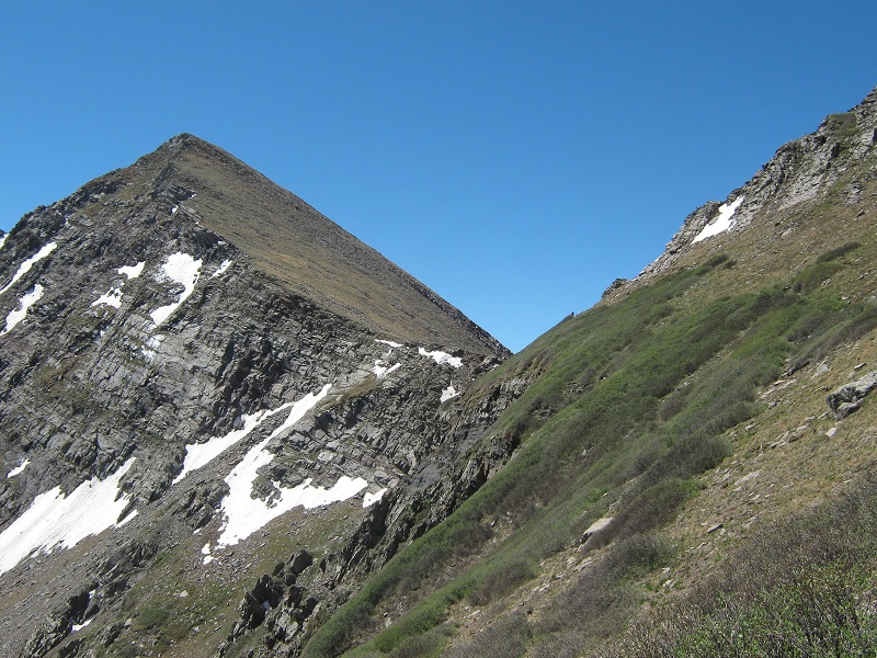
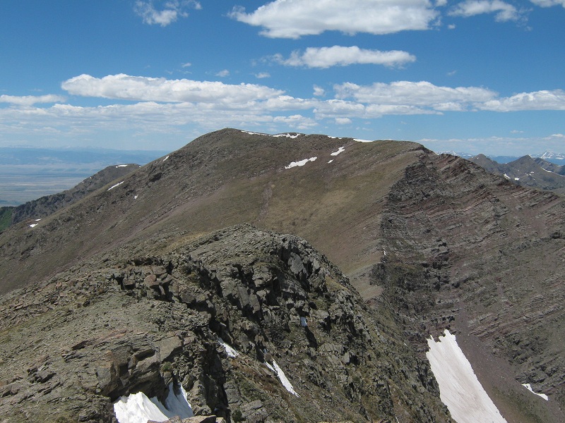
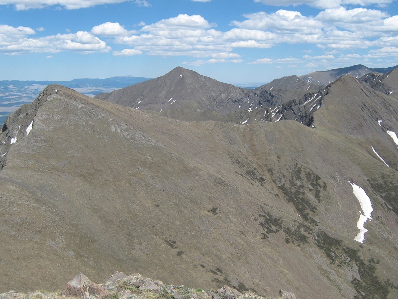
my next two objectives: spring mountain at the right and venable peak to the left
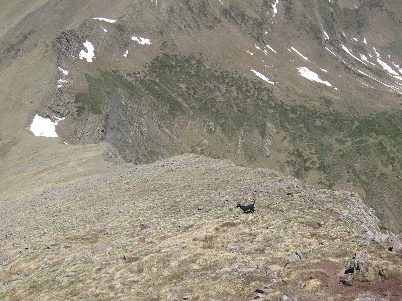
The Outward Bound group was just departing for Comanche Lake and I noticed that one or two members were having great difficulty with a bit of exposure on the trail on the east side of the pass. I felt sorry for them and reflected on how we all have an individual learning curve when it comes to the ways of the mountains. I headed on up the ridge to the northeast toward Spring Mountain on grass and then talus.
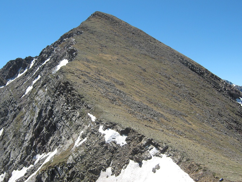
the ridge up to spring mountain, the summit is at the upper left
Speaking of learning curves, Abby had never been above timberline before and was hesitant navigating some of the blocky talus near the summit so I had to backtrack a bit and find a more comfortable route for her. I stepped atop Spring just before 1 p.m. and took another nice 15 minute break before continuing on.
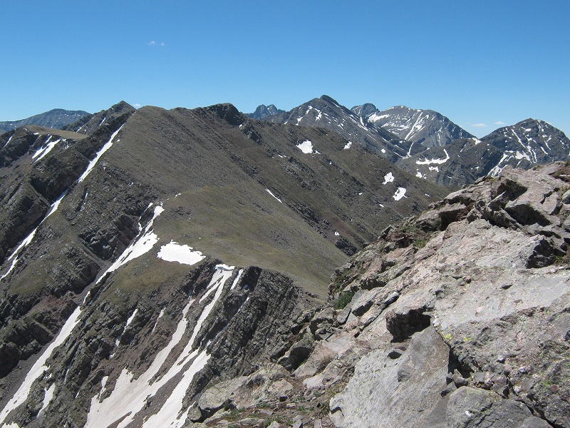
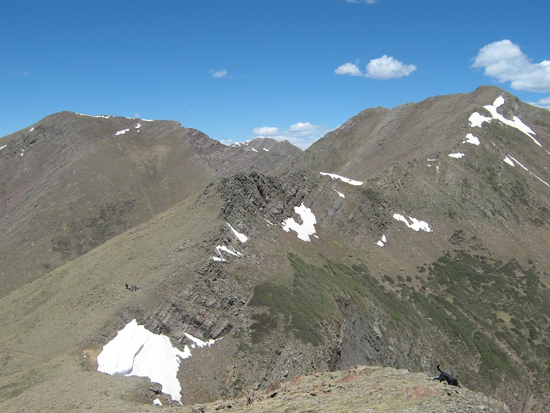
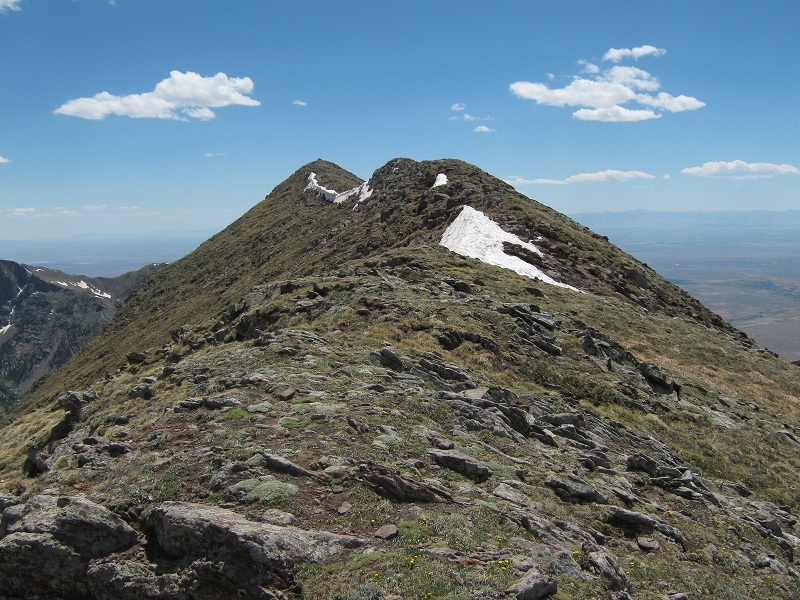
view to the south from spring mountain. comanche peak is in the foreground
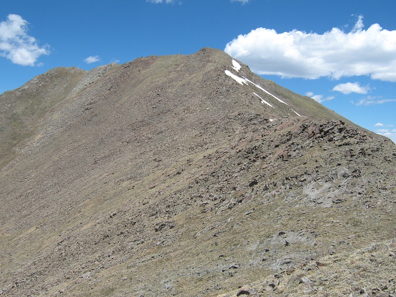
view of venable peak from spring mountain
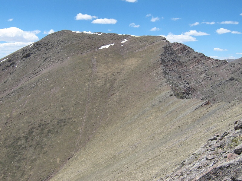
Had I been alone I would have headed straight down the steep talus west of the summit but instead found it necessary to circle around to the south of it for Abby’s sake. I headed northwest down the slope to the 12,700 foot saddle between Spring Mountain and Venable Peak.
i cut down to the saddle at the right and then went up the grass to venable's north ridge
At the saddle I crossed the trail that comes across from Comanche Pass and then climbed 500 feet up steep grass to Venable’s north ridge. Once I gained the ridge it was a pleasant stroll to the summit.
venable's gentle north ridge
I arrived on top at 2:30 and sat and relaxed for half an hour on this fine peak while soaking up the grand views.
view to the south from venable's summit
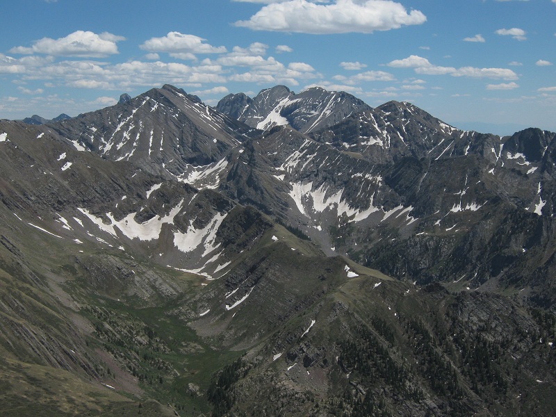
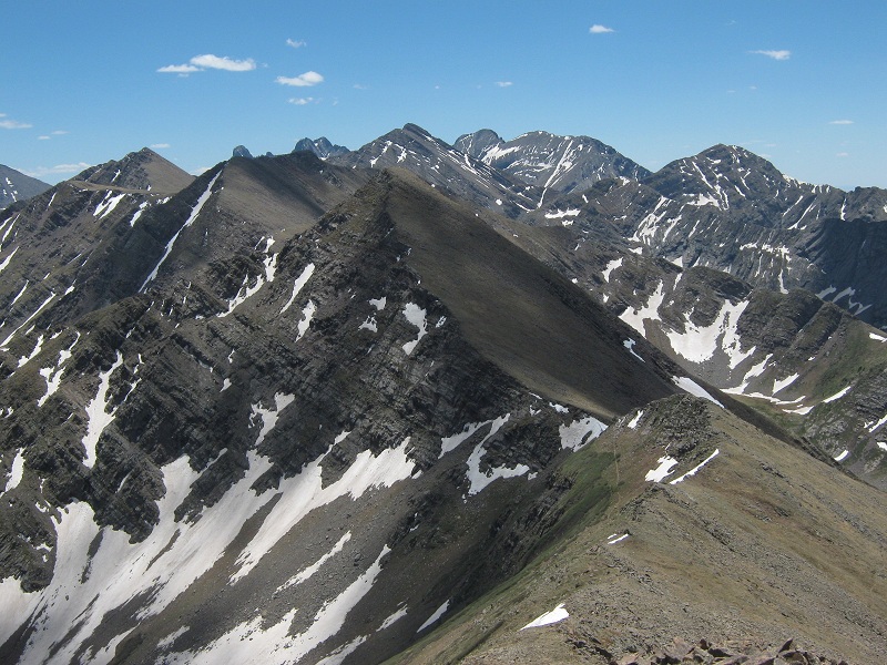
view of spring mountain at the left and comanche peak at the right from venable peak
The weather was still holding up beautifully but I was getting pretty tired. I headed back down to the saddle and there I met two young fellows from New York, Matt and Chad, who were on an extended backpack in the Sangres. They had just come across the Phantom Terrace and excitedly warned me about its dangers. I had heard about this place before and was eager to see it. I said goodbye and headed north down from the saddle on the trail across the Phantom Terrace.
the trail across the phantom terrace
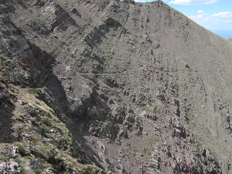
looking back at the phantom terrace

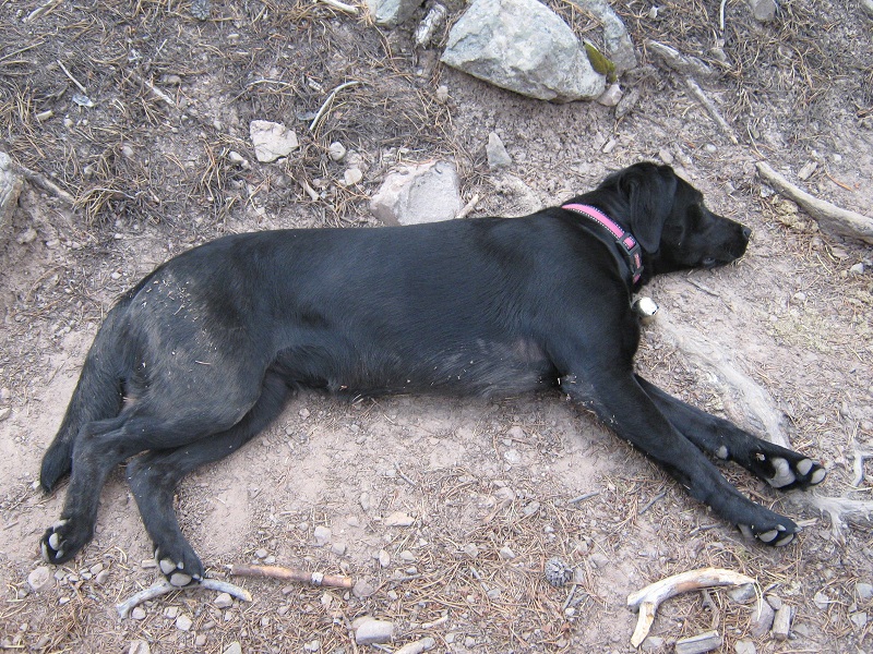
The Terrace was narrow and quite exposed but not bad if you paid attention to what you were doing. I wouldn’t want to ride a horse across it. It reminded me of sections of the Bright Angel Trail in the Grand Canyon, except this was more cliffy. I rapidly hiked down the trail to upper Venable Lake, at 12,100 feet, eager to filter some water and get a drink since I had depleted my supply. But alas, my water filter broke after I had filtered about two thirds of a quart! I ruefully decided I could make it back to the truck with that amount even though I still had four and a half miles to go. I headed on down the trail along beautiful Venable Creek. Over the next few miles I met three more backpacking parties struggling up the trail, and I reluctantly answered their inquiry in each case about how far it was up to the lakes yet, knowing full well the discouraged look on their faces that would result. I hiked down through beautiful flowery meadows amid lush aspen groves but was too tired to appreciate it at this point. Abby had never done a hike so long and grueling and began to lay down at every opportunity.
a tired dog!
I finally dragged myself back to my truck in the late afternoon heat at 6:20, and headed for home.