THE COSMIC ASHTRAY, UTAH
October 31, 2022
By Tim Briese
8.5 miles, 900’ elevation gain, 5:30 roundtrip time
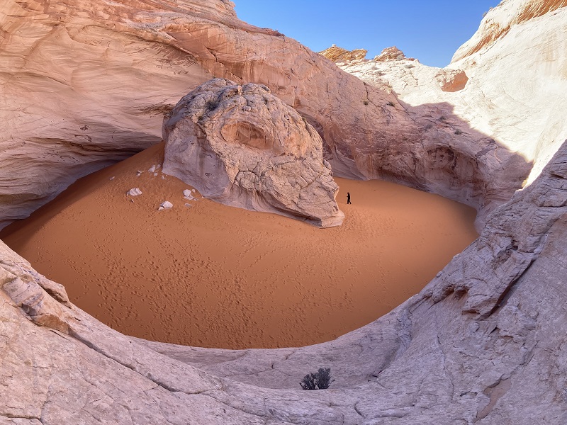
The Cosmic Ashtray, also sometimes called the Volcano, is another of the amazing geological features found in southern Utah. While these names given to this feature are colorful and descriptive, to me they debase the majestic awe this place can inspire. The feature is actually the world’s largest erosional sandpit, formed over countless thousands of years as the wind hollowed a vast bowl in sandstone which has collected windblown orange sand within it. The variety found in nature is seemingly endless.
I was intrigued to go see this unique place. It is located in a very remote place in the Grand Staircase-Escalante National Monument east of Escalante, Utah. Internet accounts warned of the difficulty of finding it and the danger of getting lost, as the route traverses several miles of bare sandstone with few landmarks and only a few undependable cairns. I heeded the warnings and downloaded a map from All Trails by which I could navigate with the GPS on my phone as needed. There are two routes to get there, one from the south via Harris Wash and one from the west via the Spencer Flats Road. I elected the latter as it is deemed more scenic.
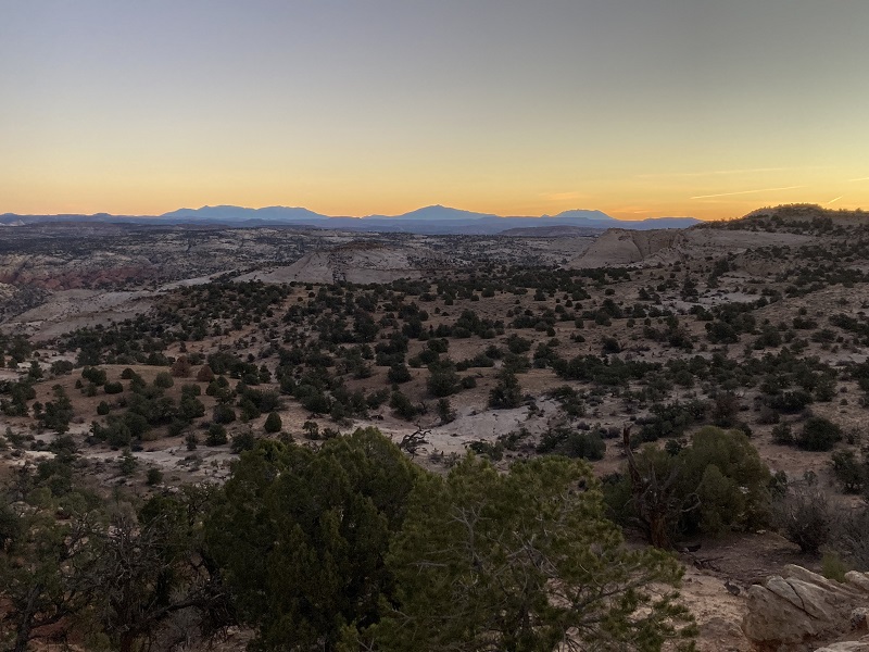
I left Escalante at dawn and drove east on Hwy. 12 about ten miles and turned right at mile marker 71 onto the dirt Spencer Flats Road.
dawn in the desert from the spencer flats road
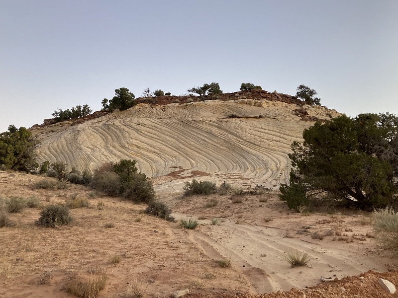
an interesting rock formation along the road
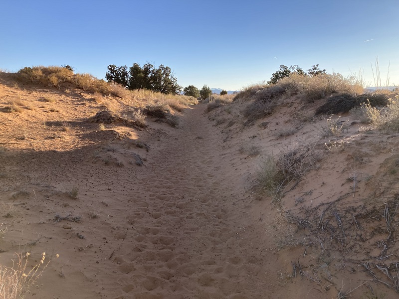
This scenic high clearance road rolled eastward across the desert about 6 miles and then turned south. A track continued east at the turn and I wasn’t sure which way to go and turned south and went a couple of miles but decided that was incorrect and returned and took the path east for about a half mile to a spacious parking area which was the trailhead. There was a young couple there from Phoenix who had car camped and were also going to hike to the Cosmic Ashtray. The sun was just coming up and it was a chilly 29 degrees as I began hiking northeastward on a sandy path on an old road track, but it soon warmed up.
on the sandy path
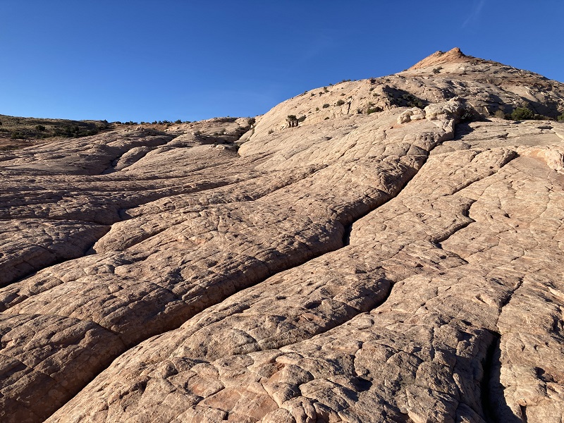
After about 0.7 miles the route left the road and went east on a well-traveled sandy path. So far so good. The path went up and down across a couple of washes and before long the sandy path gave way to unmarked sandstone and the path disappeared. The rest of the route traversed beige and orange slickrock all the way. While I normally have little trouble with routefinding, the complex terrain here with rolling sandstone, numerous drainages, and steep slopes with minimal landmarks was very difficult to navigate and I found my phone GPS priceless. The Arizonans soon passed me and they were marching along with phone in hand too.
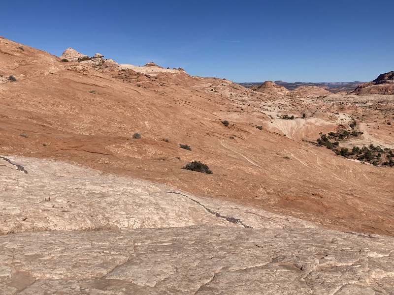
some of the terrain along the way
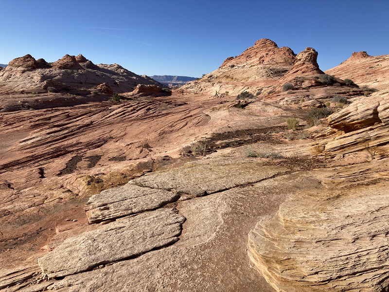
the route generally goes across the center of this photo (this photo was taken on the return)

It was actually a lot of fun hiking across all this slickrock and after a couple of miles the route turned to the southeast and traversed more rock for the last three quarters of a mile to the Ashtray.
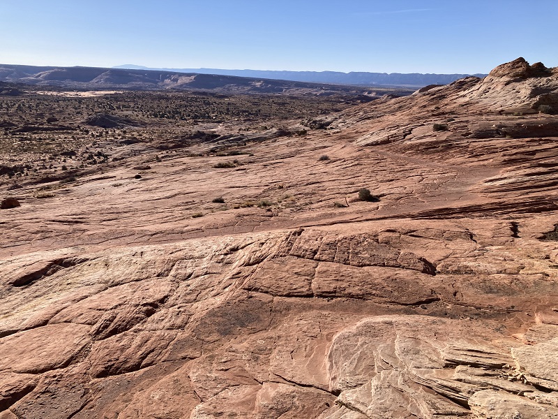
the route heads toward the upper right part of the photo, where the rim of the ashtray is barely visible
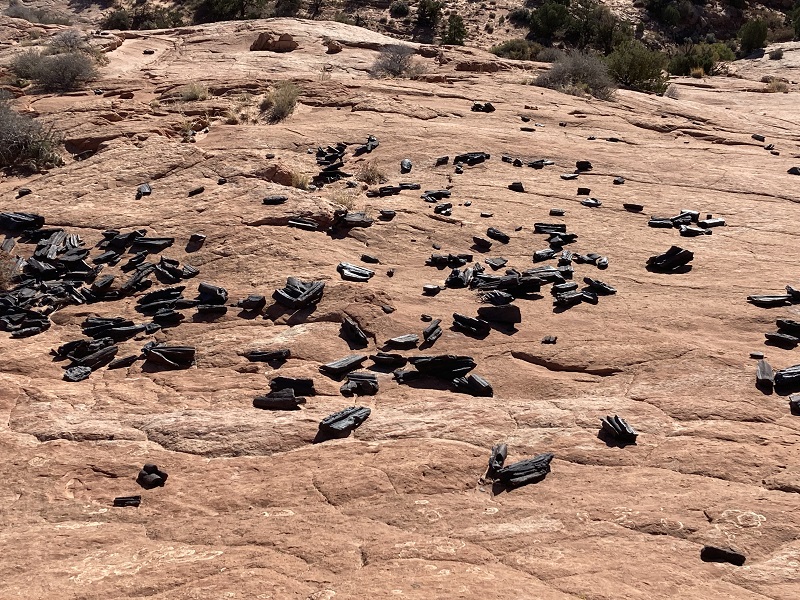
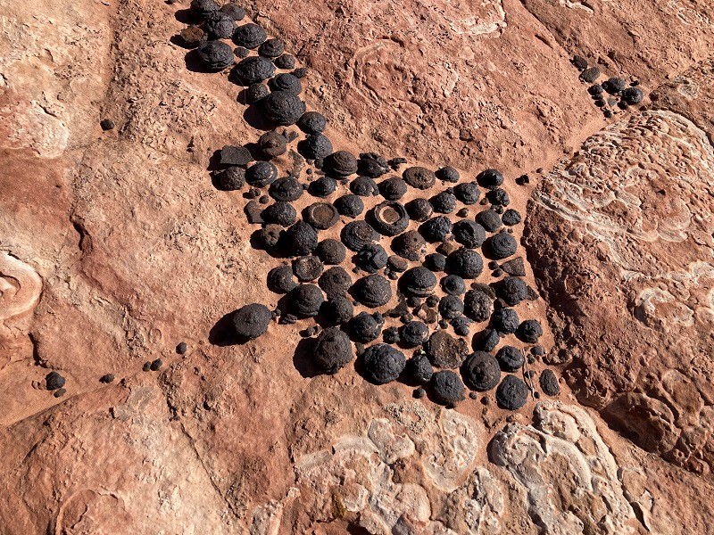
There were interesting black stones lying upon the sandstone in some places, some of them round, called Moqui Marbles, consisting of an iron compound coating a sandstone core.
interesting black rocks laying on the sandstone
i thought it was petrified wood at first but it is actually rock
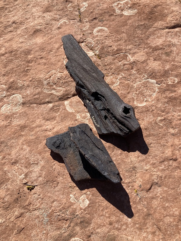
moqui marbles
When I arrived at the Ashtray I first hiked up some steep slickrock to the right to attempt to get a photo from above but the sun angle was not the best for this.
my first look at the cosmic ashtray, from above
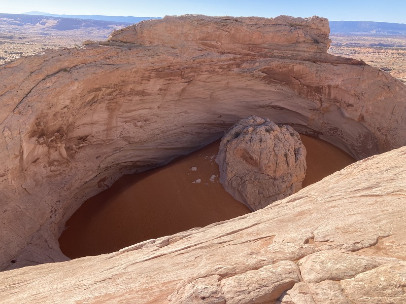
Then I went down to the entrance to the Ashtray at its northern end.
approaching the northern end of the cosmic ashtray

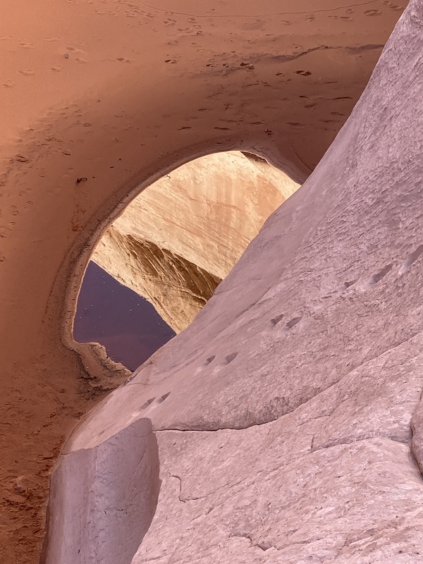
the cosmic ashtray
there was a small pool of water inside, at the lower right
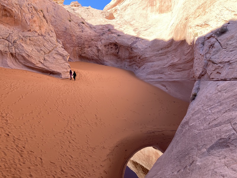
There are some footholds hollowed into the sandstone to allow one to make a twenty foot descent down into the sandpit, but I wasn’t going to try it without a rope, as the internet had advised. The young hikers were undaunted though and were down in the pit, with him taking photos of her in a Halloween costume on this October 31st.
this photo shows the footholds in the sandstone
After resting a while and visiting with the other two hikers I explored around the outside of the pit for a bit and then headed back across the slickrock.
the return route goes toward the ridge at top center
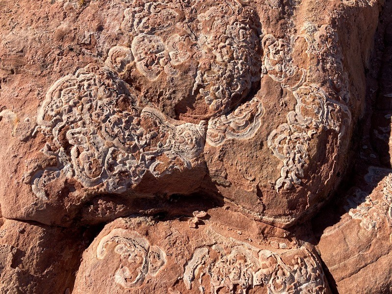
a curious decorative pattern in the sandstone
I thought I could find my way back mostly without the GPS but still needed to pull it out here and there to find the most reasonable route. At mid-afternoon I tramped back to the trailhead. This was certainly an interesting and offbeat adventure in a remote place.