COYOTE GULCH, UTAH
VIA THE CRACK IN THE WALL
October 27, 2021
By Tim Briese
10.5 miles, 1100’ elevation gain, 9:35 roundtrip time
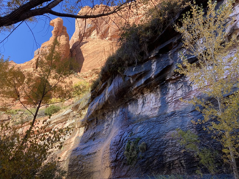
Coyote Gulch is one of the most intriguing and beautiful canyons on the Colorado Plateau, complete with soaring sandstone walls, beautiful alcoves, arches, springs, and a stream with several waterfalls. It is a classic destination and justifiably very popular in spite of its very remote location. It was on my bucket list for a long time. The biggest deterrent for me was the challenging access. There are three ways to access Coyote Gulch: a long backpack of up to 27 miles roundtrip if one wants to see the whole canyon, the Crack in the Wall, a sharp descent through narrow cracks in a cliff to access the lower canyon, and the Sneaker Route, a harrowing descent down long sandstone slabs into the mid canyon, best done with a rope. I decided that the Crack in the Wall was my best option, and I also decided that I’d better seize the opportunity to do this before encroaching age put this adventure out of reach for me. My adventurous wife and hiking partner Teresa decided that she was up for the challenge too so in late October we loaded up and headed for Utah.
The night before the hike we stayed in the remote little town of Escalante, a rather primitive outpost of about 700 people with no sizable grocery store, variable cell service, and minimal restaurant offerings. It is located literally on the edge of nowhere, in one of the most remote locations in the continental United States, at the doorstep of vast expanses of wilderness, a base for wilderness adventurers like us. We met some nice people there. We stayed at the quite basic Prospector Inn, a pretty well-kept but simple motel, with flat pillows, no hair dryer, and no breakfast, but quite adequate for our purposes. And their rate is $79 per night, year round, and has been the same for years (but I was told it is going up to $87 next year.) They don’t bother to list their place on travel booking websites either. I like the place, and I like Escalante too. I felt a real backcountry, off-the-map vibe there.
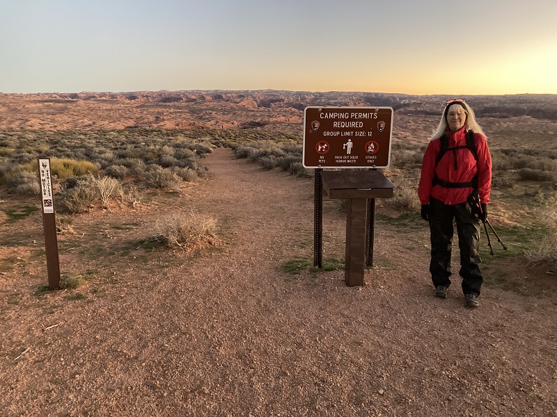
We left town about 530 the next morning, anticipating a drive of about two hours into the desert wilderness to our trailhead. The sun would rise about 745 and we wanted a dawn start for our hike to maximize the short daylight hours at this time of year. We drove southeast on the dirt Hole in the Rock Road in the dark into the vast expanse of the Grand Staircase-Escalante National Monument, a completely uncivilized and very remote area. We were expecting a very washboardy drive but the road had recently been graded and we made a little better time than expected. After 36 miles on this road we turned left onto the 4WD Forty Mile Ridge Road that would take us seven miles to the Forty Mile Trailhead where we would begin our hike. Deep sand can be an issue on this road but a big rainstorm had passed through just over 24 hours before which made the sand quite solid to drive on. We arrived at the very remote trailhead about 715 and found about eight other vehicles parked there, all 4WD’s. It was clear and chilly this morning, about 35 degrees.
the beginning of the trail
We left the trailhead about 730 and headed downhill on a sandy trail to the northeast, hiking briskly to get warm.
on the sandy trail
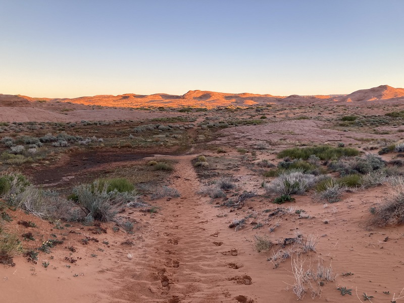
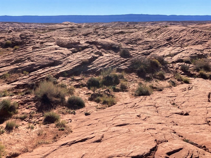
The sand soon gave way to slickrock and we followed a cairned route across rolling slickrock toward the rim of Coyote Gulch. The cairns were a bit challenging to follow until the sun came up and I mentally noted that we needed to watch our time today because it would be tough to get back to the truck in the dark.
hiking the cairned route across the slickrock

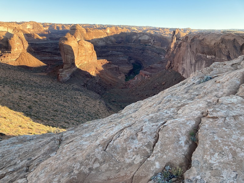
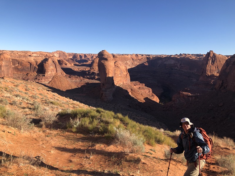
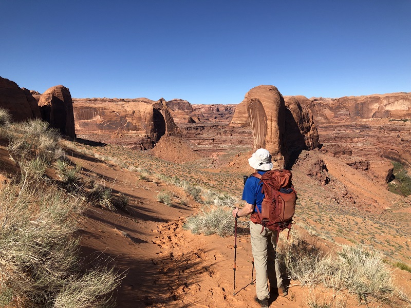
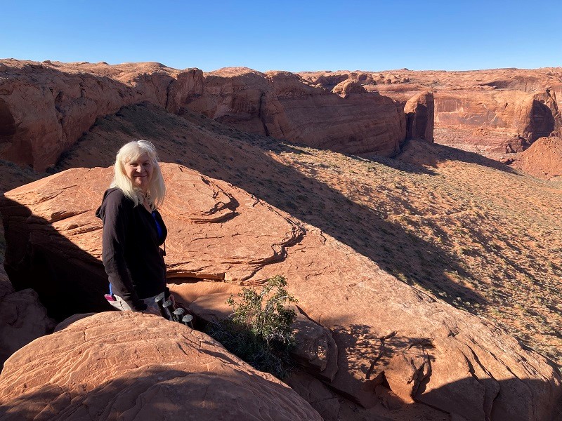
After an hour we had hiked two miles and the cairns led us to the rim of the canyon and the top of the Crack in the Rock. The view was panoramic.
the view at the rim of the canyon
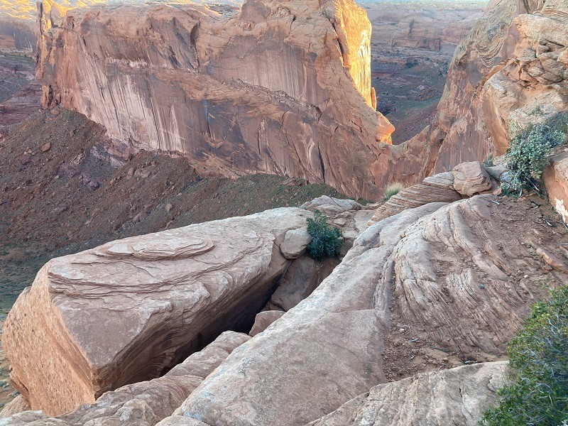
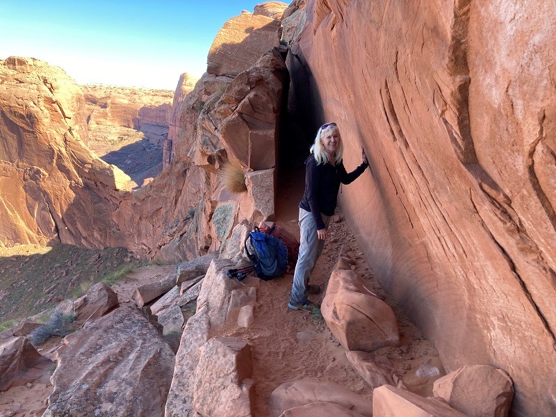
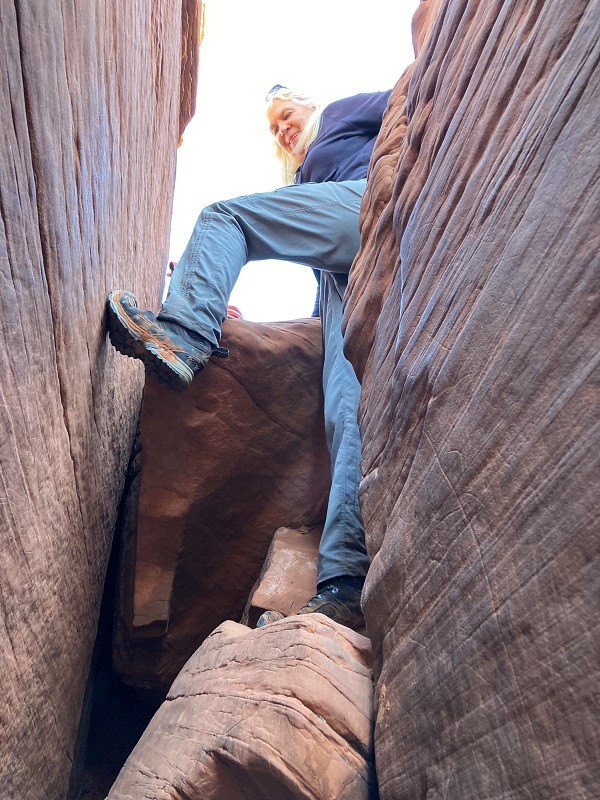
Now the real adventure began. The Crack consists of three successive narrow slots between the cliff wall of the canyon and huge slabs, with gaps between the three. It is an amazing, adrenalin-spiking route.
the entrance to the first crack is in the lower part of the photo
me about to climb down into the first crack
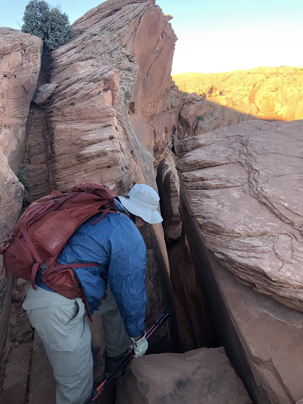
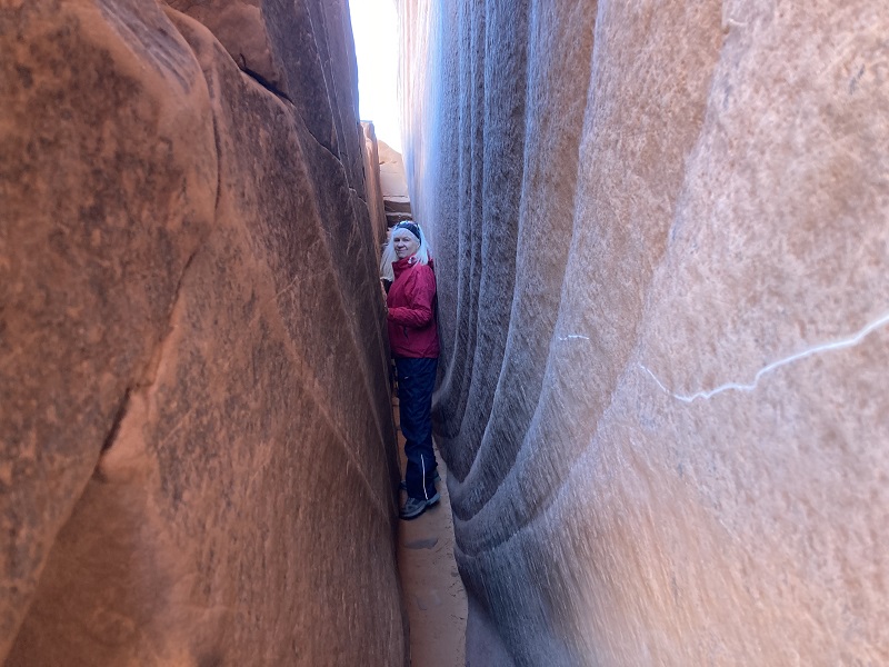
I lowered myself down a short class 4 pitch into the shoulder-width first crack. I tried to evaluate everything we did with an eye toward whether or not we could make it back up later. Teresa handed our packs and poles down to me and then I helped her down. We eased ourselves about 30 feet down through the first crack, with me carrying our packs and she our poles.
teresa coming through the first crack, with the downclimb we did visible behind her
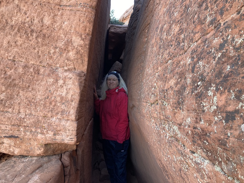
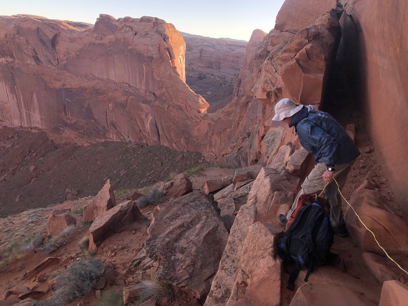
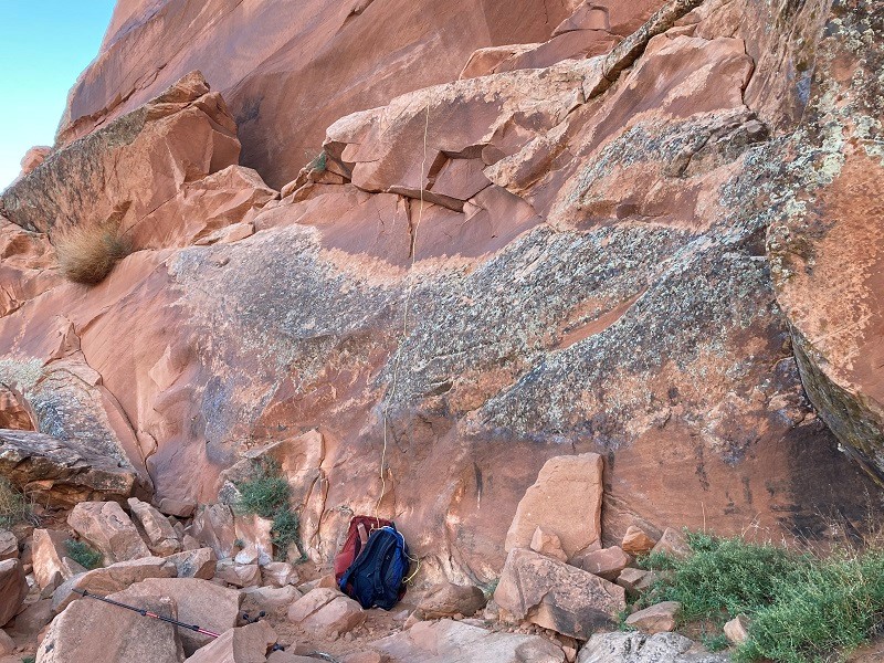
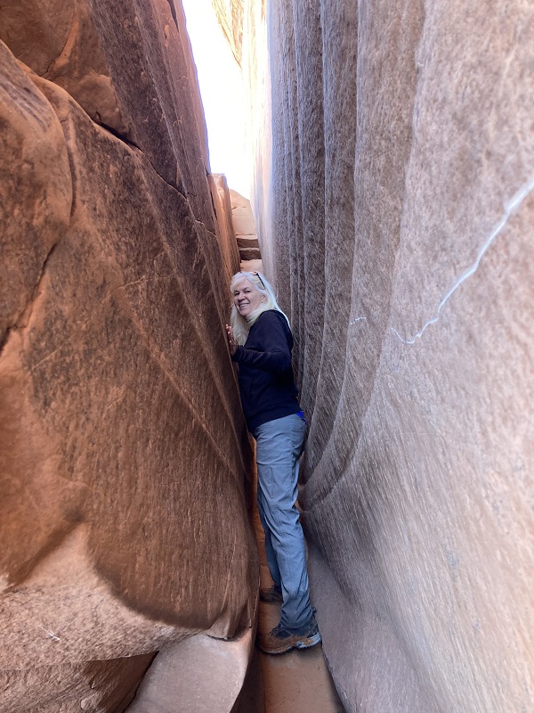
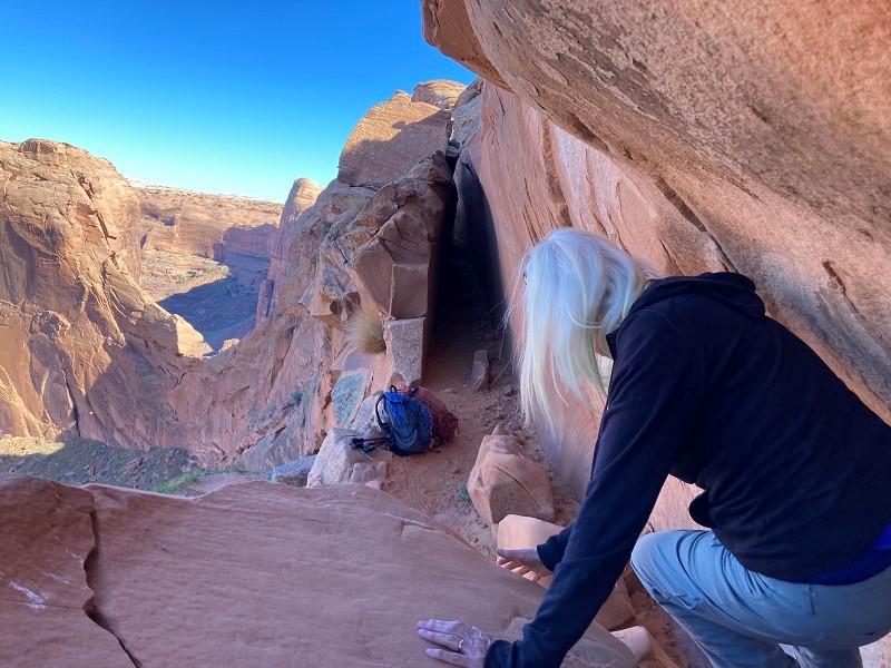
Then we came to a gap where we enjoyed a nice view down into the canyon, then worked our way on down through the second crack to another gap at a ledge. The third crack is the narrowest, probably no more than 12 inches wide, and one must slither through it sideways. This precluded carrying our packs through the third one so we had to lower them over a 20 foot cliff with a rope from the ledge between the second and third crack.
lowering our packs over the cliff
After completing that I lowered myself down another 4th class pitch into the third crack and then Teresa came down. We slithered through and emerged at the top of a massive sand dune that we would hike down into Coyote Gulch.
teresa coming through the third crack
our packs at the bottom of the cliff
Upon reaching the bottom of the Crack in the Wall Teresa exclaimed, "How are we ever going to get back up there! Oh well, that’s a problem for later." My thoughts exactly.
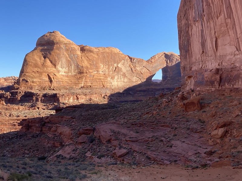
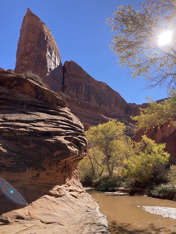
We quickly went down a nice trail on the huge sand dune to the bottom of Coyote Gulch, dropping about 600 feet in 0.8 miles. Stevens Arch was visible to the north.
heading down the sand dune into the canyon
stevens arch
the trail down into the inner canyon
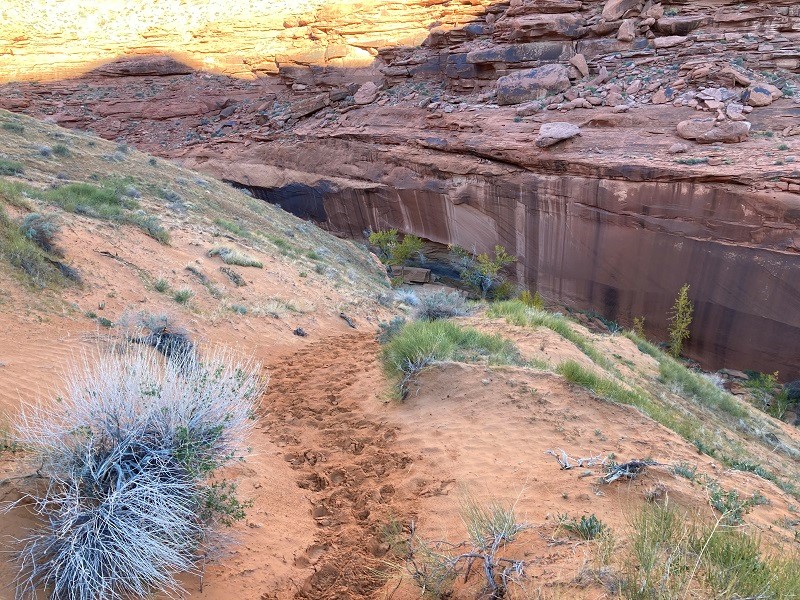
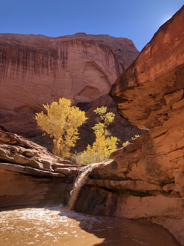
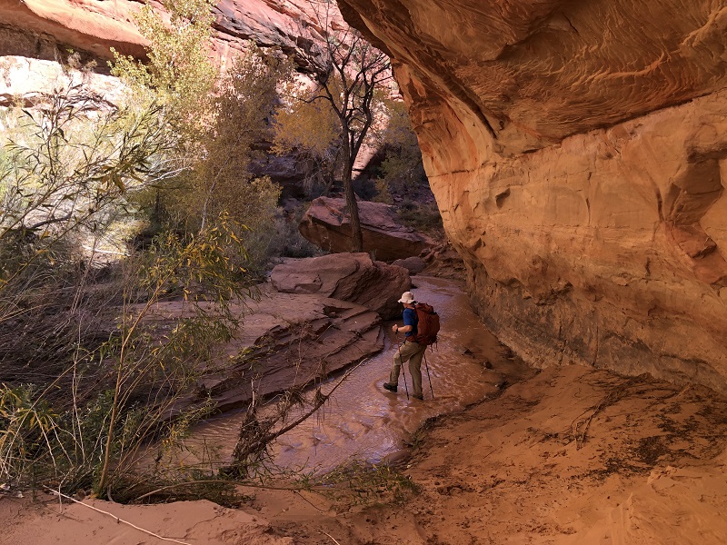
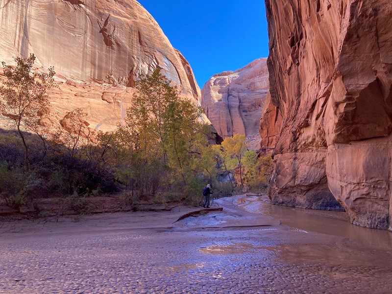
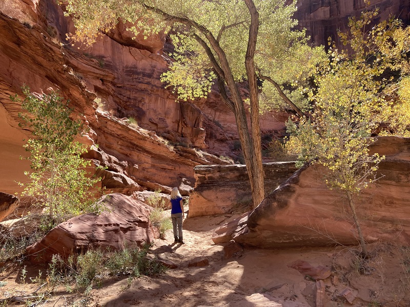
We reached the stream in the bottom of Coyote Gulch a little less than a half mile above the mouth of the gulch where it flows into the Escalante River. Our objective was to head upstream in Coyote Gulch, possibly going as far as Coyote Natural Bridge, which was some four miles upstream. It was immediately apparent that the canyon had flash flooded during the rainstorm the day before but the water level had dropped much lower now, although the water was still quite silt-laden and muddy. Bushy vegetation was laid over from the flood and beds of soft quicksand lurked along the water’s edge in some places. We pushed our way up the canyon following the best path of least resistance that we could find, wading back and forth across the stream at least 15 or 20 times. We wore hiking boots, deeming water shoes insufficient for the terrain, and tolerated cold, wet feet for the next several hours.
in coyote gulch

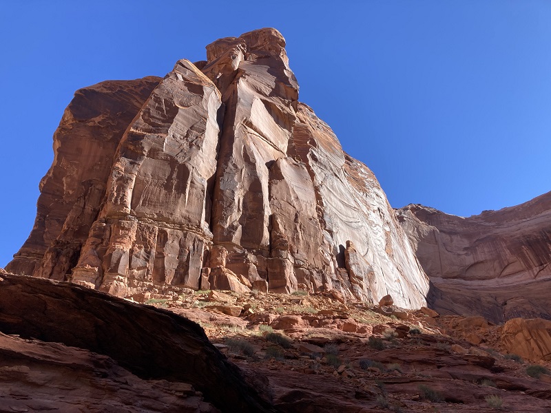
The going was fairly slow, as we pushed our way through bushes, climbed up onto ledges to get around waterfalls, and tried to avoid most of the pesky quicksand. We found a reasonable trail in some places but mostly had little or none to follow. We sporadically met a few other hikers, perhaps twenty or so during the day, all backpackers, and all apparently under the age of 40. The canyon was spectacular and lived up to its billing, with towering walls, deep alcoves, and several waterfalls.
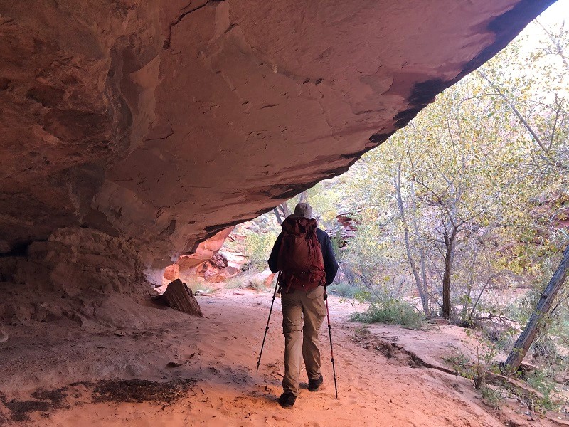
me in a big fern-draped alcove
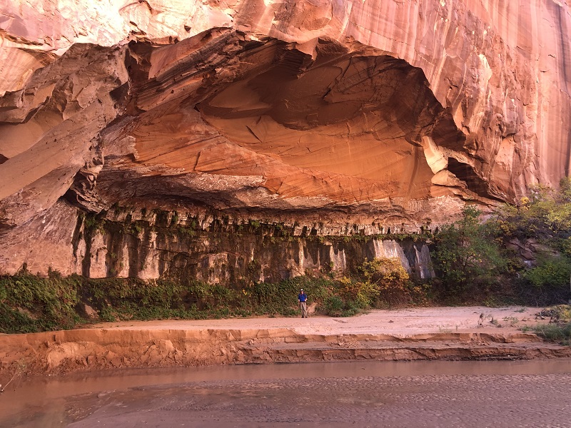
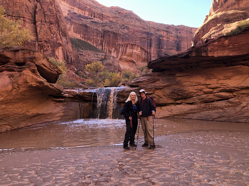

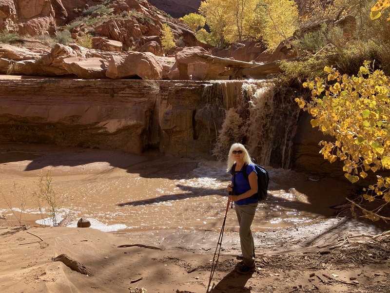
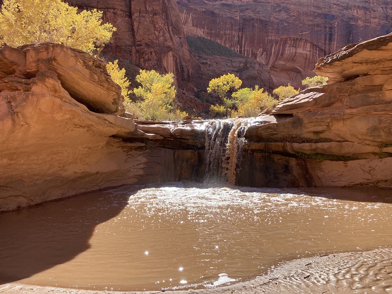
We passed Cliff Arch high up on a wall and hiked a little further to a third waterfall and took a break, having come about two and a half miles up the canyon.
cliff arch

It was almost 1230 and we decided we had better turn around, unsure of how long our return might take. It was disappointing to not make it to Coyote Natural Bridge, but then we had no idea how time-consuming this trek might be. We felt that we saw a very nice sample of some of the best that Coyote Gulch has to offer on our dayhike today. We proceeded to hike back down the gulch, taking time for more photos along the way.
a water seep running down a cliff wall
hamming it up a bit


Before beginning the climb back up the sand dune out of the canyon we stopped to take our boots off and wring some water out of our socks to give our feet some respite. The climb back up the dune was not as grueling as we feared it would be, since the recent rain made the sand damp and somewhat consolidated.
on the hike back up the sand dune
When we reached the Crack in the Wall there were two young fellows lifting their backpacks up the cliff with a rope and they asked if we would like them to lift ours up too and we gladly took them up on their offer. Teresa later quipped to me that "they were probably thinking of their grandparents, and wanted to help the elderly!" It was great fun going back up the cracks and climbing the rock pitches, just as exhilarating as it had been going down in the morning. We grinned and laughed like kids in a playground. This was one of my favorite parts of the adventure.
teresa going back through the narrowest crack
climbing the last pitch out of the crack
at the top of the crack in the wall
heading back across the slickrock toward the trailhead
We followed the cairns back across the slickrock toward the trailhead and upon reaching the sandy area lost the trail but simply bushwhacked toward the trailhead which we could now see on a hill about a mile away. We were exhausted when we returned to the trailhead about 5 pm, about an hour before sunset. We relaxed on our chairs for a while gazing across the vast desert as the sun sank low, before heading back to the Prospector that evening.