"CUPID"
(13,117’)GRIZZLY PEAK D
(13,427’)January 4, 2012
By Tim Briese
6.1 miles, 2800’ elevation gain, 5:40 roundtrip time
I drove to the parking area at Loveland Pass, looking forward to a nice high elevation hike on this unusually warm and calm January day. At 10:05 I headed up the well worn trail to the east toward Point 12,915 with my lab Abby. Snow cover was incredibly light for this time of year.
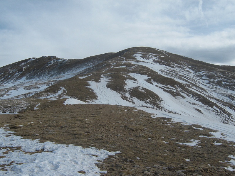
the slope up to point 12,915, which is the hump at the right
I could see a couple of other climbers high on the slopes above. At 10:50 I reached the Point and paused for a short break. The other climbers headed northeast to Sniktau but I headed south to a gentle grassy saddle and up to the rounded summit of Cupid.
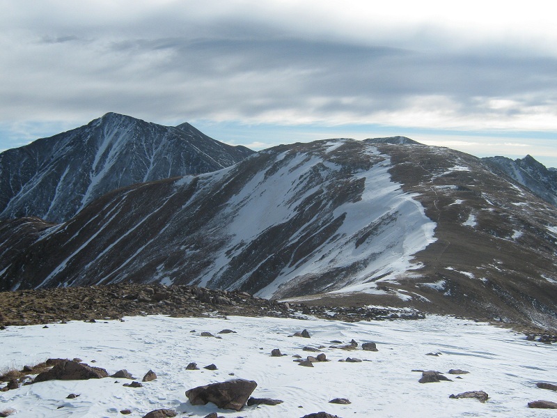
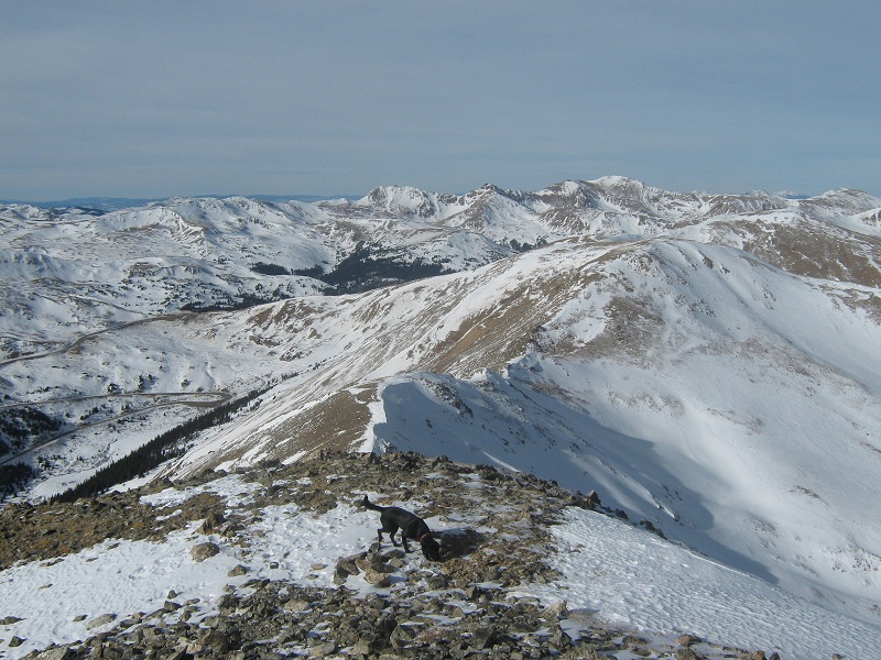
the gentle ridge to cupid, in the foreground. grizzly can be seen just above cupid, and torreys and grays are to the left
I arrived on Cupid at 11:25. The hike was quite easy so far, but the ridge to the south to Grizzly looked a little rougher.
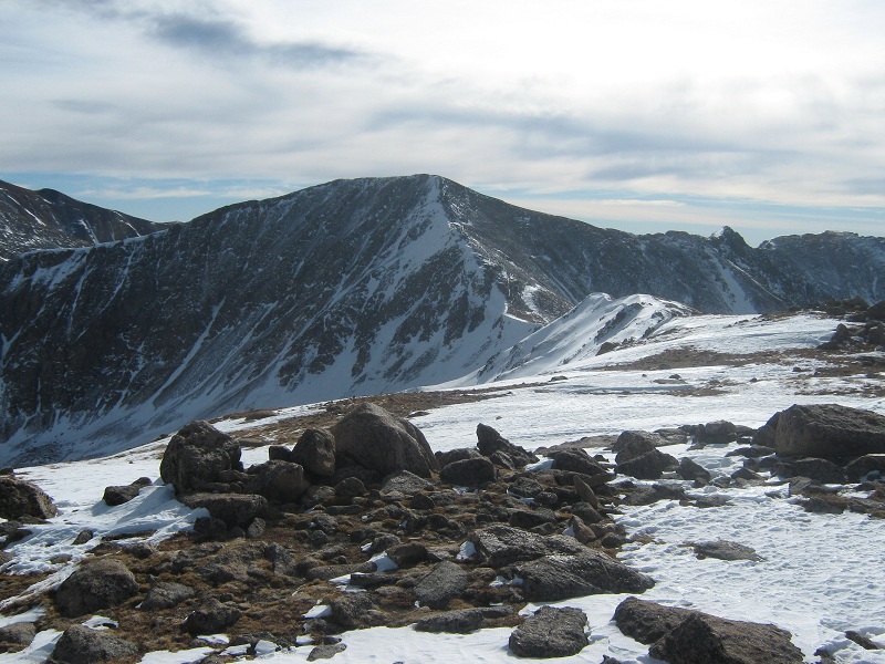
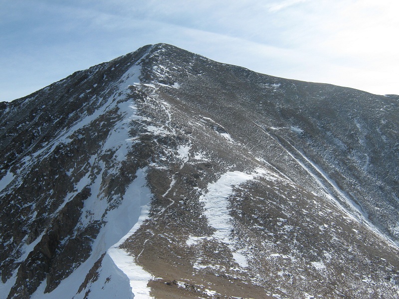
view of grizzly from cupid
I had neither the inclination nor the equipment for a snow climb today but it looked like I might be able to make it over to Grizzly on the wind scoured and mostly snow free western side of the ridge, so off I went. I skirted down to the left of a rough rocky area, dropped down to a 12,750 foot saddle, and went up and over Point 12,936.
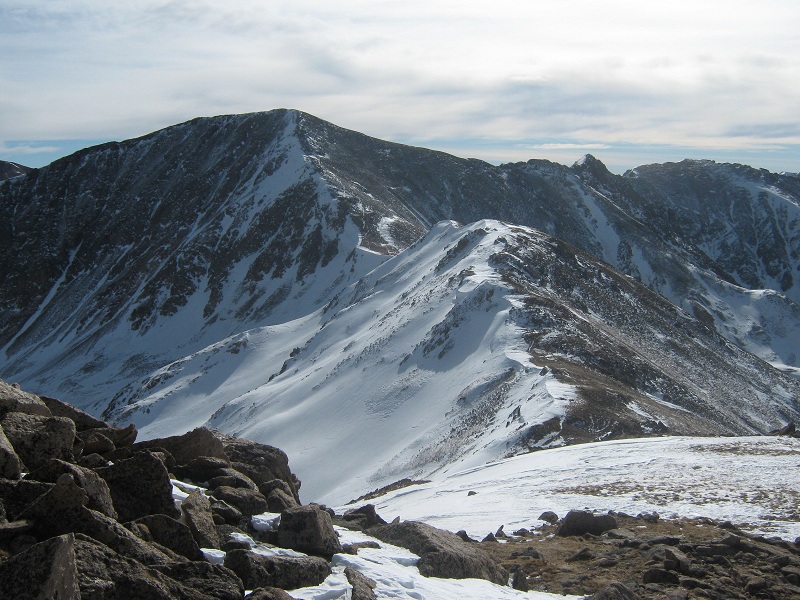
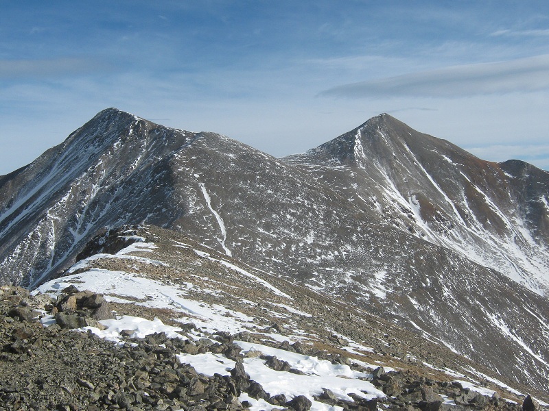
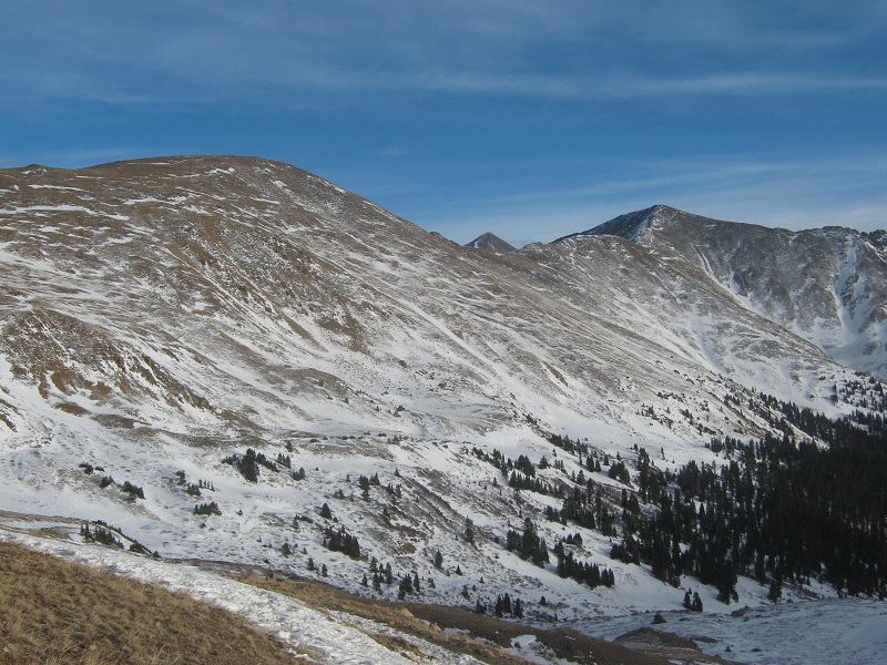
pt. 12,936 is in the foreground, grizzly is beyond
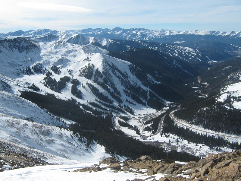
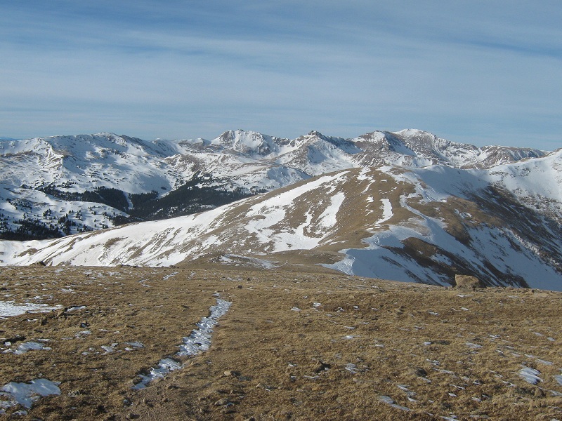
view of ski country from the ridge! a-basin is directly below, keystone lies beyond in the middle, and breckenridge is in the distance
A couple of pairs of old footprints in the snow here and there indicated that others had come this way within the prior couple of weeks. After dropping to another minor saddle I started the 600 foot climb up the scree and talus slope to Grizzly.
the slope up to grizzly from the saddle
I followed a climbers trail for a while until the terrain got rougher and then did an ascending traverse across small talus to the peak’s southwest ridge, then strolled 100 yards up a grassy slope to the summit. The summit appeared to be at the western end of the summit ridge but I walked 50 yards east along the ridge and back to be sure. I arrived on top at 1:00 p.m. and sat on top for half an hour enjoying the surrounding wintry scenery.
view of torreys and grays from the summit
the rugged ridge southwest of the summit

view to the west toward dillon
view to the northwest. loveland pass is at the left, cupid is to the right
The temperature was 20 degrees, not bad for this elevation in early January. The wind had been light on the entire climb until I reached the summit, where a stout breeze was blowing, so the rockpile on the summit served as a welcome wind shelter. I left the top and retraced my steps back down the ridge. Interestingly enough, my entire route today was along the crest of the Continental Divide. When I reached the grassy slope northwest of Cupid I sat down on the tundra for a while and simply gazed about at the winter scenery, reveling in the experience of being in a lofty alpine meadow on such a pleasant and calm winter day.
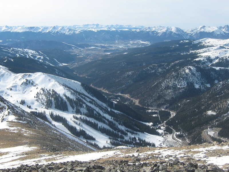
the slopes back to pt. 12,915. the citadel, etc. are in the distance
The sun was sinking low over the ridge to the southwest when I hiked back down the slope toward my waiting truck at Loveland Pass, but some hikers were still heading up the hill.
looking back up at cupid, torreys, and grizzly from near the trailhead
At 3:45 I returned to the pass and headed for home.