ARCHES NATIONAL PARK, UTAH
FIERY FURNACE
CANYONLANDS NATIONAL PARK, UTAH
ISLAND IN THE SKY
April 28-29
By Tim Briese
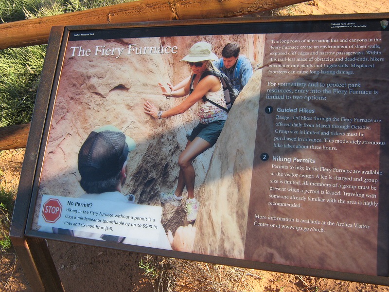
In late April my wife Teresa and I headed to the Utah canyon country, one of our favorite destinations in springtime. We planned to stay in Moab, and we wanted to explore an area of nearby Arches National Park that we had never been to before, the Fiery Furnace. This is a very rugged area of the park consisting of a vast maze of fins, domes, arches, and slot canyons. The maze-like terrain is difficult to navigate through and getting lost is a real concern, so entry is permitted only for those going with a guided group or for experienced hikers who get a permit to go in on their own. We stopped at the park visitor center shortly before it closed on our way into Moab and inquired about going into the Fiery Furnace the next day. The guided tours were filled for the next few days but some individual permits were available for the next day so we filled out some paperwork, watched a required video and walked out the door with our permit.
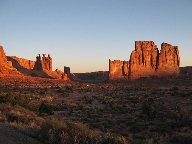
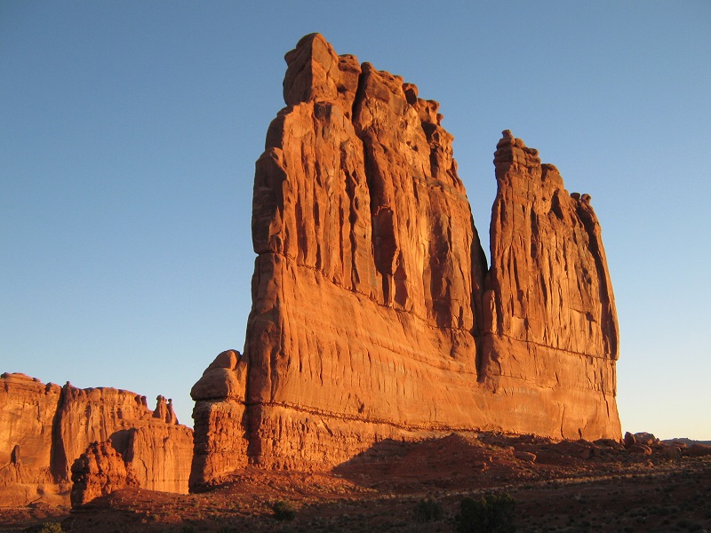
The next morning we headed up into Arches early to get some nice sunrise photos and we were not disappointed.
sunrise views in arches national park
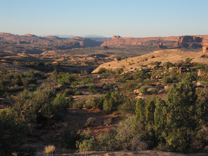
After driving around for a while taking photos we headed to the trailhead for the Fiery Furnace. We were the only ones there when we arrived in the cool of the morning, so we had the place to ourselves for a while before the guided groups and others arrived.
sign at the trailhead for the fiery furnace
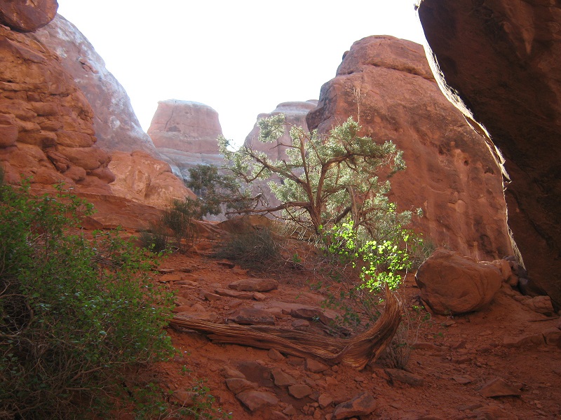
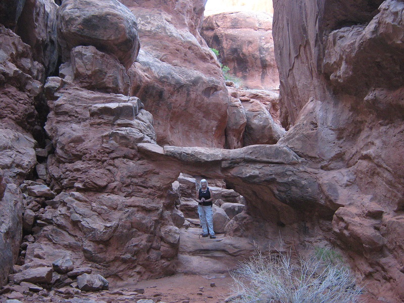
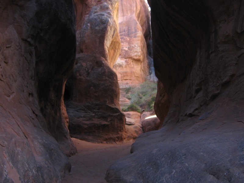
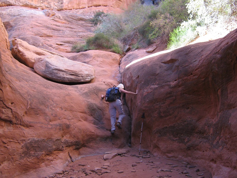
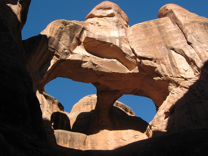
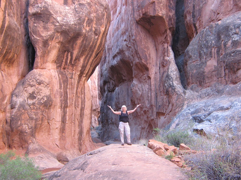
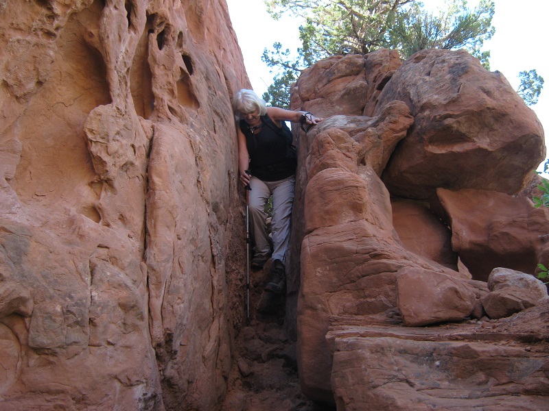
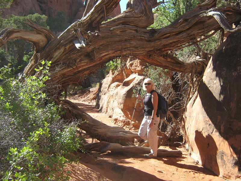
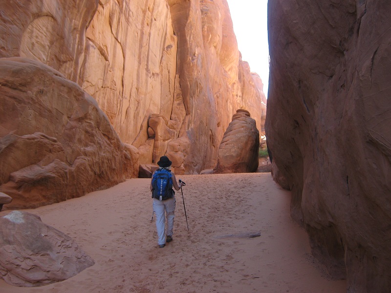
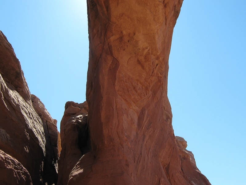
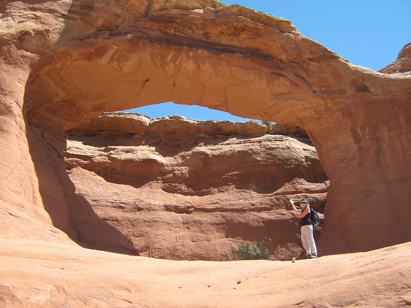
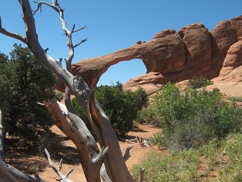
We headed to the northeast from the parking area on a sandy trail and a few minutes later entered the Fiery Furnace. It was indeed a stunning place, a vast labyrinth of canyons, cliffs, and domes. There were no trails but only footprints in the sand one could follow here and there but they led nowhere in particular, or everywhere at once, depending on your point of view. I paid close attention to the surrounding features to help with routefinding. We spent the next two to three hours exploring this wonderful place. It was certainly fascinating.
the following photos were taken in the fiery furnace
We gradually worked our way in a clockwise direction around the Fiery Furnace and late in the morning made our way up a slope back to the parking area, encountering a group led by a park ranger on their way in. We spent the next couple of hours hiking a few miles on some other trails north of the Fiery Furnace to see some of the park’s other arches.
on the way to sand dune arch
broken arch
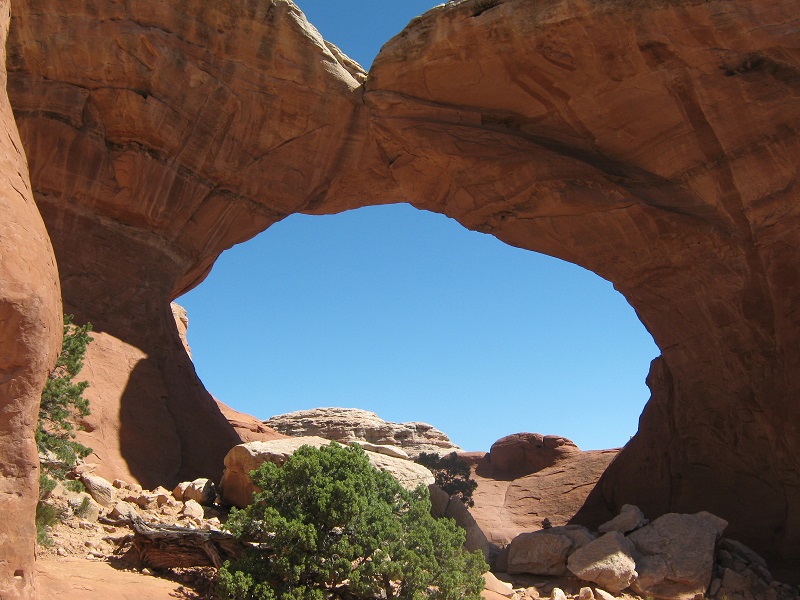
tapestry arch
skyline arch
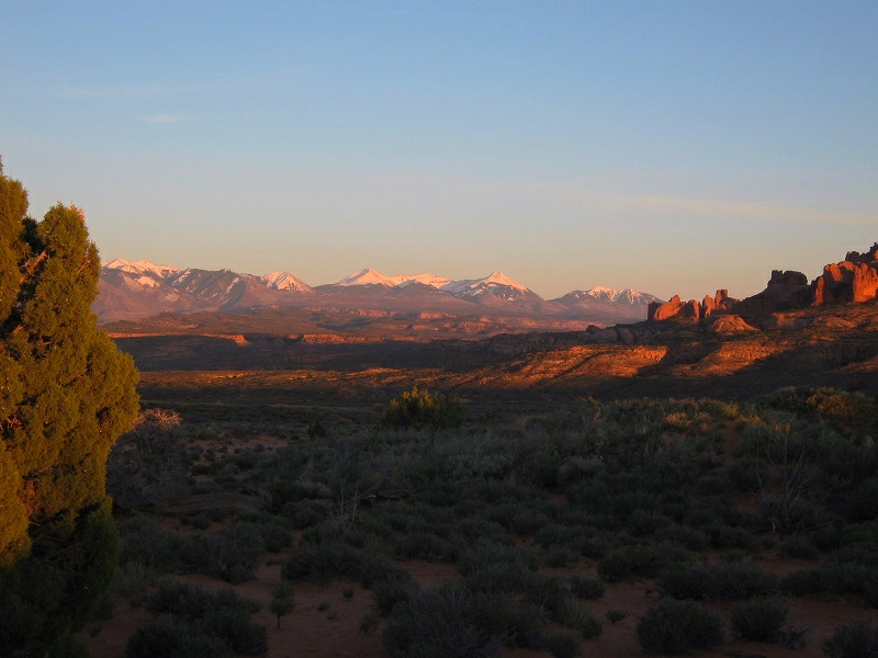
Then we went back into Moab to rest and relax at the motel a while before driving back up into Arches in the evening to get some sunset photos.
a sunset view of the la sal mountains from arches national park
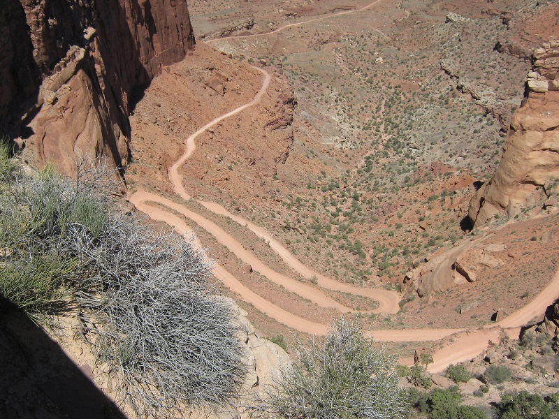
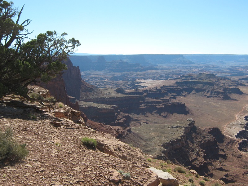
The next morning we drove north of Moab up into the Island in the Sky district of Canyonlands National Park. This area consists of a narrow peninsular mesa about 15 miles long that lies about 2000 feet above the rugged canyons of the Colorado River to the east and those of the Green River to the west. We spent the day exploring various sights and trails. Our first stop was to take a look at the Shafer Trail, a hair-raising dirt road that descends from the mesa at a place called the Neck, where the Island in the Sky is little more than a few feet wide.
the shafer trail. this road is not for the faint of heart!
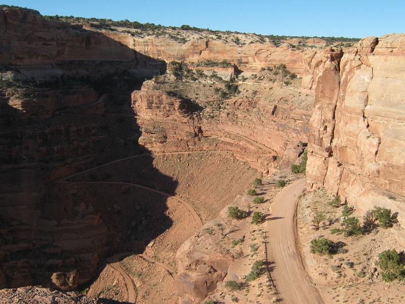
the lower part of the road
we did not drive on this road today, but i was on it about 40 years ago.
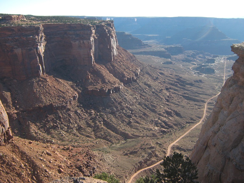
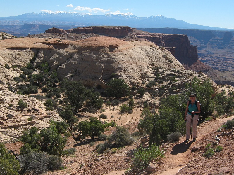
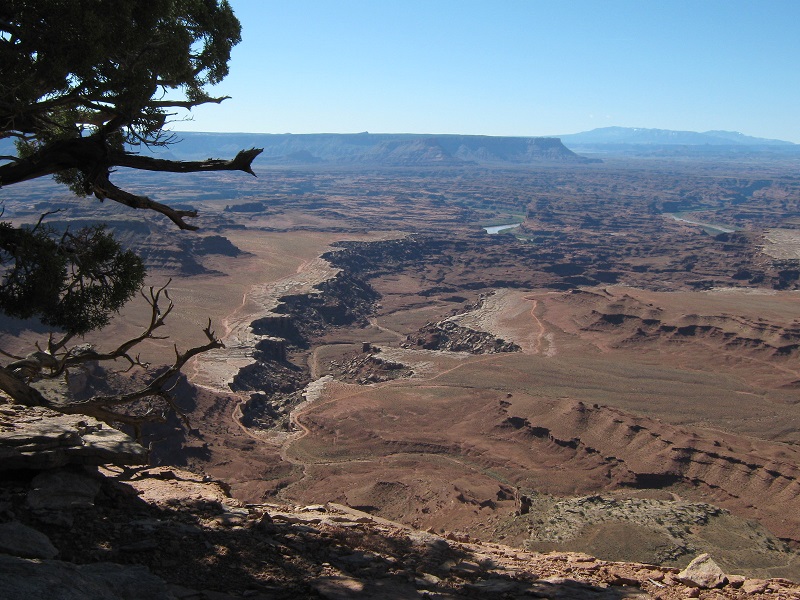
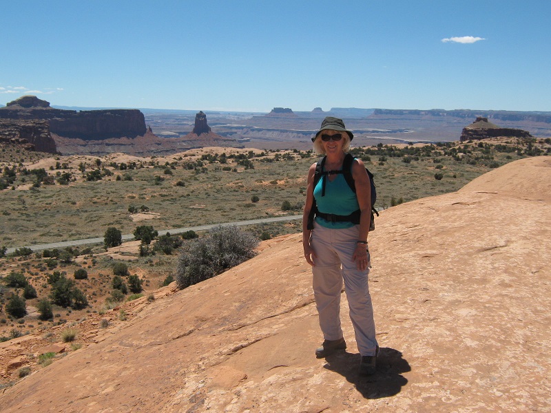
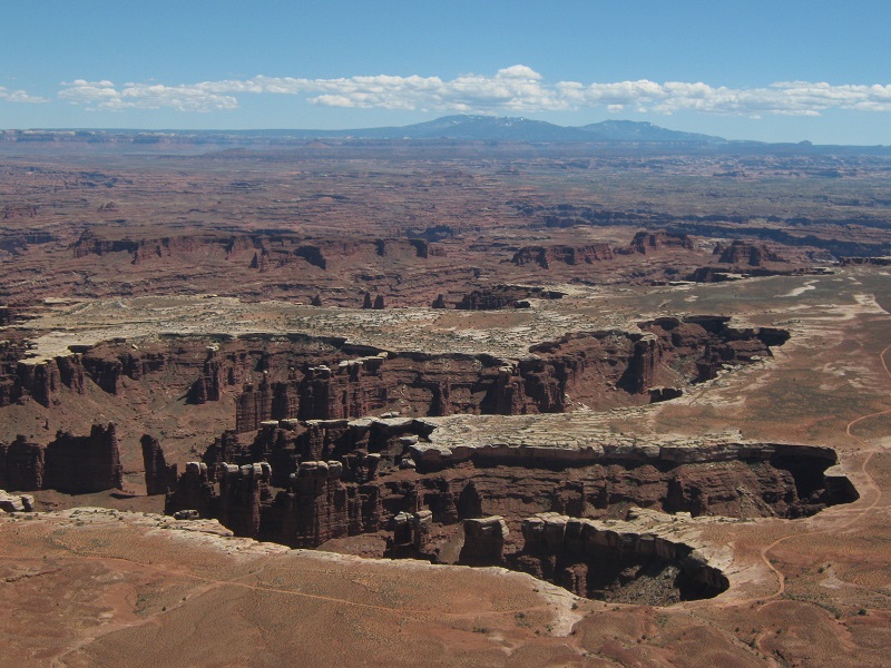
Then we hiked the Lathrop Trail across the mesa top a few miles to the edge of the rim to take a look at the views.
teresa on the lathrop trail. the la sal mountains are in the distance.
view of canyons and the colorado river from the lathrop trail
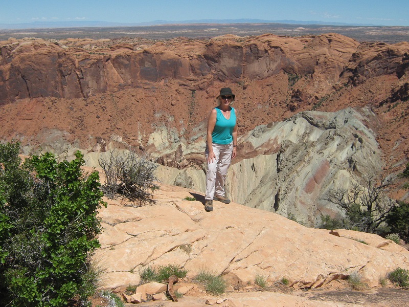
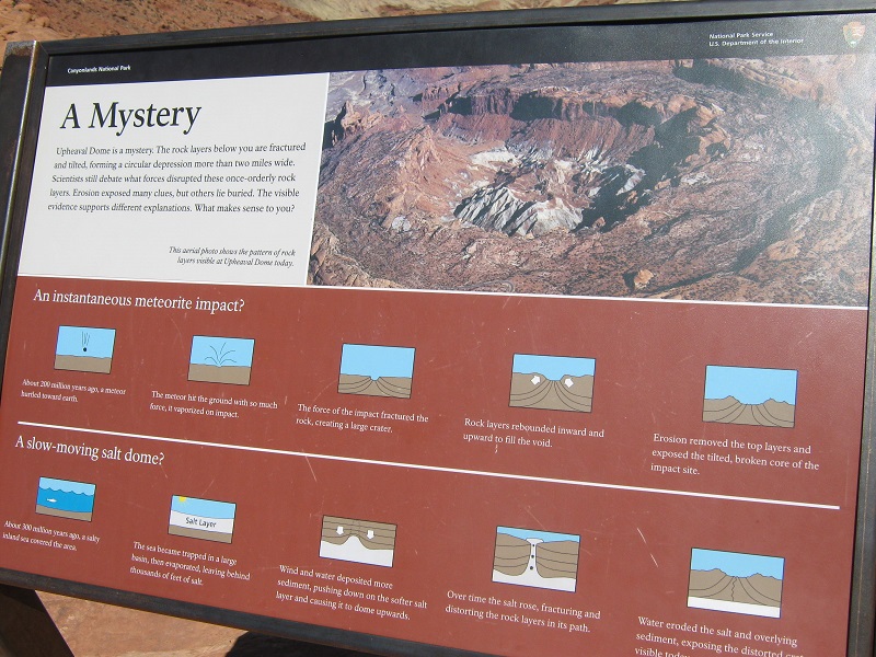
We later hiked to see Upheaval Dome, a curious formation about whose origin scientists are unsure. It might have been created by a meteor impact, or perhaps by a salt dome upheaval in the earth’s crust.
at an overlook for upheaval dome
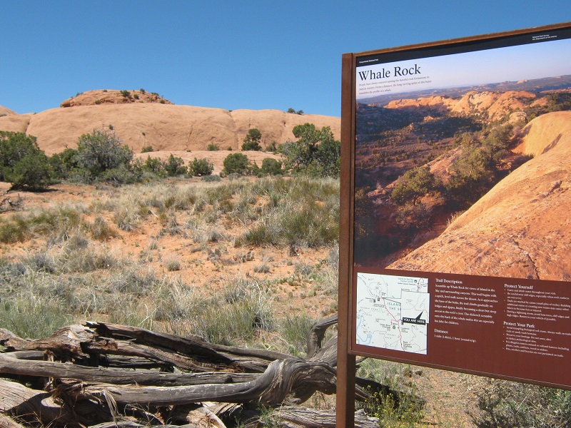
Then we hiked to the top of Whale Rock, which offered a nice climb up slickrock slopes to its top.
whale rock
on top of whale rock
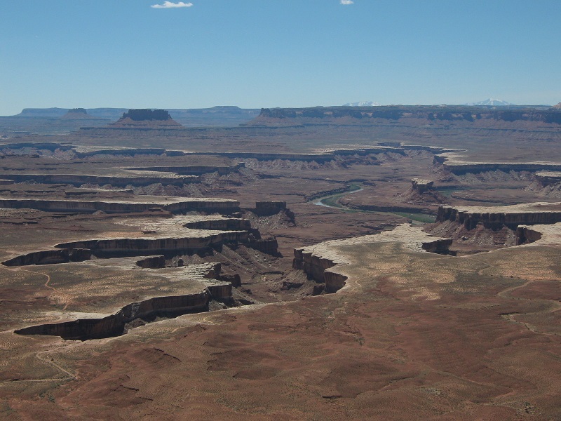
Then we drove on to see the Green River Overlook, then Grandview Point, which is at the very southern tip of the Island in the Sky, and we finished up by visiting world famous Dead Horse Point.
green river overlook
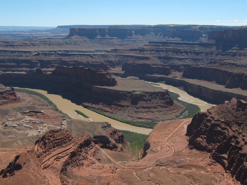
the view from grandview point
dead horse point
After this adventurous day we returned to Moab and had a wonderful dinner at the Sunset Grill, high on a hill with splendid views of the town below. The following day we headed for home.