SQUARE TOP MOUNTAIN (12,985’)
HENRY MOUNTAIN (13,254’)
FOSSIL MOUNTAIN (12,749’)
July 20, 2021
By Tim Briese
9.0 miles, 3800’ elevation gain, 9:00 roundtrip time
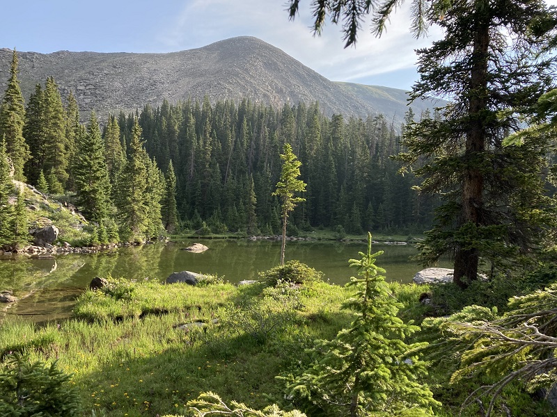
Brian and I drove up the excellent Gold Creek Road to the trailhead for Lamphier Lake early in the morning. It only took about 45 minutes to get here from Gunnison. At 605 we headed up the trail and hiked briskly up to beautiful Lamphier Lake.
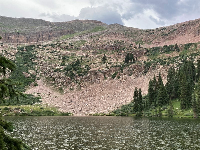
a scenic pond northeast of lamphier lake
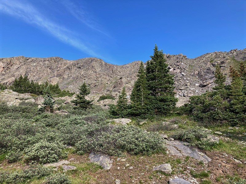
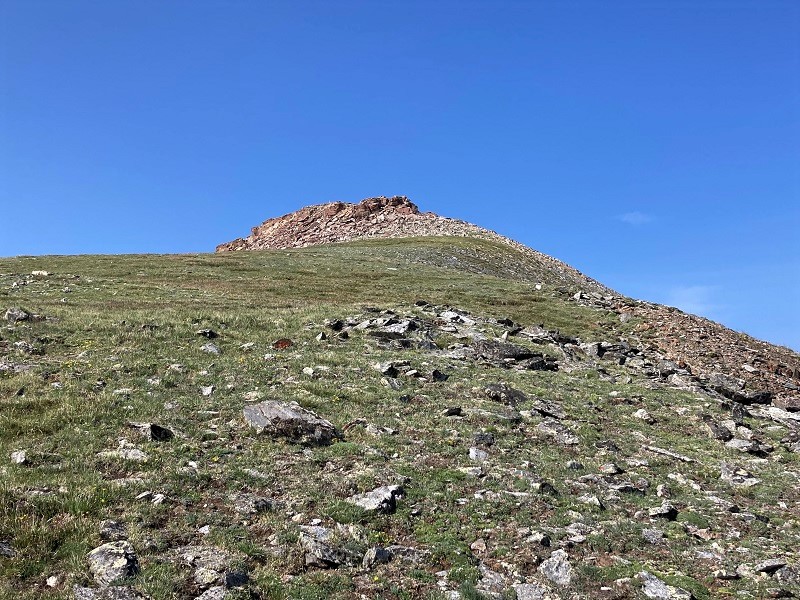
After a short break we began bushwhacking to the northwest from the lake, aiming to climb to the crest of the rough ridge east of Square Top Mountain. After a while the willows gave way to talus slopes and we picked a gully to go up that was close to Square Top. There was at least one easier looking gully further east up to the ridge but traversing along the crest of the rugged ridge looked very questionable.
we went up the gully right in the center; square top is to the left
After working our way up a steep slope on talus and a little grass, and a little nifty ledge work, we attained the top of the ridge at 12,700’, about a thousand feet above the lake. This was a little tougher than I expected. (Note: There is another route up a drainage southeast of Square Top which we saw from the top of Fossil Mountain later that appears much easier. See photo later.)
brian coming up the talus slope; lamphier lake is below

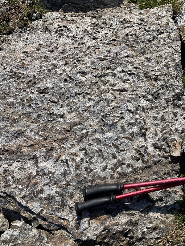
some namesake fossils in a rock, here in the fossil ridge wilderness area
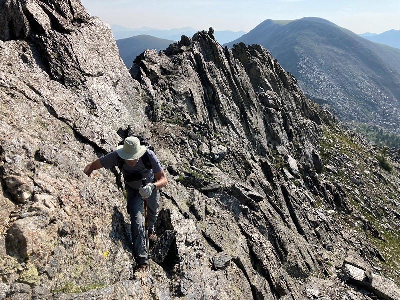
some handy ledges shortly before we reached the crest of the ridge
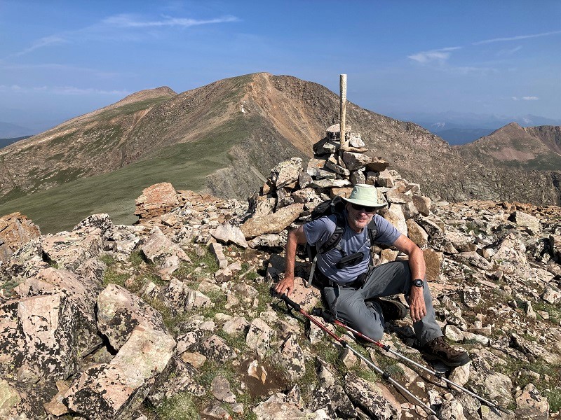
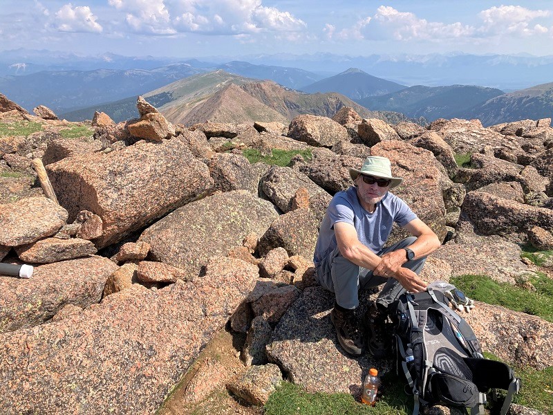
After topping out on the ridge it was an easy climb up to the nearby summit of Square Top, where we arrived about 945.
the summit of square top mountain
This is a nice little summit with fine views.
brian on square top, with henry mountain beyond
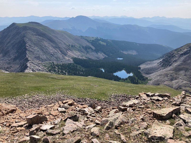
lamphier lake from square top; broncho mountain is at the left
Then we made the easy hike down to the saddle to the northwest and the 500 foot climb up to Henry Mountain on grass and a little scree.
on the way to henry mountain
brian on top of henry
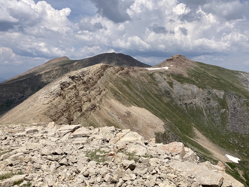
We didn’t stay too long on Henry because the forecast was stormy for this afternoon. We contoured back below the west side of Square Top and gained the ridge south of Square Top on our way to Fossil Mountain. We came to a very rough stretch of ridge with towers and blocks. While checking out the east side of the ridge I happened to touch a boulder, at least two feet in diameter, near my right shoulder which abruptly tumbled down and grazed past my right leg, bloodying it a little and tearing my pants. That was a very close call. A trajectory difference of a few inches could have ended my hiking days, or perhaps worse. I was shook up about this the rest of the day, and for the next several days in fact. Life and health are indeed precious, and precarious. We found better going on the west side of the ridge but it was rocky and slow. We made our way down to a saddle and up to the summit of Fossil.
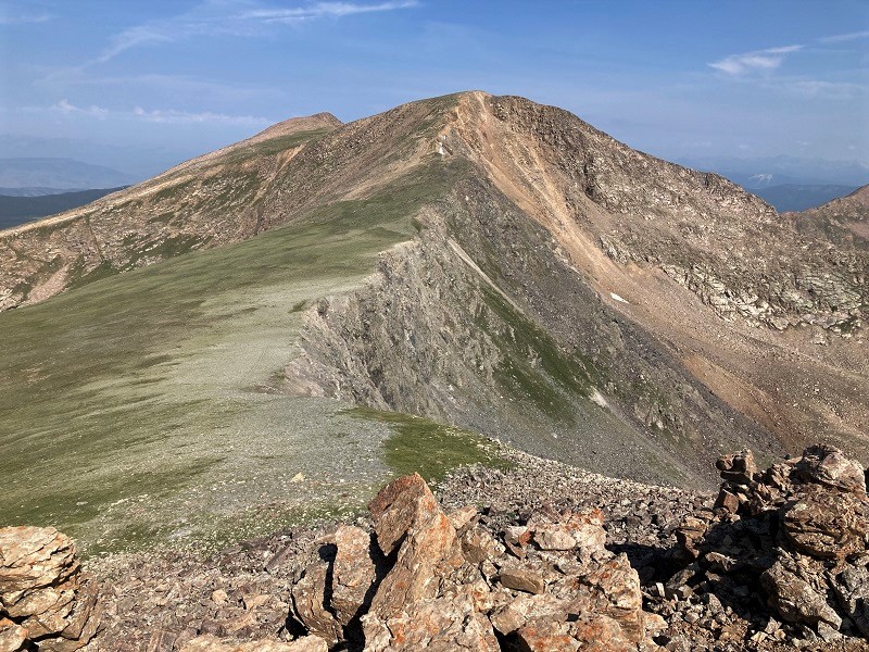
from fossil mountain looking back at the rough ridge, with square top at the right, and henry beyond
Far below we could see a solid trail going up the drainage southeast of Square Top, apparently a much easier route than ours. Oh well, maybe next time.
we could see a trail coming from the right and going up the grassy slope toward square top, at the far left

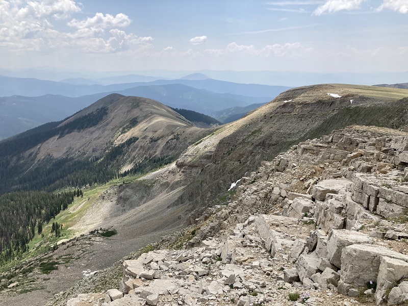
We had considered continuing on down the ridge to Sheep Mountain and returning via the lengthy Fossil Ridge Trail, but that looked like a long and arduous undertaking now, and particularly not a good idea with the clouds building up.
the ridge to sheep mountain, at the left.
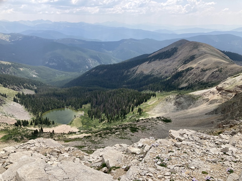
Instead we decided to make a rough thousand foot descent from Fossil down to Mill Lake.
mill lake from fossil mountain
This was plenty challenging, with a lot of steep scree, talus, and cliff bands, but we made it down to the lake in about an hour. It was good to be there, because thunder began rumbling minutes later.
from mill lake looking back up at the rough terrain we came down from fossil mountain, in the center
We hiked two miles down the Mill Lake Trail to the road, hustling near the end, motivated by the beginning of rain and close lightning strikes. We rapidly walked a couple of hundred yards up the road from the Mill Lake Trailhead to the Lamphier Lake Trailhead and jumped into the truck just as a torrential rain unleashed. It was nice to climb these peaks today but it was more arduous than I expected.