HONAKER TRAIL, UTAH
November 6, 2019
By Tim Briese
3.4 miles, 800’ elevation gain, 2:30 roundtrip time
(2.0 miles, 1:45 in the canyon)
If you are looking for an interesting hike in a very remote place, this is one to consider. This remarkable trail in southern Utah improbably descends 1200 feet into a rugged canyon down to the San Juan River.
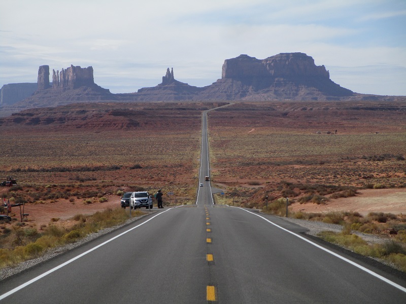
On my way home from Arizona I went through Monument Valley and drove north through the remote hamlet of Mexican Hat, Utah.
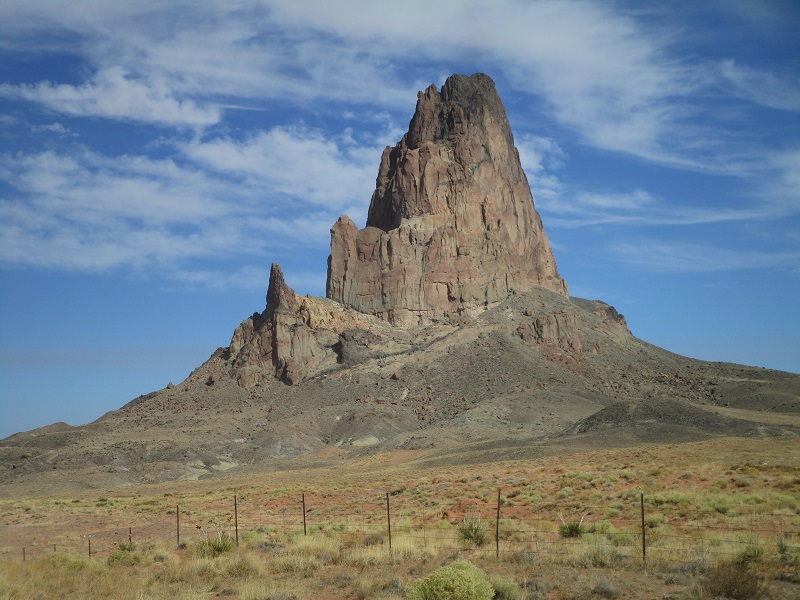
i drove past impressive agathla peak just south of monument valley
do you remember this view of monument valley from the forrest gump movie?
A few miles north of Mexican Hat I turned off of UT 261 onto SR 316, a spur road that runs a few miles southwest to the remarkable Goosenecks of the San Juan River (see a photo of it in my April 13, 2019 trip report). After going 0.5 miles on SR 316 I turned right onto a well maintained dirt road and followed it northwest 2.5 miles across the wide open desert. At this point there was an old water tank lying to the left side of the road and I turned left here onto a dirt track that headed southwest. This track is probably doable with high clearance 2WD when dry, even though it became markedly rougher after the first mile.
wide open country, indeed

At about 1.5 miles this track reached some benches near the rim of the San Juan River canyon, and multiple dirt tracks went in different directions. To reach the start of the trail one should turn left here and go about 0.3 miles, to a point where a rougher track goes to the right (west). Park here or four-wheel about 0.2 miles to the rim of the canyon, where the start of the trail is marked by a four foot tall cairn.
I wish I had known these precise directions when I arrived. I did not have a good map of the area and was armed only with directions I had read on the internet the night before. And of course there was no cell service here. GPS coordinates of that cairn would have been nice to have. As it was, the directions I read got me close but I spent a frustrating hour wandering around looking for the trail, finally spotting it from a distance when I looked over the canyon rim from a spot a half mile to the north.
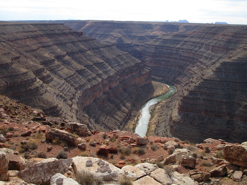
from this vantage point i spotted the trail switchbacking from the rim at the far upper left down toward the river
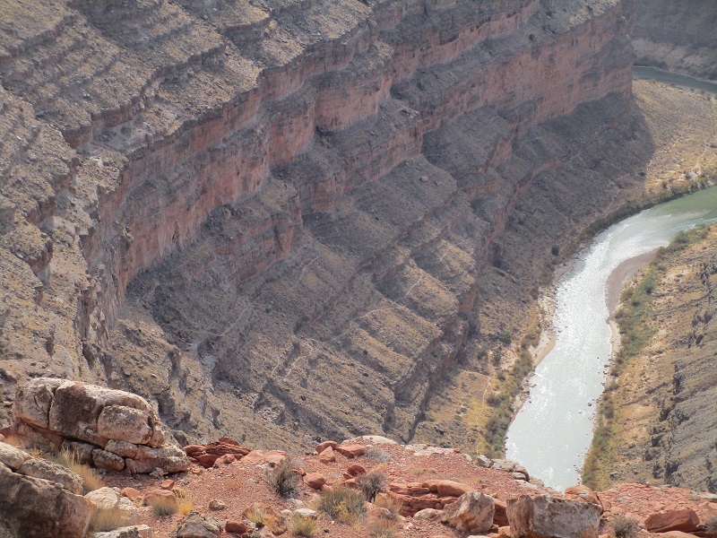
a zoom shot showing the trail traversing ledges above the river
It was well after 1 pm when I finally started down the trail from the cairn with my lab Abby.
the cairn at the canyon rim marking the start of the trail
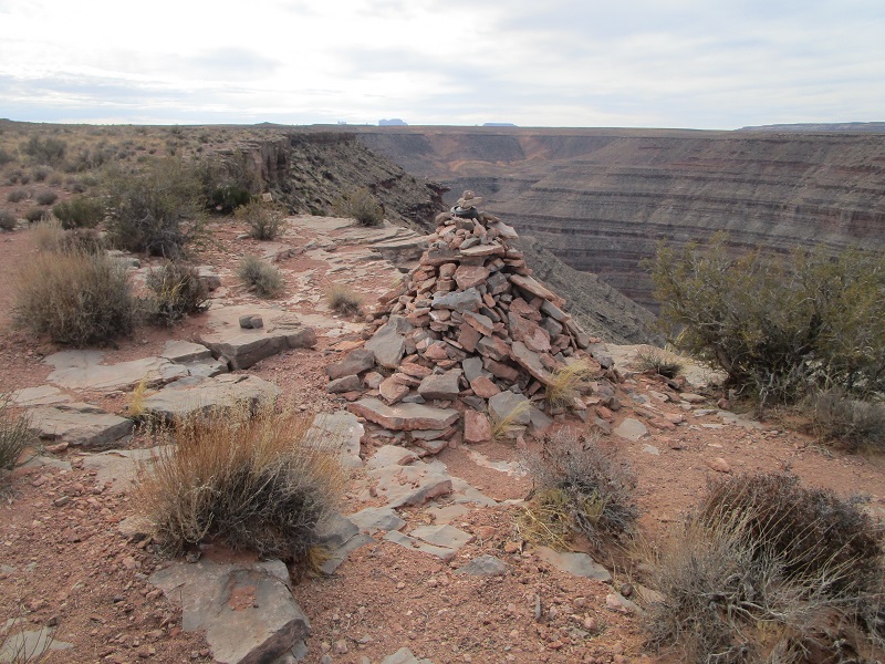
the beginning of the trail
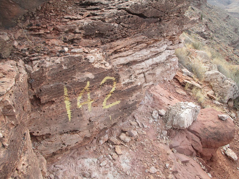
This remarkable trail was built in the 1890’s by gold prospectors and drops precipitously to the river. It has been used extensively by geologists over the years to study the layered rock formations in the canyon and there are numerous painted numbers along the way that identify geologic features.
one of the geologists' markings
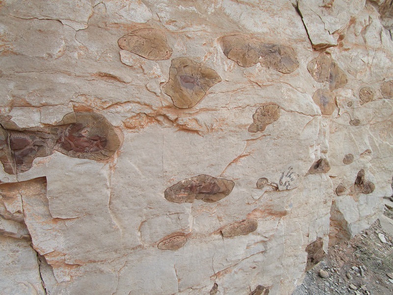
an example of many interesting rock formations
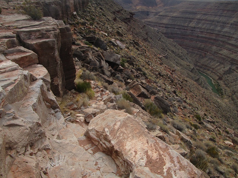
The trail is generally is good shape with a few rough rocky areas with a bit of scrambling necessary.
on the trail
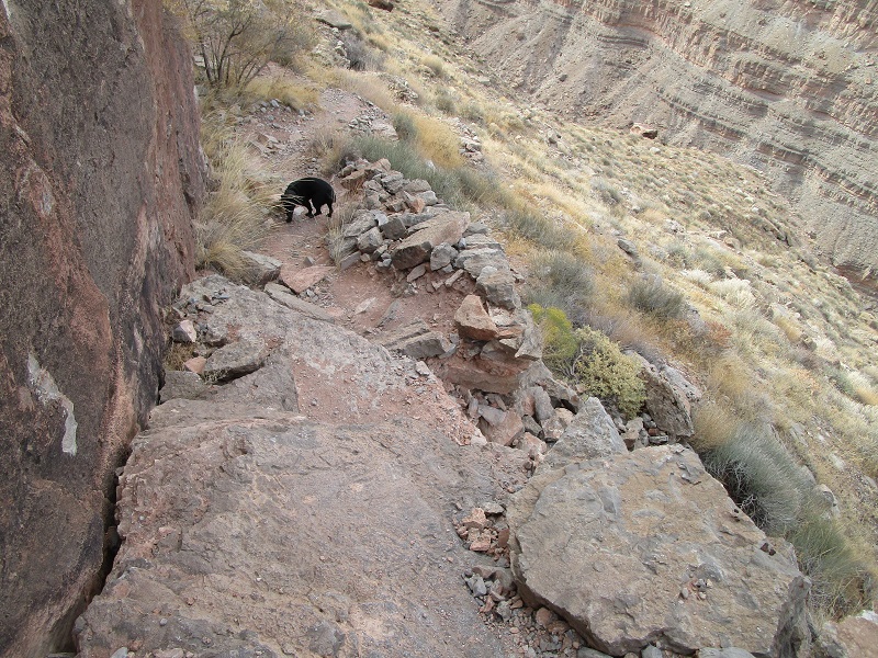
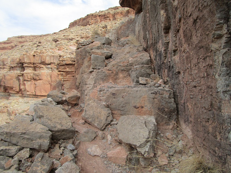
one of the rougher spots that required some light scrambling
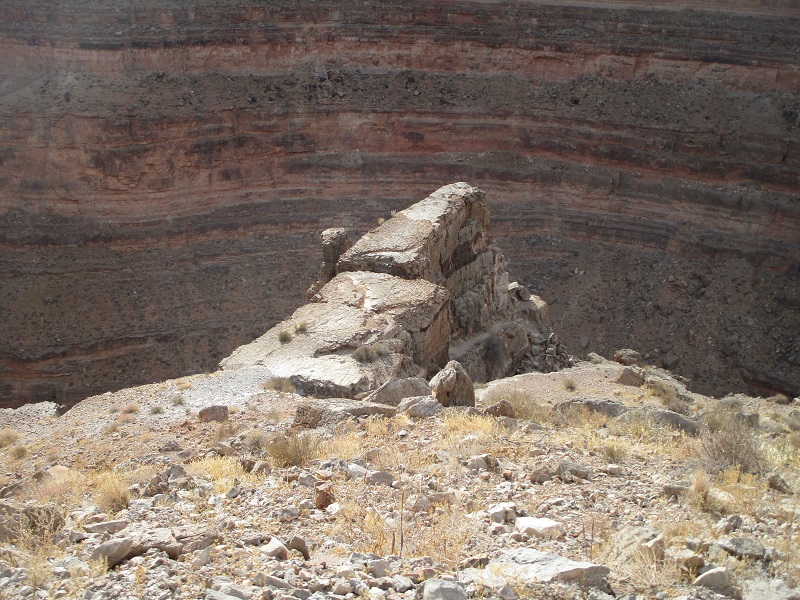
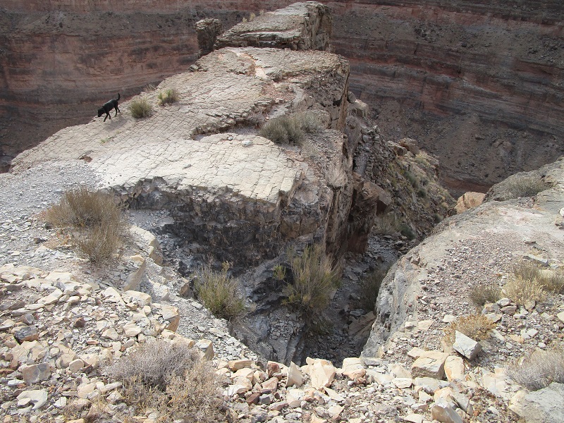
Fortunately it was pleasantly cool today as this route could be quite hot during much of the year. There was not another soul within miles and I felt a little uneasy being alone in this very remote place and wondered if my InReach would work down in this canyon in case of an emergency. I dropped about 800 feet in a mile down to dramatic Horn Point, a rocky outcropping that overlooks a sharp bend in the river below.
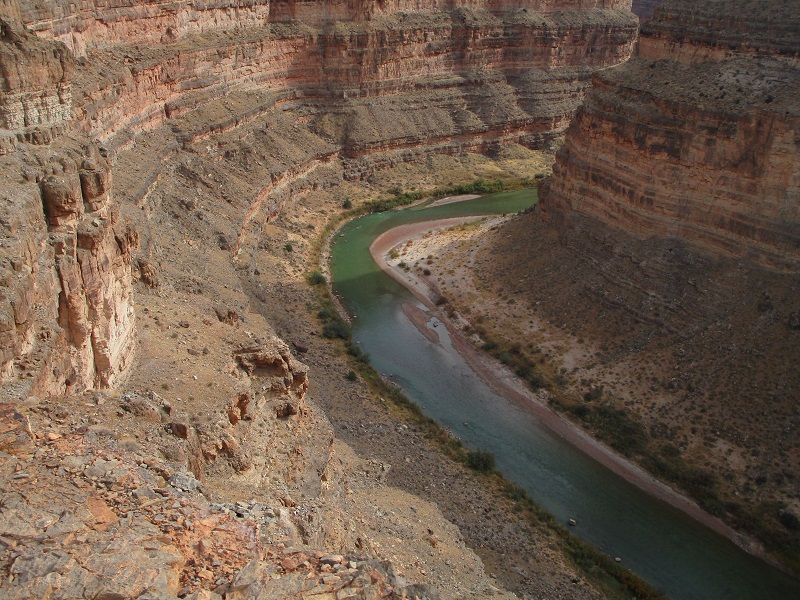
horn point overlooks a bend in the river and offers dramatic views
a view of the river from horn point
the trail drops through this gap to the right of horn point. abby didn't seem to mind the exposure on the point.
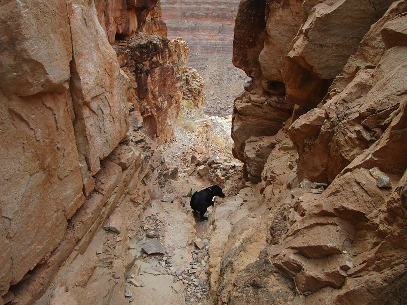
From there I descended further as the trail deftly cut through some cliff bands.
the trail goes through this sharp gap
switchbacks in the trail, and the river below
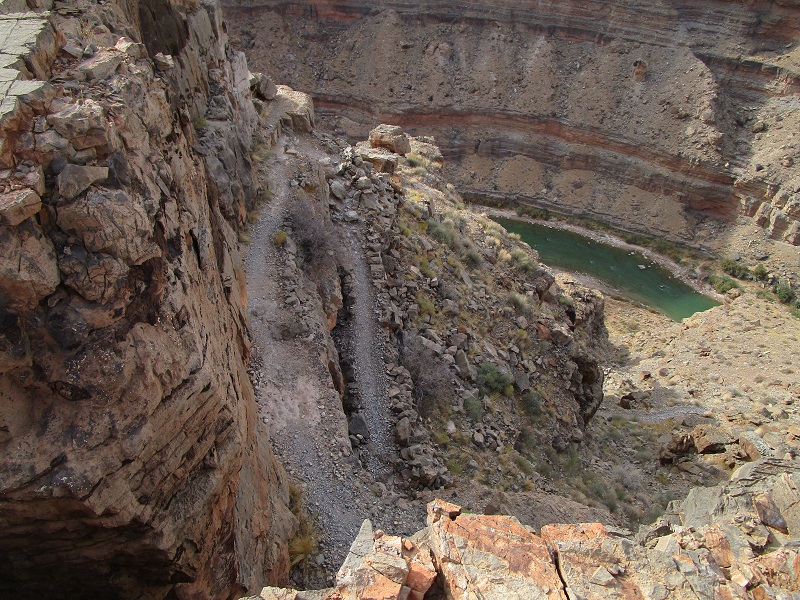
I was running out of time now and made the tough decision to turn back. The sun sets early in November, and my sense of unease still gnawed at me, and besides, I wanted to drive all the way to Moab yet this evening. The trail below made a couple of long switchbacks in another mile to the river which I could hear flowing about 400 feet below. It would have been nice to continue on down there but I felt that I had seen most of the trail. I turned and retraced my steps back up to the rim and over to my truck, concluding this interesting adventure.