MT. JACKSON
(13,670’)July 20, 2012
By Tim Briese
19.1 miles, 5600’ elevation gain, 12:45 roundtrip time
Brian and I had always planned to climb Mt. Jackson via a lengthy backpack up Cross Creek per Garratt and Martin directions, but a trip report by Steve Knapp detailing a long dayhike approach from Beaver Creek really caught our attention and appealed to us a lot. This route turned out to be even better than we expected and I highly recommend it.
I met Brian at the Comfort Inn in Avon the evening before the climb and before dinner we took a drive into Beaver Creek to scout the trailhead and parking situation so we didn’t have to figure it out in the dark the next morning. An attendant at the entry gate was very helpful and gave us a map of the area.
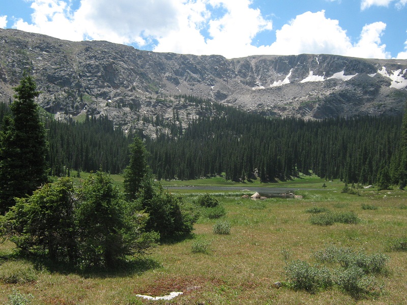
We rose at 2:45 the next morning and took the short drive up to Beaver Creek and parked in the parking garage in the lower level of the Gerald Ford Hall, which is the closest public parking available to the trailhead. It was free of charge at this time of year. At 3:20 we left the parking garage and walked a half mile up a paved road in the dark with our headlamps to a gate on the left where the well-signed Beaver Lake Trail begins. The route then went up through the Beaver Creek Ski Area, part of the way on ski roads, past chairlifts, and past a large assemblage of ski patrol snowmobiles whose reflective markings stood out boldly in the dim light of our headlamps. Eventually the route turned into a real trail, and at 2.6 miles we entered the Holy Cross Wilderness. At 3.0 miles we reached Beaver Lake, where we were temporarily confused in the darkness by an array of trails around the lake before we found the one that continued up the valley. We tramped on up the wonderful trail making excellent time. The trail was not very rocky and the grade was quite gentle most of the way. At 6.7 miles we reached the Grouse Mountain Trail junction. The time was 6:55 and the early sunlight was just beginning to shine on the heights above. Just past the junction we hiked past broad and shallow Lower Turquoise Lake.
lower turquoise lake (photo taken later on our descent)
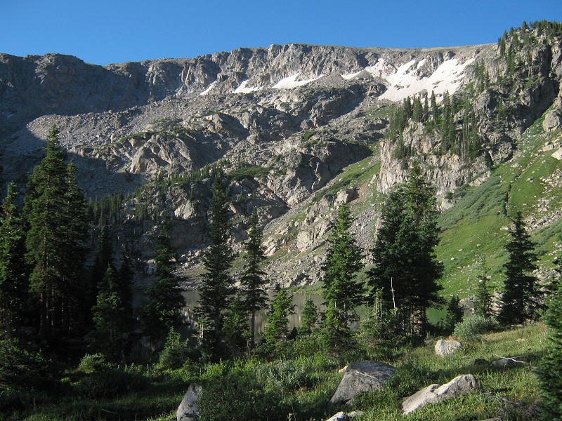
A few minutes later, at 7:15, and at 7.3 miles, we caught our first glimpse of Upper Turquoise Lake just ahead through the trees. The lake lies in a magnificent cirque that is ringed by cliffs.
upper turquoise lake is visible through the trees
Just at this point we looked up to the right and saw the exit gully that we would take to climb up out of the cirque to the heights above.
the gully we went up
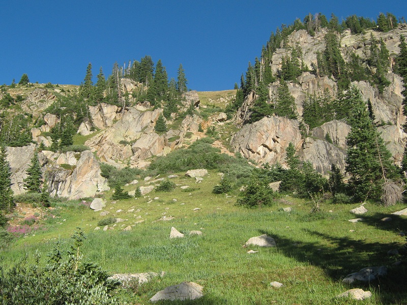
After a fifteen minute break we left the main trail and headed up the steep gully, and were pleased to find a reasonable climbers trail that went up the gully.
brian coming up the gully
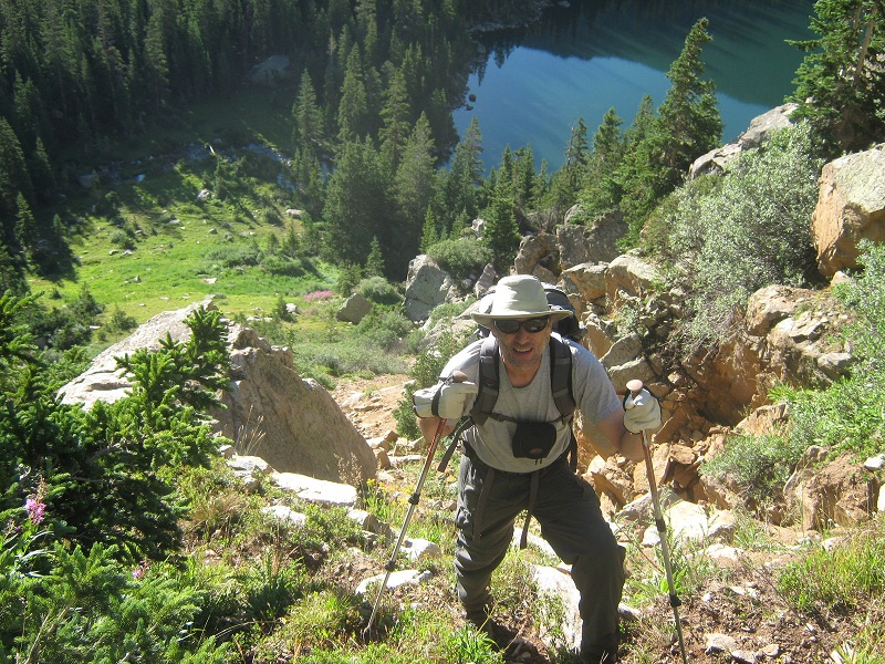
there was a nice view of upper turquoise lake below

It took us 25 minutes to reach the top of the gully where we found pleasant grassy slopes above. We headed crosscountry to the south in the general direction of Jackson, picking our way up grassy slopes with some talus in places.
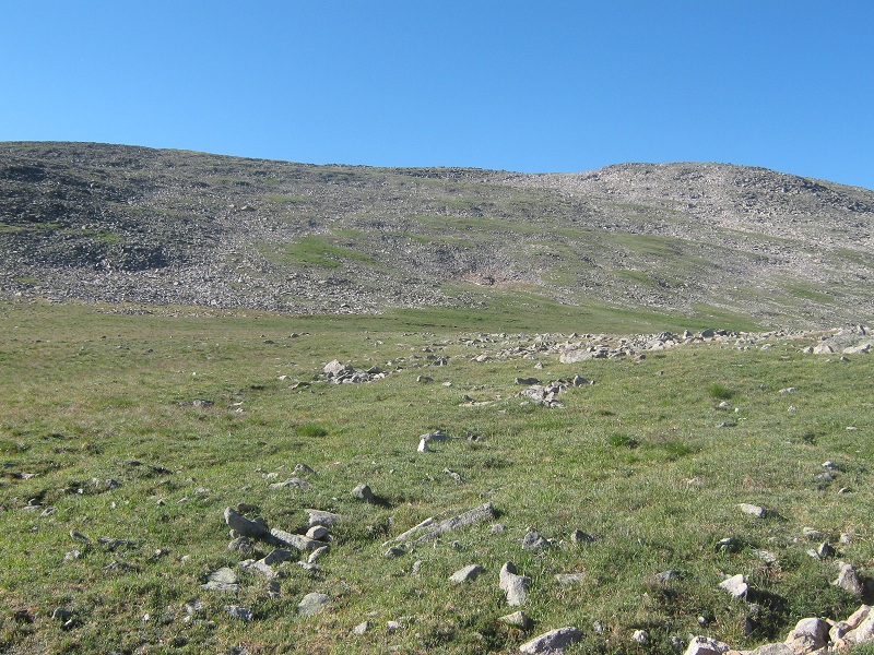
we headed south up this gentle slope
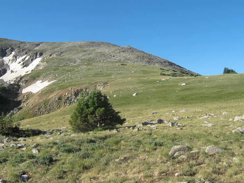
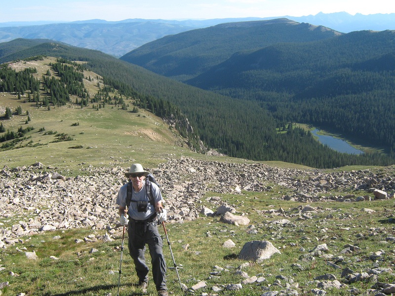
brian coming up the slope. lower turquoise lake and the valley we came up lies beyond.
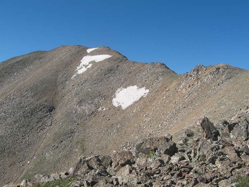
the upper slopes to jackson's northeast ridge
We climbed to the ridge northeast of Jackson and followed it around to the right a short distance to the peak’s north ridge. The north ridge went smoothly, with only one gnarly spot where we dropped down about 50 feet on the left side of the ridge.
the ridge to jackson's summit. the only rough spot was at the far right.
We stepped on the prized and remote summit at 10:05, thoroughly pleased with how smoothly the climb had gone. In spite of its length and considerable elevation gain, the route traveled quickly and was no harder than Class 1 nearly all the way, with only a couple of minor Class 2 places in the gully and on the north ridge. We sat on the summit for over half an hour relaxing and enjoying the nice views.
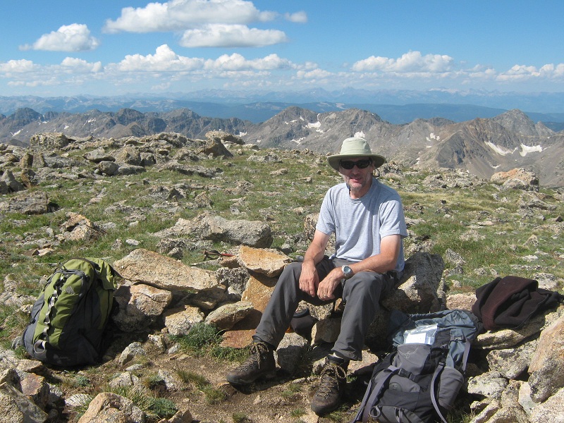
brian on jackson's summit
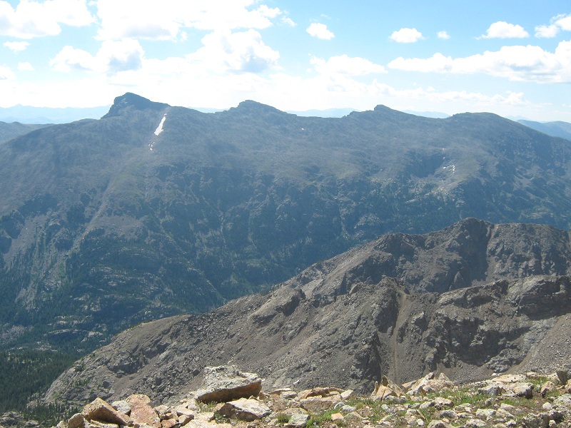
left to right: mt. of the holy cross, holy cross ridge, and unnamed 13,768
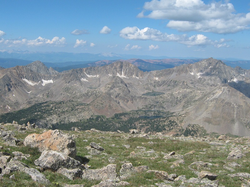
gold dust peak, at the right. the elk range is visible in the distance at the far left
The weather was holding quite nicely with only a few clouds beginning to form. The register indicated that we were the 26th and 27th climbers to summit this year. Brian considered going on to an unnamed point to the south but in the end elected not to. We left the summit at 10:40 and made a fast descent back down to the lakes and stopped for an extended break by the Grouse Mountain Trail junction. I was getting very thirsty and welcomed the opportunity to filter some water. Although the sun was still shining the clouds were rapidly developing an ominous look. We met about 8 backpackers coming up the trail as we tramped the long miles back down the valley. Thunder began to rumble and about 3 p.m. the skies cut loose with rain. As we sloshed down the wet trail through the ski area we noticed a young couple clutching a tiny baby standing off to the side under a tree trying to escape the worst of the rain. We dragged ourselves back to the parking garage at 4:05. My legs felt like they were about to fall off for a while, but a cold Coke helped to revive me. After dropping Brian off at his car at the motel I pulled onto I-70 and headed for home.