
LOST CREEK WILDERNESS BACKPACK
May 21-22, 2020
By Tim Briese
First day: 15.3 miles, 4800’ elevation gain, 10:00 time
Second day: 9.4 miles, 1000’ elevation gain, 6:50 time
Total: 24.7 miles, 5800’ elevation gain
For many years I have explored the Lost Creek Wilderness, climbing its peaks and enjoying its incredible rocky scenery on various lengthy day-hiking routes. One of the most scenic areas of the wilderness had eluded me though, in particular the McCurdy Park Trail, because it is just too remote and distant for a day-hike, for me at least. I suggested to my son-in-law Rod that we do a backpack into this area and he eagerly agreed.
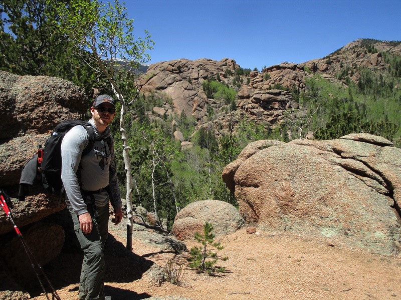
We drove to the Goose Creek Trailhead and hit the trail at about 730 am on a beautiful sunny morning. There were about ten other vehicles parked at the trailhead.
rod at the trailhead
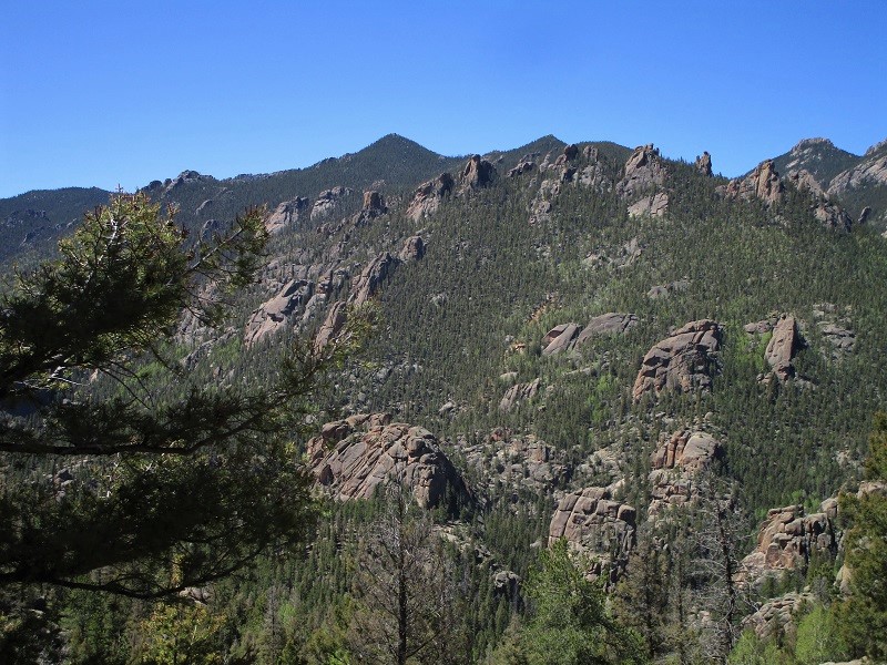
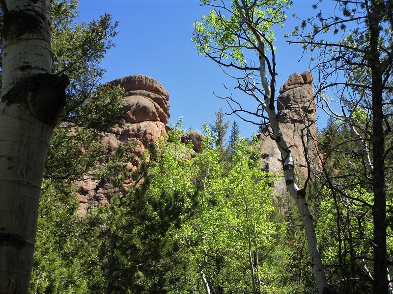
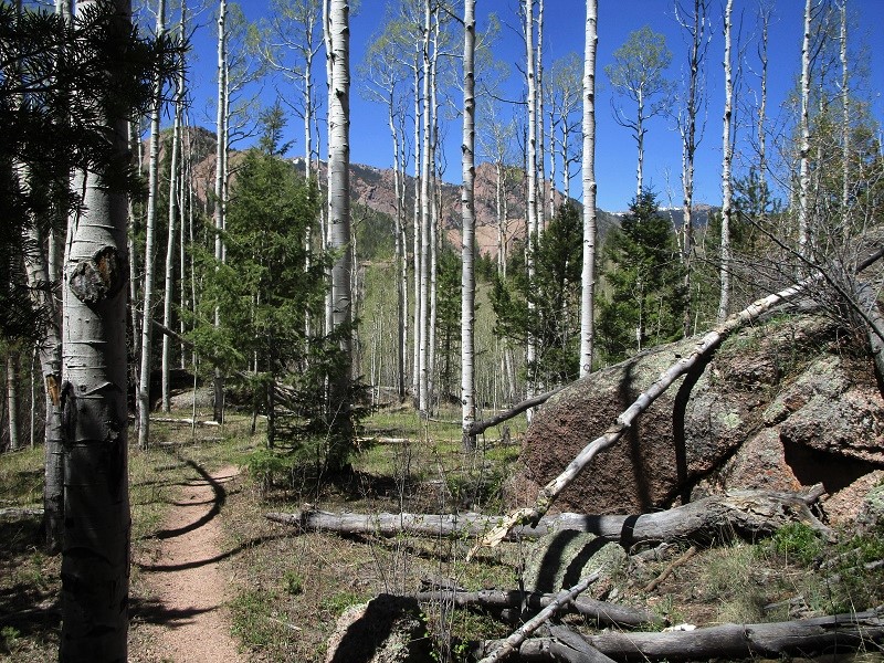
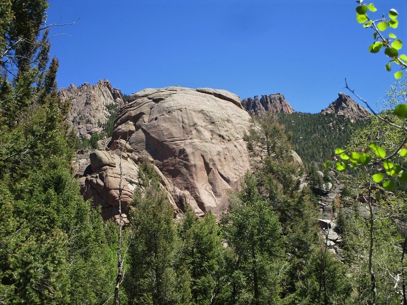
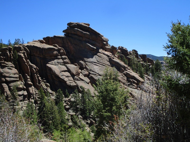
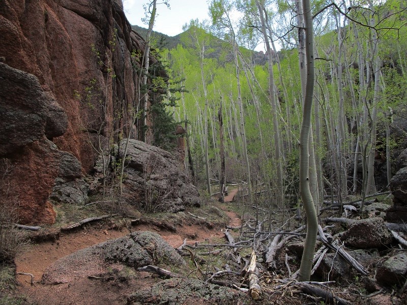
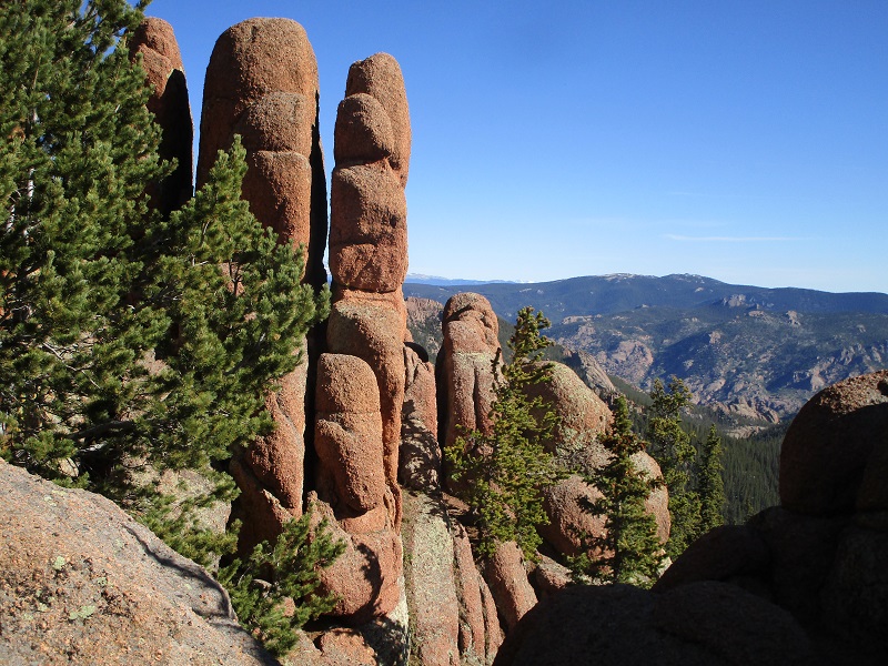
We hiked about 7.3 miles north on the Goose Creek Trail to its junction with the McCurdy Park Trail, enjoying the creek, rock formations, and newly green aspen trees along the way. We turned left onto the McCurdy Park Trail and soon made a 550 foot descent into Refrigerator Gulch. The amazing trail then went up and down across drainages, and around and through a myriad of fascinating rock formations.
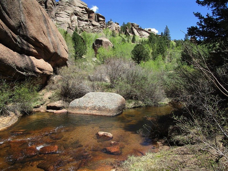
Around midday we reached a place where Lost Creek, true to its name, issued out of the rocks after flowing beneath them for some distance. This charming place was one of my favorites of the hike.
lost creek, just below the spot where it comes out of the rocks
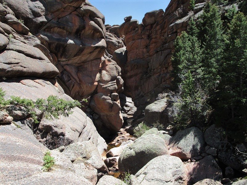
After enjoying lunch here we continued on the trail and hiked up over a ridge and came to a place upstream where Lost Creek disappeared into the rocks.
the creek disappears into the rocks here
We saw about ten other backpacking parties today, including one fellow with his eleven year old son. What an adventure for the young man! Most people were doing the same loop we were on but hiking it in three days instead of two as we were doing. We continued up and down some more on the amazing trail through more rocky scenery in the afternoon. I felt like a kid in a playground exploring a new place. It is quite a marvel that someone found a route through this terrain that we traveled several miles through today.
the route continues through this terrain ahead

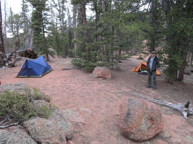
After a while we began a long haul up the McCurdy Park drainage through the woods to McCurdy Park. I was getting pretty tired by now as we had hiked well over ten miles. We climbed a grueling 2000 feet in four miles and reached a saddle at 10,900 feet, having now hiked over 14 miles on the day. We turned left here onto the Brookside-McCurdy Trail and descended a few hundred feet to Hay Creek, where we loaded up with water and washed up a bit. Then we climbed up the trail a couple of hundred feet to a 10,800 foot saddle at the junction with the Lake Park Trail and camped here on a broad flat area for the night.
our camp
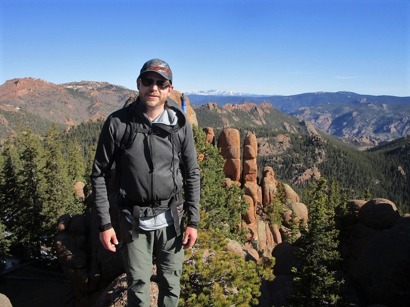
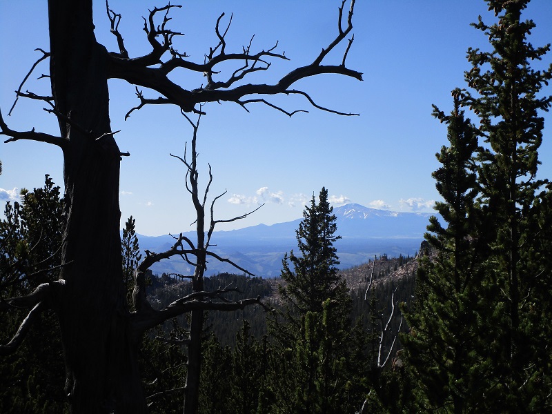
It was quite chilly overnight and my thermometer registered 24 degrees when we rose in the morning. It was too cold to bother with breakfast here in the shadow behind the big ridge to the east so we just packed up and headed up the Lake Park Trail, and found a nice sunny spot near the crest of the ridge at 11,100’ to eat breakfast. I don’t think hot coffee and ramen ever tasted so good. We continued southeast on the trail through the woods as it climbed to the highpoint of the entire loop at about 11,600’. There were some snow banks to contend with on this approach but they were not too troublesome. At the highpoint we scrambled 50 feet or so up onto some adjacent rocks to enjoy incredible panoramic views.
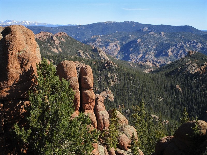
a view of the rocky terrain in the valley below that we hiked through yesterday
We had hiked about 1.4 miles from camp to reach this point. The rest of the way to the trailhead would remarkably (and thankfully) be downhill nearly all the way, a descent of 3400’ in eight miles! We began to meet more backpackers as we continued this morning.
a view of pikes peak in the distance
After a few miles we reached Hankins Pass and turned left onto the Hankins Pass Trail, with 4.4 miles remaining to the trailhead. We hiked down this trail through extensive aspen groves, across meadows, past rock formations, and then down a canyon along Hankins Creek. We met more and more hikers as we approached the trailhead. At 1:35 we finally tramped back into the parking lot. We were astounded to see the spacious lot jammed with vehicles, with dozens more lining the approach road for a few hundred yards. We counted 95 of them in all! True, it was the Friday beginning of the Memorial Day weekend, but it was also just an example of the crowds of people that I saw all year drawn to the outdoors during this pandemic year of 2020.