THE MAZE, UTAH
October 30 – November 2, 2025
By Tim Briese
The Maze District of Canyonlands National Park in Utah is one of the most remote and least accessible places in the continental US. I had been intrigued with the idea of exploring it for over 30, no maybe 40 years. I have visited countless other bucket list places in southern Utah and northern Arizona over the years but the Maze always eluded me because of the difficulty in getting there and because of the rugged and remote terrain. The Maze can be accessed by a very difficult 4WD road that takes several hours to drive, or by a lengthy multi-day backpack into this rough place that holds very little water. I long ago gave up on the idea of driving there because of the technical nature of the four-wheeling. Park service admonitions about being prepared for self-rescue gave me pause too. And a long backpack there was intimidating and possibly dangerous because of the lack of trails in the complex terrain and the lack of water. There was one other possibility though - going in with a guided group. At age 70, I was in a sort of now or never mindset and decided that this was the year I would finally go there.
There is just one company that I could find that leads expeditions into the Maze, Navtec Expeditions in Moab, Utah. They offer 4 day trips with a standard itinerary that they post online. I called them a few times to get details and asked if I could sign up for a trip at the last minute if space were available and they said yes. I wanted to be sure I felt healthy enough and I wanted to go in nice weather if possible, especially for photography. When I checked with them in early October they told me a trip was scheduled to leave on Thursday, October 30th and that it had a special itinerary that a group had requested, with a lot more hiking than their usual trips, essentially across the entire Maze. That was perfect, I thought, just the itinerary that I would have requested! I liked it better than the standard itinerary. I also asked about who else was going, because I didn’t want to crash anybody’s party or slow anybody down. They told me that it was a party of three other people, all in their 70’s. This was starting to sound providential! I waited until the Monday before the trip to squeeze the trigger and sign up, keeping an eye on the weather forecast. The weather looked perfect for the trip. I drove to Moab the day before the departure.
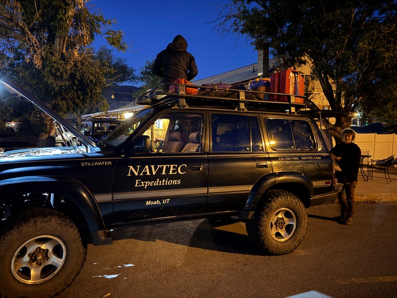
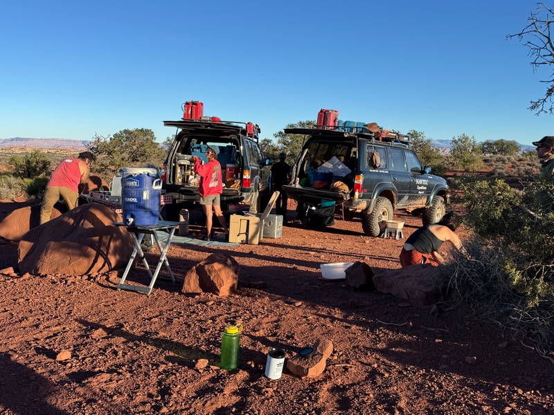
On the morning of the departure I went to the Navtec office in Moab and everyone was there loading up.
getting loaded up
I brought my own tent, sleeping bag and personal gear and Navtec supplied all the food and water. We were going in Navtec’s Toyota Land Cruisers, tricked out to handle the rough roads. Normally one or two guides goes on these trips, but this time we had the luxury of getting two experienced guides, Charlotte and Matt, their all-star guides, and three trainees, Cody, Ben, and Courtney. I met the three other people who had signed up too, three friends from the Seattle area. They were 71 year old Monty, a retired Amazon engineer, 70 year old Jack, a retired CPA, and his 74 year old brother Bob, a prominent immigration lawyer in the Northwest who still practices. They were great guys, all with a Christian background, and fun and interesting to hang around with over the next few days. They were friends since college and had very extensive and impressive hiking and climbing credentials over the years. They were incredibly fit and fast hikers for their age. We hiked almost 32 miles over the next four days.
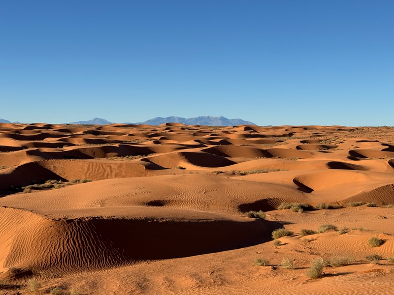
We pulled out of Moab as the sun was coming up and headed down the highway. A three hour drive was ahead of us to the first trailhead. After an hour and a half on the highway we embarked on a 50 mile drive on a 2WD dirt road toward the Maze.
some scenic sand dunes along the way
We stopped at the Hans Flat Ranger Station for a short break, which is the most remote ranger station in the US outside of Alaska.
airing down the tires for the rough roads ahead
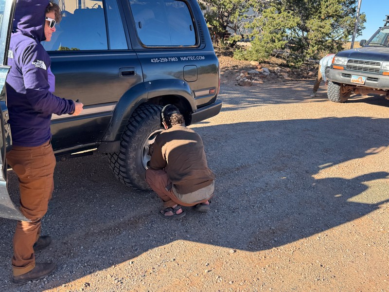
Then we four-wheeled a couple of miles on a very rough road to the North Point Trailhead.
this is why the maze is so difficult to get to!

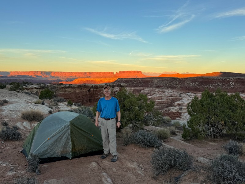
my three hiking companions - monty, jack, and bob
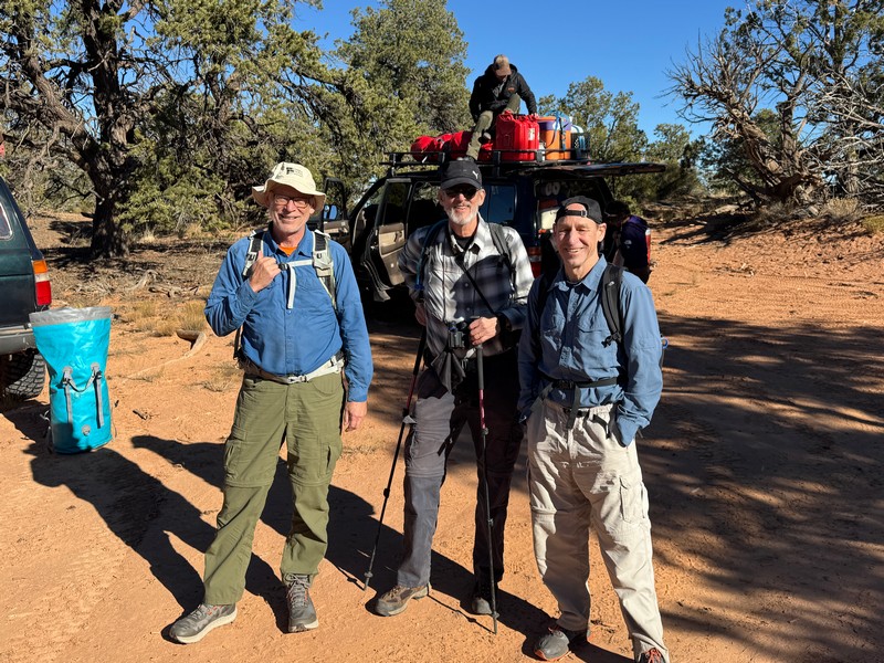
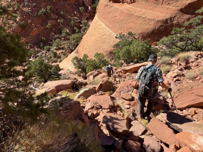
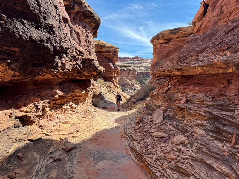
Charlotte would lead the three guys and me on a 6.5 mile hike down North Trail Canyon while the other guides drove the vehicles around to meet us down below. She told us to go ahead and start down the trail while she finished preparations and she would catch up. I wondered if she regretted that because my companions hiked so fast that she had to jog to catch up.
heading down into north trail canyon
bob and i
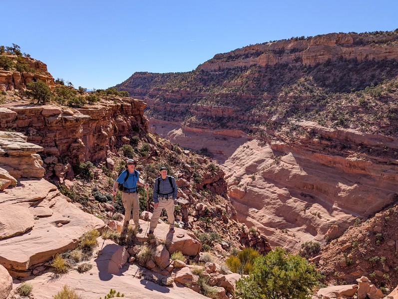
We hiked down the trail in three and a half hours to the Land Cruiser awaiting us at the bottom. Then there was a 5.5 mile drive on a 4WD road to our campsite at the Maze Overlook. Jack and Bob, tireless walkers that they were, elected to walk the road while Monty and I rode with Charlotte in the vehicle.
we stopped to peer into horse canyon
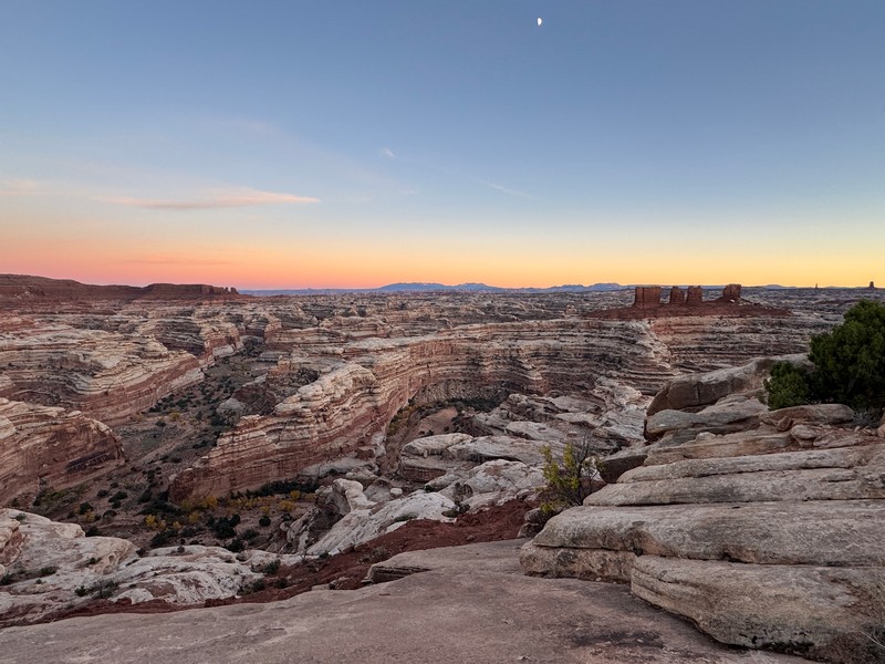
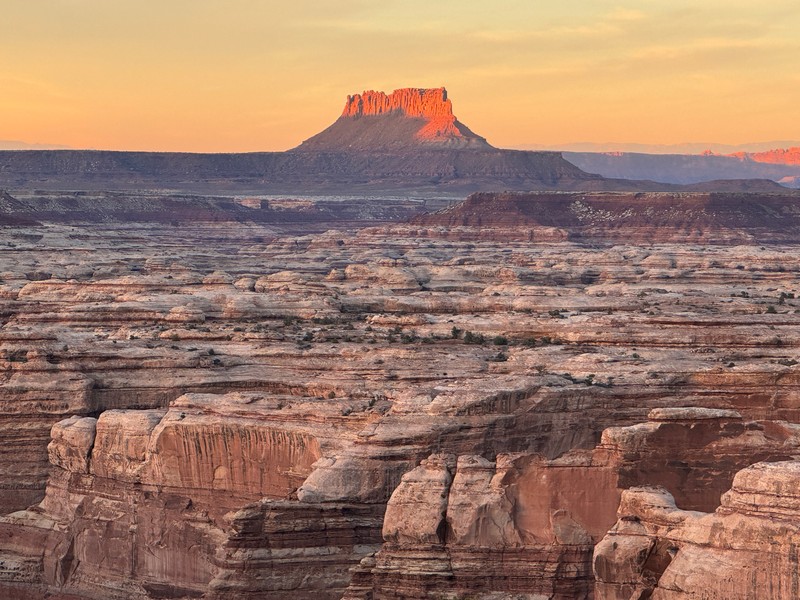
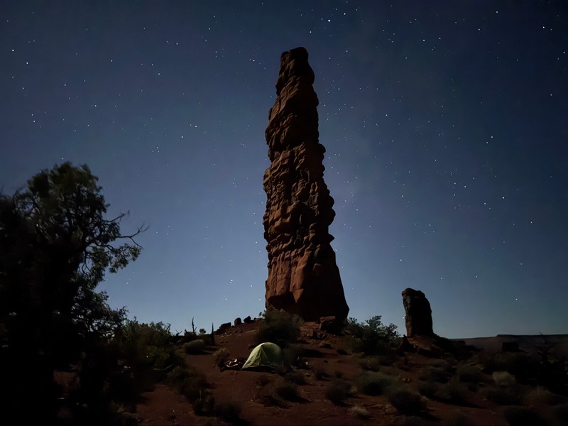
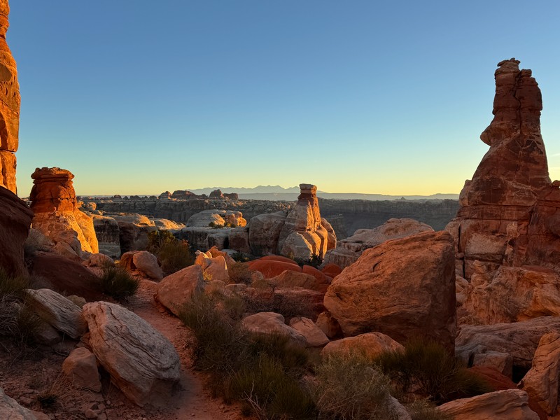
I had always wanted to see the Maze Overlook and was thrilled to get to go there, especially on a beautiful clear evening like this one.
a view into the heart of the maze from the overlook
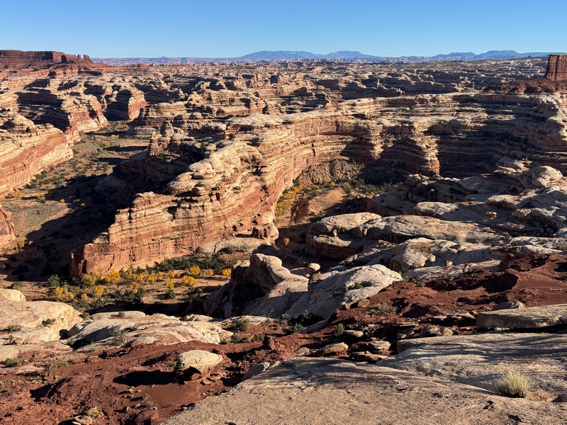
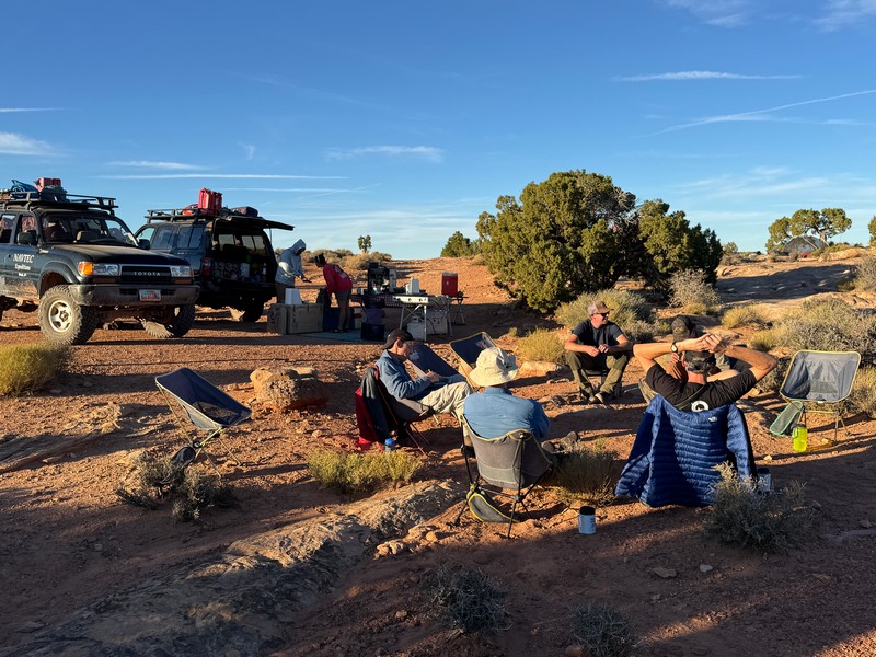
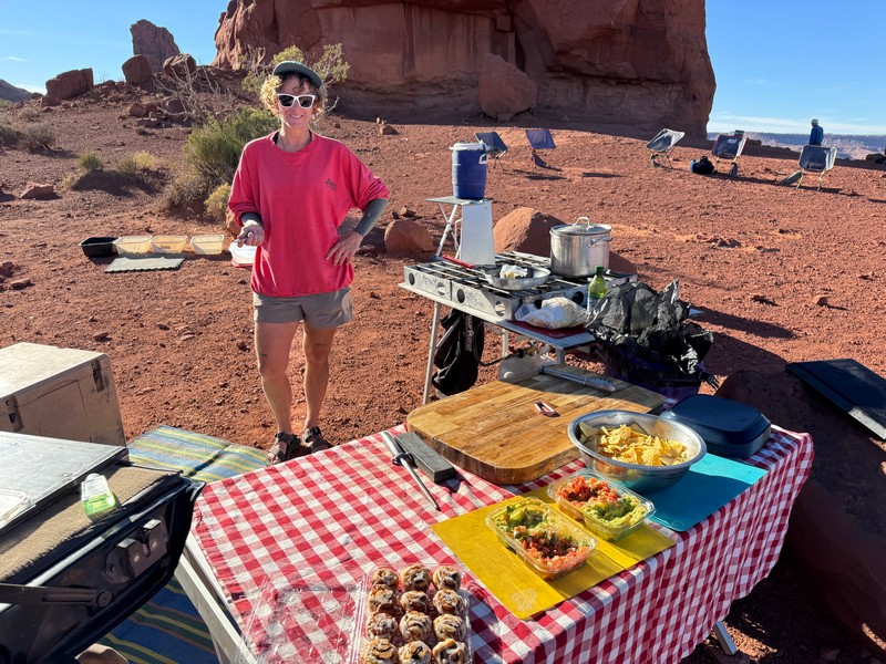
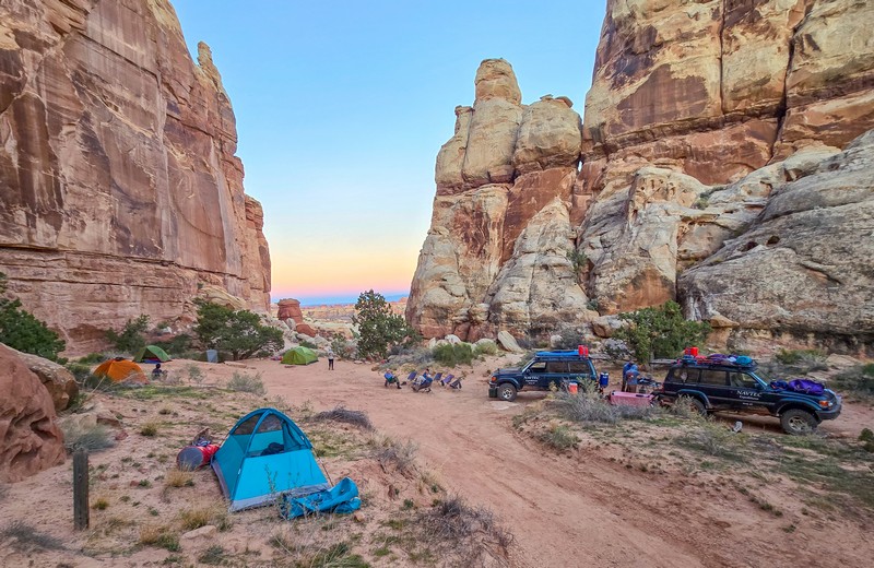
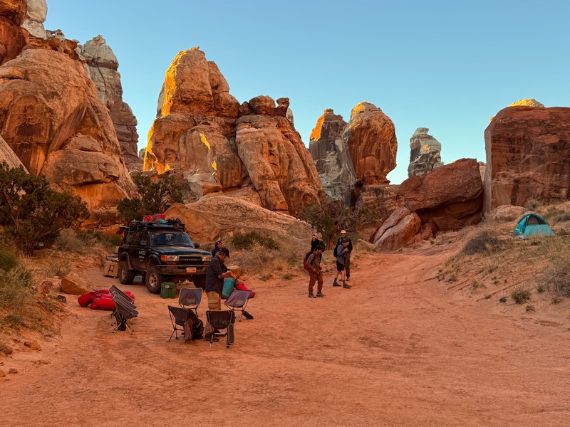
The standard Navtec Maze itinerary does not go to the Maze Overlook. Not only did we get to go there but also to camp right on the rim – a truly spectacular place to camp! There are only a handful of designated places to camp in the Maze area and Charlotte told us that reservations are hard to get for this one at the Maze Overlook. Our great guides prepared a wonderful dinner for us and we sat around and visited and wandered about admiring the grand scene spread out before us, taking numerous photos. The Maze is a twisting, turning labyrinth of canyons where it is easy to get lost. Tomorrow we would hike across it.
relaxing around camp
our great guide crew - charlotte on the left, matt on the right, and ben, courtney, and cody in the middle
view of the chocolate drops from camp
all set up for the night
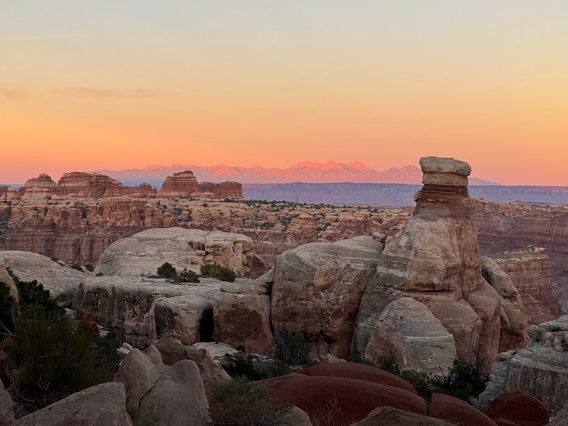
view from camp at dusk
moonlight on my tent

The next morning we packed up and prepared for our descent into the heart of the Maze and our hike across it.
got to have a cup of coffee in the morning

not a bad view for breakfast!

getting ready to start our descent into the maze
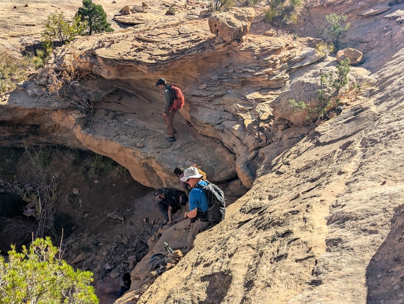
Matt led us today and guides Ben and Courtney also accompanied us. The descent was tricky and the route only lightly marked with cairns.
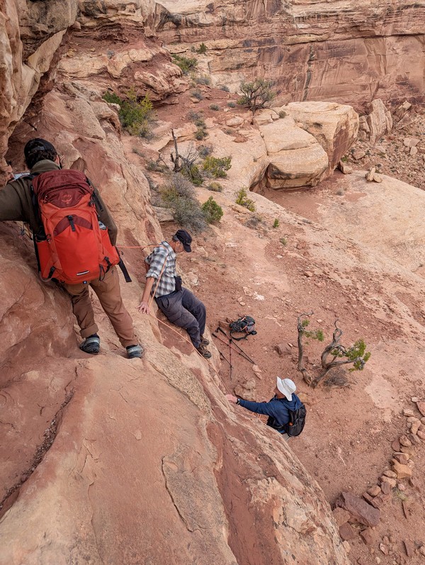
Matt had a 40 foot rope he pulled out to assist us on some of the down climbs. It could have been done without a rope but it was comforting to have one. We were glad we had a guide for this descent too.
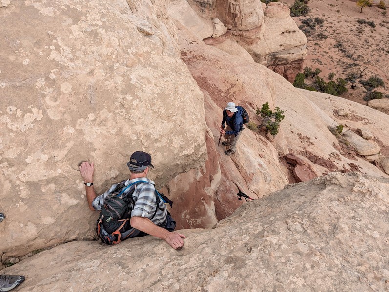
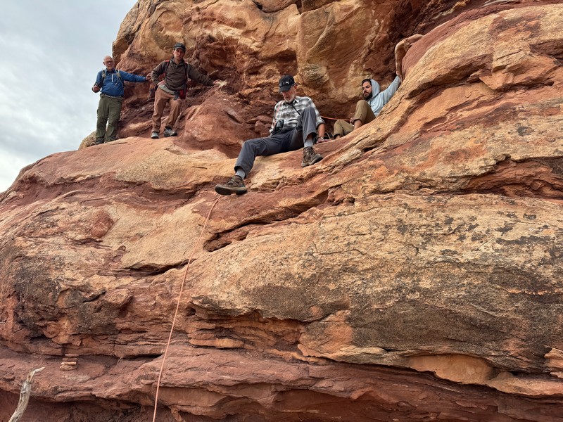
After an hour and a half we finally reached the floor of the Maze.
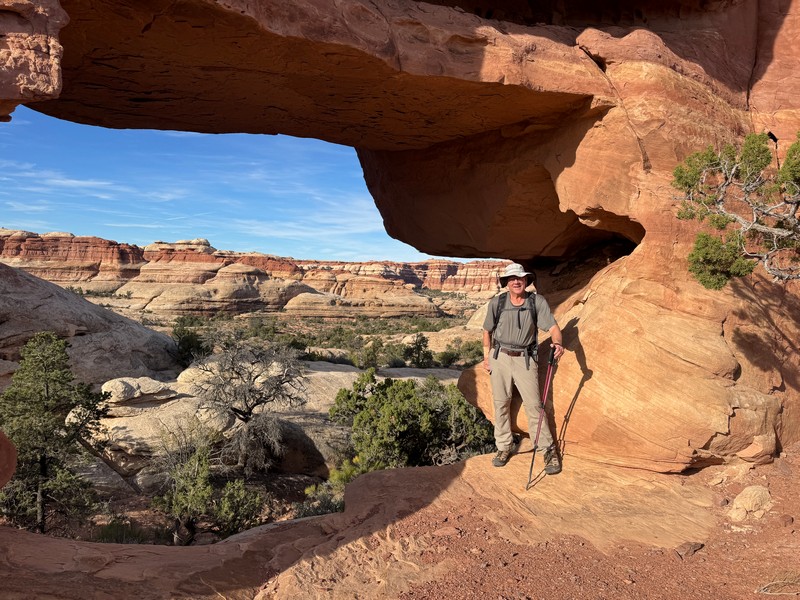
Matt led us up the main canyon a ways and then took us up a side canyon to see some interesting arches.
a couple of pothole arches

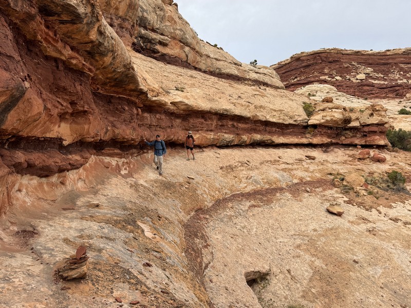
There were no real trails or signage, just some footprints and a light trail here and there, and it was nice to have a guide here too.
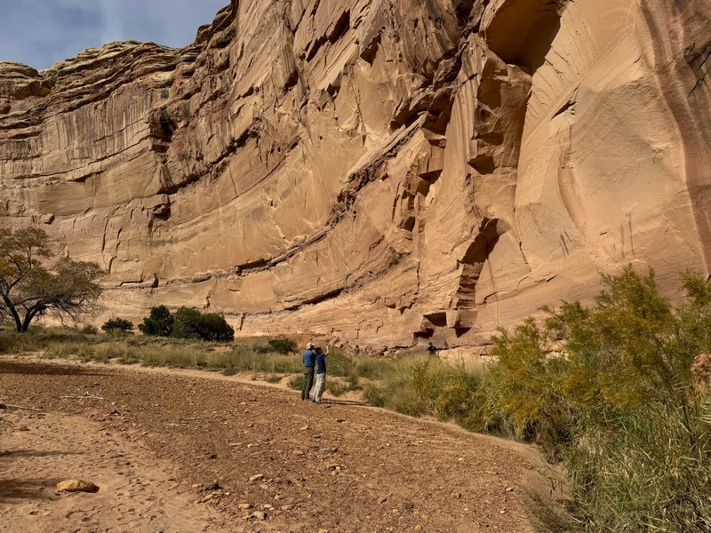
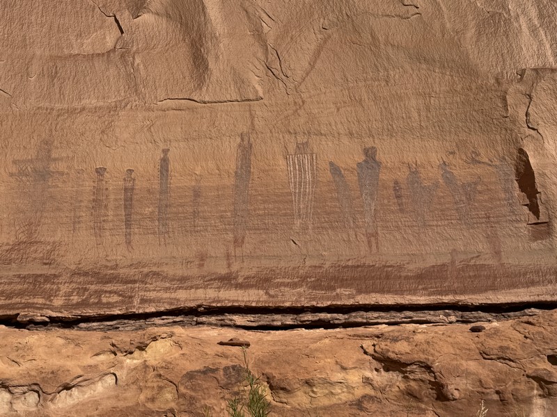
We hiked further to the Harvest Scene, a 500 foot long panel of pictographs that may be three or four thousand years old. This was an interesting place and we took a long lunch break here.
looking at the harvest scene on the wall
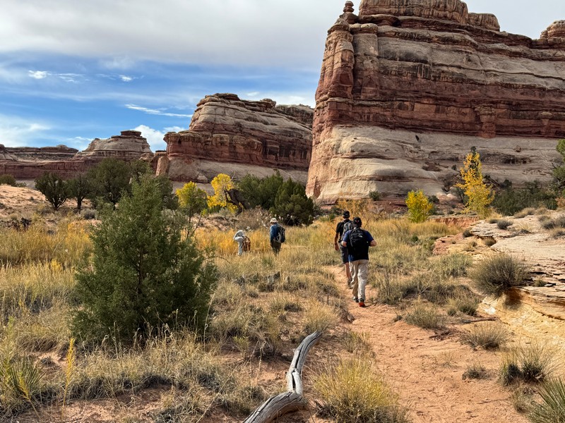
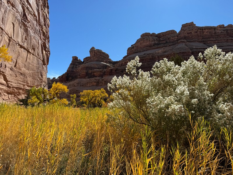
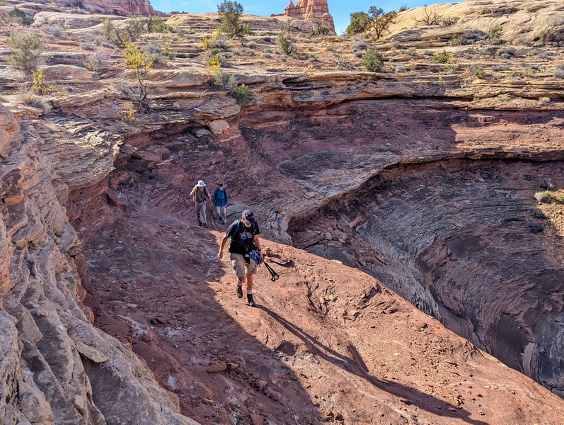
Then we hiked more miles up the canyon.
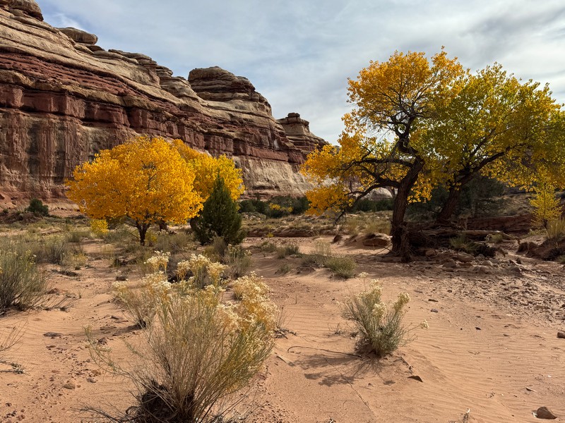
there were some nice fall colors
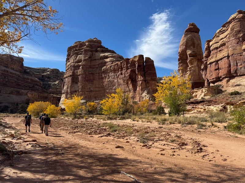
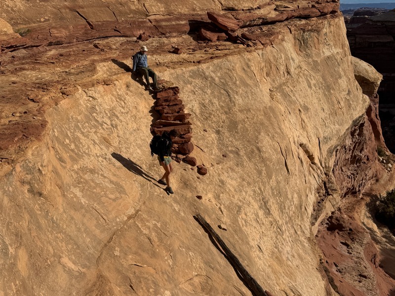
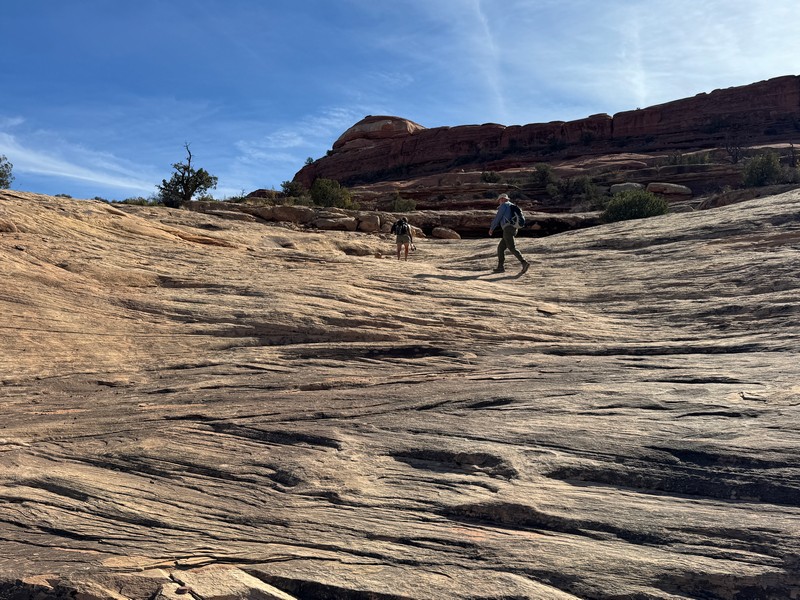
We eventually made a challenging climb of a few hundred feet on a rugged route up out of the canyon.
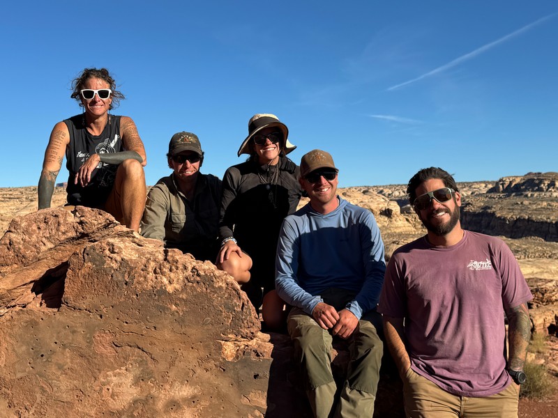
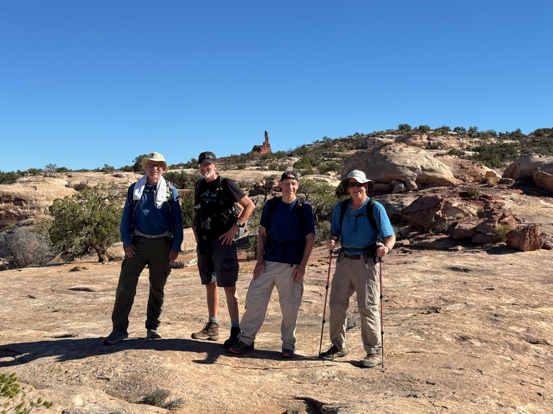
four happy hikers who have hiked across the heart of the maze!
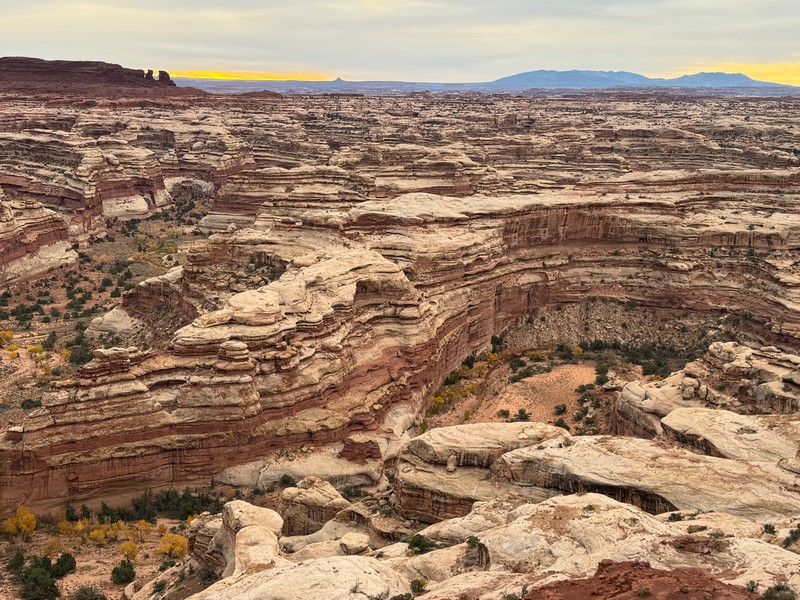
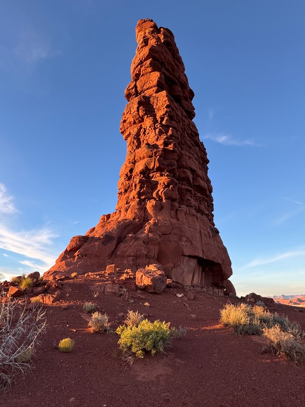
Once on top we hiked a short distance on a road to our campsite for the night at Standing Rock. It took us six and a half hours to hike about 9.5 miles today. Charlotte and Cody drove the Land Cruisers around to meet us at camp and it took them almost as long to four wheel to get there! This was another spectacular campsite with panoramic views.
charlotte creates another feast for us at camp
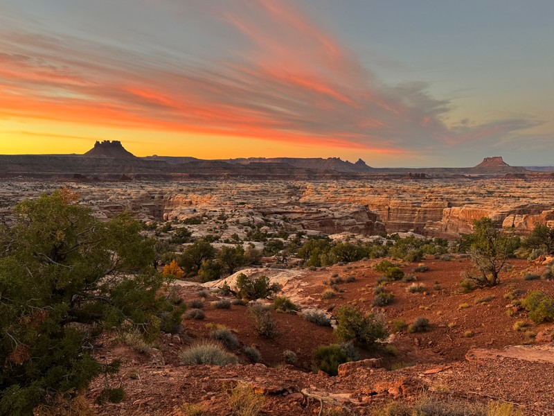
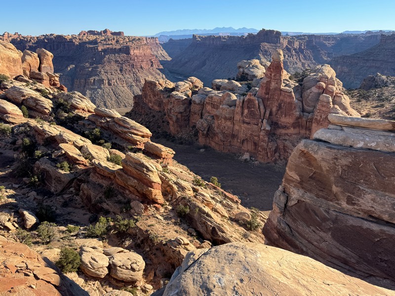
looking back across the heart of the maze that we hiked across today
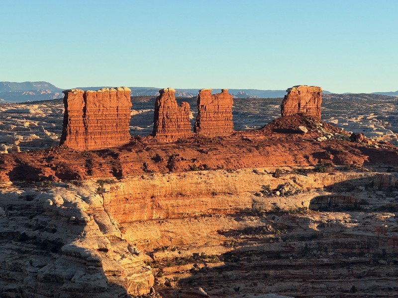
standing rock where we camped is a landmark that can be seen from miles around
moonlight on standing rock and my tent
breaking camp the next morning
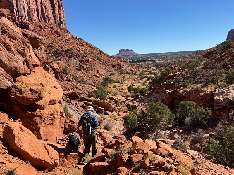
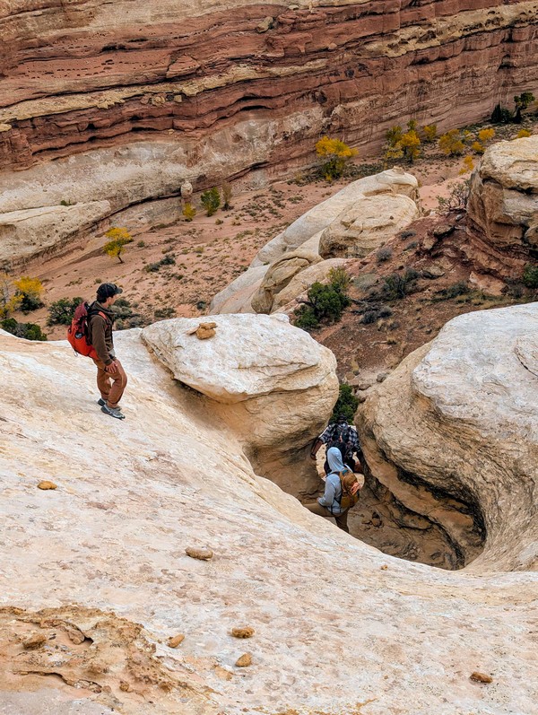
The next morning Charlotte led the four of us on a lengthy hike that would eventually bring us to our next campsite at the Doll House while the rest of the guides four wheeled there.
looking down into shot canyon as we began our hike

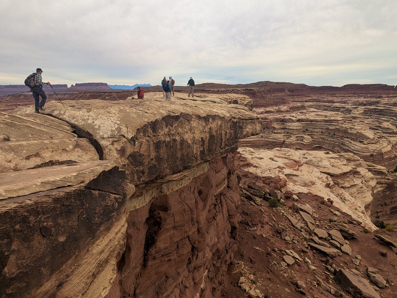
We made a rugged descent into Shot Canyon that got everyone’s adrenaline going.
another precarious descent!
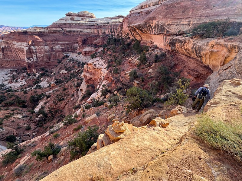
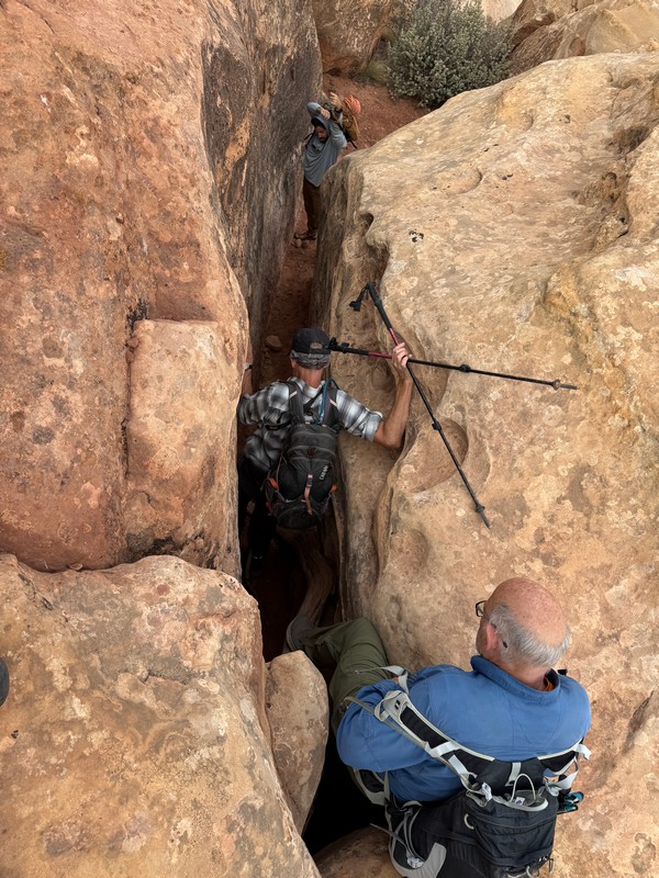
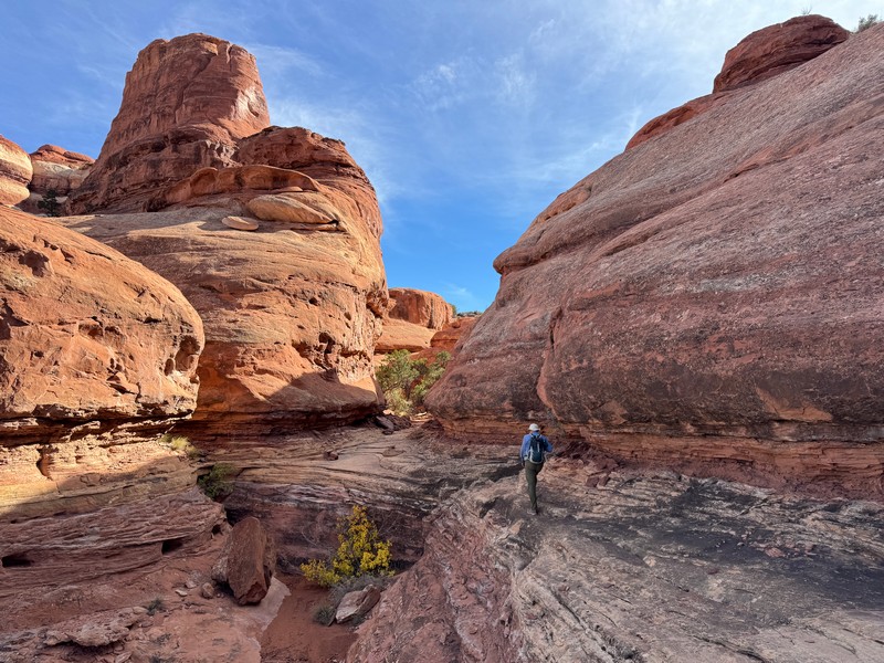
Then we hiked down Shot Canyon for a while and then hiked up out of the canyon and crossed Water Canyon on an amazing intricate route that is part of the fun of hiking in the canyon country. The route was unsigned but lightly marked with cairns. A good footpath appeared later on.
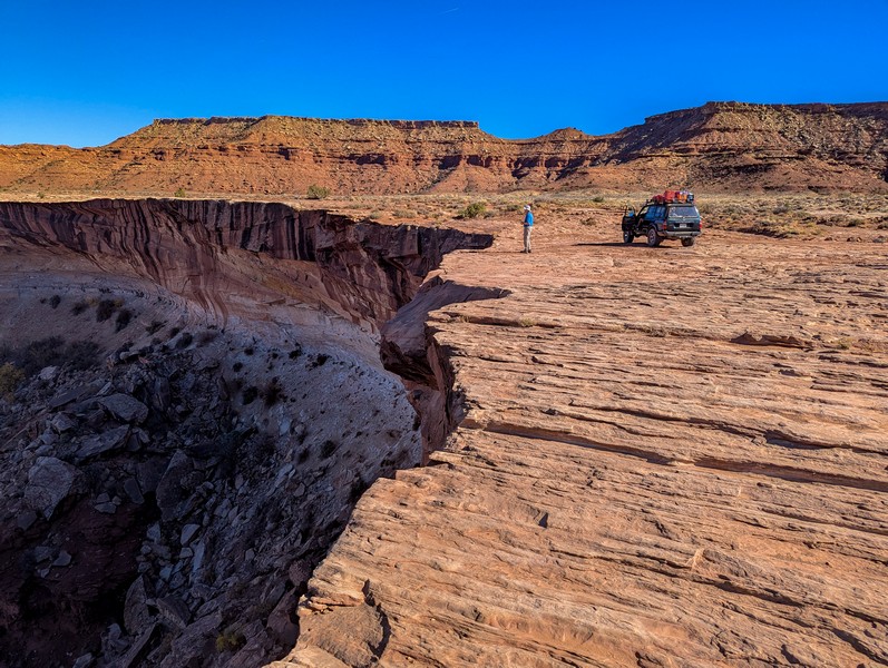
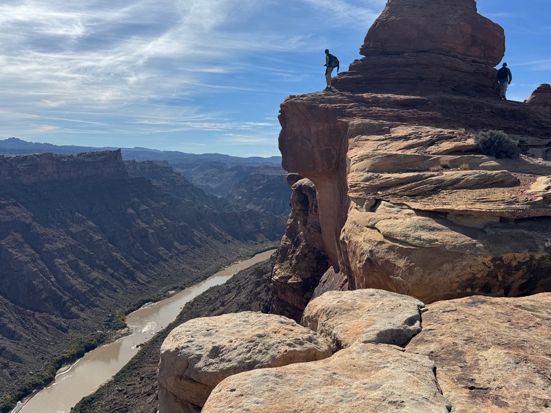
We made a side trip out to an impressive overlook of the Colorado River.
We had hiked about 8 miles at a rapid pace by this time and I thought it would be nice to hike the remaining 5 miles to camp at a more leisurely pace and enjoy the peace and silence of the desert. The other fellows completely understood and they blasted off toward camp but Charlotte would have none of me hiking by myself so she and I hiked to camp and had a nice time visiting and communing with the desert.
at beehive arch on our way to camp
approaching the doll house

a cool slot canyon on our way to camp

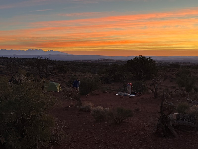
The camp at the Doll House was another spectacular place with tall pinnacles ringing our camp area and a nice view of the distant La Sal Mountains.
our camp at the doll house
Jack and I were pretty tired after hiking almost 13 miles today but Monty and Bob seemed indefatigable and were ready for more. Their athleticism was incredible for seventy something year olds.
sunset on the la sal mountains from camp
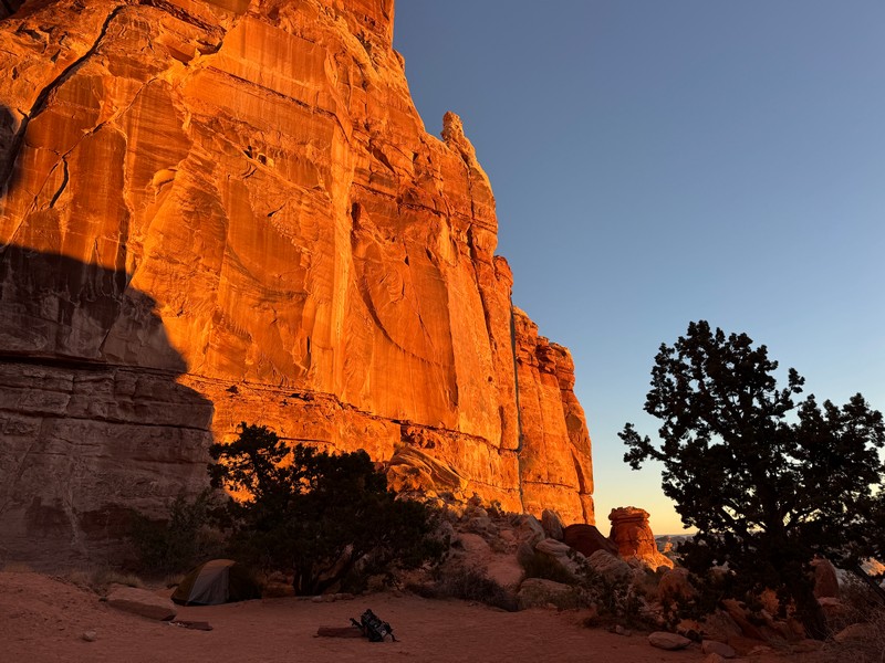
moonlight on the cliffs above camp

After another beautiful moonlit night we arose to pursue another adventure.
early sunlight on the cliffs at camp
getting ready for this morning's hike
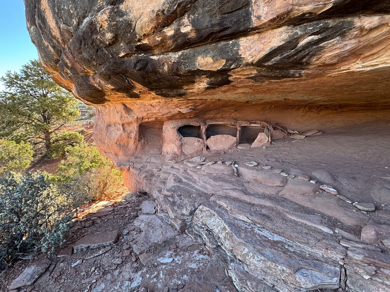
We had only a few hours available to hike this morning because we had a long drive back to Moab today – 5 hours on the rough roads out to the highway and then 3 more back to civilization! The other three guys wanted to hike down to the Colorado River and back, about 3 miles roundtrip and 1400 feet of elevation gain, but I knew that they would do it in footrace fashion which did not appeal to me this morning. My ankle was kind of sore and I preferred a more leisurely scenic hike so they hiked down there with guides Ben and Courtney while I hiked the so-called Granary Loop nearby. Charlotte was okay with me doing that by myself. It was a scenic two and a half mile loop that took me past an old Anasazi granary that was perhaps 1000 years old or so.
the anasazi granary
a nice view down into surprise valley on my hike this morning
When we all returned to camp later in the morning we loaded up and took off. The four wheeling itself was quite an adventure. Charlotte expertly drove our Land Cruiser while the other guides followed in the one behind. At one particularly tricky spot she had us get out and walk for a short distance. I asked her later if that was because of the weight distribution in the vehicle, or the danger, or to avoid panic attacks for her passengers. She vaguely affirmed that the latter was the case. The drive went pretty quickly and it didn’t seem like it took 5 hours to get to the highway but it certainly did. The ride was adventurous and the conversation good. We eventually pulled into Moab as darkness was falling, and we all exchanged contact info and goodbyes. This completed one of my most memorable adventures in a long time.