MILL CREEK TRAIL
June 22, 2020
By Tim Briese
9.4 miles, 1800’ elevation gain, 7:50 roundtrip time
Years ago my website almost exclusively featured reports on peaks I climbed. As I’ve gotten older my hiking interests have expanded. I still love to climb mountains of course, but I also like to explore other new and beautiful places and take photos of them, particularly with my wife Teresa who shares this interest. The Mill Creek Trail is one of those places.
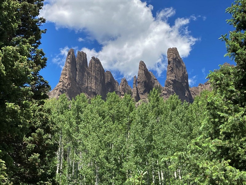
I was researching a way to hike to see the Castles in the West Elk Wilderness northwest of Gunnison, and while finding access to them rather lengthy and therefore challenging, I read glowing reports about the nearby Mill Creek Trail which offers similar scenery, with descriptions like "one of the most scenic hikes in Colorado." I knew it was a place we had to go see.
We turned off Hwy. 135 just north of Gunnison onto the Ohio Creek Road (CR 730) and followed it about 8 miles northwest and then turned left onto BLM road 3118. We found this turnoff surprisingly hard to find as it was not marked with either a road or trailhead sign. This excellent road crosses a private ranch for about three miles, complete with (very low) private speed limit signs, before it enters the national forest. I suppose the reason the turnoff was so hard to find is that the landowner had said something like: Okay, I’ll grant public access across my ranch if the road is left unmarked in order to keep the traffic down! In spite of this there were quite a few other vehicles up in the national forest. We drove the road all the way to its end and parked at the Mill Castle Trailhead. This road could easily be driven with a passenger car almost all the way.
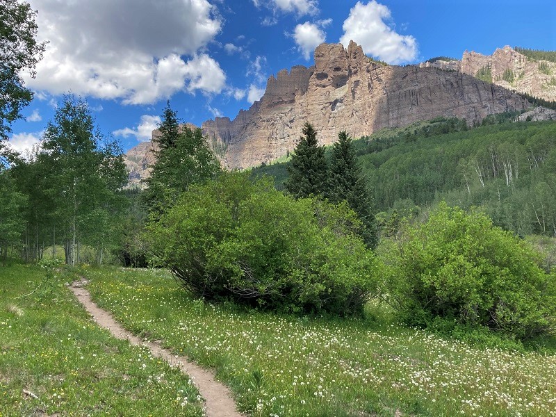
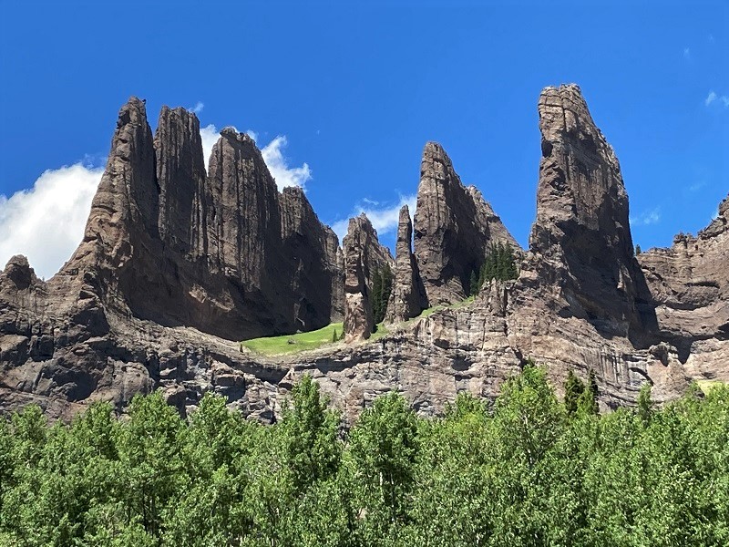
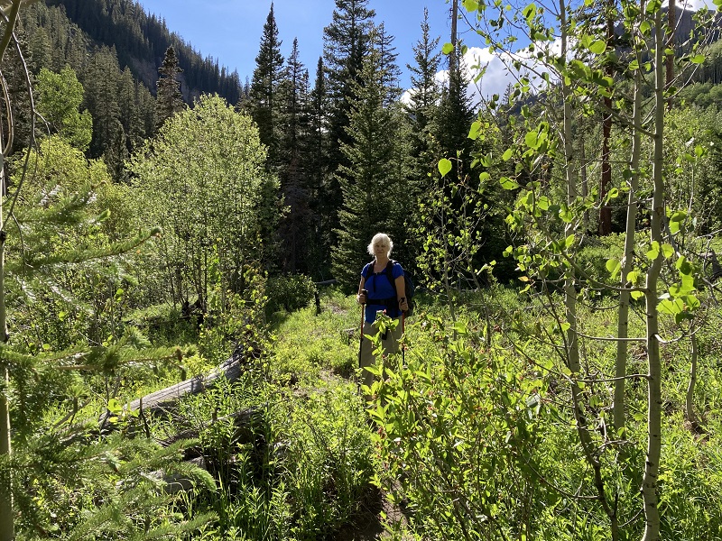
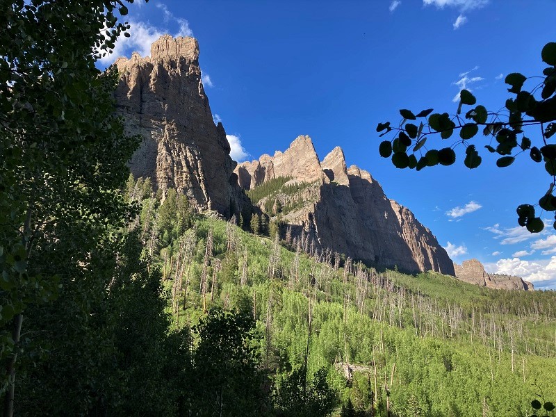
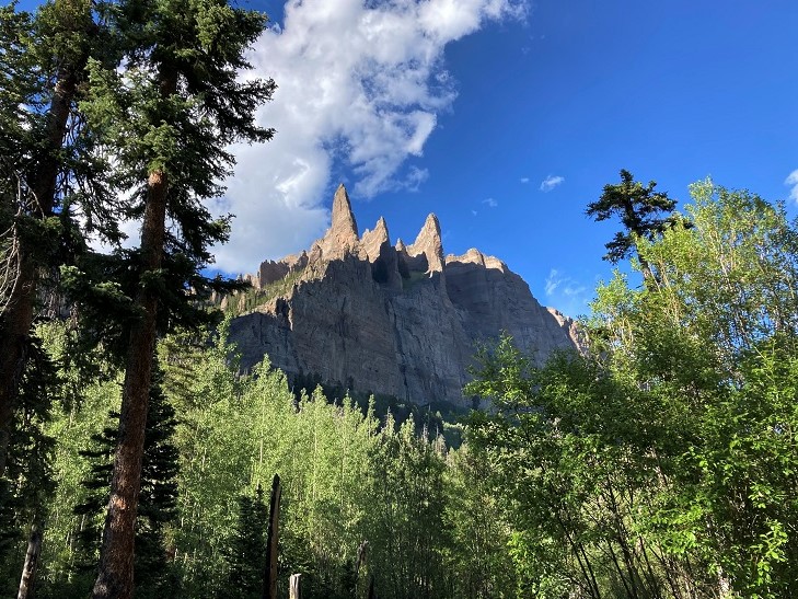
A little after noon we headed west through stands of aspen and pine on the excellent Mill Creek Trail that goes up the valley and were soon treated to tantalizing views of cliffs and pinnacles lining both sides of the canyon that is one of the most alluring features of this beautiful hike.
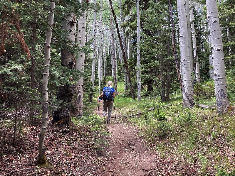
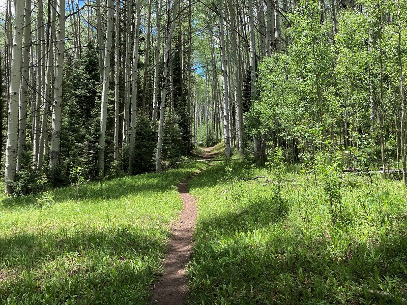
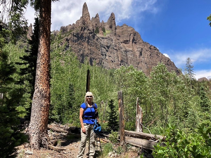
After about a mile we reached a broad meadow that afforded expansive views up the valley. One writer on the internet compared this scene to California’s Yosemite Valley, and the resemblance is certainly there. Shortly after this we crossed to the north side of Mill Creek, choosing to remove our boots to wade through the calf-deep water. For the next couple of miles we hiked through beautiful aspen forests with frequent spectacular views of the pinnacles above.
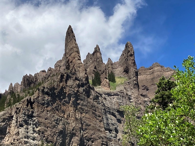
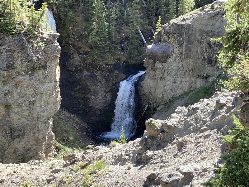
After about three miles we came to a green livestock gate, having climbed only about 400 feet of net elevation gain on this gentle trail so far, which makes this a great outing for the whole family. The route steepens beyond this point and many turn back here, but we wanted to explore further. The canyon becomes narrower and rougher and we followed this lesser used stretch of the trail for another mile and a half or so up to a point above a nice waterfall in Mill Creek and decided to turn back there.
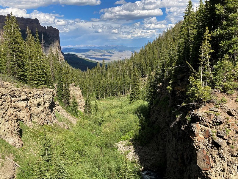
a view back down the valley
The trail climbs steeply beyond this another 2000’ up to 12,496’ Storm Pass, said to be a very scenic place with an outstanding view of the Castles. Enticing perhaps, but that was beyond the scope of our endeavor today. We hiked back down the trail in the late afternoon sun, admiring the golden light upon the valley’s features. With all those aspen groves we hiked through today, we decided we needed to come back and see this place in the fall sometime.
We got back to our truck about 8 pm and headed into Gunnison for the night.