MURPHY TRAIL, CANYONLANDS NP, UTAH
Plus MESA ARCH AND GRANDVIEW POINT
March 17, 2019
By Tim Briese
Murphy Trail: 10.0 miles roundtrip, 1100’ elevation gain, 5:45 roundtrip time
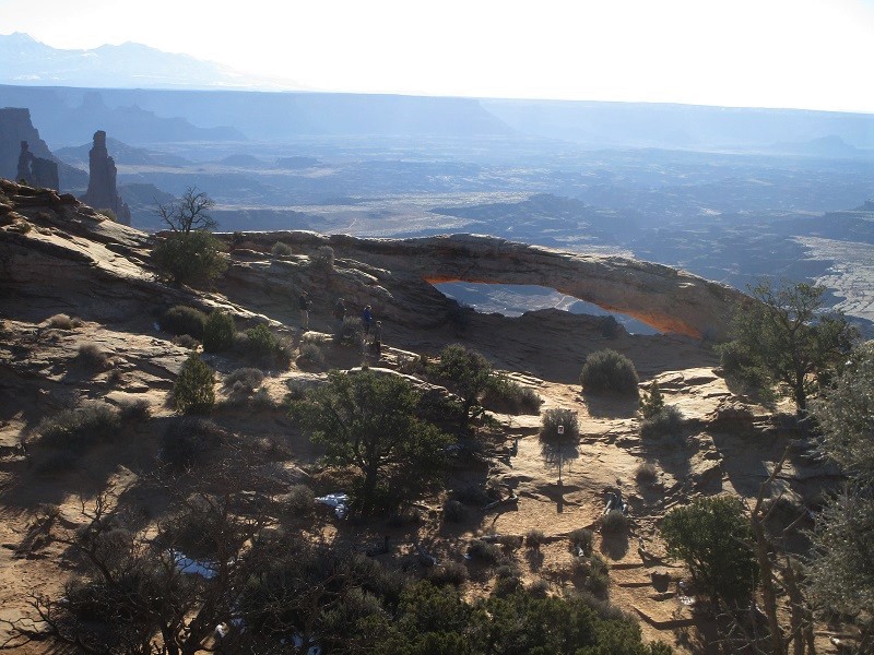
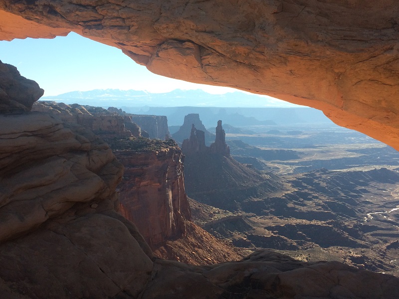
I left Grand Junction early in the morning and drove to the Island in the Sky District of Canyonlands National Park northwest of Moab, Utah. The Island is a long peninsular plateau about 30 miles long that towers one to two thousand feet above the canyons of the Colorado River drainage to the east and the Green River drainage to the west. One of my objectives today was to hike the Murphy Trail, which drops off the Island down to the west. On the drive out to the trailhead I stopped to do a short one mile loop trail to see Mesa Arch, which was well worth the time.
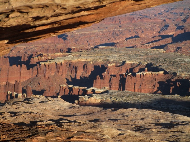
mesa arch
when i saw this view i realized i'd seen it on calendars or in books before
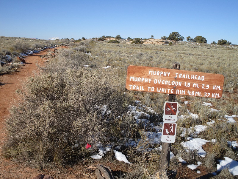
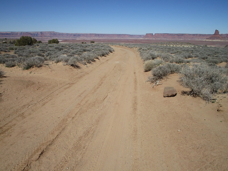
I arrived at the Murphy Trailhead at mid morning and embarked on the trail.
the trailhead sign
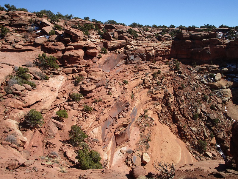
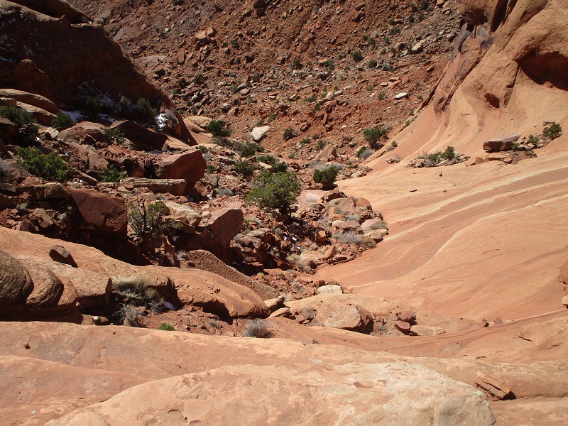
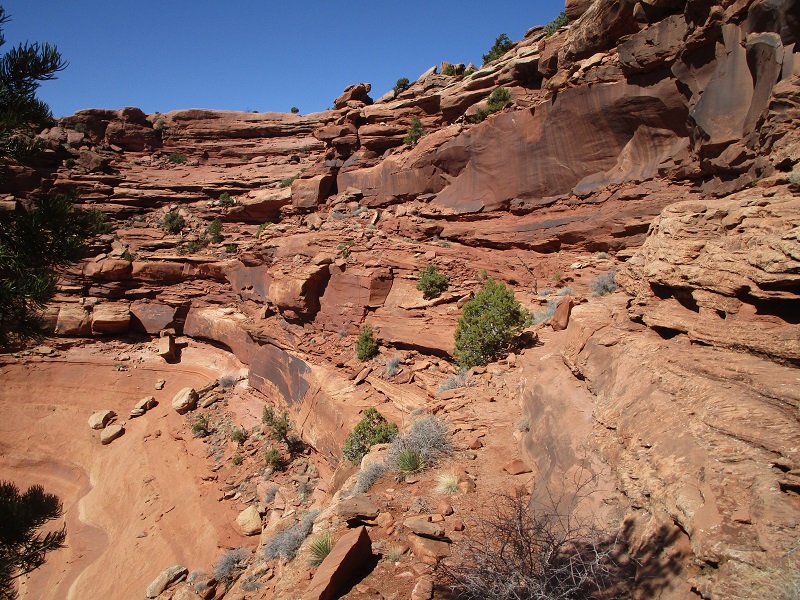
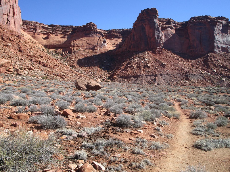
The sandy route went through scattered junipers for about 1.2 miles on a gentle downslope to the rim of the Island, and then the fun began. I looked down at the sheer cliffs below. A viable route looked improbable, or nerve-wracking at the very least. The well-cairned trail switchbacked down on skinny ledges over to the top of a steep talus slope, then switchbacked on down from there. A few icy spots in shaded areas were a little tricky.
the route follows ledges across the center of the photo to the top of the talus slope at the right
down i go - looking down from the top of the talus slope
my eventual destination is way down there in the upper portion of the photo, several miles away
looking back from the top of the talus slope at the ledges i came down
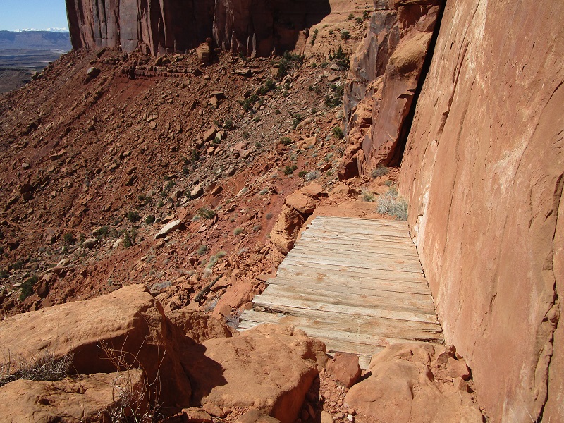
a convenient wooden bridge provided passage across a gap
I scooted on down and in short order descended a thousand feet to much easier terrain below. You’ve got to admire the intrepid cattlemen who built this trail down from the Island for cattle in 1918!
looking back at where i'd come down from, in the top center of the photo
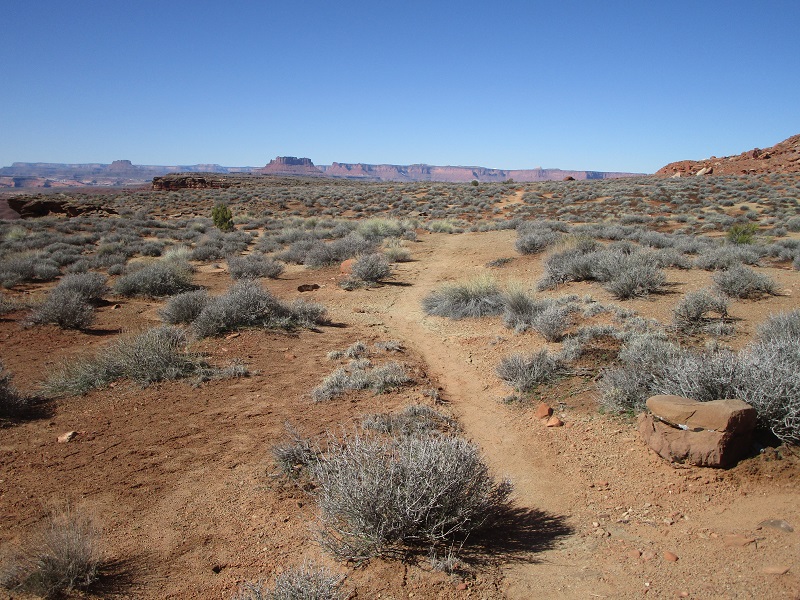
now it was easy sailing across the desert flats
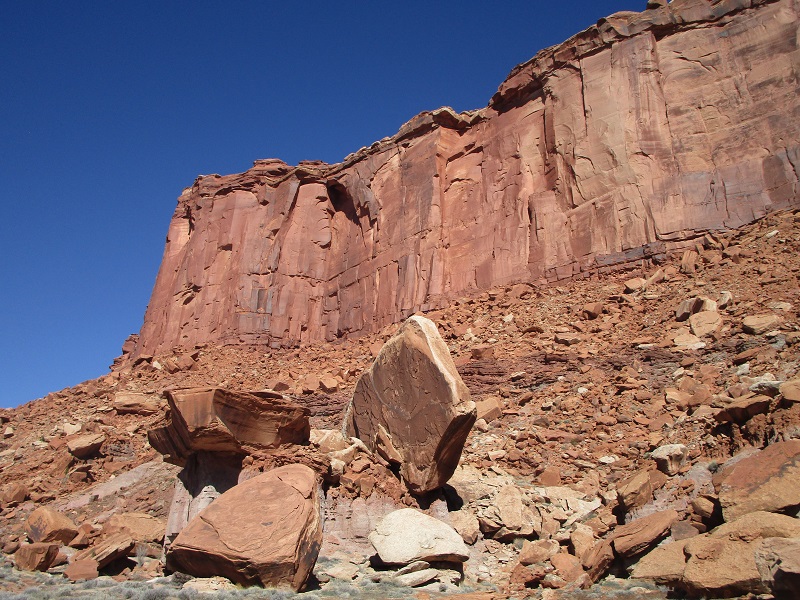
impressive cliffs above
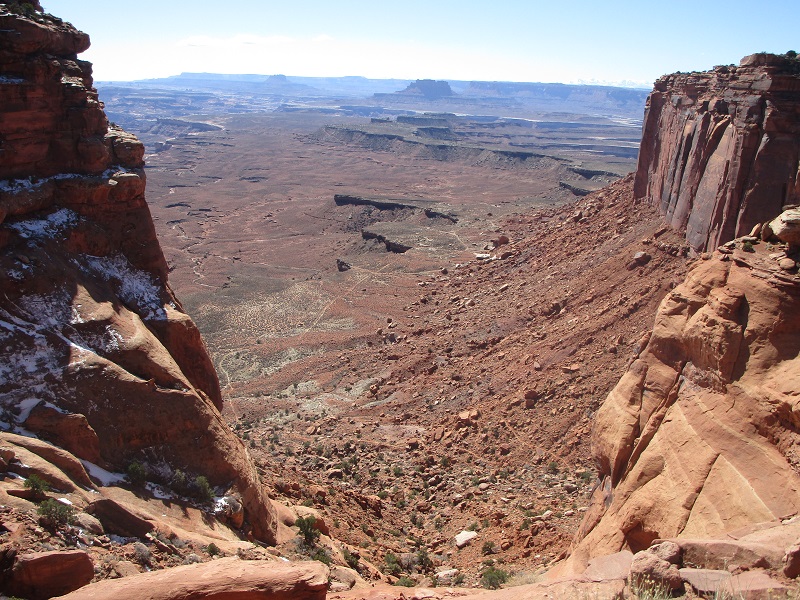
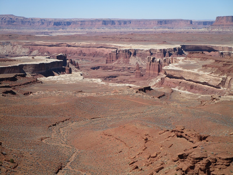
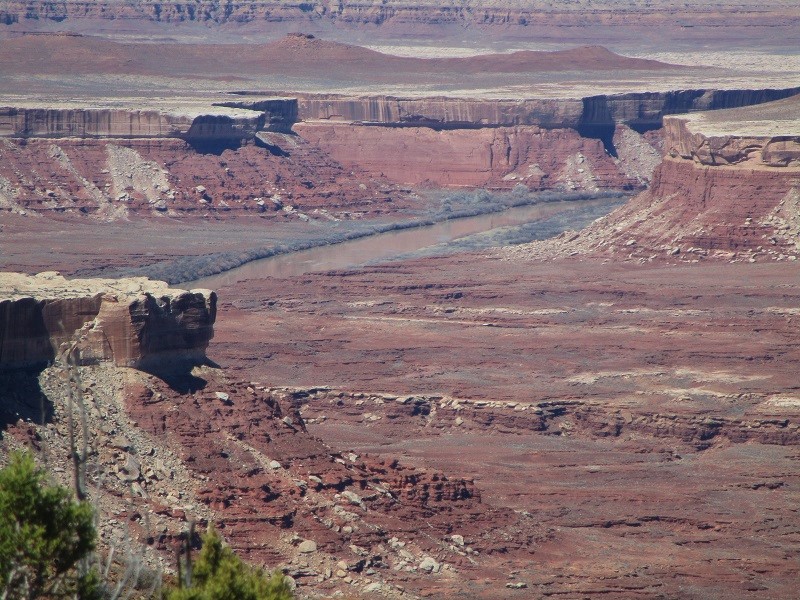
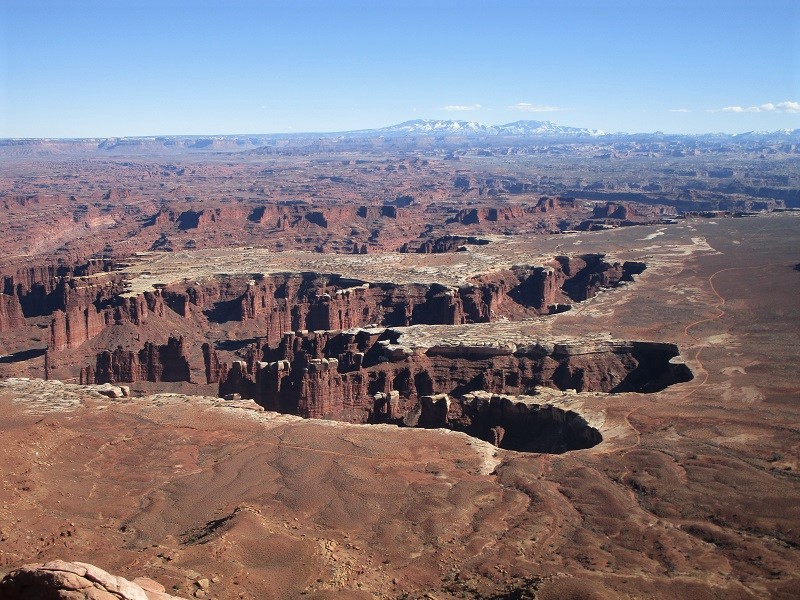
I hiked the trail across open desert along a flat ridge called the Murphy Hogback all the way out to the White Rim Road, a hundred mile long 4WD route that circles below the Island in the Sky, popular with bikers and 4WD enthusiasts. From there I had glimpses of the Green River in another canyon below.
the well-named white rim is clearly evident in this photo
a sandy stretch of the white rim road
the green river. its color isn't green here, maybe it is somewhere
After a lunch break on this beautiful sunny March day I retraced my steps back. I saw only another hiker or two on the way down but perhaps a dozen or more on the way back. I returned to the trailhead at mid afternoon and drove on down the road to Grandview Point, at the very southern end of the Island.
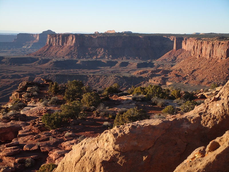
view of the white rim and the rugged maze of the colorado river drainage from grandview point
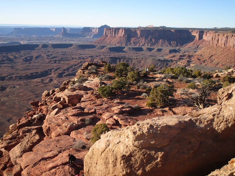
From the parking lot I hiked the Grandview Point Trail a mile out to the very tip of the Island and sat on a high rock for an hour or more waiting for the sunset, gazing about at the spectacular 270 degree view of the immense Colorado and Green River drainages sprawling away in the distance below. This was truly a sublime experience.
from here i could see where i had hiked on the murphy trail, below the cliffs a few miles away to the north
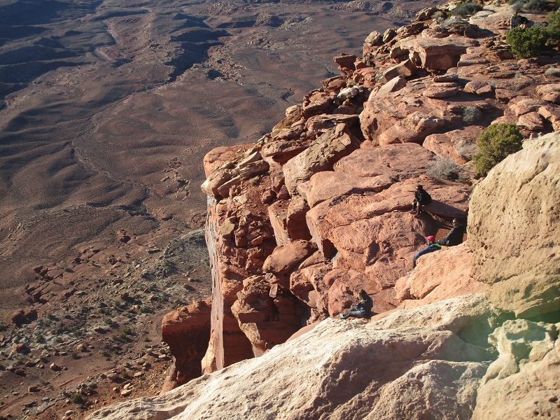
other hikers on the rocks below awaiting the sunset
view to the southeast, with the blue mountains in the distance

view to the north as the sun sank low
view of the la sal mountains to the northeast

I stayed until dusk, then hiked back and drove to Moab for the night.