NORTH ARAPAHO PEAK
(13,502’)August 27, 2017
By Tim Briese
10.5 miles, 3800’ elevation gain, 10:25 roundtrip time
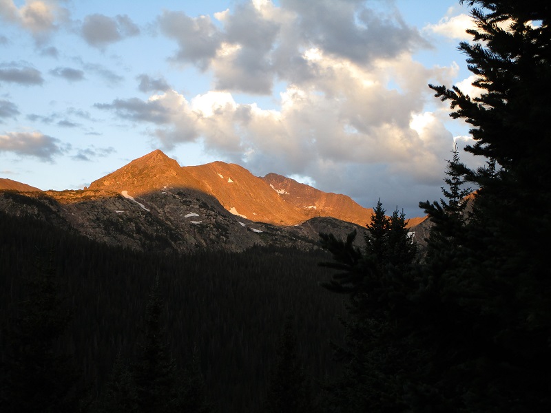
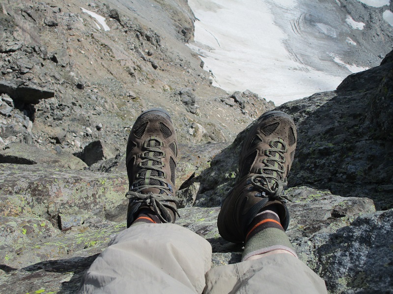
Brian and I left Boulder shortly after 5 am and drove to the 10,200’ Fourth of July Trailhead west of Nederland. We hit the Arapaho Pass Trail at 620 on this cool and pleasant morning.
early sunlight on peaks to the west
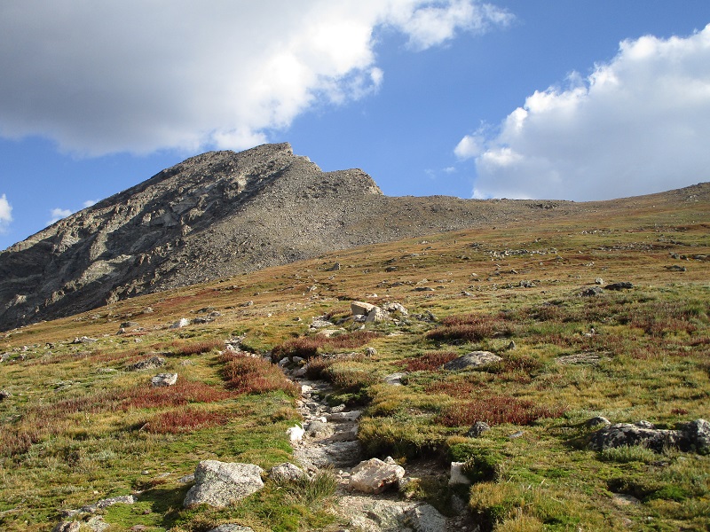
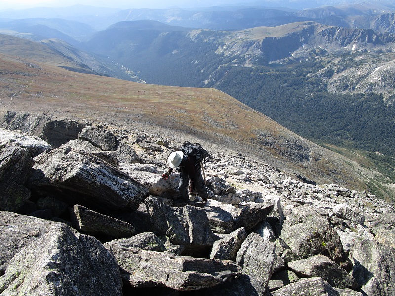
We made good time and an hour later turned right onto the Arapaho Glacier Trail at a junction at 11,200’. We marched up the trail toward the 12,700’ foot saddle below South Arapaho Peak.
on the trail up to the saddle and south arapaho peak
a view back into the valley below
We arrived at the saddle at 850 and took a nice break. We were very familiar with this route after our attempt to climb North Arapaho in 2015, which was thwarted due to poor weather.
the slope up to south arapaho
After the break we hiked up the steep trail to the 13,397’ summit of unranked South Arapaho.
brian coming up the slope to south arapaho
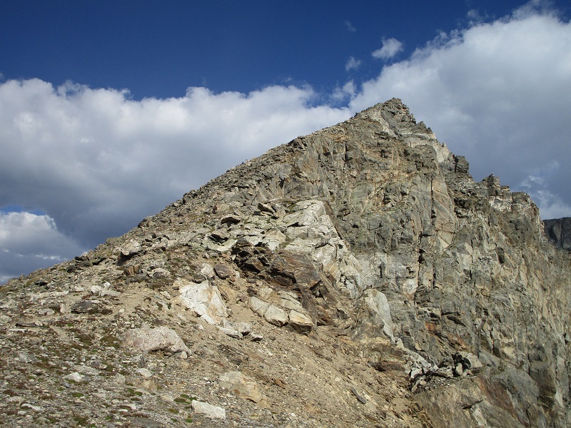
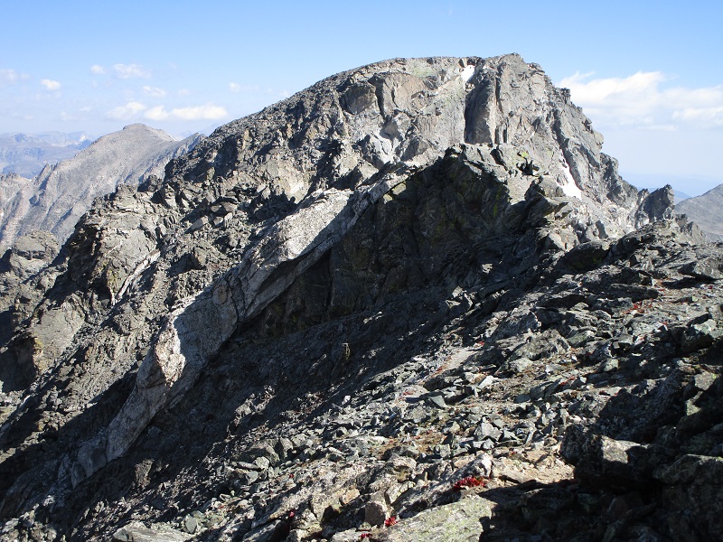
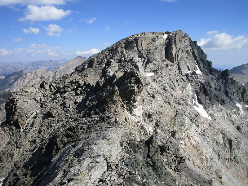
From the summit we studied the rough ridge to North Arapaho, which lay only about 0.6 miles away, then set forth.
the ridge to north arapaho

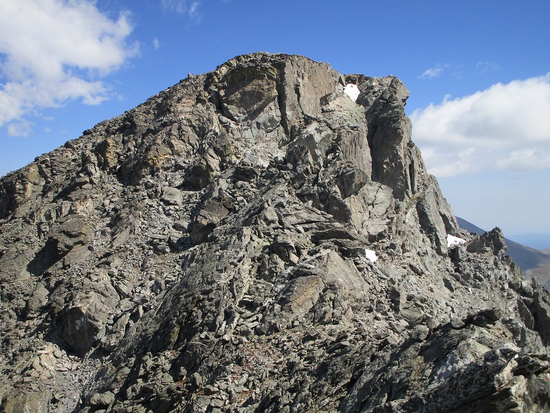
The first couple of hundred yards along the ridge was easy before it quickly turned gnarly.
the route was about to get much rougher at this point
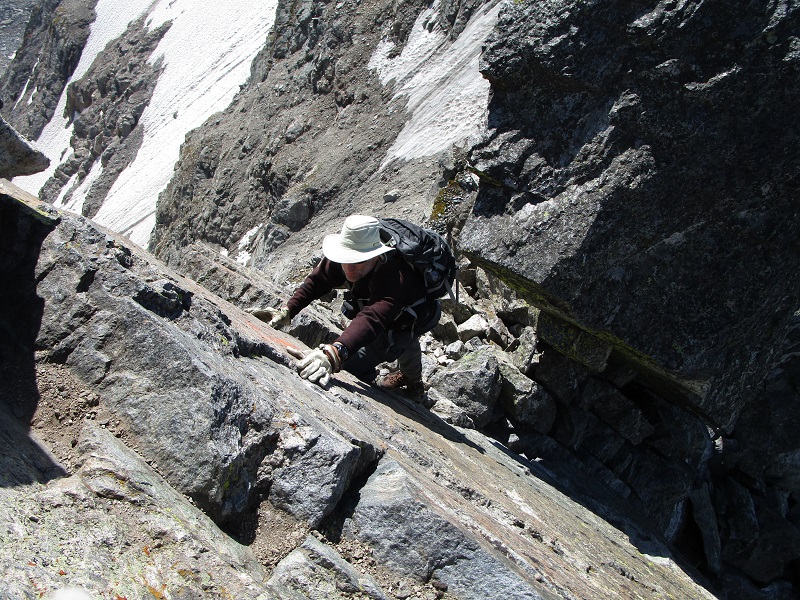
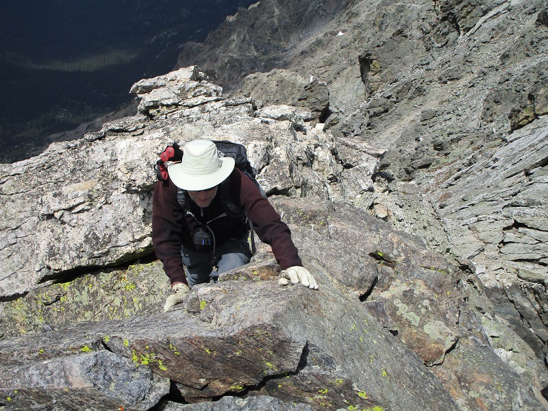
We reached the first crux on the ridge, a towering step which we chose to bypass by dropping down to the left on steep rough talus on a lightly cairned route. Then we engaged the second crux, a steeply sloping Class 3 slab, by climbing directly up its face.
here is the second crux
brian coming up the slab
Beyond this we made a careful airy scramble along the exposed ridge for a little ways.
exposure anyone?
brian on the exposed ridge (viewed on our return)
the rough ridge ahead
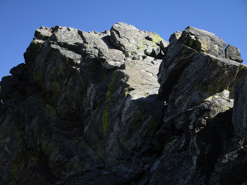
The third crux was a drop-off on a steep step on the ridge which we bypassed by dropping some distance to the left side of the ridge. The final crux was a narrow Class 3 gully that we climbed to reach the summit plateau of North Arapaho.
the final crux was a gully that goes up through this rugged terrain
When we reached the summit plateau we strolled the final short distance to the summit, where we arrived at 1150.
The ridge was more difficult than I expected, with a lot of Class 3 scrambling, if not a little Class 4. We saw about ten or so other climbers on the ridge, mostly younger fellows in their 20’s and 30’s, scampering along the ridge like mountain goats. We thought it would take us about an hour to run the ridge from South Arapaho to North based on trip reports we had read, but it took us two hours. Fortunately we had great weather. The ridge was supposed to be a lot of fun, which I did find it to be to some extent, but I found it almost more harrowing than fun, with the extensive route-finding and the physical demands of all the scrambling on the rough terrain. I would call this a younger person’s climb.
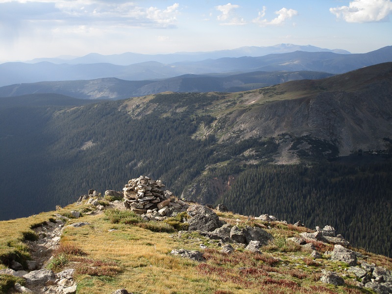
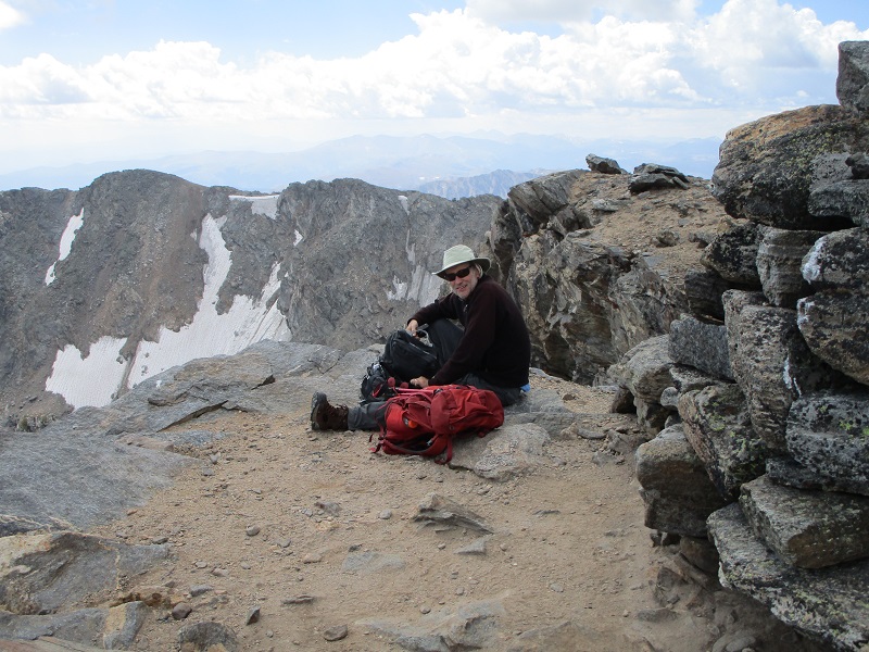
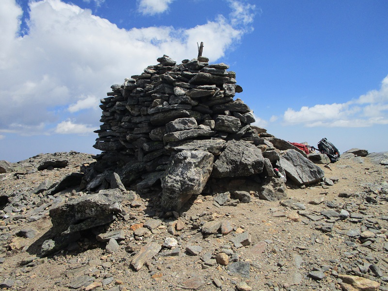
There was a large cairn on the summit and great views which we sat and enjoyed for about half an hour.
brian on the summit
the big summit cairn
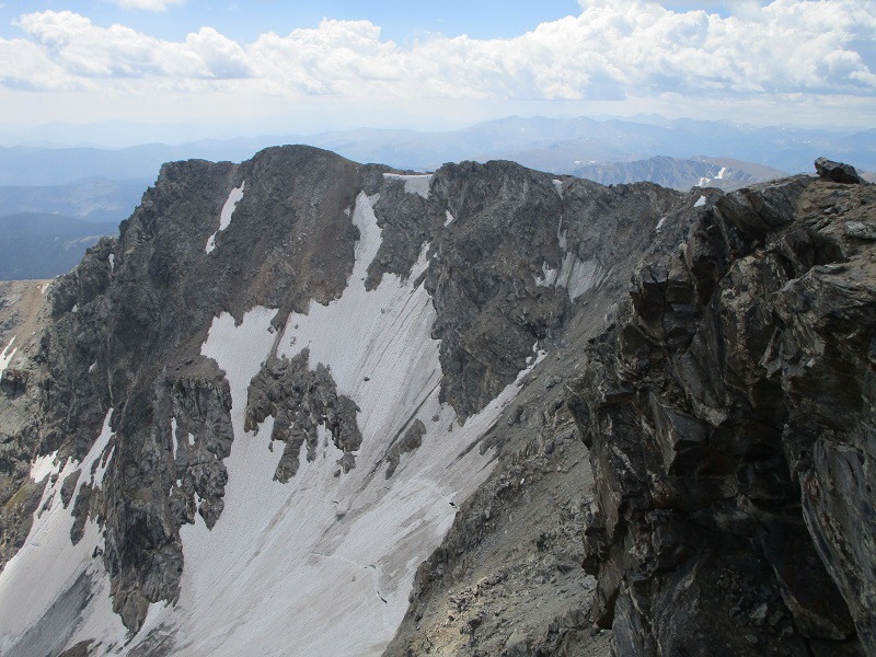
the view back to south arapaho, with the arapaho glacier below
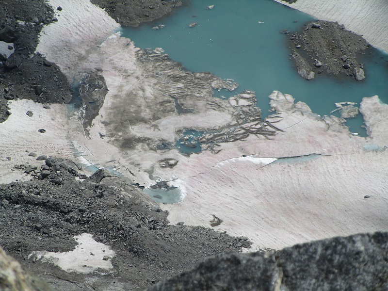
a partially frozen lake in the basin below to the east
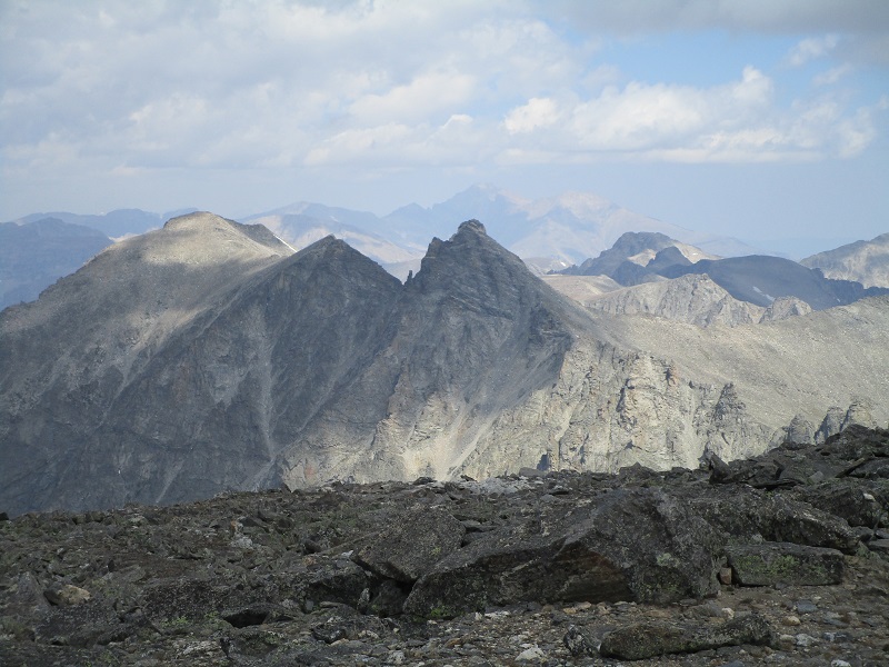
navajo peak, in the center, with longs peak beyond it in the distance
The return across the ridge took us less time, about an hour and twenty minutes, because we didn’t have to consume so much time with route-finding. From South Arapaho we hiked back down the trail toward the trailhead.
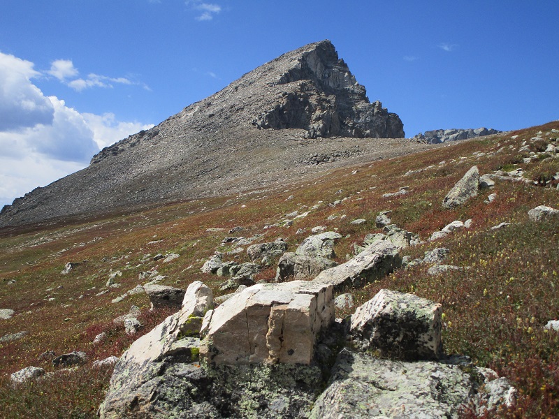
an impressive view of south arapaho on the way down
We encountered numerous casual hikers on the lower part of the trail. We arrived at the trailhead at 445 and headed for Estes Park.