PARIA CANYON, UTAH
October 29, 2021
By Tim Briese
14.8 miles, 200’ elevation gain, 9:25 roundtrip time
Like Coyote Gulch, Paria Canyon is another classic hike that was on my radar for years. The world renowned trek through this incredible canyon extends about 38 miles from the White House Trailhead off of Hwy. 89 in southern Utah to the place where the Paria River flows into the Colorado River at Lee’s Ferry, Arizona. Doing the entire hike entails a three to five day backpack, which is well beyond the scope of what we wanted to do. We opted instead for a long dayhike seven miles down the canyon to its confluence with Buckskin Gulch and back, which gave us a great taste of the narrows and towering walls in the canyon.
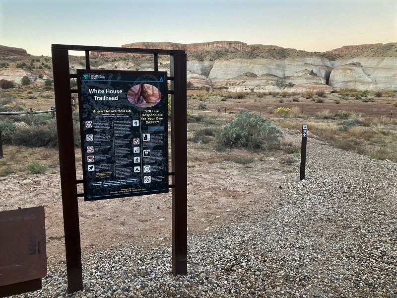
Teresa and I left Kanab, Utah in the dark and drove southeast about 45 miles on U.S. 89 to the turnoff for the White House Trailhead and followed the dirt road about two miles to the trailhead. We arrived at dawn on this chilly morning. There was only one other vehicle in the trailhead parking lot but a small adjacent campground with about a half dozen sites appeared full, and shivering campers were milling about or running their vehicles to keep warm. I strolled over to a kiosk to obtain our required permit and pay the fee of six dollars per dayhiker, intending to pay cash as I had done at the Buckskin Gulch Trailhead last winter. I was dismayed to read that no cash was accepted here, and that I had to scan a QR code and log in to recreation.gov to obtain our permits electronically. I just barely had enough cell service to pull this off but soon had the task accomplished. We took off about 730 in the frosty air and began hiking down a well-used trail to the south toward the Paria River and in short order were hiking along the stream.
the trailhead
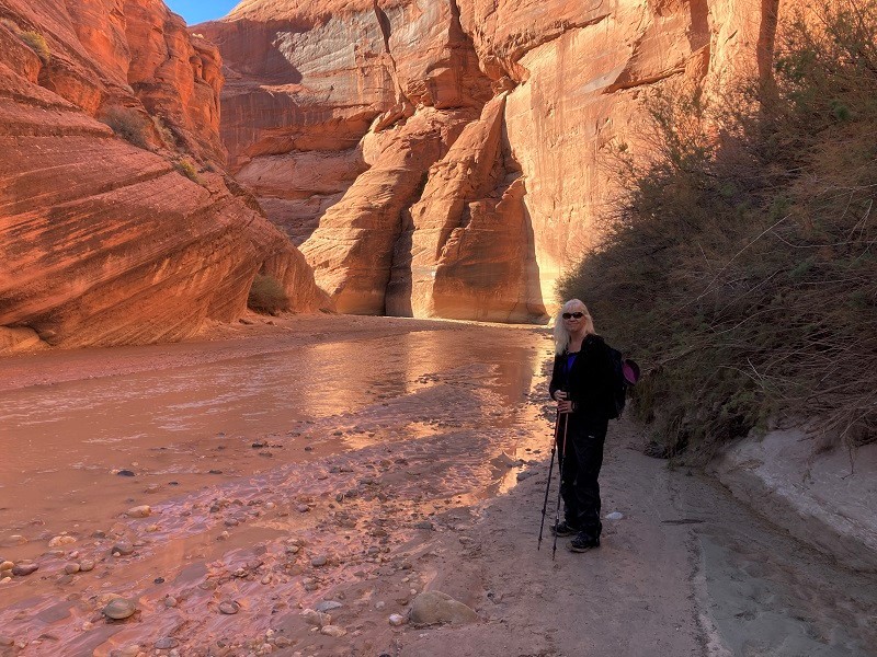
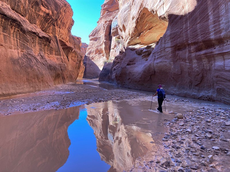
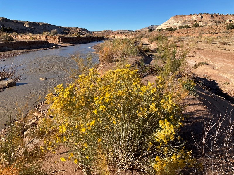
view of the paria river shortly after we left the trailhead
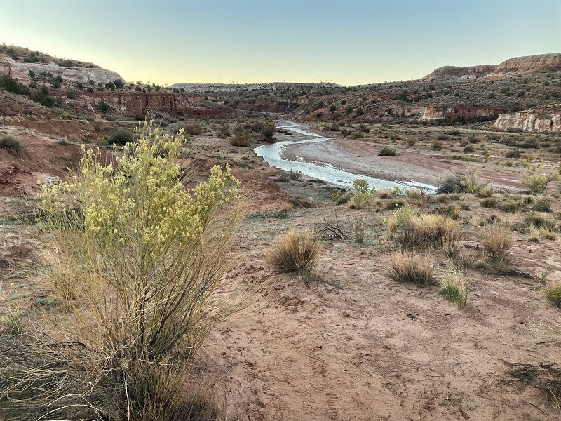
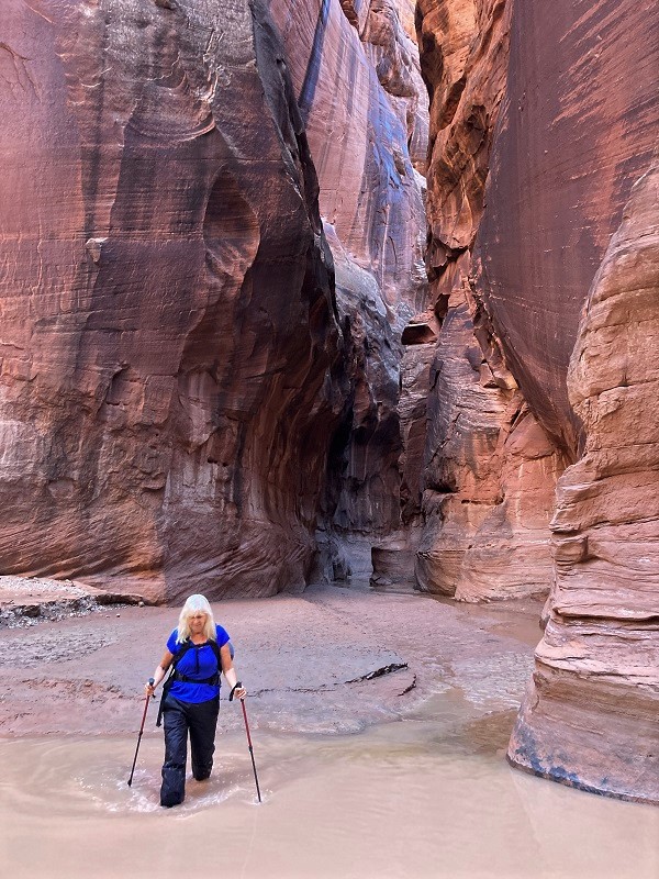
There is often minimal water flowing at this time of year but the same rainstorm that had flash flooded Coyote Gulch a few days before also impacted the Paria. It was evident that the river had run considerably higher but had now receded to a modest stream. Within twenty minutes it was evident that we were entering a canyon as cliff walls began to appear on the sides. It didn’t take long to reach our first necessary river crossing either, as the river swings back and forth from one wall to the other. The water was cold but less than a foot deep, and this was a mere taste of the 50 or so crossings we would have to make on our trek down the canyon, with as many on the way back.
cliff walls soon appeared
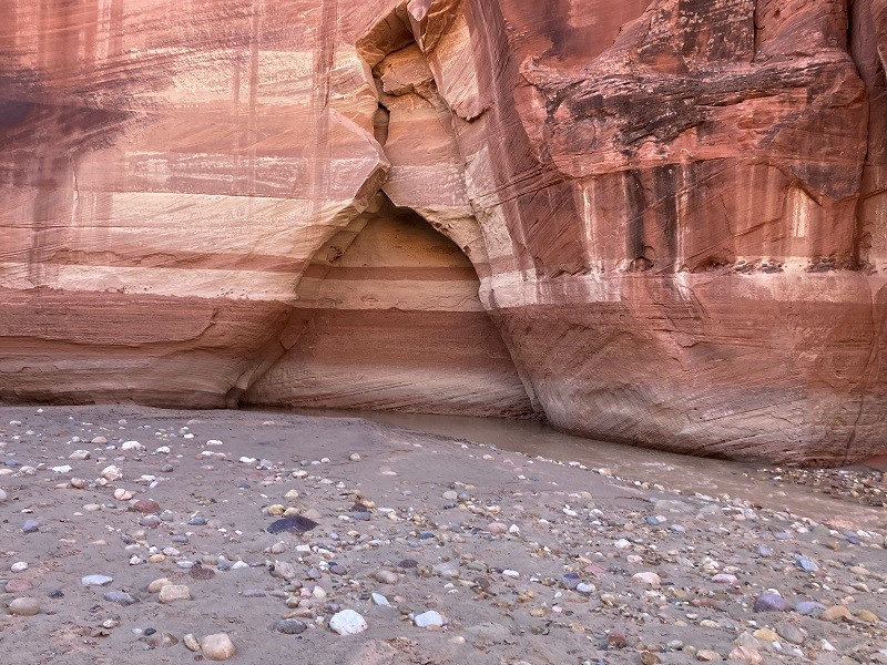
interesting holes eroded by the water

In spite of the sandy or rocky footing and all the water crossings we made good time hiking down the canyon. For a while it seemed like a walk in the park compared to Coyote Gulch, at least until the miles wore on. The Paria is occasionally scoured by big flash floods which preclude much vegetation growth, which makes hiking easier.
we took a break by a rare tree in a wide spot in the canyon, about three miles down from the trailhead
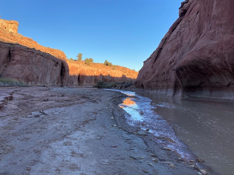
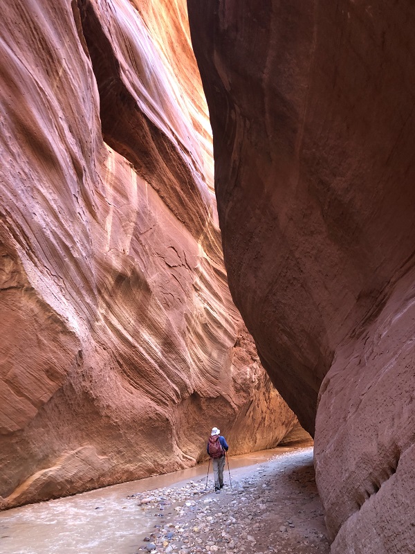
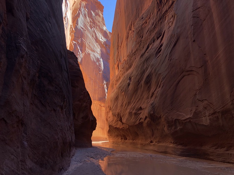
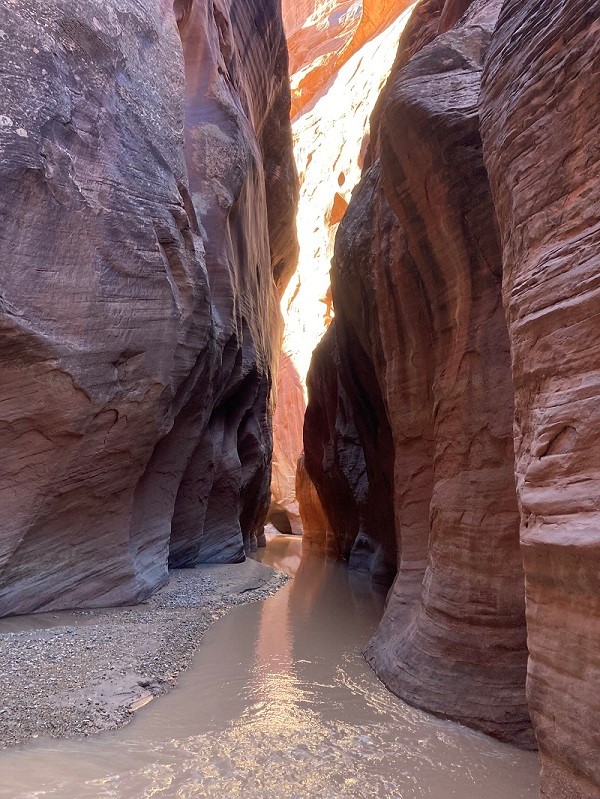
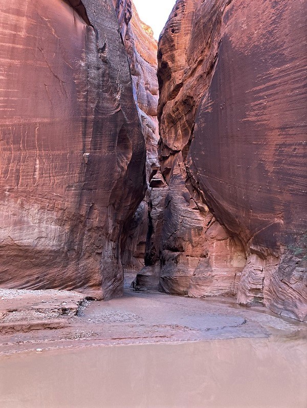
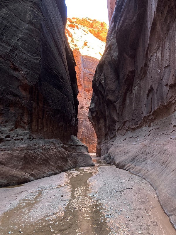
About four miles down the canyon the walls became noticeably taller and the canyon narrower, with the grandeur increasing around every turn.
interesting stripes on the wall
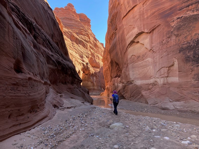
Much of the hike was in the shade in this deep canyon, but occasional shafts of sunlight warmed our souls. The canyon became as narrow as about ten feet, with walls towering 500 to 800 feet above. It was sublimely impressive!

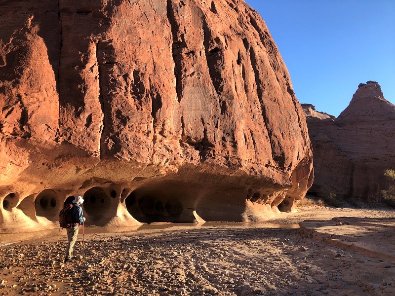
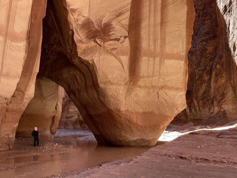
All the water we waded in was less than about a foot deep, except at one place next to some boulders where the current had washed out a hole at least five feet deep. We managed to slip right along the wall on one side in water up to our thighs. About six and a half miles down the canyon we came to Slide Rock Arch, one of the most impressive features on the hike.
slide rock arch
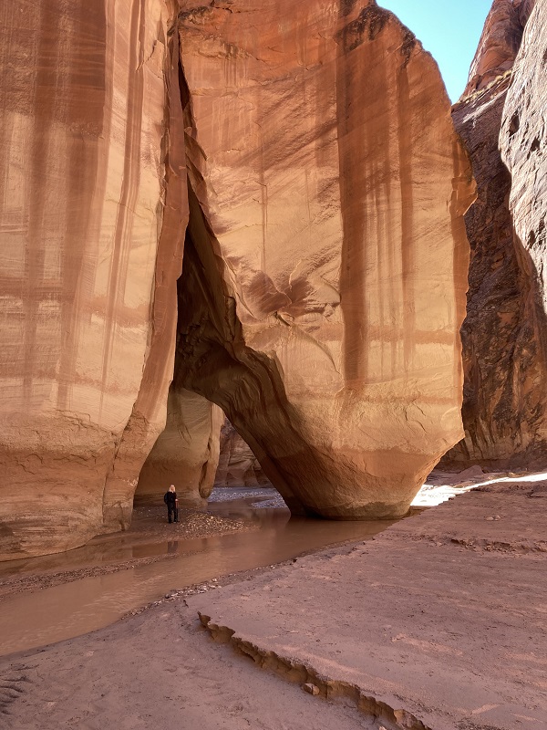
teresa walking under slide rock arch
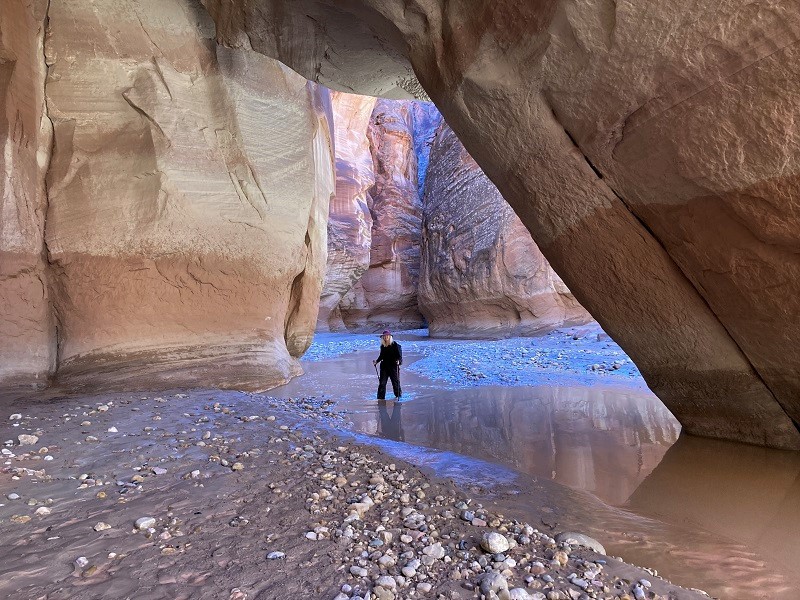
A little over seven miles down the canyon we finally reached the confluence with Buckskin Gulch, a narrow towering slot canyon that came in from the west. Buckskin is said to be one of the longest and narrowest slot canyons in the world, and traversing it is an epic adventure.
buckskin gulch, where it joins paria canyon
at the confluence of buckskin gulch, at the left, and paria canyon, at the right

There was only a trickle of water flowing down Buckskin today and we walked up it a few hundred yards to explore.
buckskin gulch
Then we turned around and headed back up the Paria.
leaving buckskin and wading back across the paria
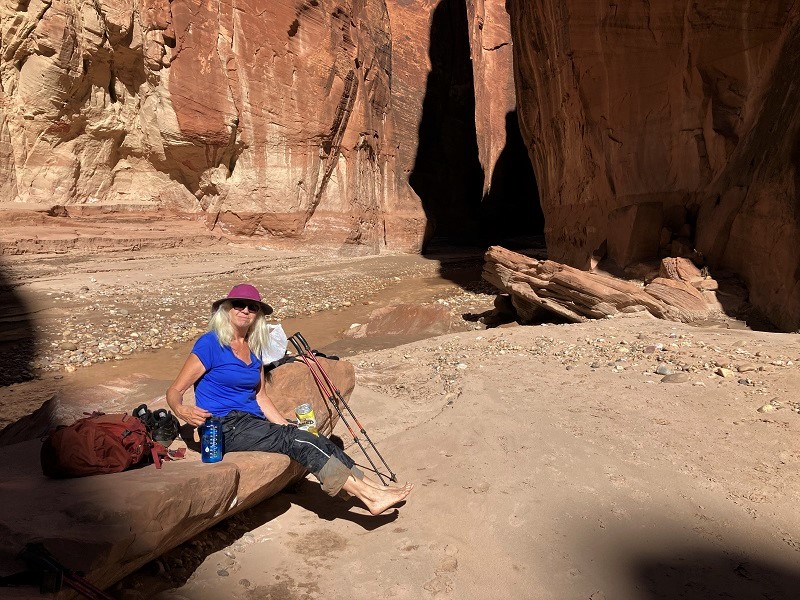
When we reached a sunny spot we stopped to take off our boots and we gave our waterlogged feet a break.
giving the feet a break
After hiking a couple of miles back upstream we finally saw the first other hikers we saw today, a young couple backpacking with their dog who intended to set up camp near the confluence with Buckskin and hike back out the next day. Later we saw a second couple of young backpackers. We were really dragging for the last few miles of the hike as the distance caught up with us. Curiously, the water, which I estimated to be perhaps 50 to 55 degrees, did not feel nearly as cold on our feet as it had in the morning. Had the water warmed up a bit? Were our feet getting acclimated to it? Or were they just numb? About a mile from the trailhead a young fellow rapidly approached us from behind and when he caught up we visited and he told us he was a trail runner who had come all the way down Buckskin Gulch today on his way to the White House Trailhead, which I knew was an incredible feat. He told us about chest deep pools of water in Buckskin, and a 15 foot roped downclimb, a rugged twenty-some mile adventure in eight hours! Amazing!
nearing the trailhead on our way back
About 5 pm we tramped back to the trailhead. It was warm and sunny now, and we sat for a while and treated our feet to the dry air before loading up and heading to Page, AZ for the night.