PEEKABOO TRAIL
CANYONLANDS NATIONAL PARK, UT
March 18, 2019
By Tim Briese
12.5 miles, 800’ elevation gain, 7:00 roundtrip time
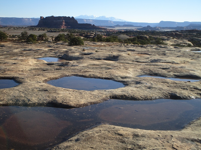
I’ve hiked a lot of trails in the Needles District of Canyonlands National Park but had not done this one. A description of it in a guidebook really piqued my interest. I left Moab early in the morning and drove about 80 miles southwest to the remote Needles District and parked in the spacious parking lot on the south side of the Squaw Flat Campground. The sandy trail initially headed southeast through varied terrain with a few stretches of bare slickrock.
pools of water on the slickrock from recent rains. a couple of cairns are visible beyond the pools.
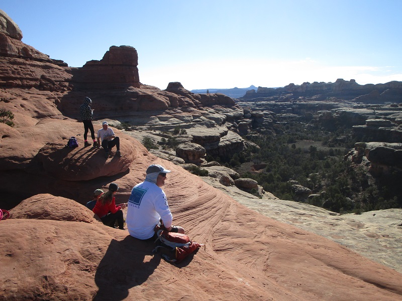
After a couple of miles the trail climbed up over a slickrock saddle.
other hikers resting at the saddle
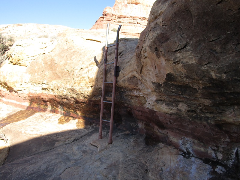
The rest of the way could hardly be called a trail, but rather a route over the slickrock that has been carefully cairned by the National Park Service, in amazingly complex and colorful terrain that would be very difficult to navigate without the cairns. One had to pay close attention to follow the cairns. From the saddle I descended through layers of slickrock that were reddish-pink, beige, and yellow to a sharp step that was afforded passage by a metal ladder.
the first ladder along the route
After a short stretch in a canyon bottom the route then climbed back up onto slickrock terraces above and then zigzagged up, down, around and through canyons, ridges, fins, and saddles for the next few miles. I felt like a kid in an immense natural playground that defied the imagination. Some moves on rocky steps stretched my abilities a bit, and were better suited for those more nimble than I. One spot required contouring across a short and very steep side slope, trusting the friction on one’s boots to prevent falling 50 feet or more into the canyon below, with a resulting severe injury or worse. I suppose many have turned back here, and it certainly raised my adrenaline level. At another spot ice had formed from melting snow in the shade behind a vast wall, treacherously covering the steeply side-sloping trail but I managed to carefully skirt up and around this area without mishap.
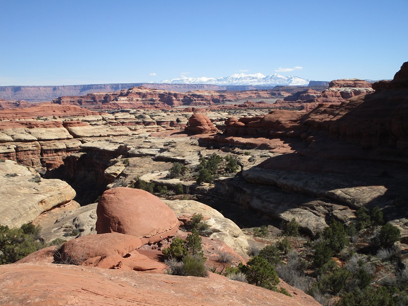
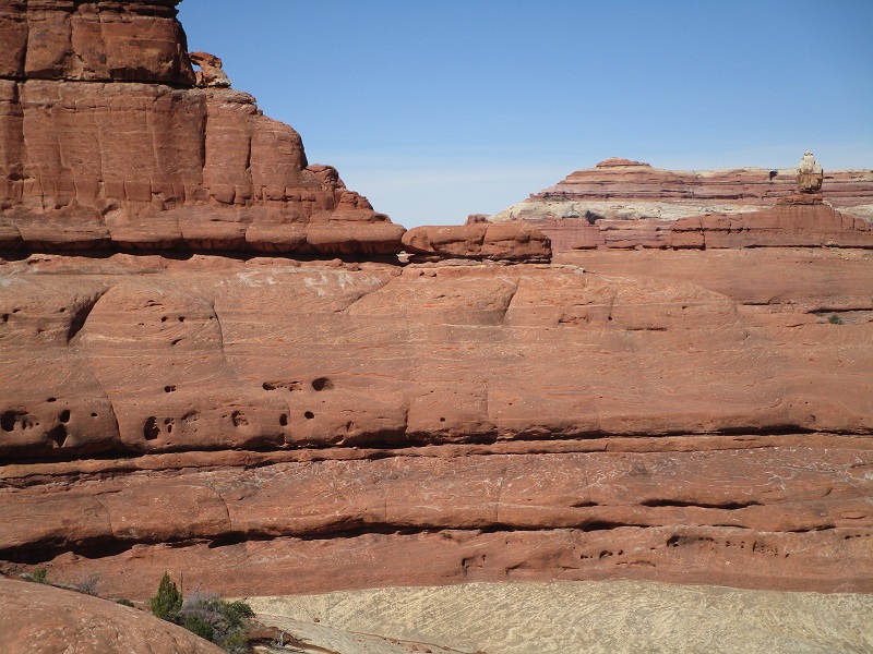
some scenery along the way
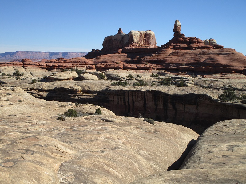
a vast rocky wilderness
Toward the end the route surprisingly popped through a window in a fin, from which the trail derives its name.
the route went through this window. note the cairn at the lower right.
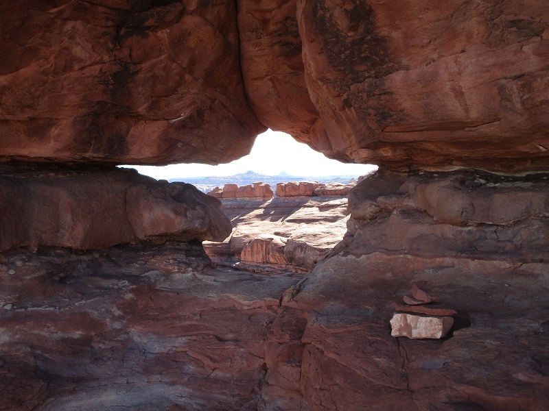
looking back at the window, just above the center of the photo. the route then contoured across the slope to the left.
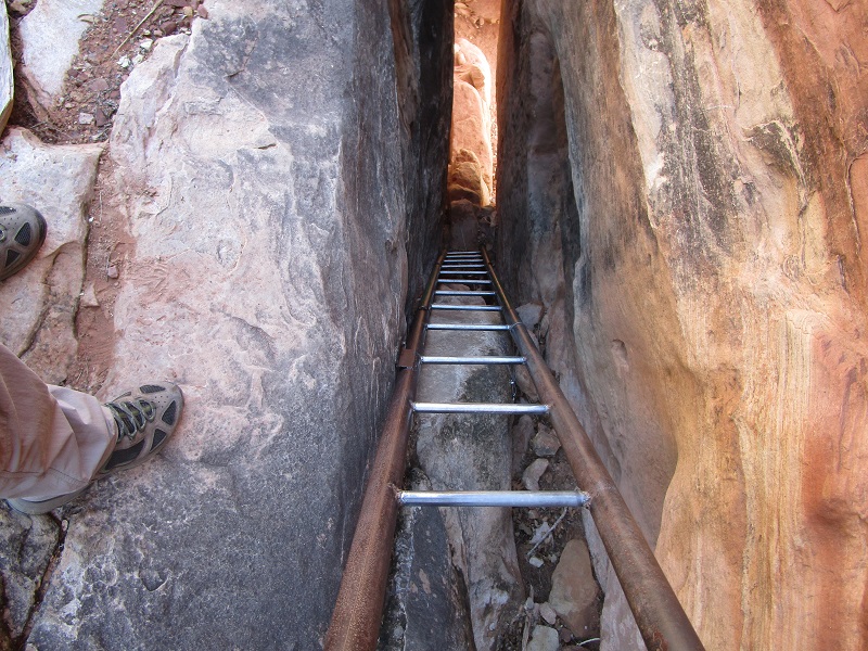
Then the route descended sharply down the crest of a ridge and went down a narrow twenty foot chute via another ladder.
the route went down this slot on the ladder
looking down at the end of the trail in Salt Creek Canyon
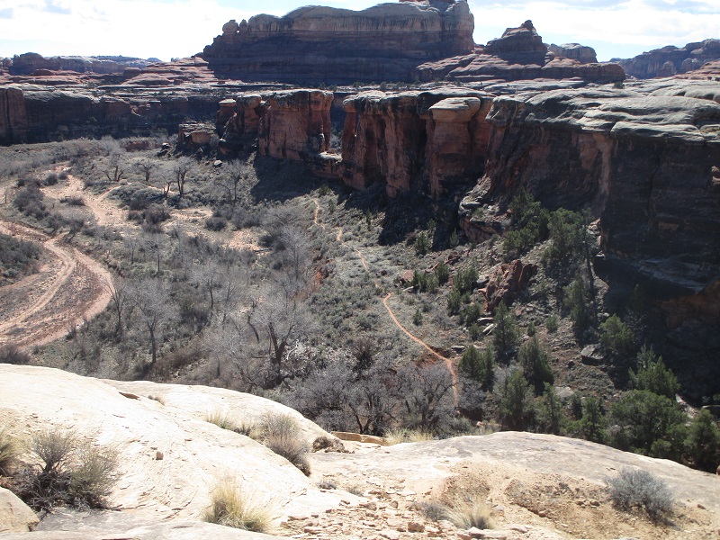
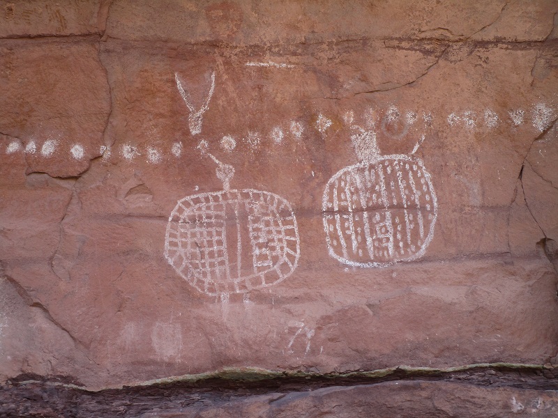
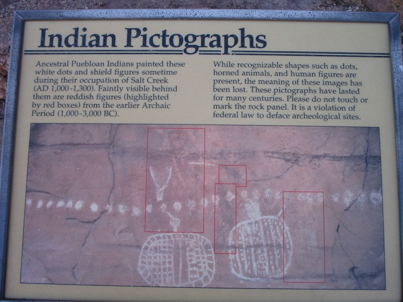
Now I was in Salt Creek Canyon, almost at the end of the trail after some five miles, and hiked a couple of hundreds more to see some pictographs on a canyon wall.
some of the pictographs
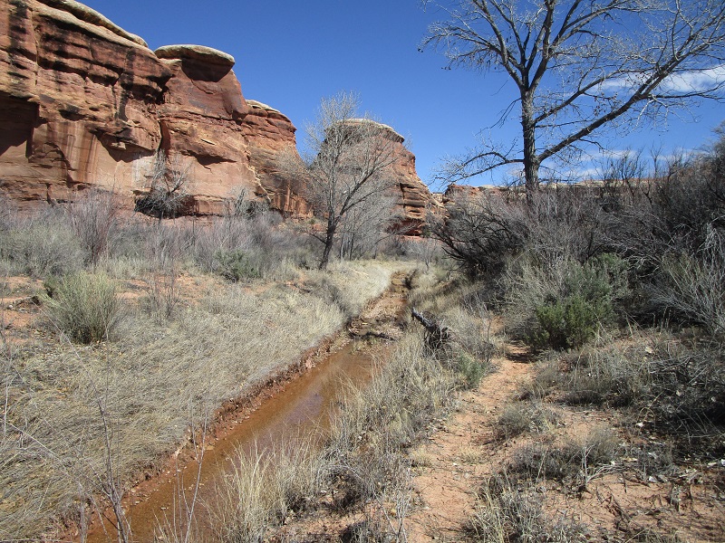
I had planned to retrace my route back but had no appetite to tackle the challenges and potential dangers again, so I opted instead to tediously hike down the Salt Creek wash through a lot of sand and bushes to eventually arrive at a paved road that I could take back to the trailhead. This added a couple of miles onto my day but at least there was a rough 4WD route down the wash that helped somewhat.
on the route down Salt Creek Canyon
I arrived back at my truck at mid afternoon, concluding this interesting adventure.