
POTOSI PEAK
(13,786’)Aug. 23, 2011
By Tim Briese
4.9 miles roundtrip, 2800’ elevation gain, 8:20 roundtrip time
Brian and I left Ridgway and drove up into Yankee Boy Basin and parked at a flat parking area along the road at 11,300 feet, the same spot we had parked for our climb of Teakettle a few years before. The final part of the road up to this point usually requires 4WD but it had recently been graded and was in surprisingly good shape. We even saw a car that had been driven up this far. Potosi loomed far above to the east.
potosi peak
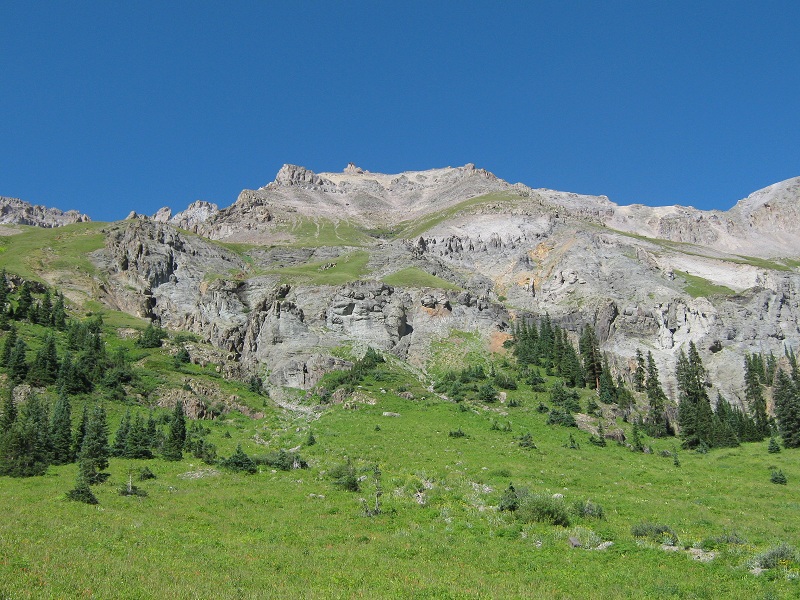
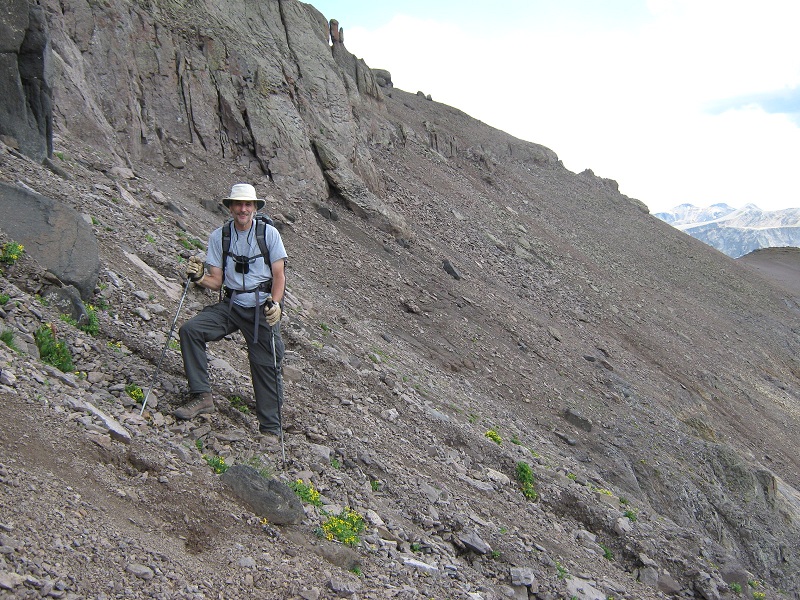
We left the parking area at 7:00 a.m. and headed up the steep grass to the north.
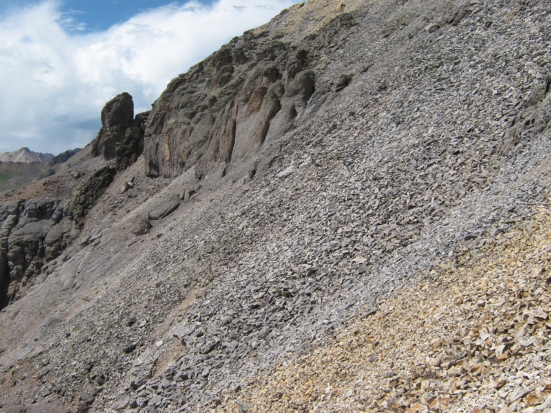
we went up the slope at the far left, then circled to the right and went up the slope in the middle (photo taken later in the day)
Yankee Boy Basin was spread out below as we climbed higher, and the early sun gleamed on the surrounding peaks.
view to the south in the early light

When we reached a flatter grassy area we circled to the right and headed up the steep slope below the Coffeepot, staying to the right on grass as high as we could.
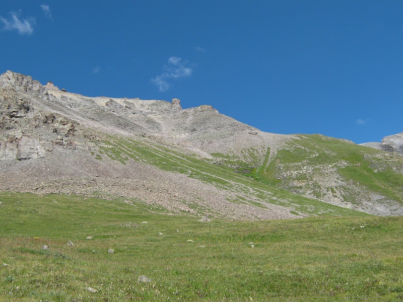
we went up the skyline ridge to the tower just to the left of center. the coffeepot is at the upper left
We found the footing to be most solid along the ridge at the right edge of this slope. At 13,000 feet we came to a tower on this ridge. Our goal at this point was to get over to the saddle between Teakettle and Potosi. We had planned to climb on up the very loose slope a few hundred feet to the vicinity of the Coffeepot and then come down the ridge to the saddle, but I spotted a possible shortcut route on a contour across a very steep slope directly over to the saddle. It was so steep that a rockslide looked like a possibility but we decided to give it a try.
we cut across this slope to the saddle, at the right
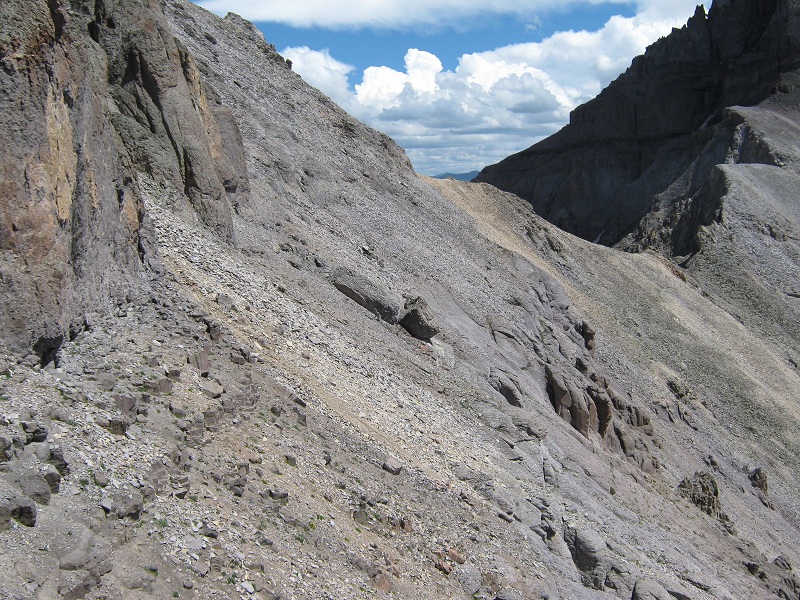
the shortcut allowed us to avoid a climb up this loose slope to the coffeepot
We scooted right across the slope and arrived at the saddle at 9:35.
potosi looked very imposing from the vicinity of the saddle

From the saddle we followed a climbers trail that went up toward Potosi and then countoured south below Potosi’s cliffs at 13,200 feet.
contouring across the slope below potosi's cliffs
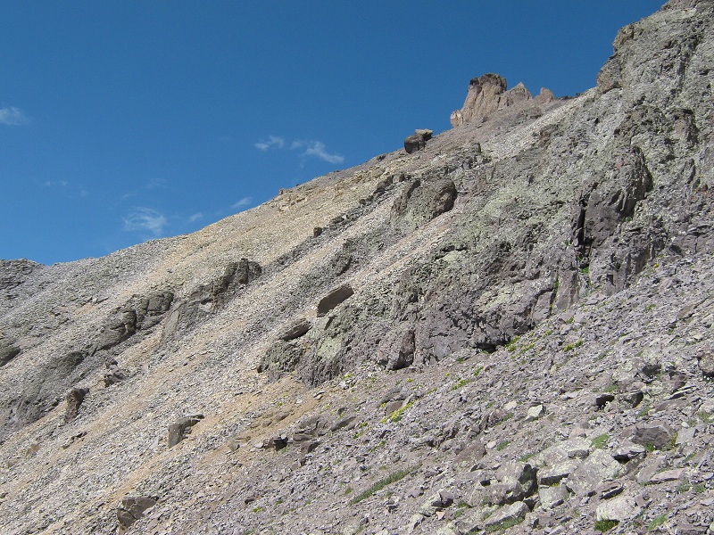
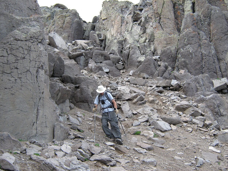
After going about 0.3 miles south on this contouring route we arrived at a flat area on Potosi’s southwest ridge at 13,200 feet and took a break. We should have headed northeast up the ridge from here but I led us astray by misinterpreting an old route description and suggested that we contour east along the base of cliffs and look for a southeast facing gully. We tried this but did not find a viable route and returned to the flat area on the southwest ridge about 45 minutes later. We headed northeast up the ridge and found a crude trail that was fairly well cairned. We climbed up to 13,400 feet and turned right and traversed about 300 yards to the base of a rocky 40 foot wide gully.
the rocky gully we went up (photo taken on the descent)
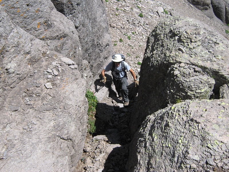
We went left up this class 3 gully and near its top traversed east into another sandy gully and headed up it a ways until we reached a class 2+ crack on the left.
brian exiting the sandy gully and coming up the crack
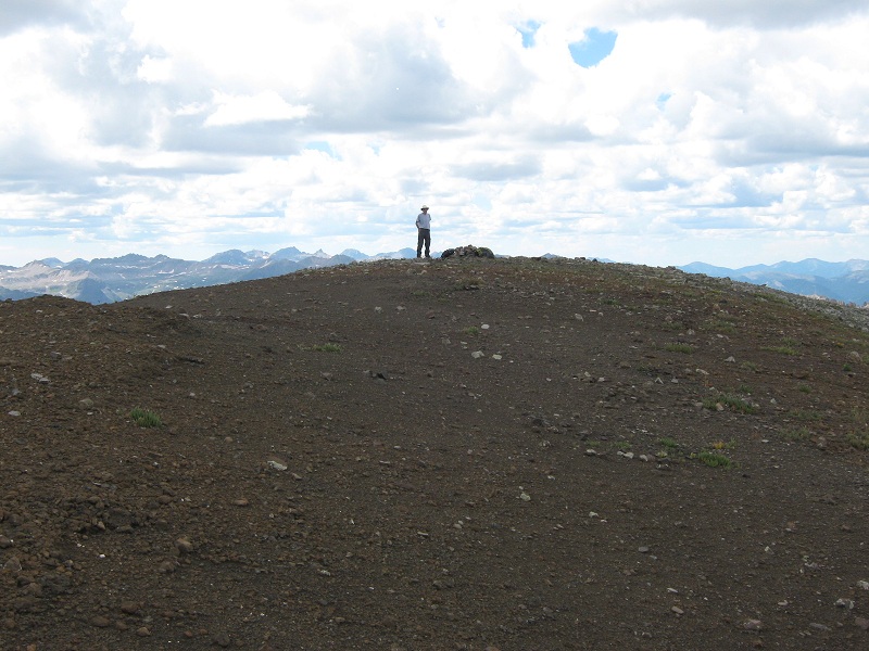
We climbed up this crack and then made our way up slabby, rubble-covered ledges to the summit area. The route from the southwest ridge up to the summit was more intricate and involved than I expected but was pretty well marked with cairns. We strolled 100 yards west across the spacious summit to the highest point. We arrived there at 12:10 p.m. Potosi’s expansive flat summit area is remarkable for such a rugged peak. The peak resembles a lofty desert mesa when seen from a distance. I had seen it from afar many times over the years and was pleased to finally have a chance to inspect it in person.
potosi's expansive summit
There were excellent views from the summit.
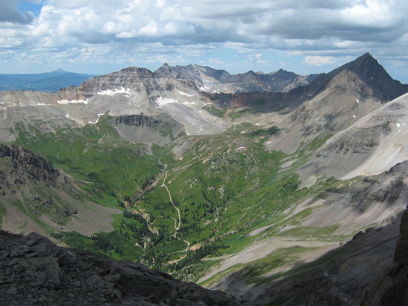
yankee boy basin, and mt. sneffels at the right
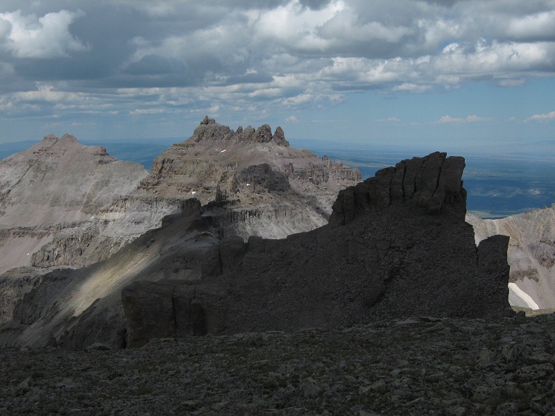
teakettle mountain, and cirque mountain at the left
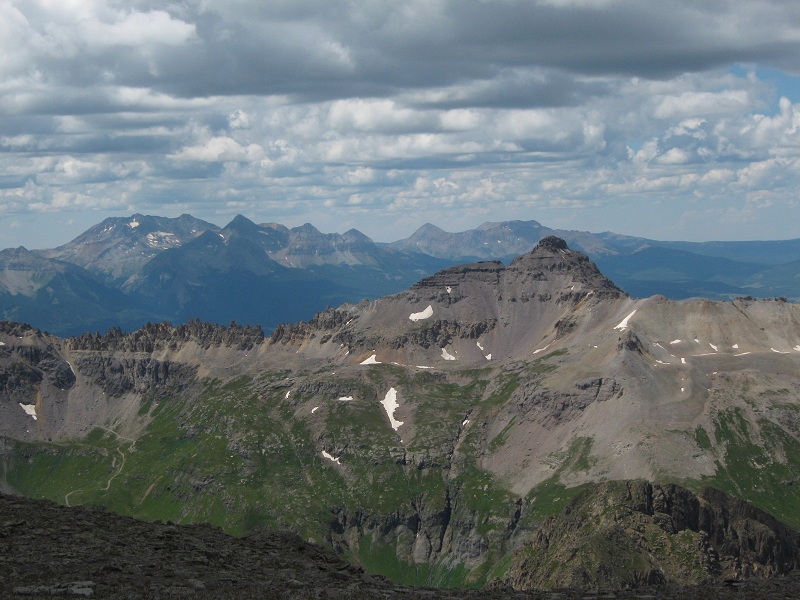
mt. emma and the st. sophia ridge in the foreground, with the wilson group of peaks beyond
Clouds were building up and rainshowers were falling from some clouds in the distance so we took our leave of the summit and headed down at 12:40.
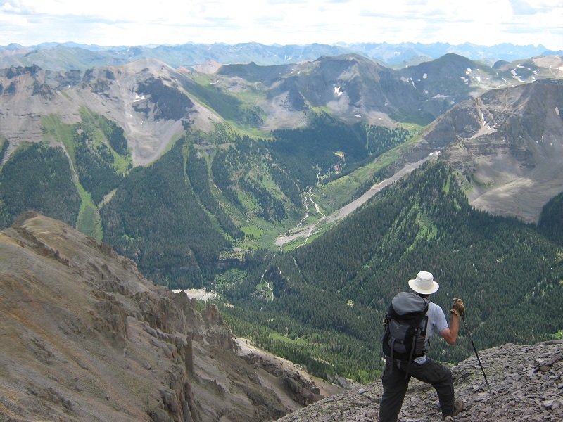
the beginning of the descent
The steep descent to the southwest ridge went quickly and we made good time back to the saddle, arriving at 1:55. The weather unexpectedly improved and bright sunshine returned.
the shortcut slope from the saddle back to the tower
it was time to take a well earned break

We scooted back down the very steep slopes to the truck and arrived there at 3:20.
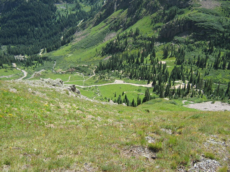
the grassy slope down to the truck, in the center
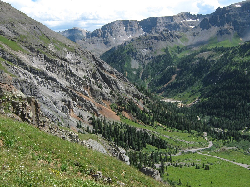
potosi's colorful and rugged lower slopes
The climb does not involve very many miles or very much elevation gain, comparatively speaking, but it took quite a bit longer than I anticipated because much of the terrain is very steep and rough. We headed to Silverton for dinner at Handlebars and then drove over Stony Pass to get ready for the next day's climbs.