PRECIPICE PEAK
(13,144’)COURTHOUSE MOUNTAIN
(12,152’)July 27, 2013
By Tim Briese
Precipice Peak: 3.6 miles, 2400’ elevation gain, 5:10 roundtrip time
Courthouse Mountain: 3.6 miles, 1800’ elevation gain, 2:50 roundtrip time
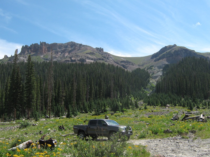
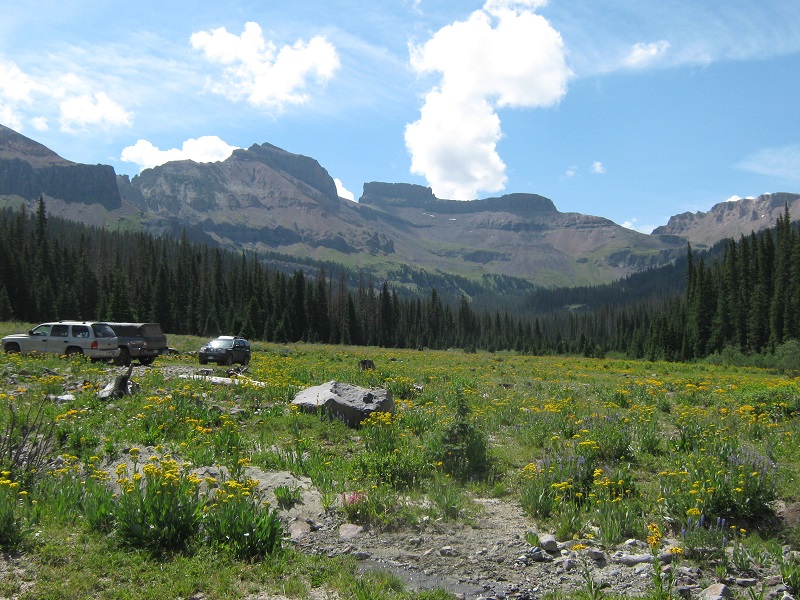
Brian and I left Ridgway at 4:15 a.m. and drove over Owl Creek Pass to the Wetterhorn Trailhead in the West Fork of the Cimarron River Valley. The last mile or so of this road requires some modest four wheeling. We arrived at the trailhead at 6 a.m. and met Terri Horvath, who had arrived the night before and car camped at the trailhead. It was good to see her, for our paths had not crossed in a while. At 6:15 the three of us left the trailhead and embarked toward our goal. The route to Precipice is very direct but steep. Basically you make a steep climb of nearly 2000 feet in a little over a mile to the ridge south of the summit and then hike north along the very scenic ridge to the top.
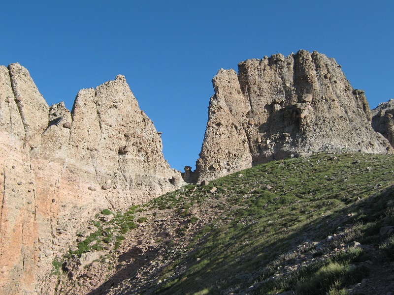
we went up and along the drainage at the right to the grassy saddle, then left to the summit. (photo taken later when we returned)
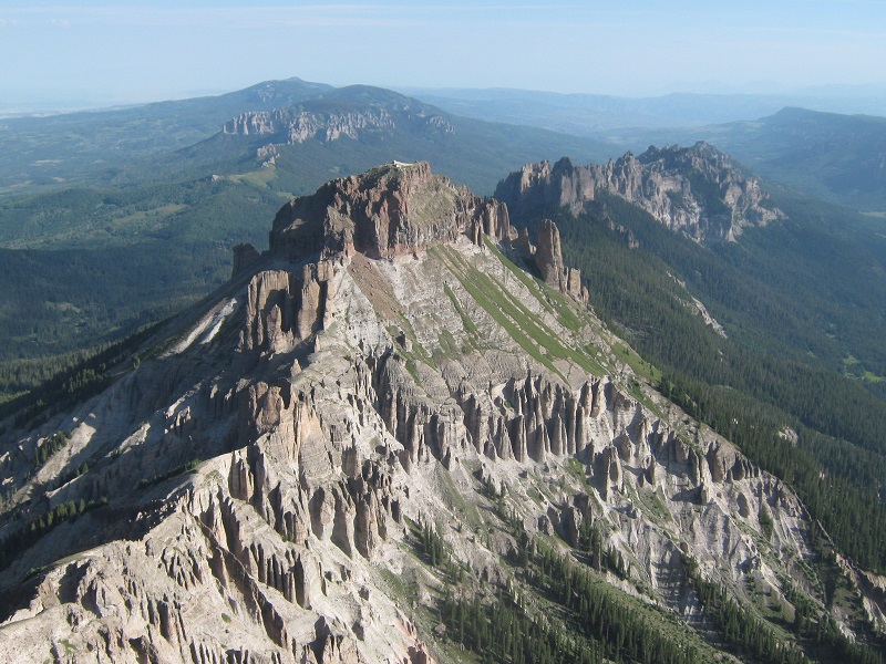
From the parking area we headed straight up the obvious drainage to the east on a climbers trail along the north side of the drainage bottom. After a while when the drainage became too rugged and steep we made a very steep ascent a few hundred feet up through the trees to the northeast and then continued upward parallel to the drainage above its left side. As the trees thin out near timberline the drainage splits, and we crossed over the left fork to a rib between the two forks and continued upward to a rocky gap in a cliff band at the upper end of the right fork of the drainage. We went up through this gap and continued on a steep climb of a grassy slope several hundred feet to the crest of the ridge above. When we got to the ridge incredible views unfolded around us.
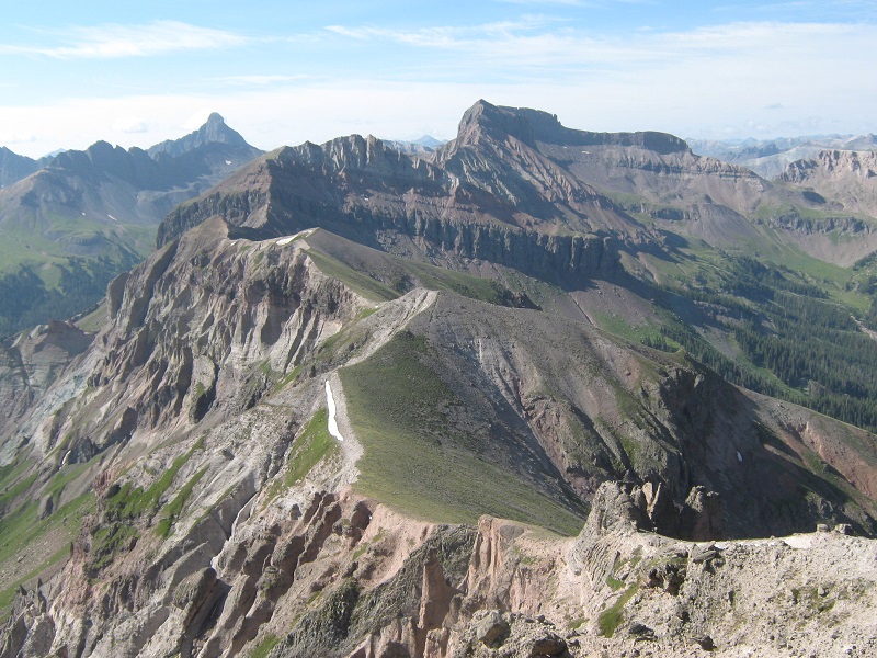
the view to the south from the ridge; uncompahgre peak looms to the left, Wetterhorn peak is to the right
towers along the ridge
looking back down at the parking area from the ridge
We headed north along the ridge and presently came to a fun notch that we scampered through.
we went through this interesting notch in the center of the photo.
terri going through the notch

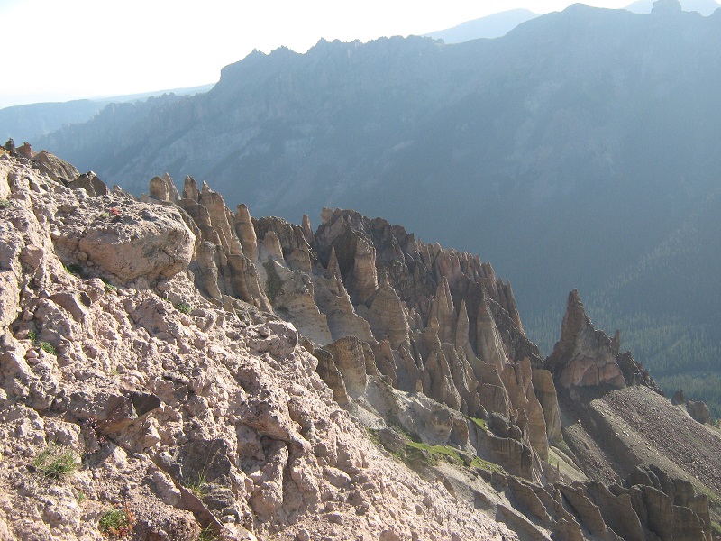
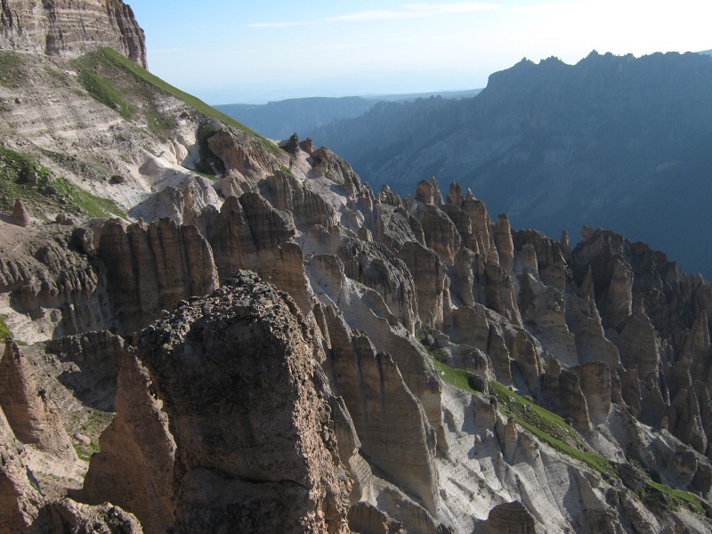
As we continued up the ridge we hiked past an incredibly scenic array of towers, hoodoos, and even a toadstool rock formation.
some of the towers along the ridge
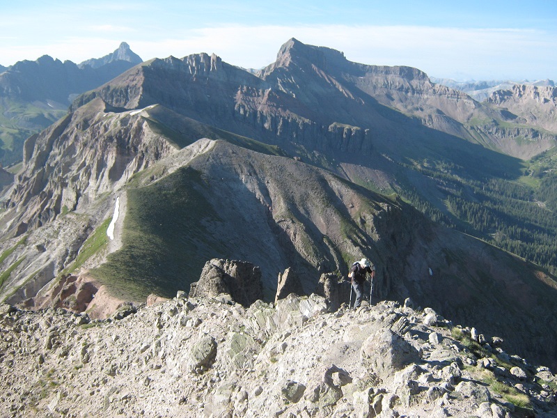
brian coming up the ridge
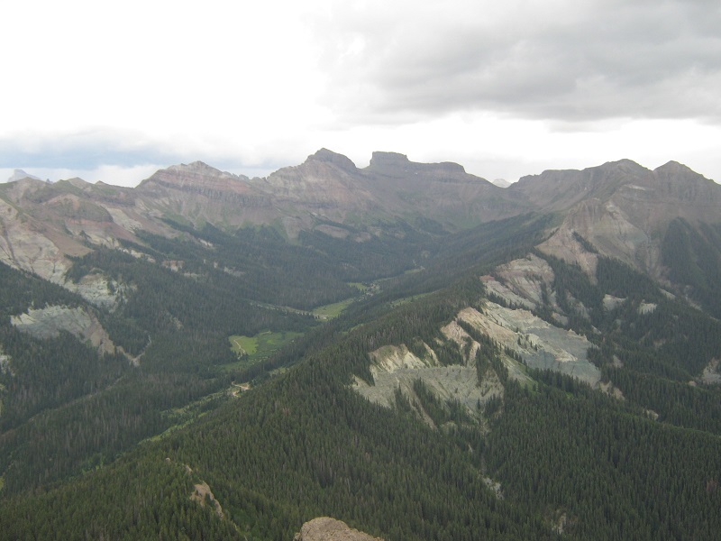
a view of courthouse mountain across the valley
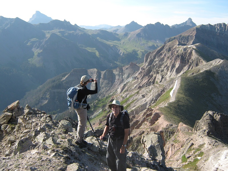
We arrived on the spectacular summit at 8:45.
terri and brian on the summit

the view of dunsinane mountain, along the ridge to the north
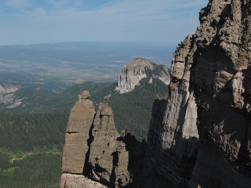
the view south along the ridge; from left to right, wetterhorn peak, fortress peak, redcliff, and coxcomb peak behind redcliff
We spent a wonderful 45 minutes on top, gazing about at the magnificent scenery and visiting about various things. It was especially touching to me to talk about parents we had lost, for my father had just passed away in April. Terri had lost her mother in March as well. We eventually left at 9:30 and retraced our steps down the ridge and back down the steep slope to the trailhead, where we arrived at 11:25.
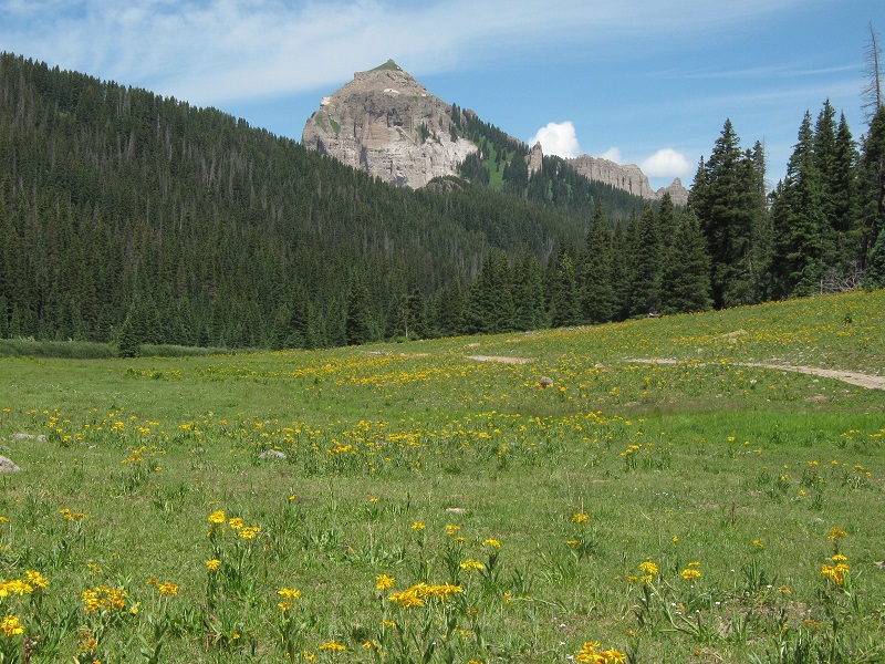
a view of coxcomb peak, in the center, from the trailhead
Terri wanted to try to climb Fortress Peak as well today, but my knees had had enough steep terrain for today so we exchanged goodbyes and Brian and I watched her stride briskly up the trail to the south toward her objective. We hoped she would have good enough weather for her climb because clouds were rapidly starting to pile up in the sky.
I was still up for some easier climbing so Brian and I decided to drive back down the road a couple of miles and head up the trail to Courthouse Mountain. This peak is a scenic landmark that can be seen for miles around and climbing it had been on our wish lists for a while.
courthouse mountain
We embarked up the excellent trail at 12:10 and soon met a couple of hikers on their way down. The trail climbed about 800 feet in just under a mile to a junction, where we turned right onto the trail that led to the summit. The weather was rapidly looking increasingly nasty so we hustled along quickly. The fine trail carried us steeply up through the trees on the east slopes of the mountain. The trees ended and the final 300 feet of climbing was rougher and rocky. We nearly ran the last few feet to the top because the weather looked so bad. Sheets of rain were falling nearby and thunder was rumbling too. This exposed peak had the distinct feel of a lightning rod to me!
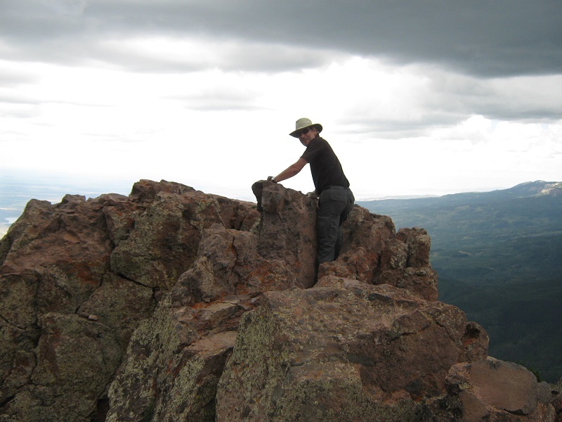
brian on the summit of courthouse mountain
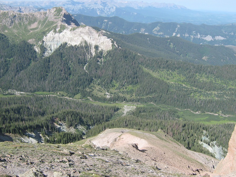
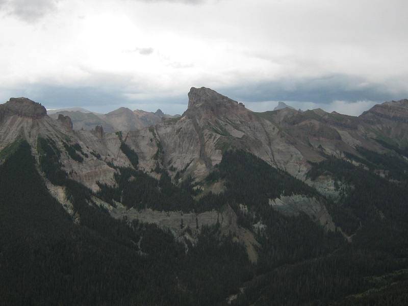
view of redcliff and coxcomb from the summit
precipice peak across the valley
this is a view you don't want to see while on a summit!
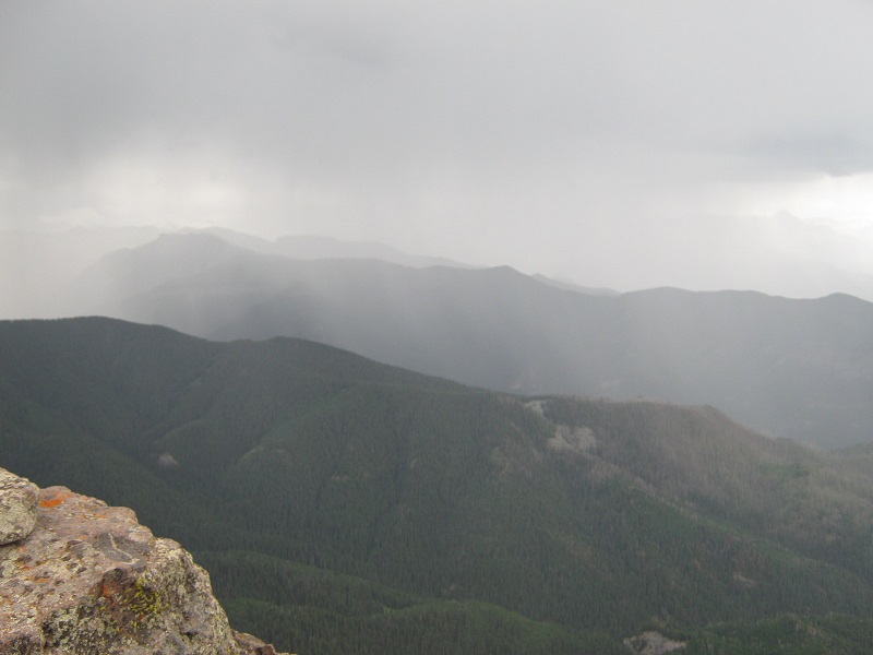
We arrived on top at 1:40, rapidly snapped a few photos, and left in a couple of minutes. I thought I felt hair standing up on my arm as we hustled down through the exposed rocky area. Sure enough a bolt of lightning struck not too far away when we were still about 100 feet away from the relative safety of the trees. We reached the trees and continued on down the trail as light to moderate rain fell. Down lower we met four hikers going up the trail. We wondered how Terri had fared on her attempt and found out later that the weather unfortunately forced her to turn back a few hundred feet below her summit. We tramped back down to the trailhead at 3 p.m. and headed back to Ridgway.