PT. 13,631
September 19, 2011
By Tim Briese
12.8 miles, 4300’ elevation gain, 11:00 roundtrip time
This was our final bicentennial peak in the Elk Range, a milestone to look forward to. The other peaks that Brian and I had done in this range, especially the ones towering above the Maroon Creek Valley where we were going today, included some very difficult climbs. This one promised to be less intense, but an early season snowfall made it harder than it otherwise might have been.
I met Brian for dinner in Frisco at a superb Mexican restaurant just north of the Walmart, then we followed each other down the highway to the Comfort Inn in Carbondale where we arrived about 8:30 p.m. We rose the next morning at 4 and drove in the dark to the Maroon Lake Trailhead. Snow glistened on the Maroon Bells in the moonlight. At 5:30 a.m. we headed up the familiar Crater Lake Trail in the dark with our headlamps. From Crater Lake we went up the West Maroon Creek Trail 1.8 miles to a stream crossing and took a short break on the other side of the stream at 7:30. 0.2 miles past the crossing we turned left at a cairn onto a climbers trail that would take us to the heights above. We had been on this route twice before when we climbed Thunder and Lightning Pyramids and were now quite familiar with it. We climbed steeply up three rock gullies and steep grass to the gentle basin behind the Len Shoemaker Ridge. Here we got our first good look at the Point and my heart sank a bit when I saw the amount of snow we would have to deal with. I was certainly hoping for less.
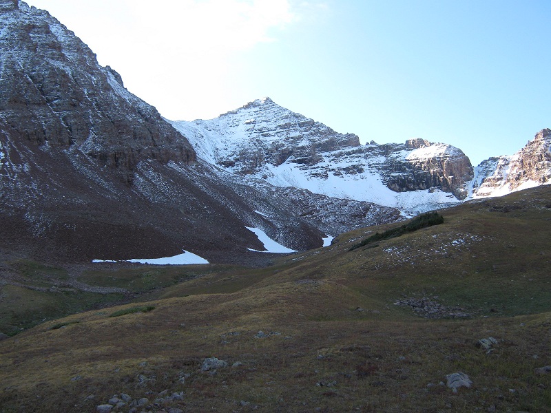
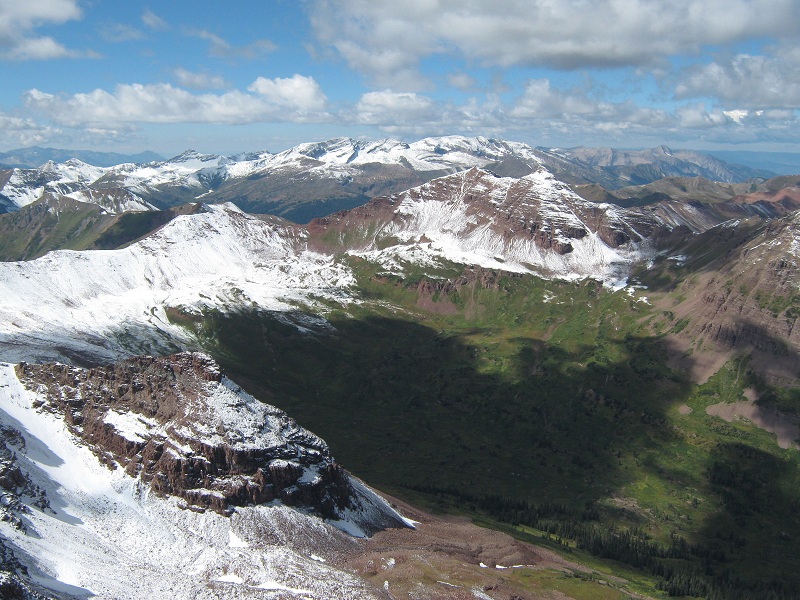
pt. 13,631. we climbed up to the saddle left of the peak
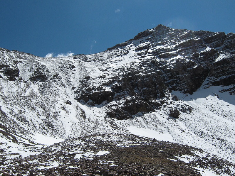
We hiked up the gentle valley as the peak loomed closer. We proceeded up a talus slope at the end of the valley and found a coat of slippery frost on the rocks which made for treacherous going. Then we began a very steep and tedious 700 foot climb up a snowy slope to the saddle above.
the slope up to the saddle (photo taken later in the sunshine)
We proceeded very carefully, kicking in steps where the snow was deep enough to do so.
brian coming up the slope
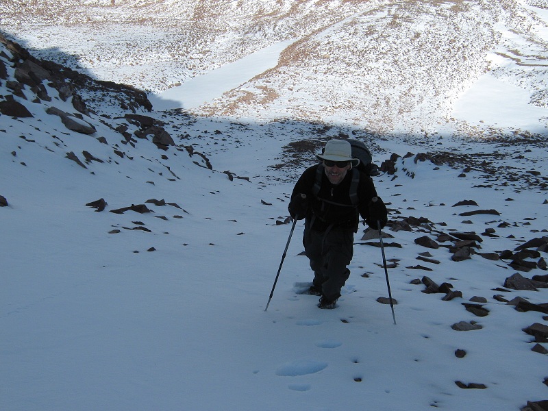
We had no ice axes along but the fresh, loose snow was generally not too deep and rocks protruded through it on much of the slope. We thought that if we slipped we would be stopped by rocks. A nasty stop perhaps, but better than sliding to the bottom! It was a relief to finally reach the 13,300 foot saddle at 10:50. The summit was only a short distance away up the ridge to the south but the ridge to get there looked pretty rugged and it had plenty of snow on it.
the ridge up to the summit
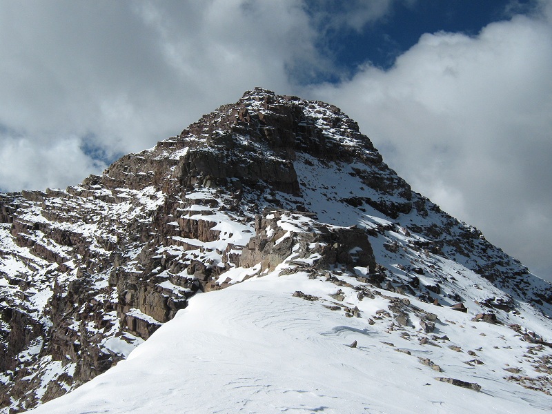
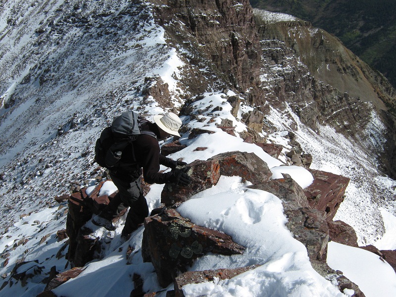
Going directly up the ridge was the only option because the ledges and gullies left of the ridge that would normally be an option held too much snow and looked too dangerous. We plodded through the snow and quickly came to the first major obstacle, a 15 foot high blocky ridge step. We worked our way around to the right of it and looked for a way up. I tried a class 4 chimney but backed off because of snow and ice. At this point we started to wonder if we were going to successfully make it to the summit today. A disheartening thought, as close as we were! But I thought, we have plenty of time, let’s poke around and see what we can do. We scrambled over boulders and wallowed through deep snow further to the right along the blocky step and found a class 3 notch that we were able to climb up through to regain the crest of the ridge. From there we very carefully picked our way up the snowy ridge, sometimes crawling hand and foot, carefully testing every step and handhold.
brian climbing up the ridge
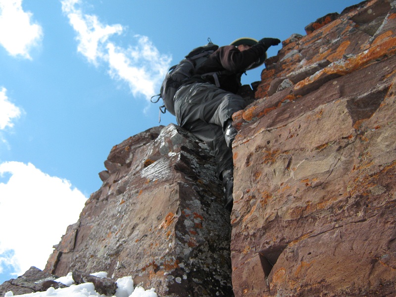
Soon we reached the crux of the climb, a ten foot high step with no option but to climb directly up it. I found a narrow and very exposed ledge on the left side from which I was able to make a class 3 climb up onto a thin intermediate step and then on up. Brian chose to go directly up a crack on the front of the block that appeared to me to be harder but much less exposed.
brian climbing the crack at the crux block
The terrain above this eased in difficulty somewhat and we slowly picked our way through the snow covered rocks to the summit. We arrived there at 11:30.
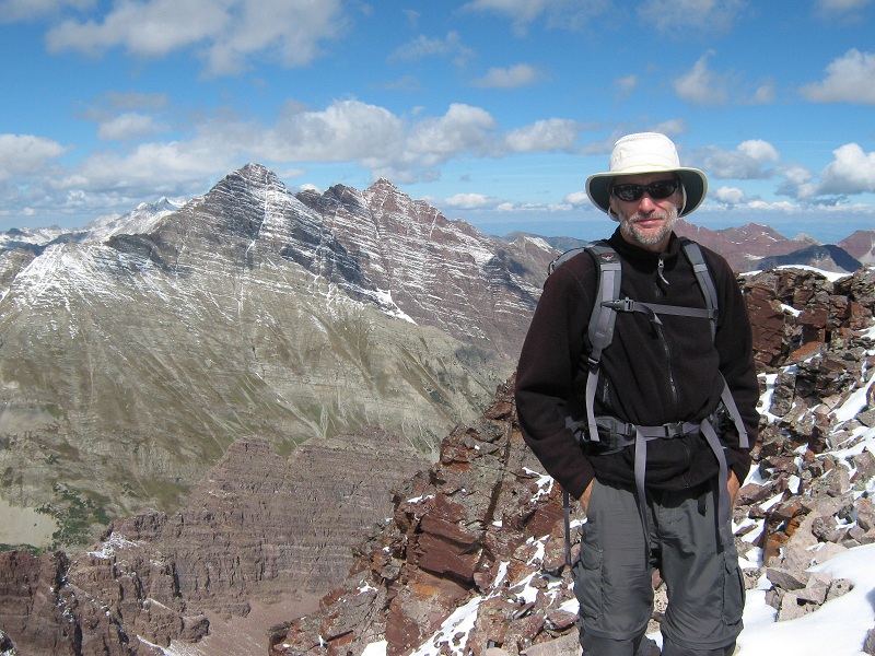
me on the summit

brian on the summit, with the maroon bells beyond
It took us 40 minutes to climb about 250 yards from the saddle to the summit. We were thrilled to make it, especially in such conditions! The summit turned out to be little more than the highpoint of a narrow and exposed airy ridge. We sat in a chilly breeze for about 25 minutes on the summit gazing at the surrounding spectacular scenery.
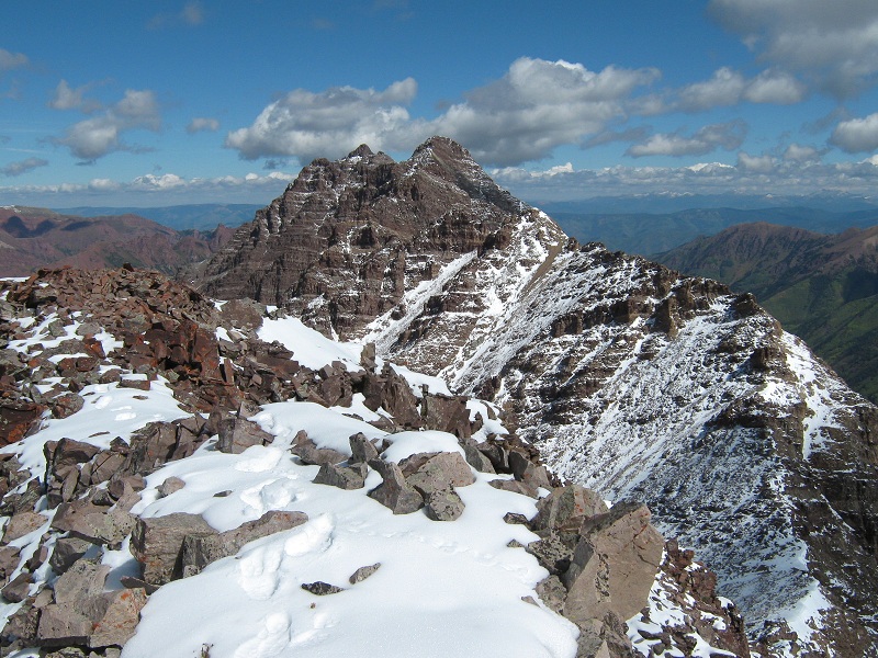
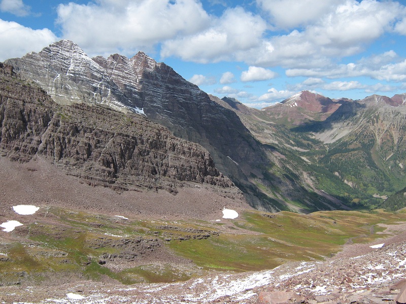
view along the ridge north to lightning pyramid
view to the southwest from the summit
I was a little uneasy about getting safely back down but we carefully took our time and all went well. It took 25 minutes to descend from the summit to the saddle. The crux block was easier to go down than up, and of course the steep snow slope down from the saddle was far less strenuous to descend. We took a nice break as soon as we reached snowfree terrain and then made our way back down the upper grassy valley.
view of the upper valley we went down
We continued down the steep slope back to the main trail in the West Maroon Creek Valley.
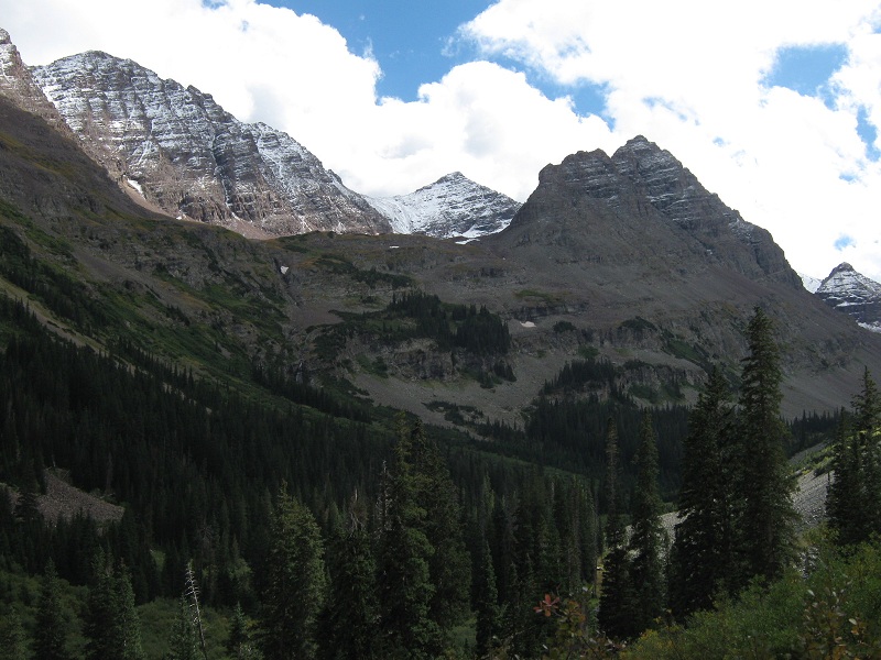
looking back up at the point, in the center, from the main trail. the steep slope to the upper valley is in the center
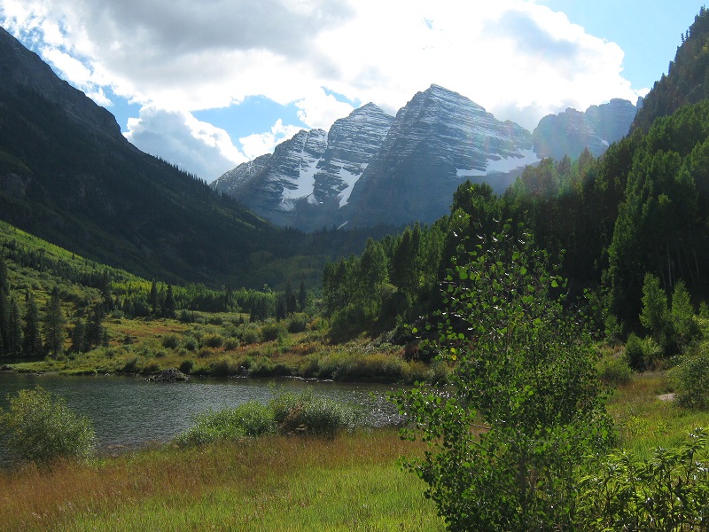
We began to meet a few tourist hikers near Crater Lake. I felt thoroughly beat up and exhausted as we hiked the last few miles back to the trailhead, for we had dealt with a lot of steep terrain and rocky footing all day. We paused at Maroon Lake to take a photo of the Bells.
the maroon bells
We tramped back to the trailhead at 4:30. A delicious celebratory dinner awaited us at Quincy’s in Leadville a few hours later.