
STORM KING PEAK
(13,752’)PEAK SEVEN
(13,682’)PEAK SIX
(13,705’)MT. SILEX
(13,628’)THE GUARDIAN
(13,617’)
July 24-27, 2012
By Tim Briese
July 24, backpack to Leviathan basin: 10.5 miles, 2300’ elevation gain, 7:00 time
July 25, Storm King Peak, Peak Seven, Peak Six: 8.4 miles, 5200’ elevation gain, 13:20 time
July 26, Mt. Silex, The Guardian: 4.3 miles, 2800’ elevation gain, 8:10 time
July 26, packed part way out: 4.2 miles, 300’ elevation gain, 2:45 time
July 27, packed rest of way out: 6.1 miles, 2300’ elevation gain, 4:10 time
Total: 33.5 miles, 12,900’ elevation gain
Brian and I had this outing into one of the most remote areas of the state on our radar for several years and now we were finally going to do it. It was a big event, too, for I hoped to finish the Bicentennial peaks on The Guardian, and after completing these peaks Brian would be only one peak away from finishing, and Mark Silas, who joined us as well, would be only two peaks away!
The three of us met in Ridgway the evening before we headed into the backcountry and the next morning we drove in my truck to Silverton and proceeded to four wheel over Stony Pass to the Beartown Trailhead. It took about two hours to drive from Silverton to the trailhead, one of the most remote trailheads in the state. Interestingly, there were six vehicles parked at the trailhead, all of which wereToyotas, including mine. At 9:15 we left the trailhead and marched up to 12,500 foot Hunchback Pass in 45 minutes, gaining 700 feet of elevation on the way. Then we began the long hike on the excellent trail down into the Vallecito drainage.
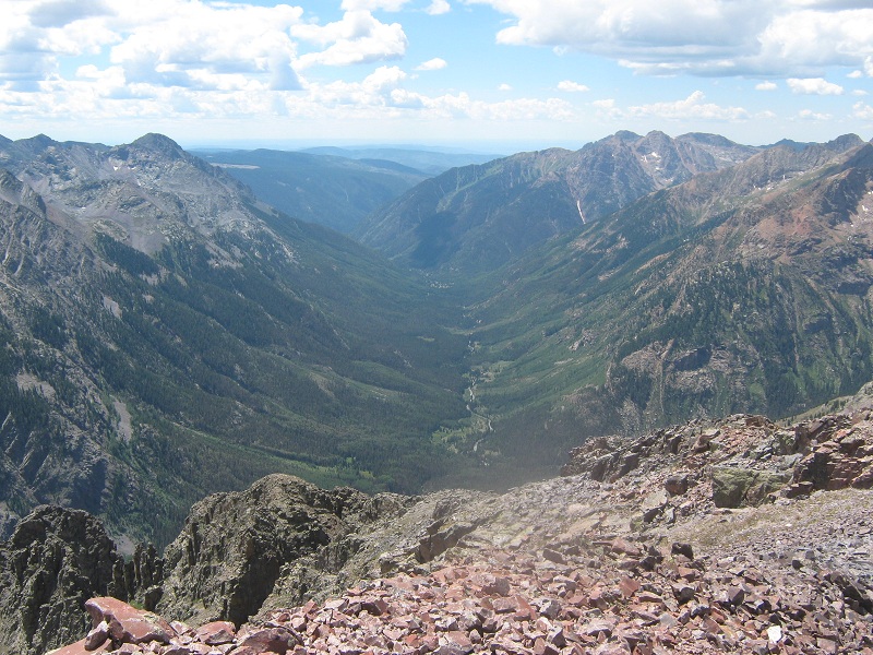
looking down the valley that we hiked down
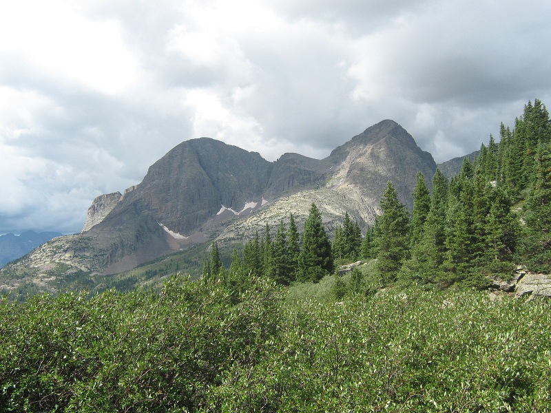
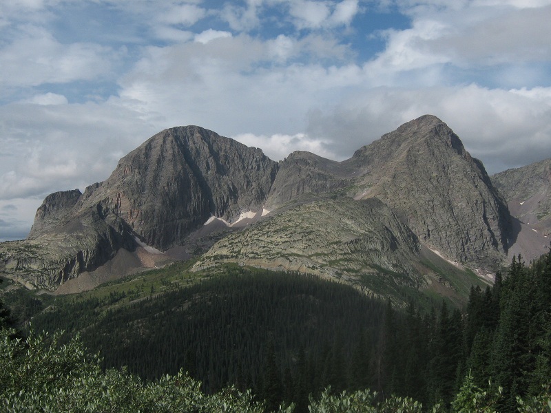
view of the guardian and mt. silex
Clouds rapidly formed and rain soon began to fall intermittently for the next couple of hours. We met several other backpackers along the way. We crossed Rock Creek on logs and after another mile or so we began looking for a side trail to the right up into the Leviathan drainage. We passed two or three questionable side trails before we reached the correct one, a strong trail about as wide as the main Vallecito Trail. This junction is some distance past (south of) the mouth of the Leviathan drainage. We followed this trail down to Vallecito Creek and donned sandals and water shoes and proceeded to ford the creek. Caution was warranted in the rushing water but the crossing was not as bad as it had been in 2005 when Brian and I crossed the Vallecito on our way to climb Jagged Mountain. As we sat taking a lengthy break on the other side of the creek a couple of guides came past who were on their way up to join a party of campers by Leviathan Lake. We headed north a short distance and looked for a way to cross Leviathan Creek and found nothing better than some narrow and wet slippery logs. The guides walked across the logs before us and the second one slipped and fell in the water but was fortunately not hurt. We thought it prudent to crawl across the logs to avoid the same fate.
crossing leviathan creek
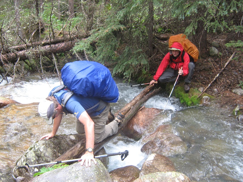
The guides quickly disappeared into the woods on the other side while we were crawling across the logs. On the north side of Leviathan Creek we looked for the trail that would take us up the drainage. The trail that we found seemed dubious at first because it went quite a ways north away from the creek before finally turning west and going up the drainage. We proceeded to climb about 2 miles up the drainage on the rough and increasingly faint trail until we reached a splendid meadow where we set up camp at about 11,500 feet. We arrived at 4:15 and had plenty of time to set up camp and get settled in. This remote place was a spectacular setting in which to camp, surrounded by high rugged peaks, with several waterfalls tumbling down the cliffs above. Before turning in for the night we identified a steep drainage with a tiny tumbling waterfall a short distance to the northwest that we would climb up in the morning on our way to the peaks above.
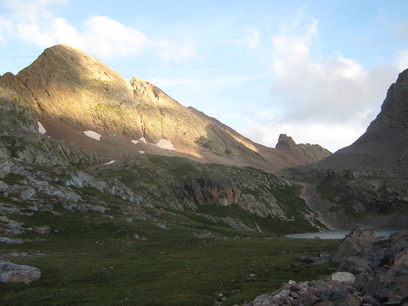
We left camp at 6 a.m. the next morning in the early light and headed up the steep slope to the right of the waterfall and hiked up to a lake in a high basin at 12,450 feet. Peak 8 was directly to the north and Peak 7 lay to the west.
peak 7 at the upper left, and the lake at the lower right
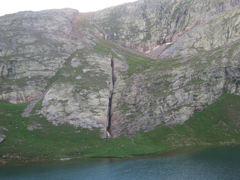
We debated for a moment whether to go around to the right or to the left side of the lake and decided to go to the right which turned out to be a good choice. From the north side of the lake we saw an immense vertical crack, or fault, in the slope above the other side of the lake, a feature unlike I could ever recall seeing in the mountains.
the crack on the other side of the lake still has some snow in it
We continued up the drainage to a small lake at the 12,700 foot saddle between Peak 7 and Peak 8. The Trinity Peaks were directly to the northwest.
the lake at the saddle, with the trinity peaks beyond

The ruggedness of the terrain in this remote place in the early morning light was very striking and seemed almost primeval to me.
arrow, vestal, and the trinity peaks
From the saddle we went down to the northeast on a climbers trail on a talus slope, losing about 200 vertical feet of elevation gain and then traversed to the east around Peak 8 to the 12,800 foot saddle between Storm King Peak and Peak 8.
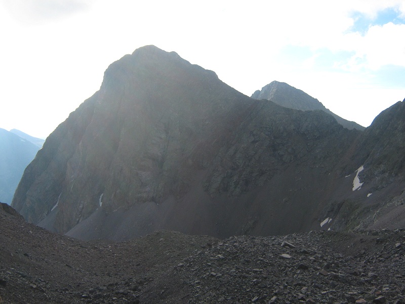
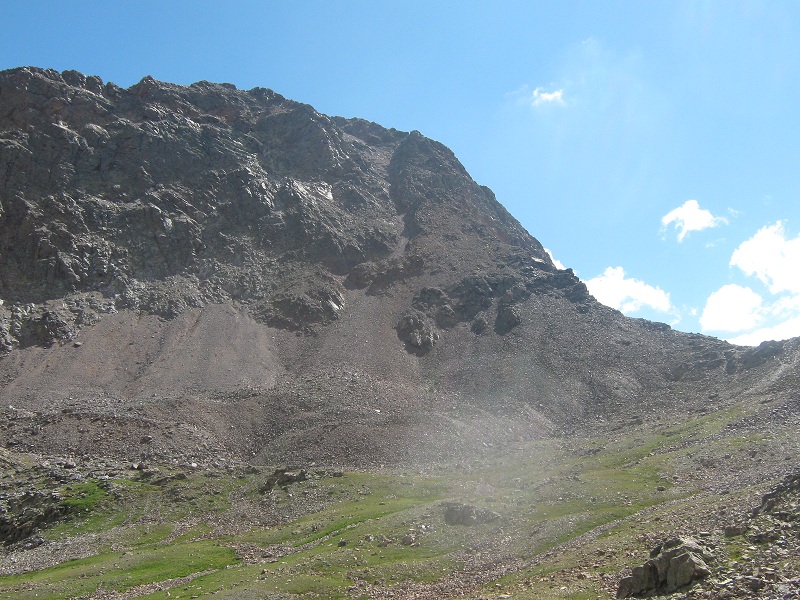
on the traverse to storm king peak, looming ahead. the saddle is around the corner to the right.
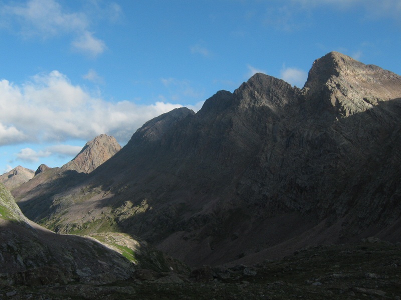
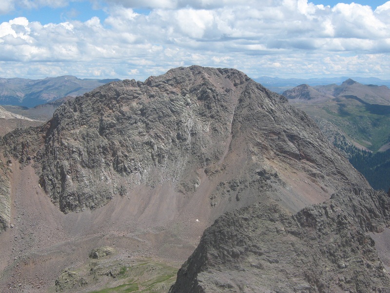
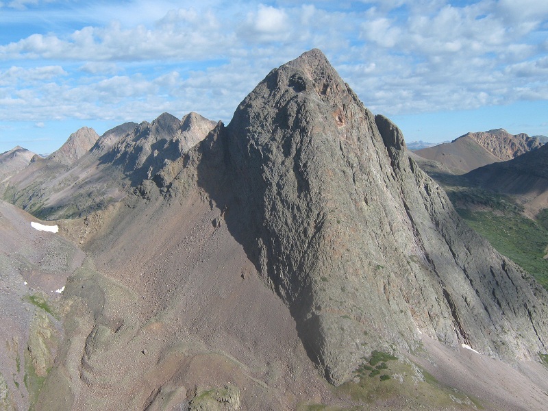
We arrived at the saddle about 8 a.m. From here we could see Mt. Silex and The Guardian off to the east, and a difficult looking traverse above Lake Silex that some climbers use to get to these peaks from the saddle where we stood. I was glad we were going to approach those peaks a different way.
mt. silex, and the guardian beyond it. a traverse over to the saddle at the right looked difficult from here.
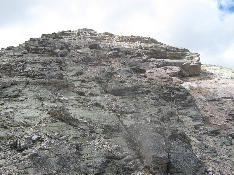
From the saddle we headed up the ridge to the north toward the summit of Storm King Peak.
looking up the ridge from the saddle
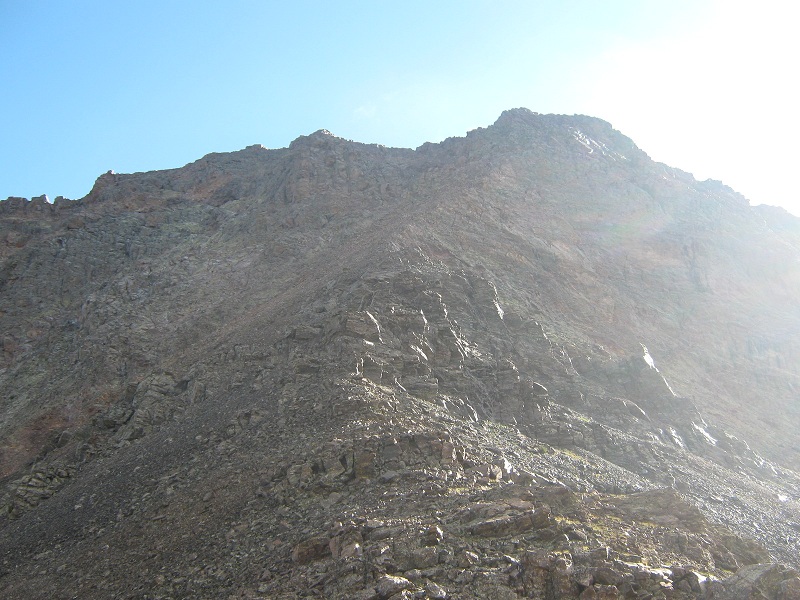
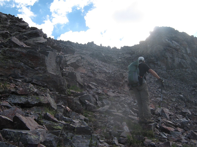
When the ridge became too rough to suit us we traversed a short distance to the left across a loose slope to get into a narrow and steep rocky gully that led up toward the summit.
from the saddle at the right we went up the ridge a ways, then traversed left into the prominent gully and climbed on up to the top
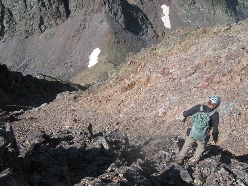
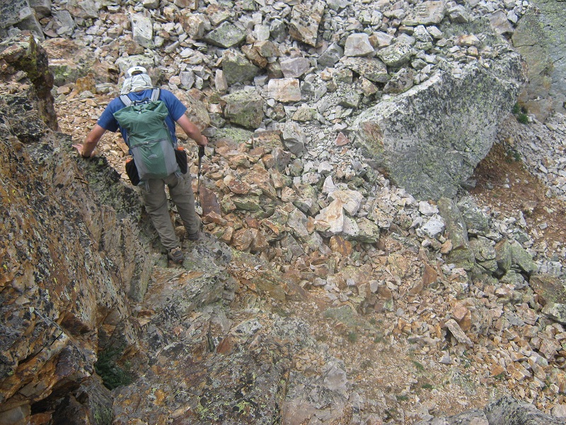
The rock in this Class 3 gully was dangerously loose so we carefully took turns climbing short stretches to avoid having anyone get hurt. The gully widened out into a steep and annoyingly loose scree and talus slope, and we angled left and headed on up to the summit.
the loose slope just below the summit (seen on our descent)
We arrived on top at 9:10. Storm King was possibly the most difficult of the five peaks we climbed on this trip, but none of them were easy.
me on the summit, with the trinity peaks beyond
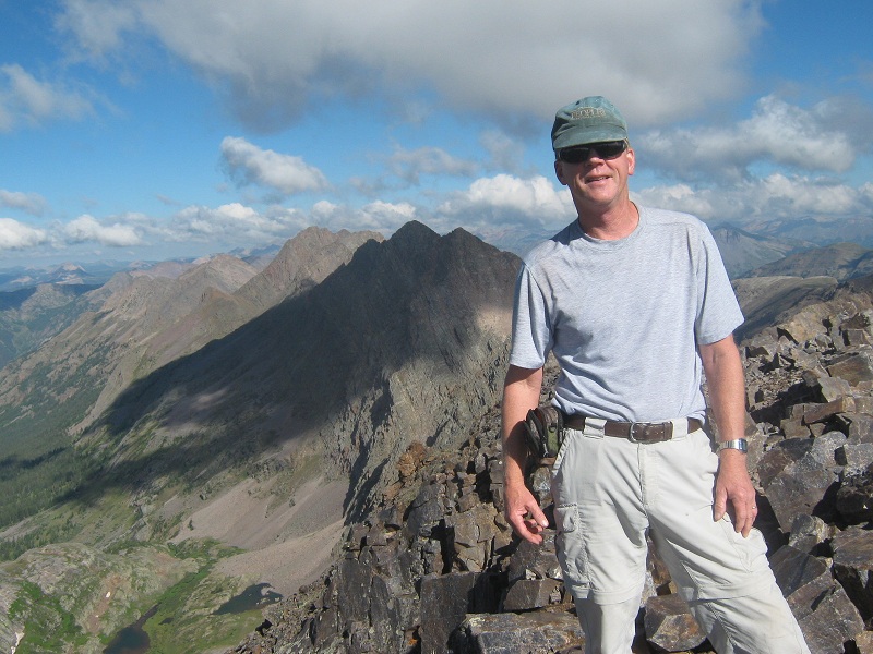
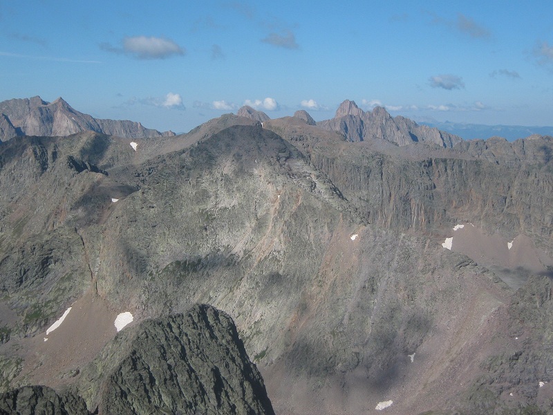
there was a splendid view of many rugged peaks to the southwest. the crack seen earlier is in the lower part of the photo.
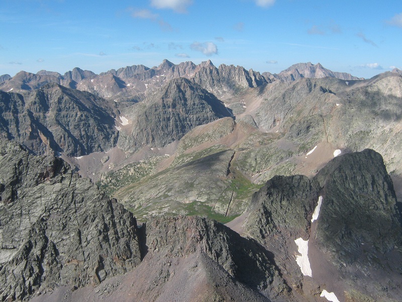
our next objective, peak 7, is in the center of the photo
We had a lot of climbing yet to do today so we left after fifteen minutes and carefully made our way back down to the saddle in 45 minutes, and back to the lake at the Peak 7/Peak 8 saddle 20 minutes later.
on the traverse back to the lake at the saddle. peak 7 lies ahead
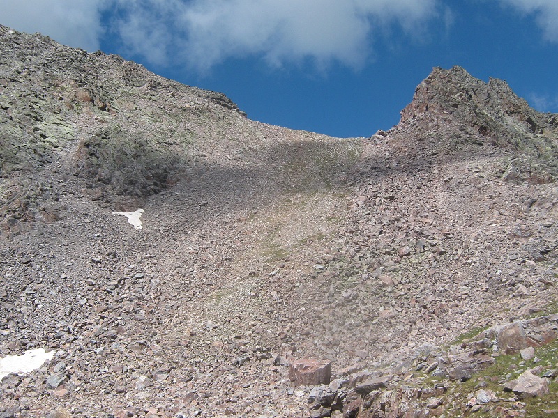
I could tell I was getting alarmingly dehydrated at this point so I filtered water while we rested at the lake and tried to replenish my fluids. After a fifteen minute break we left and quickly climbed 300 feet up to the 13,000 foot saddle on Peak 7’s north ridge that lay directly above the lake.
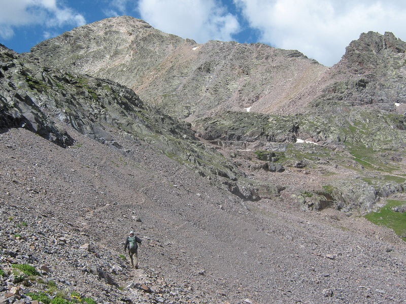
the slope up to the peak 7 saddle from the lake
From the saddle we headed up the rocky ridge, first over a small point, then past a more prominent point, more or less following a climber’s route along the right side of the ridge.
on the ridge to peak 7. the summit is at the top of the photo
We made a short Class 3 downclimb into a notch.
mark on the downclimb into the notch
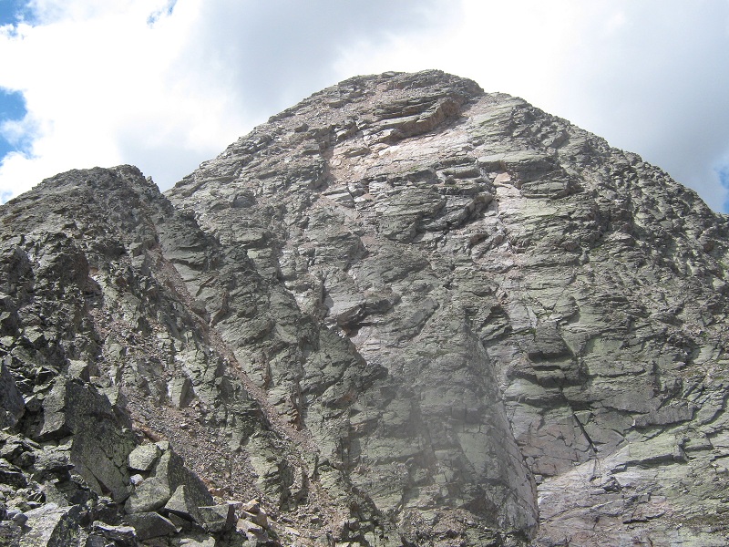
Then we made our final push up to the summit by zigzagging back and forth on ledges and loose gravel slopes through interesting downsloping slabs.
the slope up to peak 7's summit
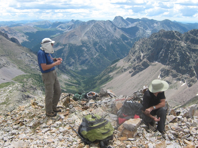
It was a great feeling to step on top of Peak 7, where we arrived at noon!
mark and brian on peak 7. mt. oso lies in the distance.
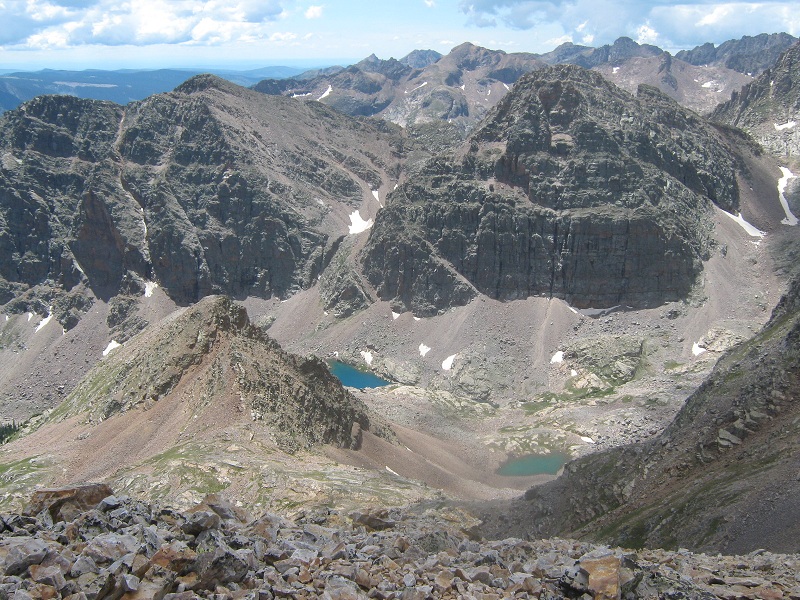
view of storm king peak from peak 7
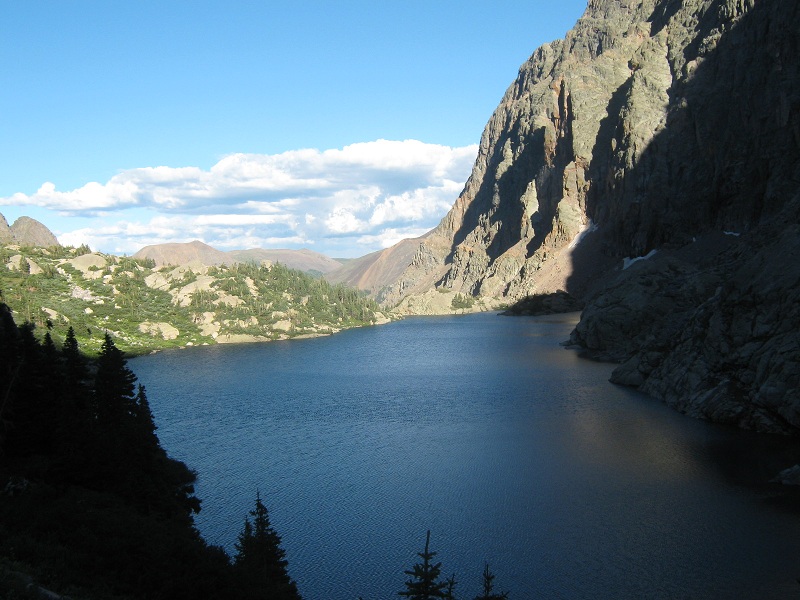
view of leviathan lake, in the center, with vallecito mountain and leviathan peak above it
The weather was holding up beautifully. We had postponed this trip by a day to try to catch a two day window of fair weather that was forecast due to a dry northwesterly air flow in the midst of an otherwise wet and stormy monsoonal weather pattern. So far that was working out well! So well, in fact, that we decided to push on and try to climb Peak 6 today also.
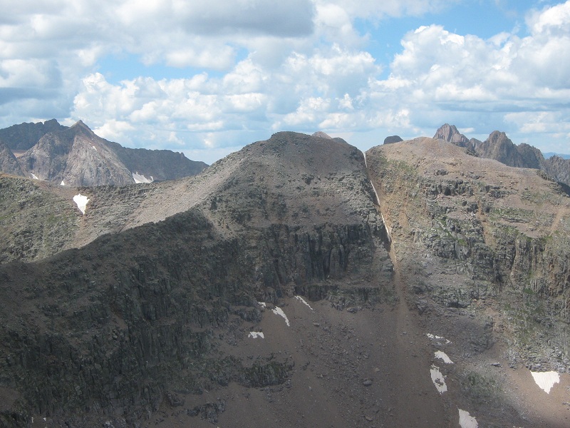
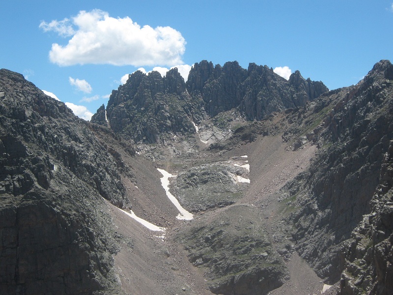
view of peak 6, in the center, from peak 7
Mark suggested trying a ridge run over to Peak 6 from Peak 7, but I expressed reservations about the uncertainties of that route and suggested dropping back down and traversing to the east below Peak 7 at around the 12,600 foot level. We agreed to try that so we left the summit and headed back down the north ridge. We met a climber from New Mexico coming up and three other climbers behind him, which was quite a surprise in such a remote place. From the lake we began a traverse around the east side of Peak 7 at about 12,700 feet, then went up a grassy slope to 12,900 feet, around a grassy basin, down a scree slope to 12,500 feet and into the drainage east of Peak 6.
there was a spectacular view of jagged mountain from our traverse route.
I was getting very tired by this time and sore knees and continued dehydration symptoms slowed me down considerably. The 1000 foot climb up the steep and miserably loose slope to a 13,500 foot saddle just south of Peak 6 seemed to take forever but we eventually made it. Mark was still going strong and pushed on ahead. Once we reached the ridge it didn’t take long to finish the final 200 foot climb up to the summit, where Brian and I arrived at 4:35. Mark had already summited and went back down to the saddle to wait for us. The weather was still holding up incredibly well, which was the key to our being able to get three peaks climbed today! I called my wife with the satellite phone I had brought along while we sat and soaked up the surrounding views.
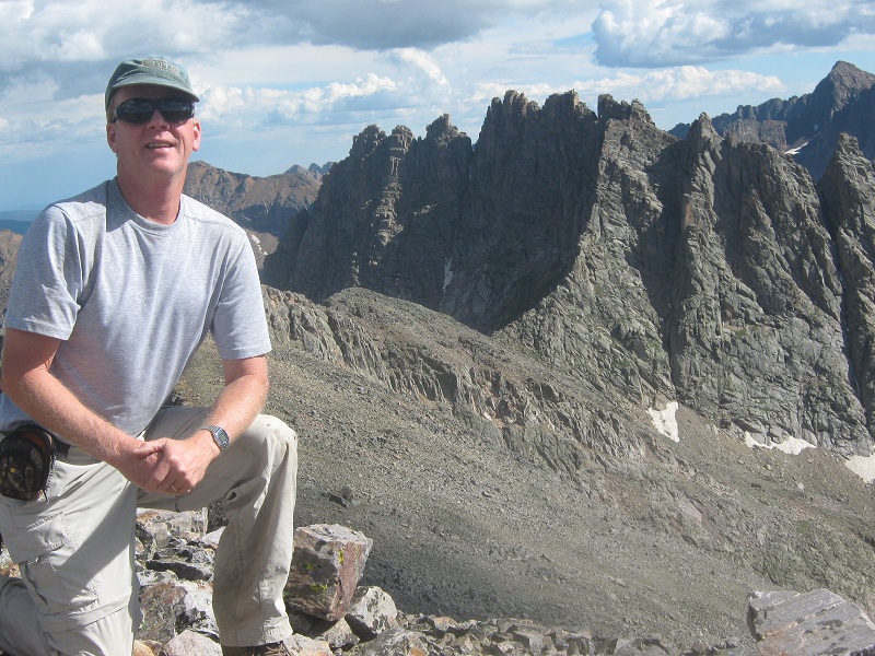
on top of peak 6, with jagged mountain beyond
We left the top at 5 p.m. and headed down. I headed down the gully that went down the east face of the peak while Brian and Mark cut off somewhat to the left. After I had descended about a thousand feet to where the drainage leveled out a bit on its way down to Leviathan Lake I stopped and looked around for the others but saw them nowhere. I waited for ten minutes or more watching for them to appear on the talus slope above and finally started yelling for them. Unnoticed by me they had done a high traverse past me to the north to a point well above and northwest of the lake. When we finally spotted each other we proceeded to converge at a place down below and hiked down past Leviathan Lake.
leviathan lake
On a grassy slope northeast of the lake we hiked past the camp of the party the guides had mentioned to us. We followed a slight trail which was faint at best back down toward our camp.
on the route from leviathan lake back to our camp
We finally arrived back at camp at 7:20. I was completely spent after our epic thirteen hour and twenty minute day. I felt too sick to eat or drink for a while but finally forced myself to do so.
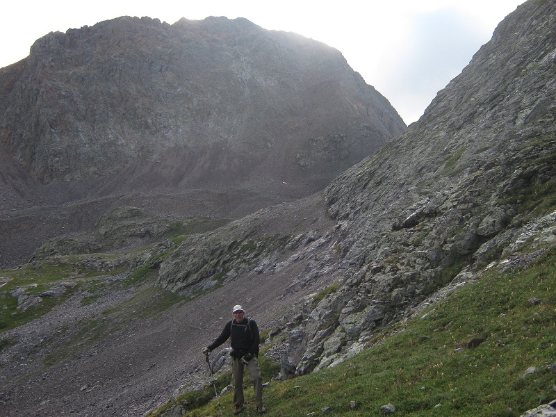
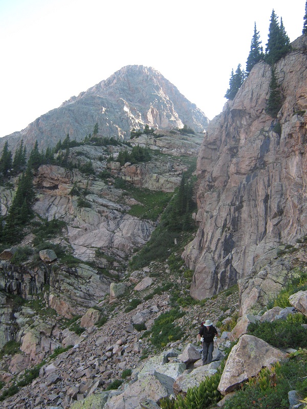
When I awoke in the morning I was nauseous and felt awful. I had slept poorly, maybe for an hour or two, and had found it necessary to go outside of the tent for a while during the night to deal with an anxiety attack. I was still dehydrated and it was very hard to put down fluids or food with the nausea. And this was the day I was going to finish the Bicentennials?! I was not sure if I could finish those two final peaks today but I was determined to do it! I certainly didn’t want to let Brian and Mark down, either. At 6:15 we left camp and I slowly led the way up a steep grassy slope through the trees to the east toward The Guardian, which we could see towering above about a mile away. We worked our way around the nose of a ridge into a rocky drainage below Mt. Silex and proceeded to slowly climb its steep and loose south face.
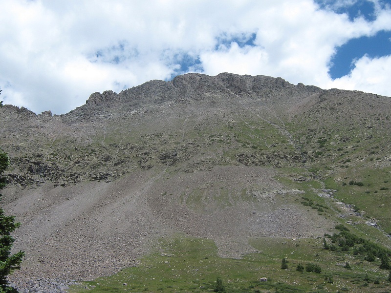
mt. silex (as seen later in the day). we went up this drainage and up the slope to the peak's southwest ridge at the far left.
We spotted another climber on the ridge above who had apparently come from the vicinity of Storm King. We found decent footing on rocks and patches of grass and reached the peak’s southwest ridge at about 13,100 feet.
view of storm king peak from the southwest ridge of mt. silex
We headed up along the right side of the ridge, and bypassed a rocky knob on the right and worked our way on up toward the summit.
on the upper slopes of the peak
We arrived on top at 9:10.
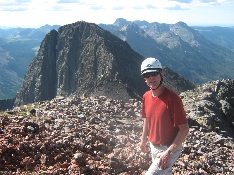
on the summit of mt. silex, with the guardian beyond
I was weak and spent and my knees were complaining but I felt slightly better than I had at camp. Brian memorably recorded in the register each of our progress on the Bi’s: "201 of 202 . . . 200 of 202 . . . 199 of 202"! We donned our helmets on the summit and at 9:40 left the top and headed down a scree gully to the south. After dropping a few hundred feet we turned left and made a traverse on grassy and rocky up-and-down ledges just below the saddle between Silex and The Guardian at about 13,000 feet.
the traverse below the saddle over toward the guardian

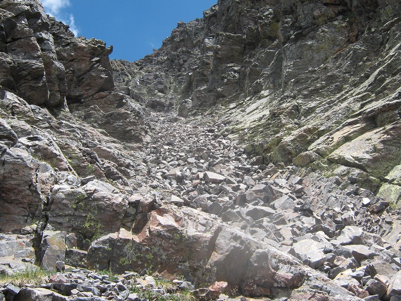
We continued below a ridge point and then began an ascending traverse until we reached a big gully on The Guardian’s south face. The gully is prominent when the peak is viewed from a distance but it is not so obvious when one comes to it on the climb. After a couple of Class 3 moves at the base of the gully we found the climbing in the gully fairly reasonable, with an occasional Class 3 move, and loose rock in some places that warranted extra caution.
the ascent gully on the guardian
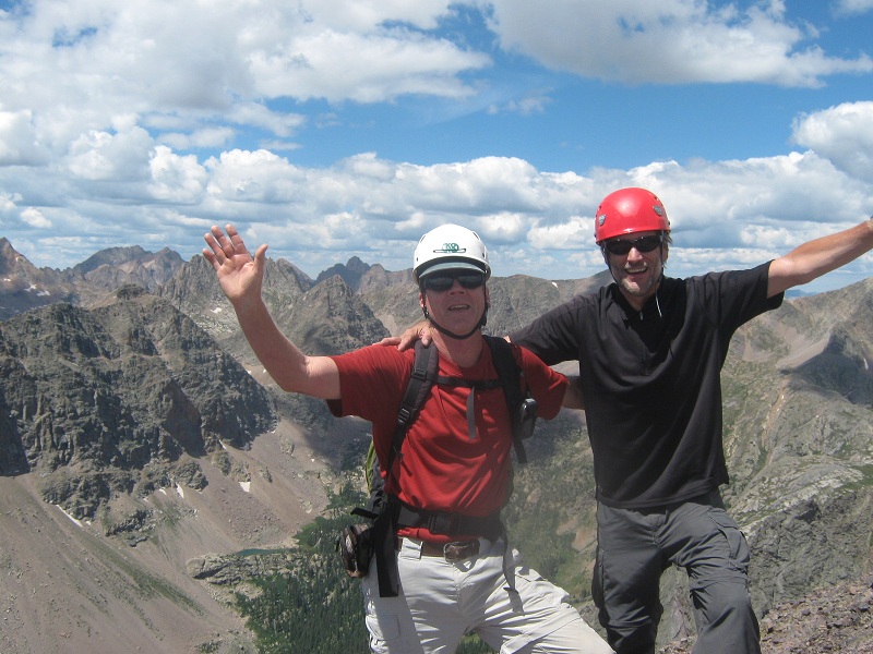
At a fork in the gully near the top we went right and climbed a short distance more up to the summit. Mark was ahead and stopped close to the top and waited for me to come up and touch the top first. I asked Brian to touch the summit rock with me because the quest to climb the Bi's had been a joint effort of ours over many years. It was an amazing feeling to complete the Bicentennials, the culmination of a multiyear string of adventures! It was a little emotional for me, and Mark said it was for him as well. I called Teresa on the satellite phone and left a message sharing the news with her. We arrived on the summit at 11:50 and basked there for half an hour, gazing around and taking photos. I collected a couple of rock souvenirs.
brian and i on the summit of the guardian
view down the vallecito drainage
We finally left and headed back down the gully, and continued directly down the slope below, descending about 1500 feet to the drainage below where we had been a few hours before.
we came down the slope at the right from the summit of the guardian
We made our way back to camp and arrived there at 2:30. The weather was still holding up nicely but the sky was starting to look a little more stormy than the day before. Our window of pristine weather was starting to close.
When we got back to camp I was very tired but thoroughly pleased with our success. We sat around and rested for a while before packing up camp and heading down the trail around 4 p.m. We tramped back down to the Vallecito, forded it, and hiked up the Vallecito Trail and found a nice campsite a short distance north of Rock Creek. My knees were so painful that walking was difficult and Mark was gracious to filter water for me.
The next morning we left camp around 7 a.m. and set a slow steady pace up the trail.
a parting view of the guardian, at the left, and mt. silex
After a while Mark decided to dash ahead and climb Hunchback Mountain and rejoin Brian and I near Hunchback Pass. We met two young backpackers coming down the trail who said they were headed into Stormy Gulch, and they told us they had seen a bear and two moose along the trail that morning. We rejoined Mark near Hunchback Pass around 10:30 and we all hiked together back to the trailhead at 11:15. Storm clouds were moving in and rain soon followed, reminding us how fortunate we had been with the weather for our climbing! We fourwheeled back to Silverton where we had lunch at Handlebars and returned to Ridgway to Brian and Mark’s cars. Brian and I went on to stay in Salida that night prior to our climb of North Star Mountain, his final Bicentennial, the next day.