TOADSTOOL TRAIL, EDMAIER’S SECRET, UT
January 11, 2021
By Tim Briese
Toadstool Trail: 2.5 miles, 100’ elevation gain, 1:20 roundtrip time
Edmaier’s Secret: 10.5 miles, 700’ elevation gain, 6:30 roundtrip time
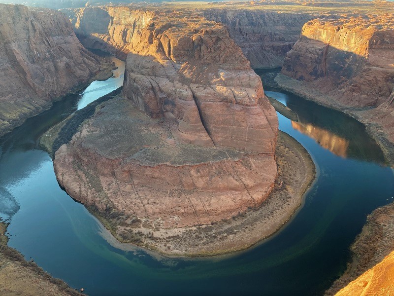
The day after we visited White Pocket we decided to hike a couple of other trails in the Page, AZ area. There is a lot of grand scenery around here, including Horseshoe Bend just off of Hwy. 89 south of town that we stopped to see on our way into Page a couple of days before.
horseshoe bend, with the colorado river 1000 feet below
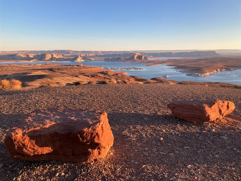
Today we left around sunrise and headed northwest on Hwy. 89, crossing the border into Utah after a few miles.
we stopped at an overlook to see lake powell at sunrise
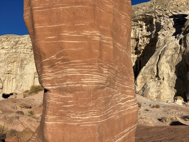
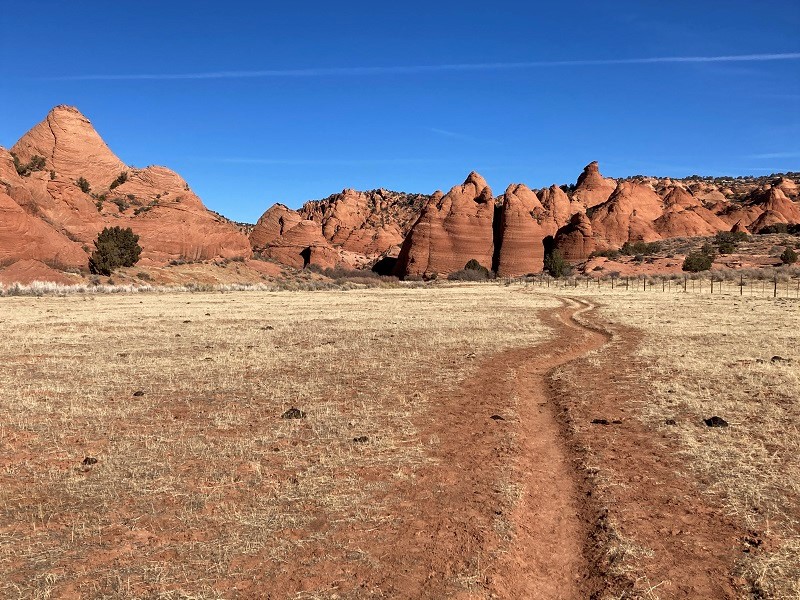
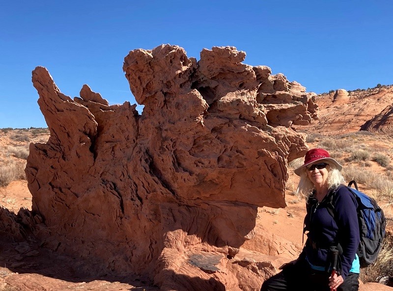
About 20 miles from Page we came to the Toadstool Trailhead on the right side of the highway. This short easy hike goes to some scenic hoodoos less than a mile from the highway. It was pretty chilly when we started, a little over 20 degrees, but the bright desert sun quickly took the chill off. After we hiked to the main scenic hoodoo we wandered around cross country exploring for a while.
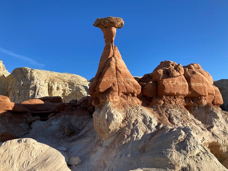
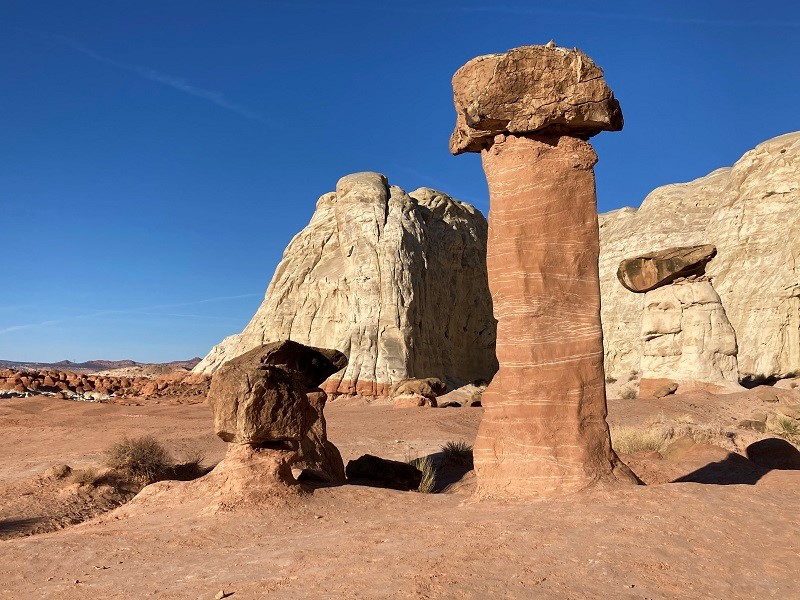
interesting white layers in the reddish rock
we hiked across the reddish terrace to the right then went down into the white formations at the left to have a look
After exploring around for a while we hiked back to the trailhead, meeting one other couple hiking in to the hoodoos.
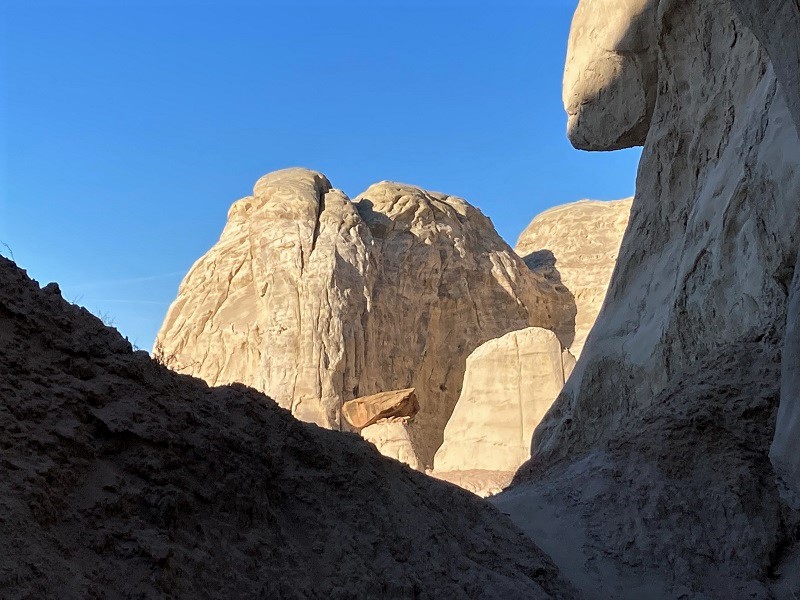
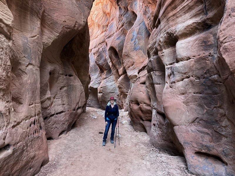
Then we drove a few miles further on Hwy. 89 and turned left onto the House Rock Valley Road. We were on the north end of the road today, having been on the south end of it yesterday when we went to White Pocket. The road is generally passable for most vehicles but it can become impassable to nearly all when it gets wet because of stretches of clay in some places. We drove down the road a little over four miles and parked at the Buckskin Gulch Trailhead on the left side of the road. We were the only ones here this morning. Buckskin Gulch is said to be the world’s longest slot canyon, and hiking all the way down it is an epic and potentially dangerous adventure. This famous canyon has topped many "world’s most" lists in magazines and online so it was cool to be here. The stretch we were hiking down today was wide and mellow though, for it doesn’t start to slot up until about four miles downstream from this trailhead. Our objective was to hike about two miles down canyon then go left up into a side drainage to a scenic area of fascinating rock formations called Edmaier’s Secret. We hiked down the gentle canyon, frequently crossing from one side of the wash to the other, admiring scenic red rocks lining the drainage.
on our way down upper buckskin gulch
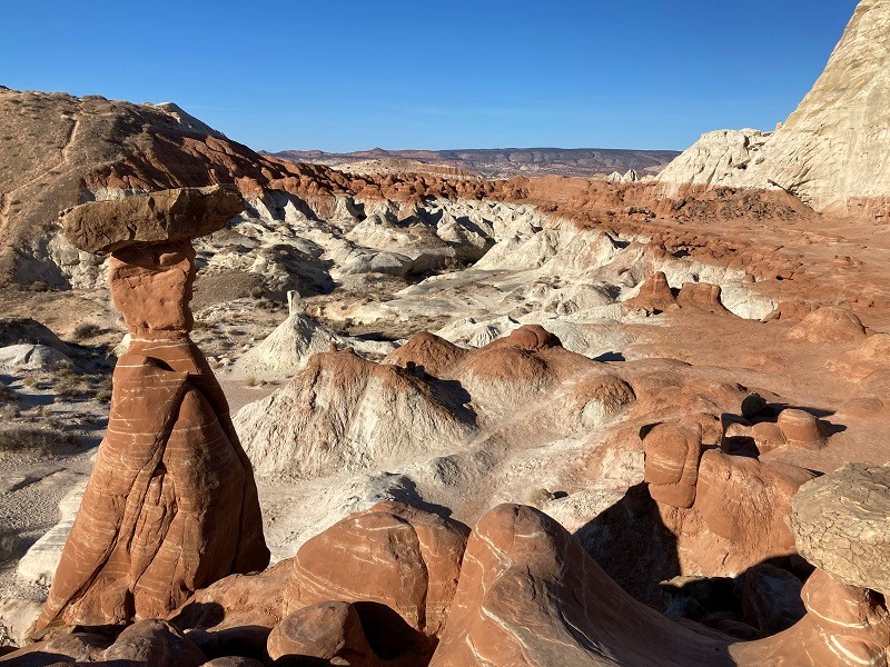
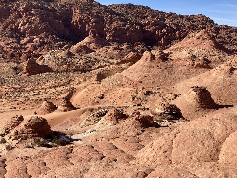
There were cows grazing in the area in some places and sometimes we walked on their trails too. After about two miles we came to a wide sandy wash that came in from the left and we turned and slogged a third of a mile up the wash on the loose sand. Then we followed footprints in the sand up to the right into an expansive scenic rocky area. We had arrived at Edmaier’s Secret. There are no trails in the area; it is rather just a destination to hike around on the slickrock and explore. We proceeded to make a grand clockwise loop, crossing washes, climbing up on slickrock, wandering off to explore anything that caught our interest. It was an amazing place, with imagination-defying rock formations everywhere.
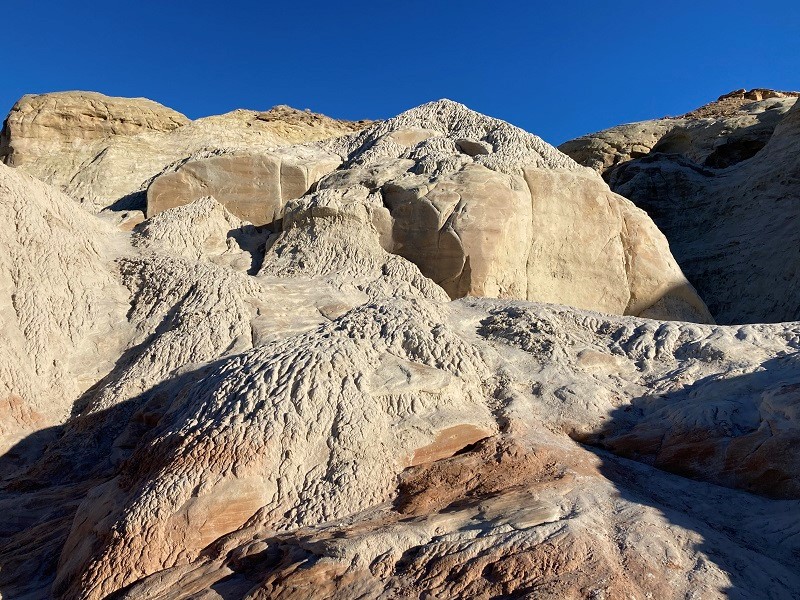
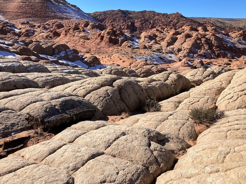
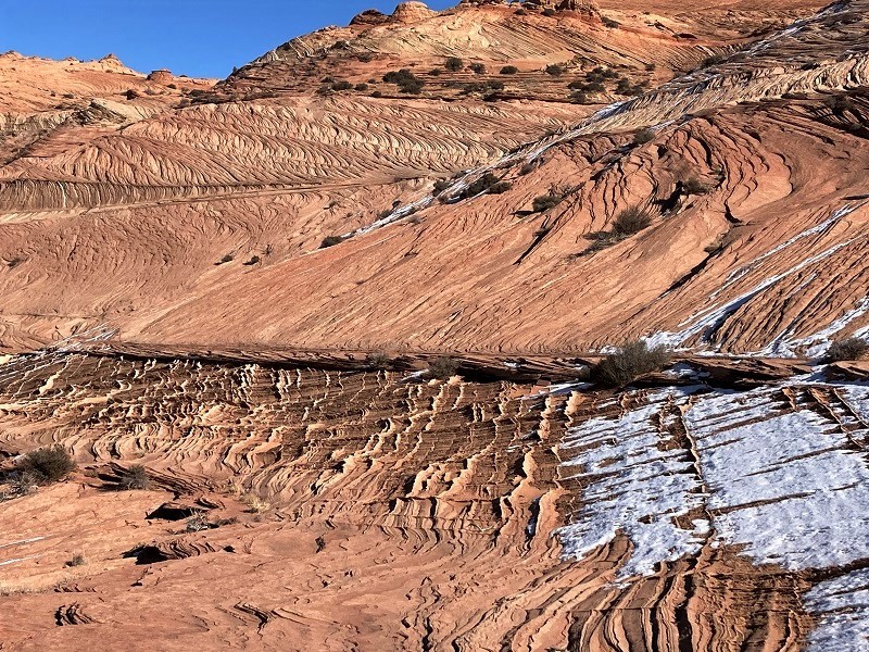
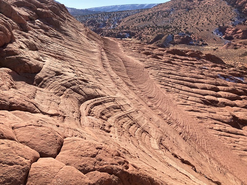
We saw quite a bit of the brain rock we had seen at White Pocket, but much of it was a different more reddish color here. There were also expansive areas of thin wafer-like layered strata in the sandstone.
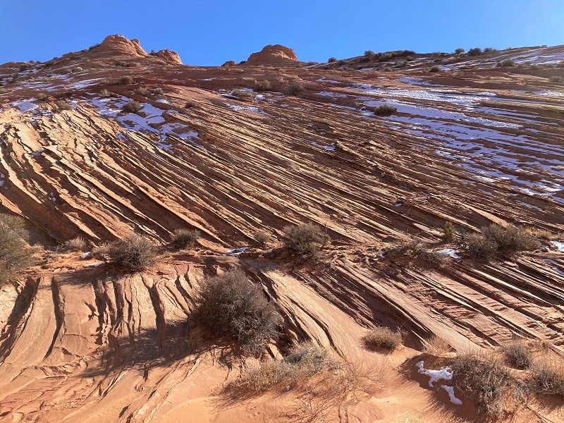
a dizzying array of interesting cross-bedded layers
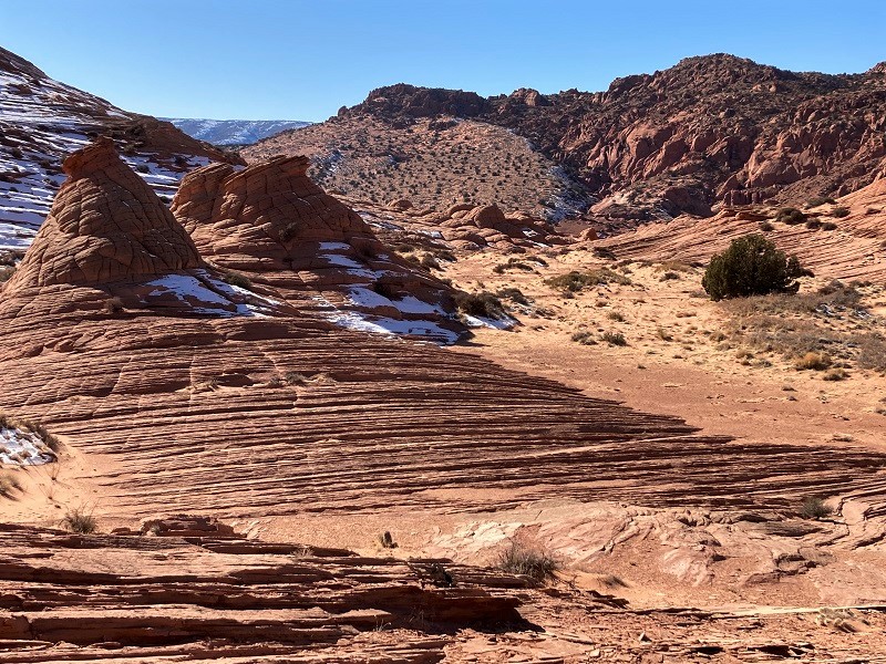
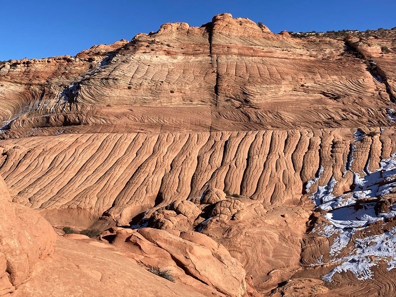
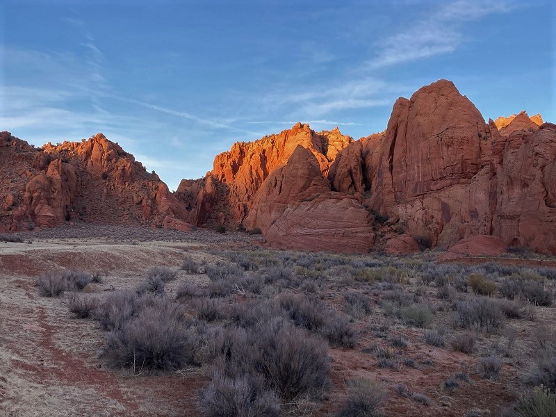
There was some snow laying on shady slopes so we were careful with our footing in those places. It was only about 40 degrees today but the warm sunshine felt good. We eventually hiked up to a saddle to the south and explored the other side, which was equally as scenic and fascinating.
the view from our lunch spot at the saddle

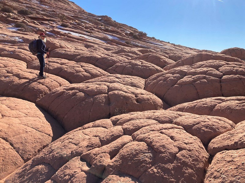
more brain rock below
it was fun hiking across the brain rock
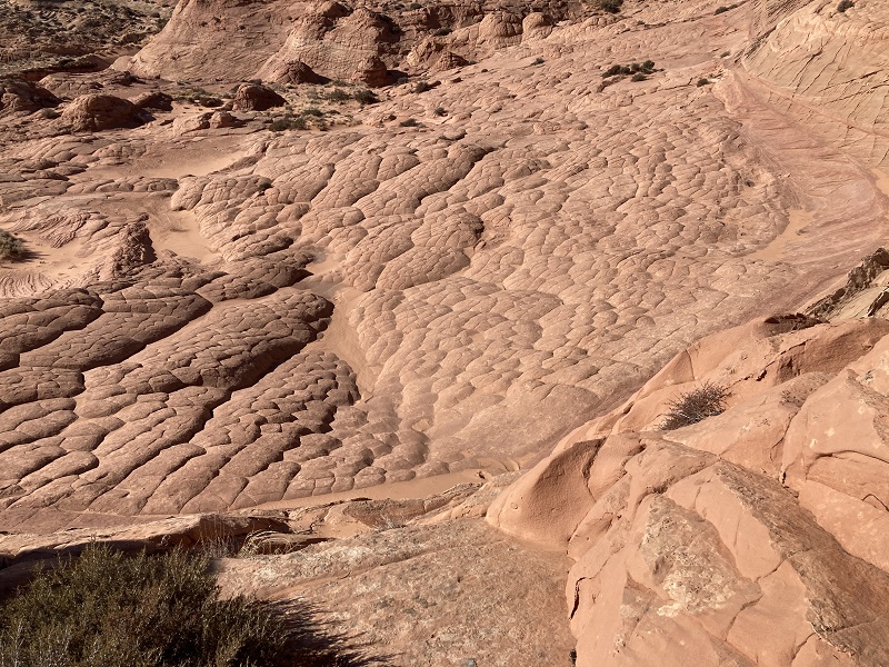
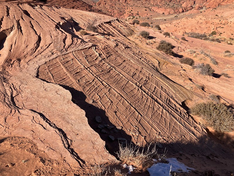
there was an interesting abrupt demarcation between the layered sandstone and the brain rock
Then we went back over the saddle and looped back on the west side of the drainage.
an artist or sculptor would be hard pressed to imagine some of nature's amazing architecture we saw today

looking over at the east side of the drainage. earlier we had hiked left to right along the line in the center of the photo.
Eventually we hiked back around and returned to the point where we had left Buckskin Gulch. We thought it would be fun to hike further down Buckskin Gulch to make it as far as the beginning of the narrows if we could. It would turn a six mile hike into a ten mile one, but no matter! It was mid afternoon and the sun sets early in January so we enthusiastically hiked down the gulch at a rapid pace.
a view hiking down buckskin gulch

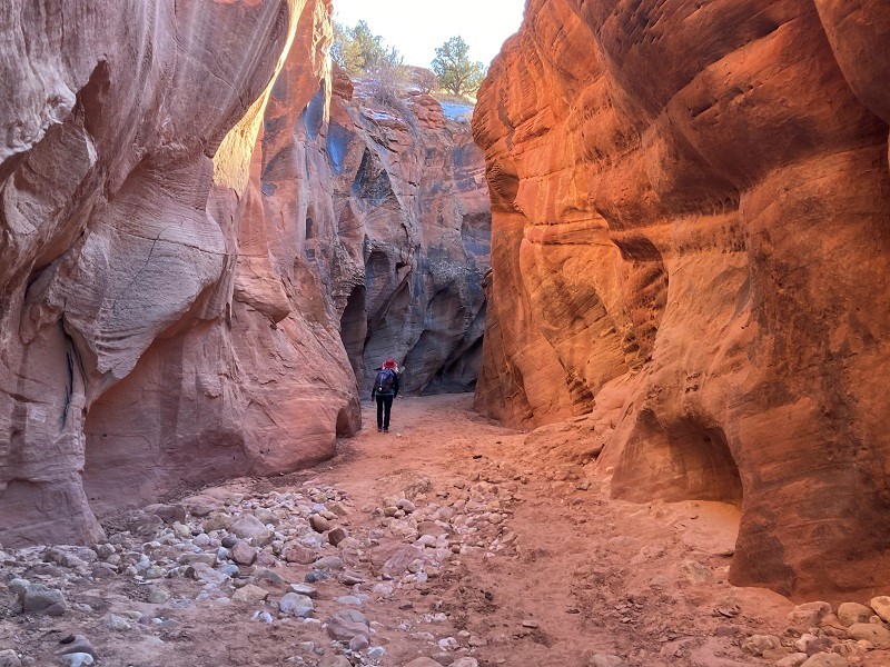
We reached the start of the narrows in a mile and a half and continued almost a half mile further before turning around and heading back. The walls are of course much taller and more dramatic many miles downstream but it was great fun getting a taste of it here.
the beginning of the narrows in the gulch
When we turned back the late sun was still shining with a reddish glow on the rocky walls above but we had four miles to go back to the trailhead so we hiked rapidly.
late sun shining on the rocks in upper buckskin gulch
A chilly dusk was settling in as we finally returned to the trailhead. We loaded up and headed to Kanab, UT for the night.