UNCOMPAHGRE PEAK
(14,309’)July 14, 2014
By Tim Briese
7.9 miles, 2900’ elevation gain, 7:35 roundtrip time
I climbed Uncompahgre in 1997 and always remembered it fondly as a fine scenic hike through flower-strewn meadows to the highest point in the San Juan Mountains. I wanted to return and climb it again someday and take my wife Teresa along to show her this wonderful place.
The afternoon before the climb we drove to Lake City and stayed overnight with a friend and retired deacon from our church, Chuck Specht, who owns a home northeast of town where he spends much of the year. His home sits high on a hill with a fabulous view from the rear deck of the town below and the surrounding mountain grandeur. Chuck is a real outdoorsman and it would have been fun to have him join us but he has ankle and foot issues that preclude extensive hiking for him nowadays.
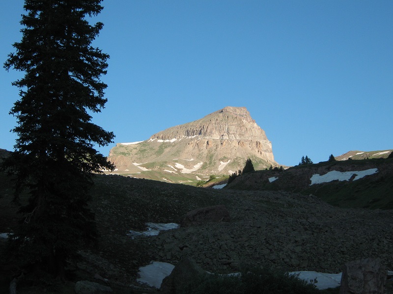
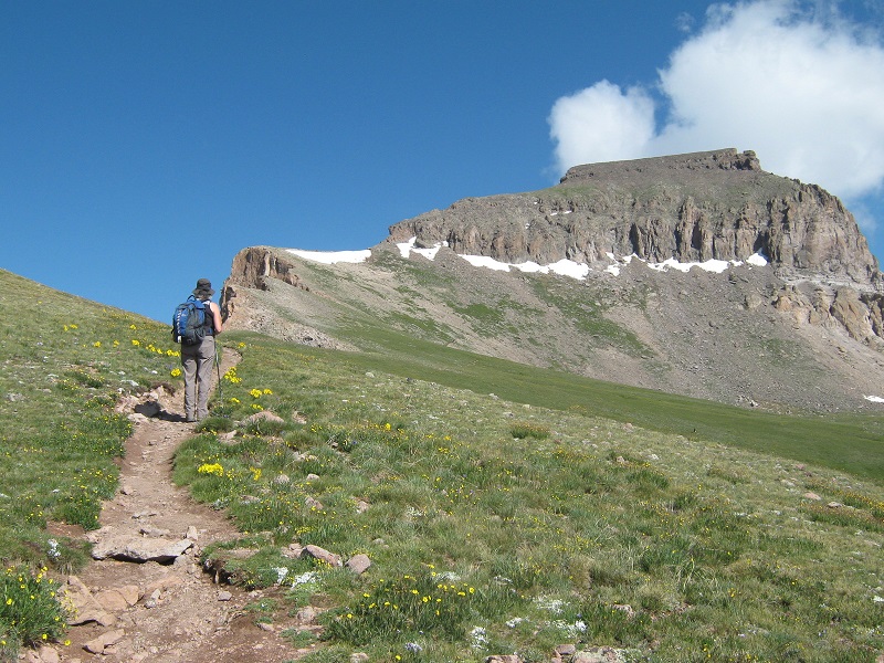
Teresa and I left Chuck’s place at 6 am and four wheeled four miles up the Nellie Creek Road to the upper trailhead for Uncompahgre at 11,400’, arriving there at 6:45. Either that road has grown a lot rougher since I was on it in 1997 or my memory of it has faded considerably, or maybe both! It was a clear beautiful morning and we hit the trail about 7 am. We shortly climbed out of the trees and gradually ascended into the beautiful basin above. The peak loomed above almost from the start of the hike and became more and more impressive as we got closer.
early light on uncompahgre peak
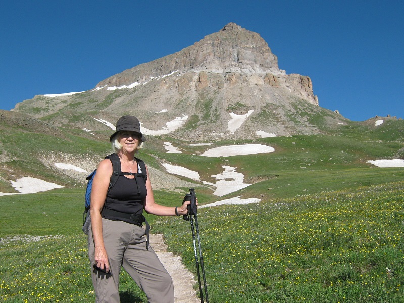
Flowers were abundant and the tundra meadows shimmered in deep brilliant green in the early morning sunlight. We stopped to visit with a climber from Ohio and his teenage son, who was going after his first 14er. There were about ten other climbers on the trail today. We hiked along at a leisurely pace, stopping frequently for photos. The fine trail was quite gentle nearly all the way and it crossed a couple of lingering snowbanks as we got higher.
on the trail to uncompahgre
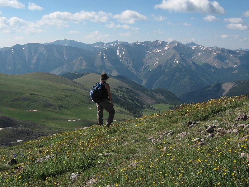
Two young male hikers flew past us on their way up and stopped long enough to tell us they were on their way up for a work project to count butterflies in an endangered species area above. The trail gracefully curved into the upper basin and a little above 13,000 feet we encountered signs in a butterfly closure area telling us to stay on the trail so as not to disturb the butterfly habitat. The views were majestic and even got better when we got on the peak’s southeast ridge at about 13,300 feet.
teresa enjoying the views
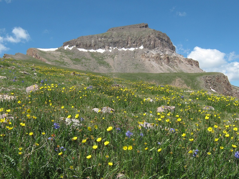
wildflowers along the trail
the butterfly closure area was to the right of the trail in this area
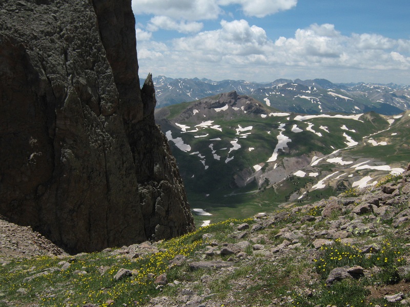
a nice view of wetterhorn peak from the south ridge
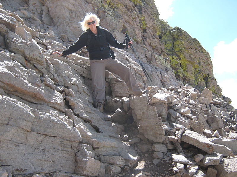
At about 13,900 feet we reached the crux of the route, a cliff band that had to be penetrated to reach the peak’s upper plateau. There was some hand and foot scrambling up rocky steps and Teresa was a little uncomfortable with this. It didn’t help that we came upon a young couple from Texas who were so spooked by this stretch of climbing that they were turning back.
scrambling up through the cliff band (photo taken on the descent)
Above this the going was much easier and after a couple of switchbacks up through a talus slope we reached the broad summit plateau and strolled across to its highest point on its northwest side. We arrived there about 11:20. Two other climbers were just leaving. There was a cool northwest breeze blowing, and we lounged around enjoying the views from this spectacular vantage point for about half an hour. I carefully climbed over to some rocks at the northwest edge of the summit plateau and peered over the edge of the peak’s precipitous north face.
teresa on the summit

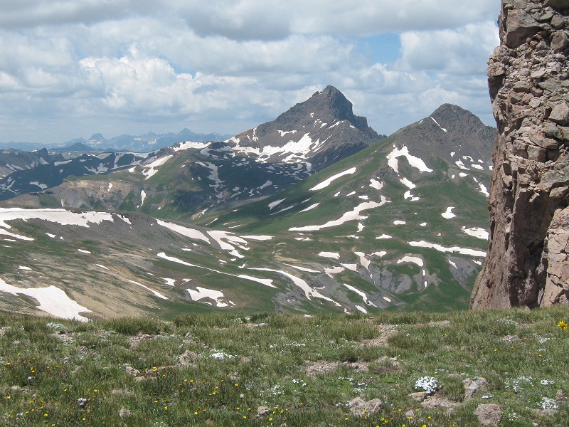
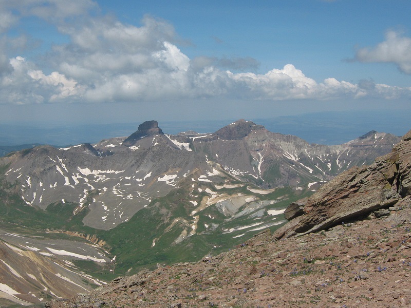
wetterhorn peak
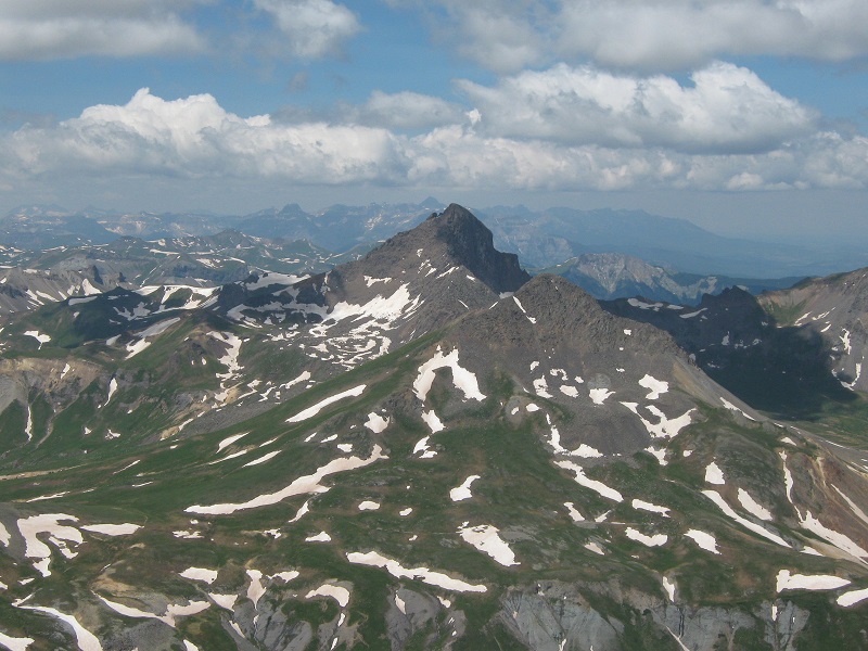
coxcomb and redcliff
We eventually left the top and strolled back down across the plateau and then went down through the talus and down through the steep rocky section and regained the easy trail below. We paused along the way to admire some impressive rock towers.
a rock tower along the ridge on the descent
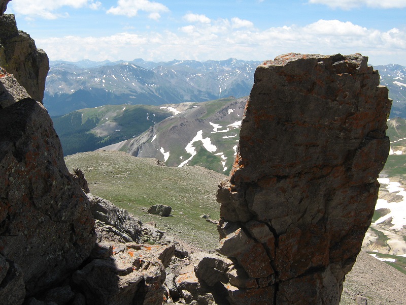
a view from the ridge on the descent
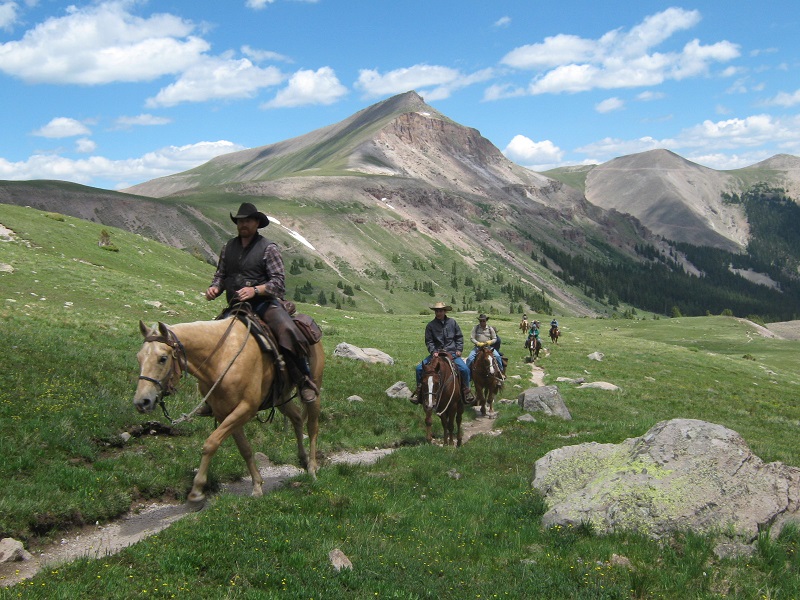
The weather was holding up beautifully and we ambled down the trail taking more photos of flowers, rocks, and other scenery along the way. We met four more climbers who were on their way up. We also met a group of riders on horseback who were apparently on a pack trip to some unknown destination in this scenic wilderness area.
riders on the trail
We tramped back to the trailhead at 3 pm, completing this beautiful hike. Then we bounced back down the rough 4WD road and headed for home. We stopped for a delicious dinner at Mario’s in Gunnison and eventually arrived home about 930 that evening.