UTAH HIKES AND SIGHTS
Kodachrome Basin SP
Bryce Canyon NP
Grosvenor Arch
Cottonwood Canyon
Buckskin Gulch
Lake Powell
October 2-3, 2017
By Tim Briese
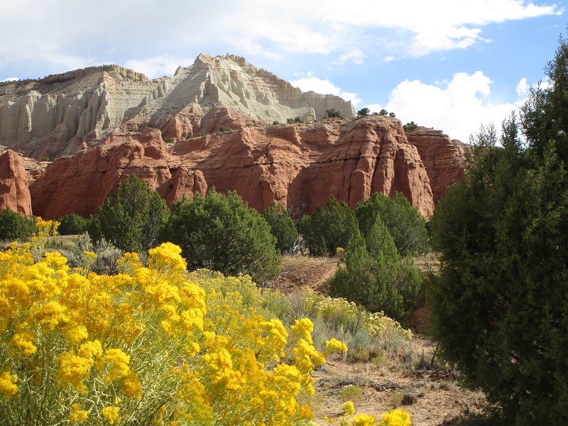
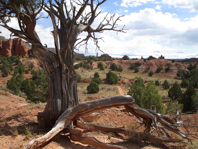
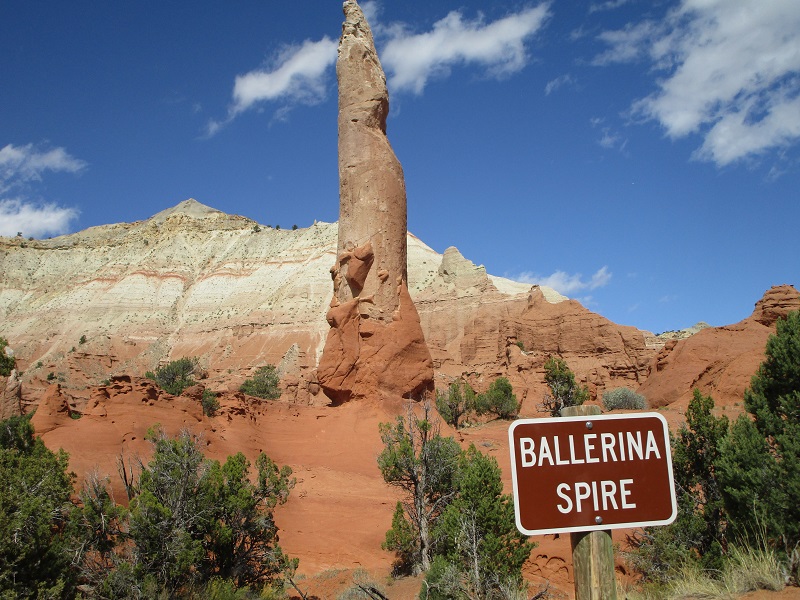
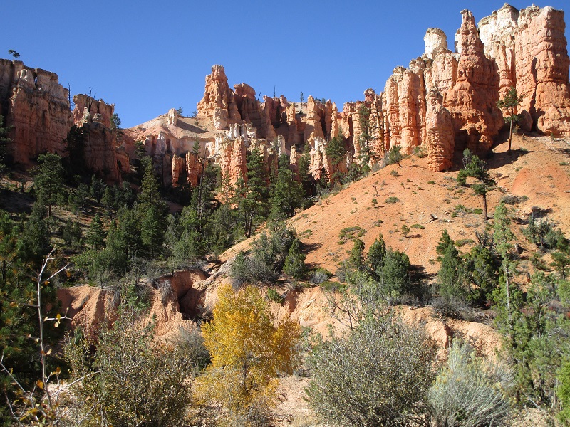
My wife Teresa and I took a fall trip to southwest Colorado and southern Utah and stopped to visit and hike a number of places in colorful southern Utah, some of which we had never visited before. From Escalante we drove west on scenic byway Utah 12 to Cannonville and went south a few miles to Kodachrome Basin State Park, a place that intrigues simply by its name. We spent a few hours there and hiked a five mile loop through some of the park’s colorful scenery.
the park lives up to its name
a gnarled juniper along the trail
an interesting rock formation
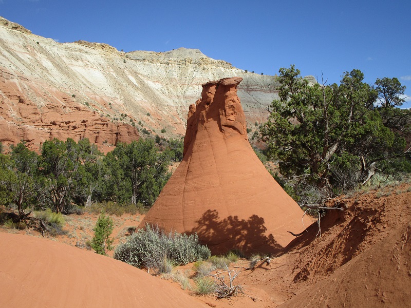
there were many rock spires in the park like this one
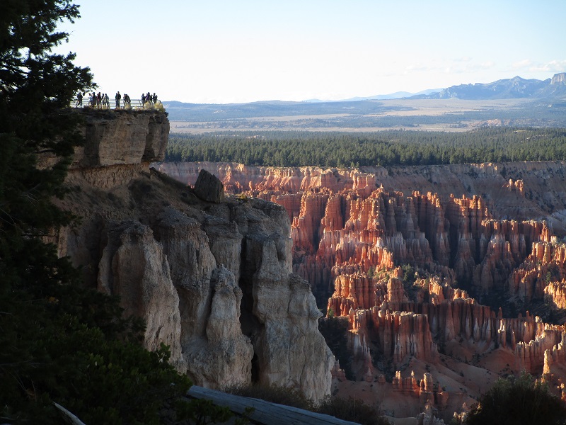
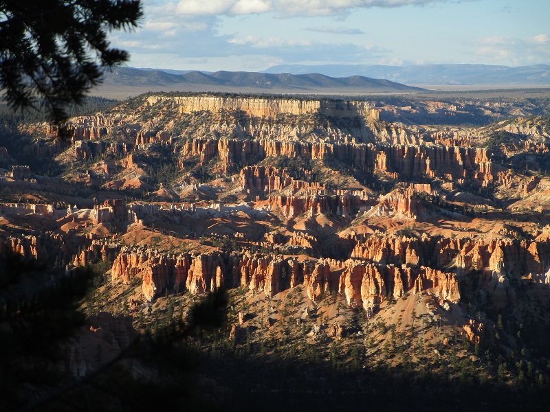
Lodging was tight at this time of year but we managed to secure an outstanding room at a very reasonable price at the historic Ruby’s Inn just outside of Bryce Canyon National Park. There were throngs of visitors there from all over the world. That evening we went to one of the park’s overlooks to watch the sunset on the canyon.
a view of bryce canyon along utah 12
a bryce canyon overlook near sunset
bryce canyon
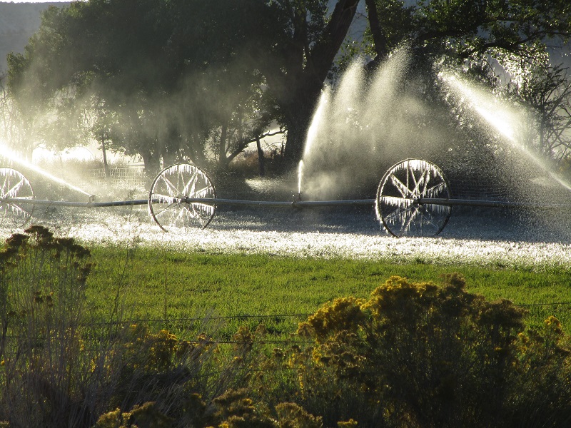
The next day we left early on this frosty October morning.
an irrigation wheel line south of Cannonville on this chilly morning
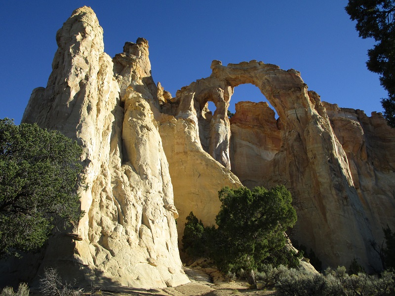
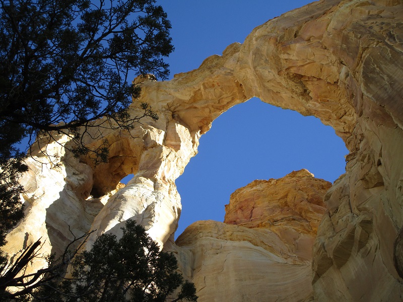
We headed south on the 40 mile long backcountry Cottonwood Canyon Road. We found this dirt road in excellent condition, but the steeper grades could be hazardous or perhaps impassable when wet. Along the way we took a short side road and walk to see Grosvenor Arch.
grosvenor arch, named in 1947 after the founder of the national geographic society
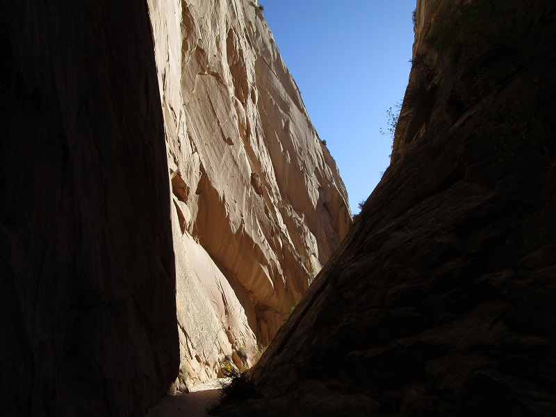
A few miles later we stopped to hike through the Cottonwood Narrows, a three mile loop including a walk back on the road to our truck.
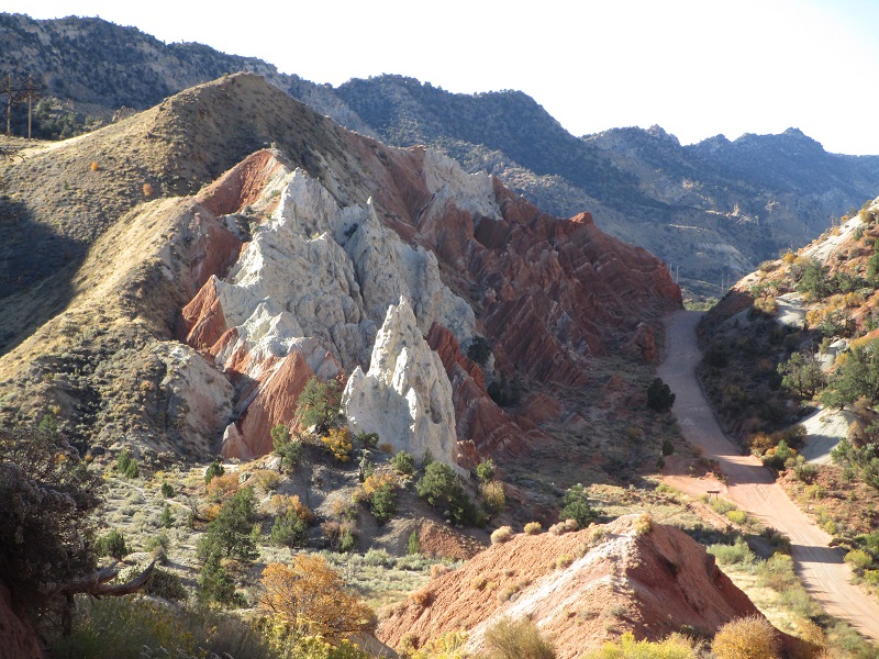
on the cottonwood canyon road, near the cottonwood narrows
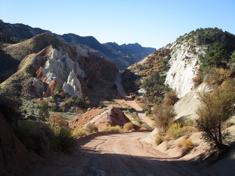
colorful rock formations along the road
on the hike through the cottonwood narrows
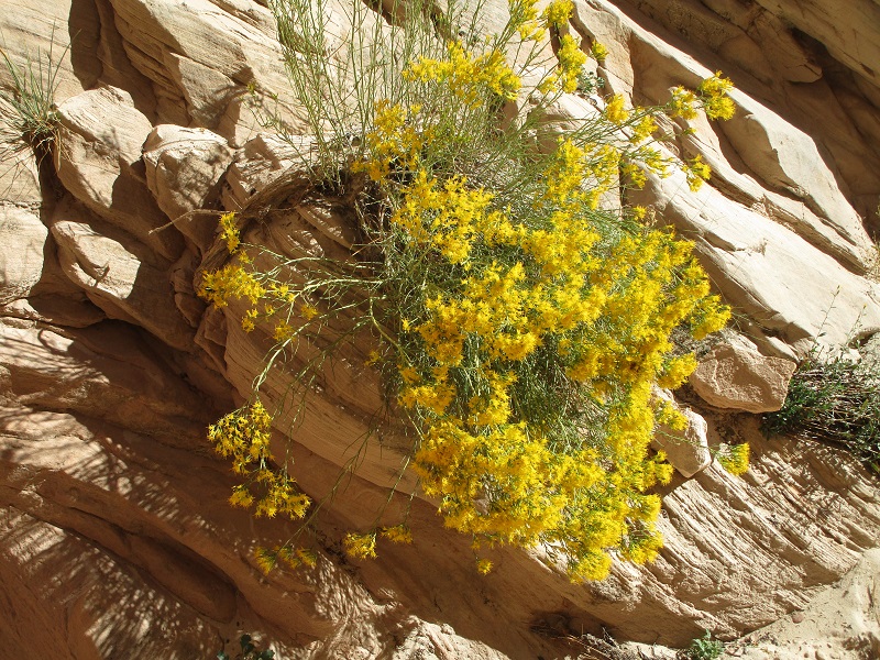
a flower growing in the narrows
in the cottonwood narrows
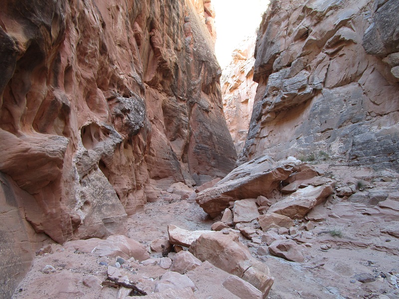
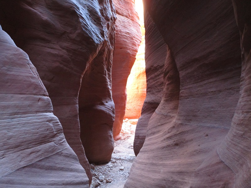
When we reached US 89 we drove a few miles west then turned south on a dirt road and drove several miles to the Wire Pass Trailhead. This is one of the starting points for hikes into Buckskin Gulch, notable as the longest and deepest slot canyon on the planet. Hikes through this canyon are world famous, epic adventures suitable only for the well-prepared and adventurous. I had long wanted to come see at least a little bit of it and we ventured into it a short distance today. This trailhead is also the starting point for hikes to the Wave, a world famous sandstone formation near the Utah/Arizona border. We would love to go see that someday too, but it requires winning lottery permits against long odds. From the trailhead we hiked a couple of miles down a tributary wash to reach an upper part of Buckskin Gulch, passing through a nice narrow slot along the way.
in the narrows of the side canyon before we reached buckskin gulch
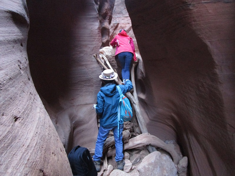
these hikers are scrambling up a tricky pour-off in the slot which we deemed too difficult for our dog, so we found a rough route around this up above
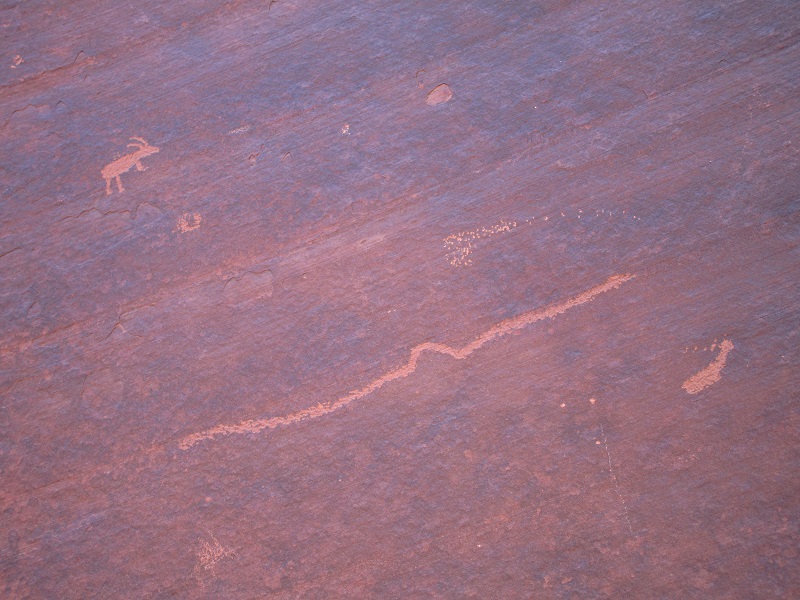
some indian pictographs on a canyon wall near the entrance into buckskin gulch
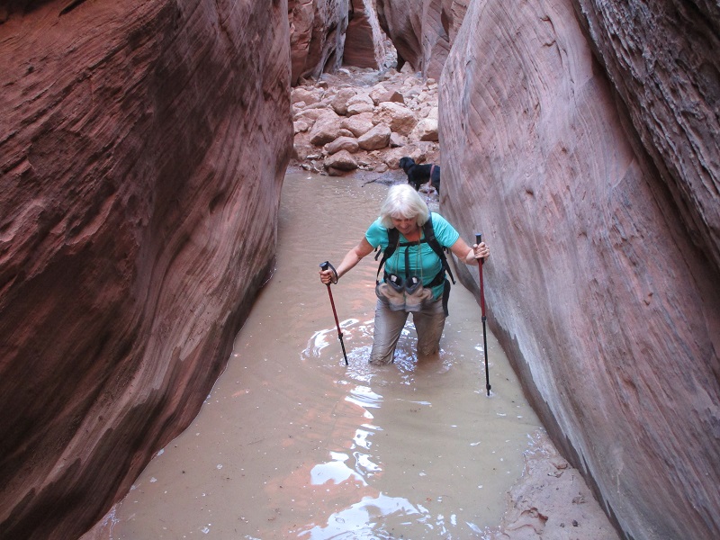
We hiked downstream in Buckskin a few hundred yards, negotiating a muddy waterhole along the way.
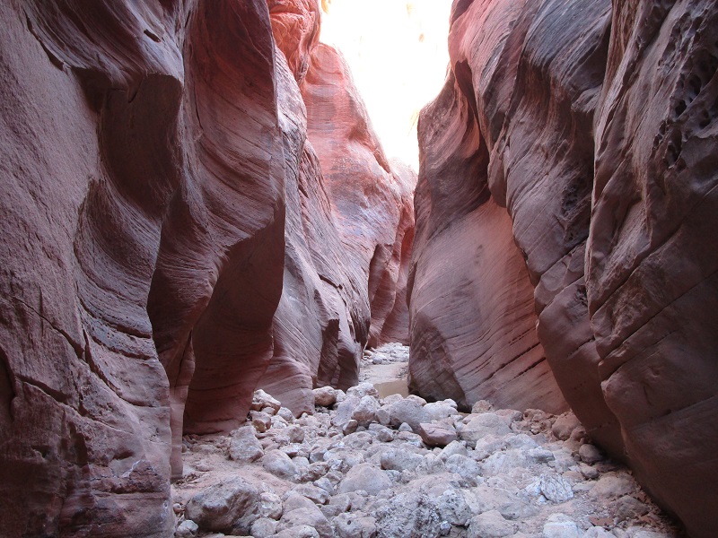
in the upper part of buckskin gulch
a wet part of our adventure
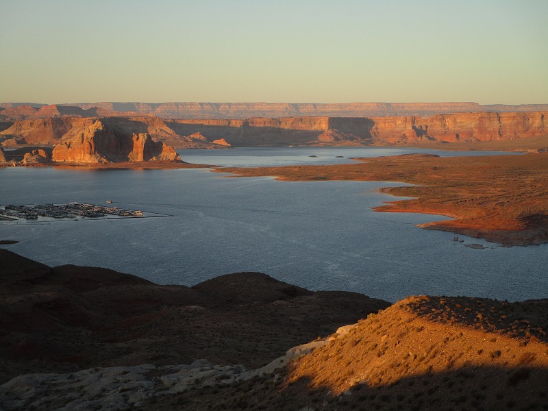
After turning back we returned to the trailhead and drove US 89 to Page, Arizona for the night. We found a nice overlook a couple of miles northwest of town to watch the sunset on Lake Powell.
sunset on lake powell
The next day we headed back to Colorado.