WASATCH MOUNTAIN
(13,555’)LA JUNTA PEAK
(13,472’)"JACKASS POINT"
(13,145’)BALLARD MOUNTAIN
(12,804’)July 13, 2015
By Tim Briese
8.4 miles, 4700’ elevation gain, 9:15 roundtrip time
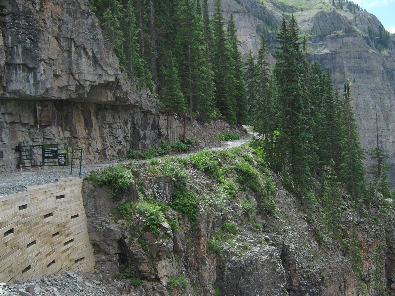
I really looked forward to this outing because I knew the area around Telluride where these peaks are located would be a scenic treat, and I was certainly not disappointed. Brian and I left Ridgway at 430 am and drove to Telluride and continued to the far end of the valley at the east end of town. We drove up a very steep narrow road with several switchbacks to a spot where we parked near the top of Bridal Veil Falls. The elevation here was about 10,380 feet. Further vehicle access up the road that continued up the valley to the south along Bridal Veil Creek was barred by a metal gate. The gate had a convenient hole through it for hikers to crawl through which we promptly did as we embarked on the hike at 6 am.
the road where we started the hike. the gate with the "hiker hole" is at the left.
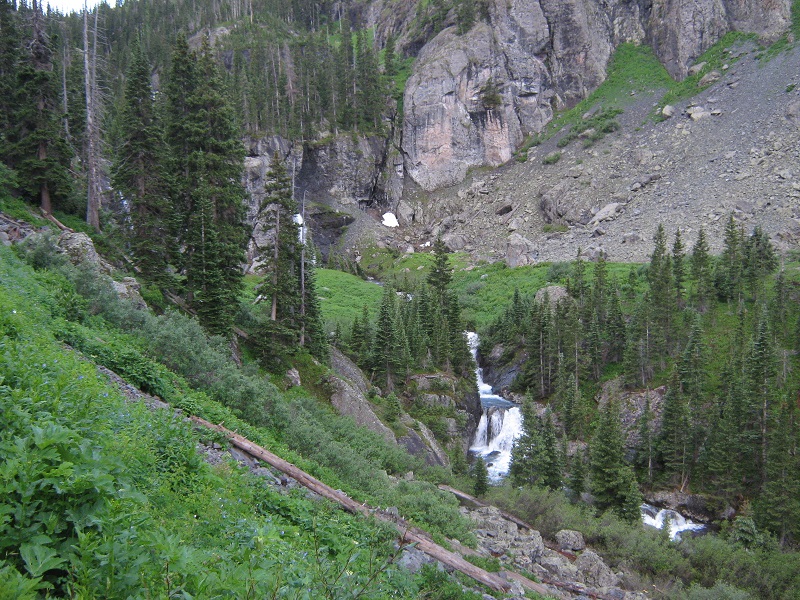
We hiked on the old road up the valley along Bridal Veil Creek, which was roaring with water from snowmelt in the basin above. This was a very scenic hike, with waterfalls everywhere.
some of the waterfalls along the way
After about a mile and a half we reached a junction where a road went left to Blue Lake and we continued to the right up into Bridal Veil Basin.
looking up toward La Junta Peak
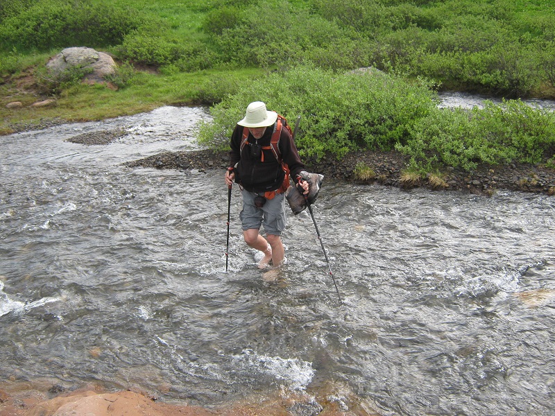
At 2.6 miles we crossed the icy creek.
wading through very cold water!
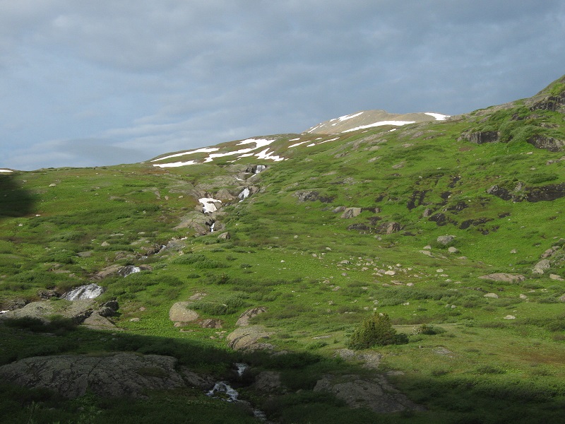
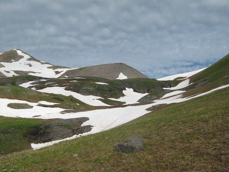
Then we turned to the west and climbed cross country up grassy slopes toward the Wasatch/La Junta saddle. There was a lot of snow remaining here in the upper basin and we side-hilled along a grassy slope to the right to avoid most of it.
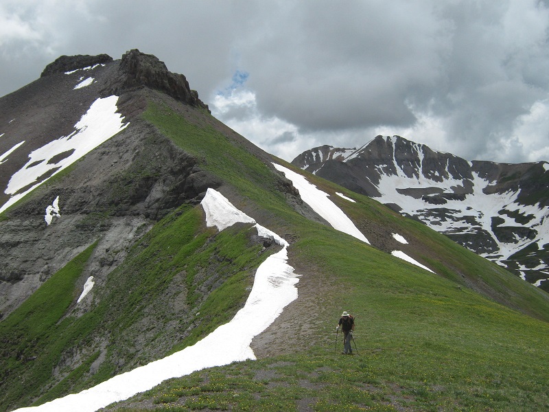
we hiked across the slope at the far right to the saddle. wasatch is at the far left.
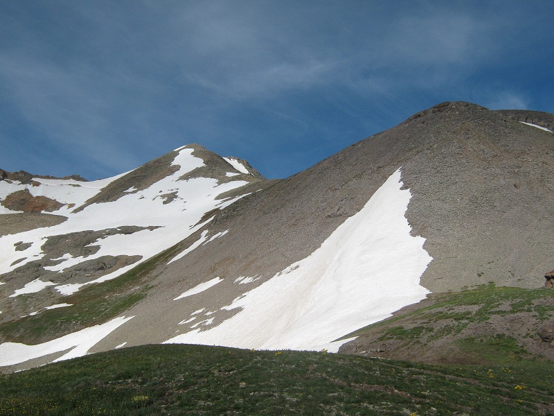
A large steep bank of snow lay just below the saddle but we managed to skirt around the right side of it. We arrived at the saddle about 9 am. At the saddle we ran into Ken Kunkel from Colorado Springs, who was on an ambitious outing to climb several peaks today. Our plan was to climb from the saddle up to Wasatch then return to the saddle and climb up to La Junta. We turned south and began to engage the ridge up to Wasatch. We turned around for a moment and watched Ken flying up the ridge to La Junta. The first stretch of the ridge to Wasatch was steep and loose but then it got considerably easier the rest of the way up to the summit.
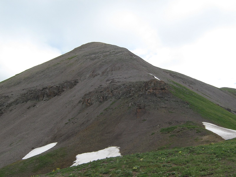
view of wasatch, center left, from near the saddle. we went up the steep slope at the right and then hiked along the ridge to the top.
on the way to the summit
We arrived on the summit at 9:53 and stayed there for about 15 minutes. The surrounding views were spectacular. We marveled at the amount of snow remaining yet on the surrounding slopes.
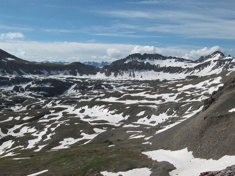
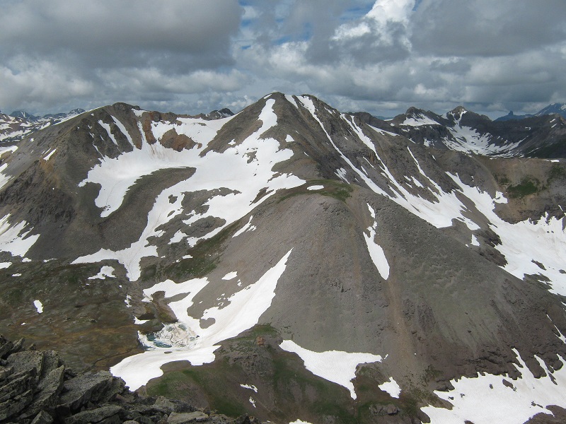
there was a lot of snow in the upper basin. the grenadiers are visible in the distance.
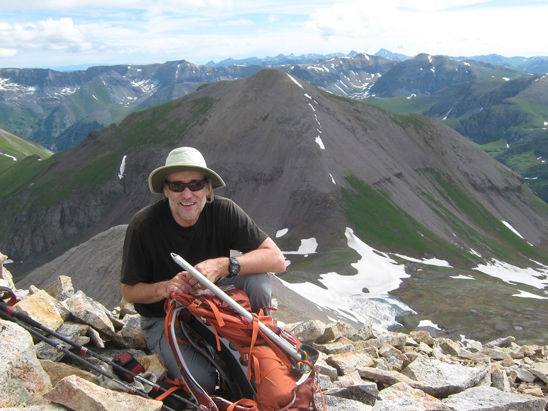
brian on the summit, with la junta peak beyond
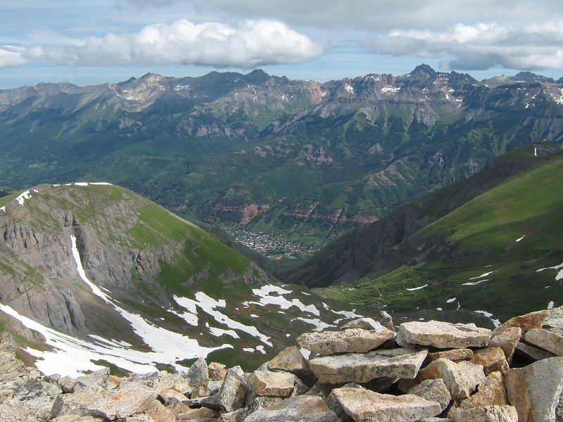
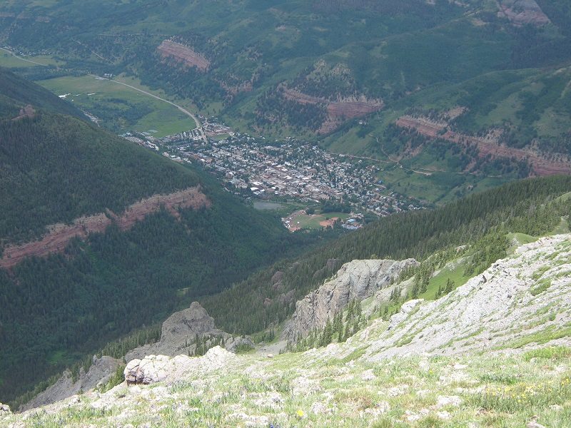
view of telluride from the summit of wasatch
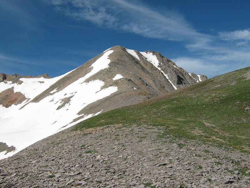
We left the top and hiked back down to the saddle in 30 minutes and then began the 600 foot climb up the ridge to La Junta.
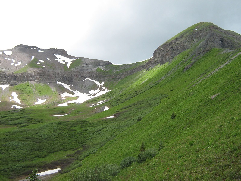
the ridge up to la junta
We reached the summit at 11:20 and stayed there for about 15 minutes also.
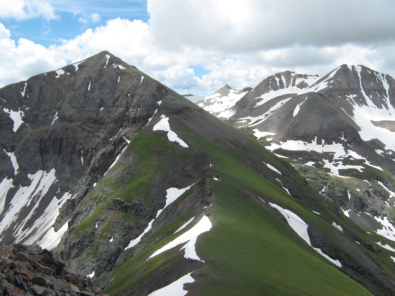
looking back at wasatch from the summit of la junta
At this point we pondered calling it a day and returning the way we had come or continuing north on the ridge to Jackass and Ballard. We elected to do the latter, in spite of the appearance of dark thunderstorms in the distance to the west.
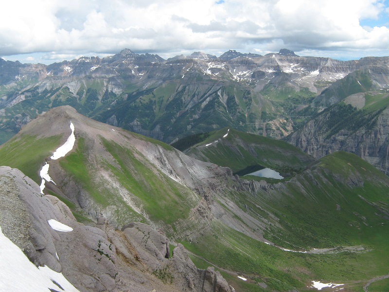
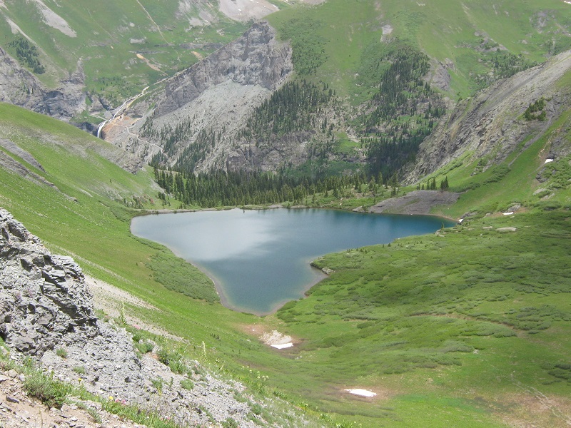
view of jackass point, at the left, from la junta. silver lake lies in the basin below.
We quickly hiked down the ridge to the north, skirting around the left side of a rough rocky area.
on the way to jackass

We hustled down to the saddle and headed up to Jackass, where we arrived at 12:10.
looking back at la junta, to the left, and wasatch, to the right, from the summit of jackass
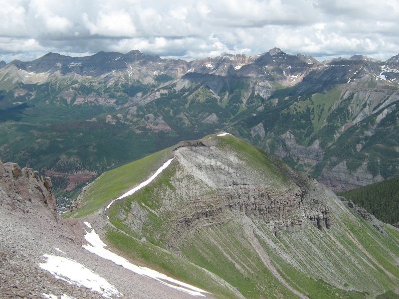
view of ballard mt. from the summit of jackass
The clouds were rapidly looking more ominous so we stayed only ten minutes and just after we left the top the day’s first rumble of thunder filled the air. The scenery along the ridge was spectacular and I stopped for several photos in spite of our hurried pace.
looking back up at jackass from the jackass/ballard saddle
We arrived on Ballard at 12:50 and basically didn’t even stop, except to take a photo of the spectacular view of Telluride in the valley below from this lofty vantage point.
the view of telluride from ballard mt.
We hiked down the ridge northeast from Ballard looking for a way to get down to Silver Lake in the basin below to the east. The entire east side of the ridge from Jackass to Ballard and beyond was guarded by a continuous cliff band. If a trip report we had read had not mentioned a route down off the ridge to the northeast of Ballard I would have questioned the feasibility of doing so. We took a look at the top of an ominously steep gully and decided to go a bit further down the ridge and found a better gully that provided a passable route down, although it was very steep and loose. Once down through this difficulty we side-hilled across a grassy slope down to Silver Lake.
on the way down to silver lake
looking back at jackass, on the left, and ballard, on the right
Upon reaching the lake we finally took a well deserved break. After resting for a while we found a nice trail to the east from the lake that took us back down to Bridal Veil Creek in the valley far below. This 1300 foot descent was quite steep and rough in some spots so we were grateful for the trail, even though it became rather rough in some places. Upon reaching the valley we forded fast-flowing Bridal Veil Creek at a wide spot and then hiked down the old road back to the truck, where we arrived at 3:15. We took some time to take some photos of beautiful Bridal Veil Falls before returning to Ridgway.
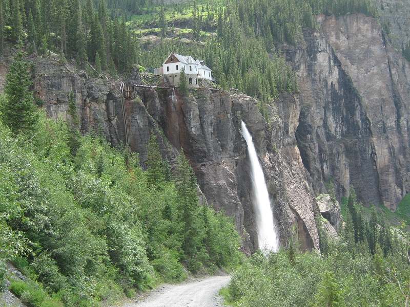
the historic power station at the top of bridal veil falls. the road we drove up is visible beyond at the right.

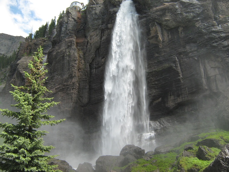
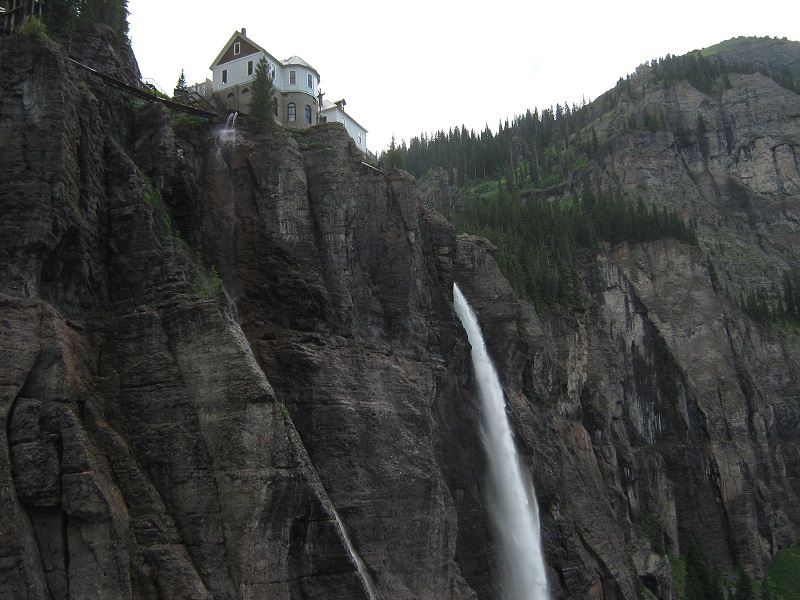
bridal veil falls. this 365 foot high waterfall is the highest freefalling waterfall in colorado.
bridal veil falls
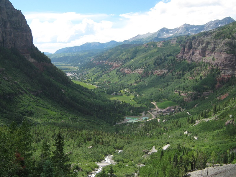
the view down the valley toward telluride
at the base of the falls