THE WAVE, NORTH COYOTE BUTTES, ARIZONA
February 1, 2023
By Tim Briese
7.8 miles, 1200’ elevation gain, 7:50 roundtrip time
The Wave is a geological wonder in an area called North Coyote Buttes just south of the Arizona/Utah border. It became internationally famous in the 1990’s and has become one of the most sought after hiking destinations in the Southwest. In order to protect the fragile landscape the BLM currently limits the number of daily visitors to 16 parties or 64 hikers through a permitting process. Some of the permits are granted through a monthly online lottery and some through a day-before local lottery. The odds of winning a permit are very small, especially through the online lottery, since there are often a few thousand applicants per day. Permits are issued year round, and the odds of winning one are slightly better in the winter when demand is a bit lower. There is a whopping fine of up to $100,000 for those who enter the area without a permit!
Teresa and I had long had the Wave on our hiking wish list, for we have hiked all over northern Arizona and southern Utah and are fascinated with the area. We had been trying off and on for three years to obtain a permit and had practically given up when we were elated to finally obtain one! We were informed of our lucky draw in early November, and our permit date was February 1st.
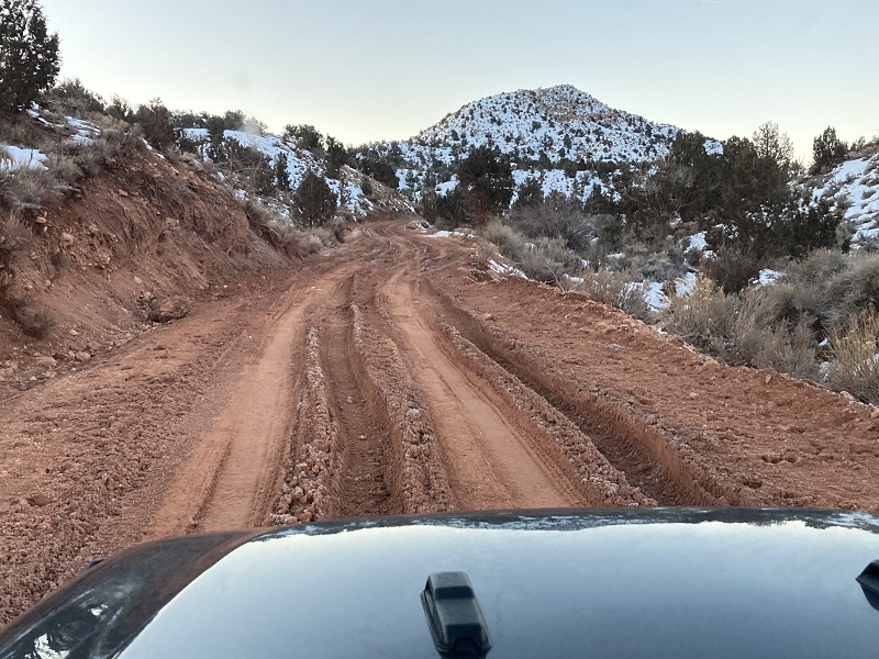
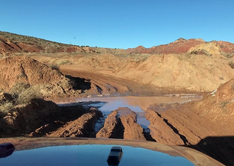
Access to the Wave is not guaranteed. One must drive eight miles on the unmaintained dirt House Rock Valley Road from Hwy. 89 to the Wire Pass Trailhead, and then hike a mostly unmarked six and a half mile roundtrip cross country route to the Wave. The road surface has a lot of clay and is passable to most vehicles when dry, but is 4WD only when wet and may be impassable to all vehicles when muddy. The area had near-record precipitation in January with a lot of snow and the road was in very poor condition when we checked into it the week before our hike. Some vehicles were getting stuck in the mud and locals said they had rarely seen conditions so bad. We had planned to drive our Tacoma to the trailhead but had second thoughts about that. We considered hiring a guide to take us in but in the end decided to rent a jeep with mud all terrain tires, which we were told should do the trick.
We picked up our rental jeep in Page the night before the hike and the next morning left town in the dark at 630 am for the hour plus drive to the trailhead. The House Rock Valley Road was heavily rutted in the mud in many places but was mostly frozen and solid on this clear cold morning so we were able to drive to the trailhead without incident.
the road was rough but solidly frozen
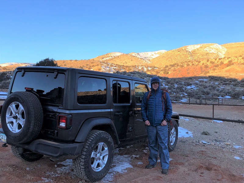
There was one other vehicle at the trailhead when we arrived. The temperature was a very chilly ten degrees when we embarked on the hike at 750.
at the wire pass trailhead
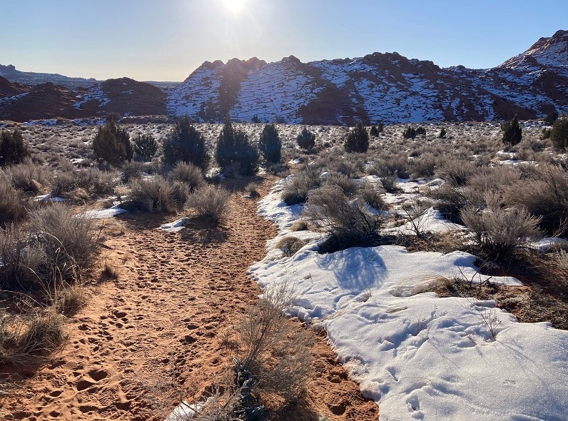
We hiked about 0.7 miles down a drainage to the east and then took a signed trail up to the right out of the drainage toward North Coyote Buttes.
the first part of the hike went down this wash
early sunshine felt wonderful on this cold morning
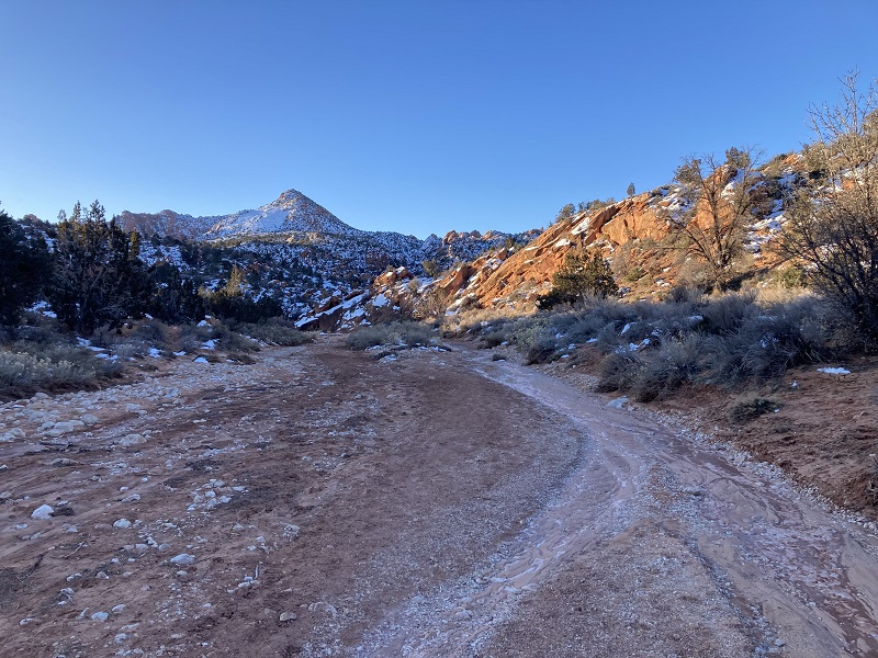
The BLM provides an excellent description with photos for hiking to the Wave but of course some people get lost anyway. I had the route from All Trails downloaded on my phone which we could follow with GPS just in case but it wasn’t necessary. Most of the hike is in Utah but the route crosses the state line and the Wave is actually in Arizona about 0.4 miles south of the border. After hiking a trail up out of the drainage we followed a sandy trail southeast to a rocky saddle.
on the sandy trail toward the saddle, which is toward the left
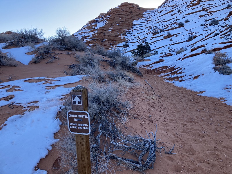
we officially entered north coyote buttes just before the climb to the saddle
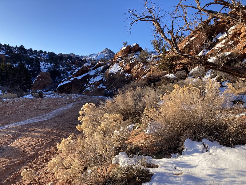
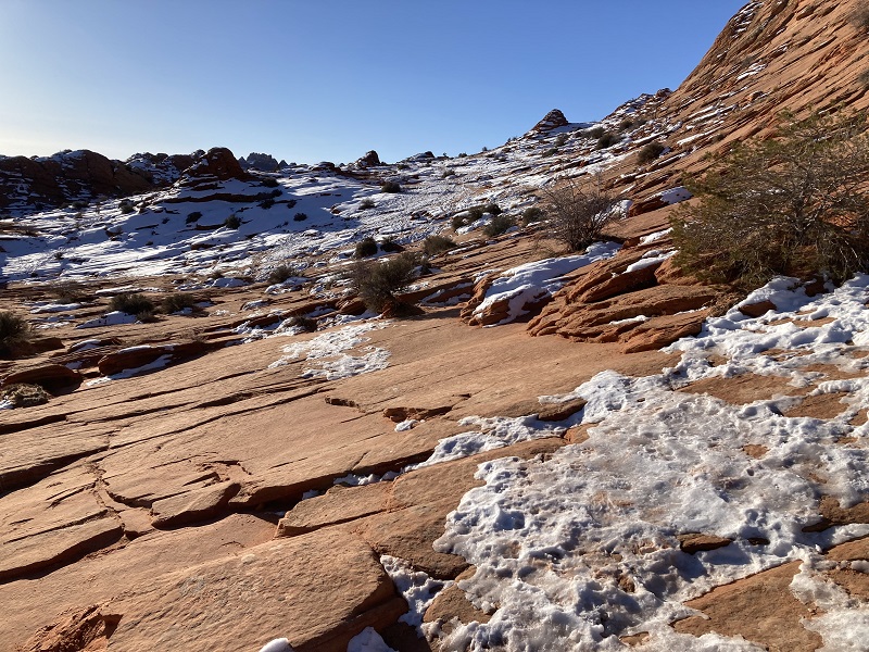
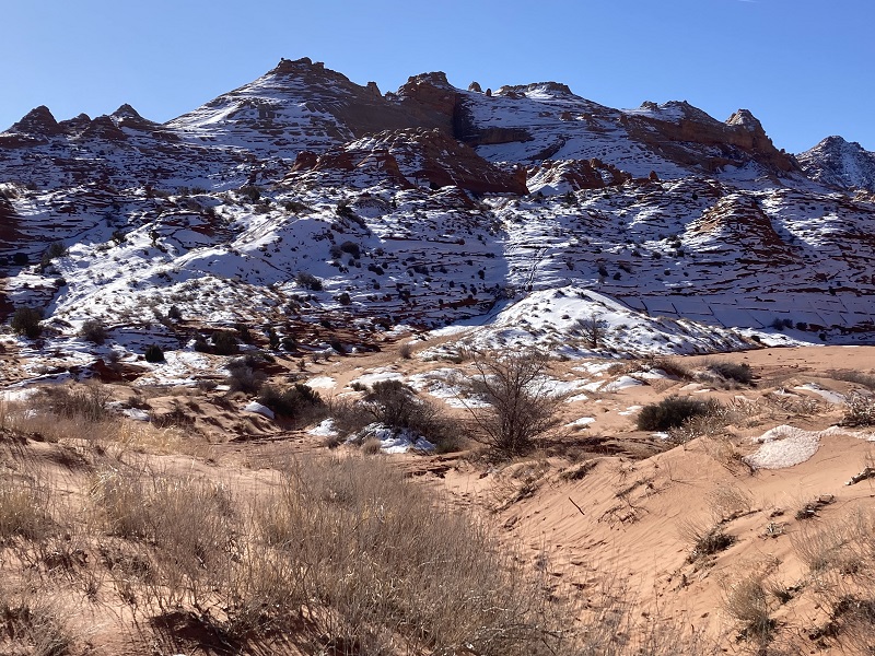
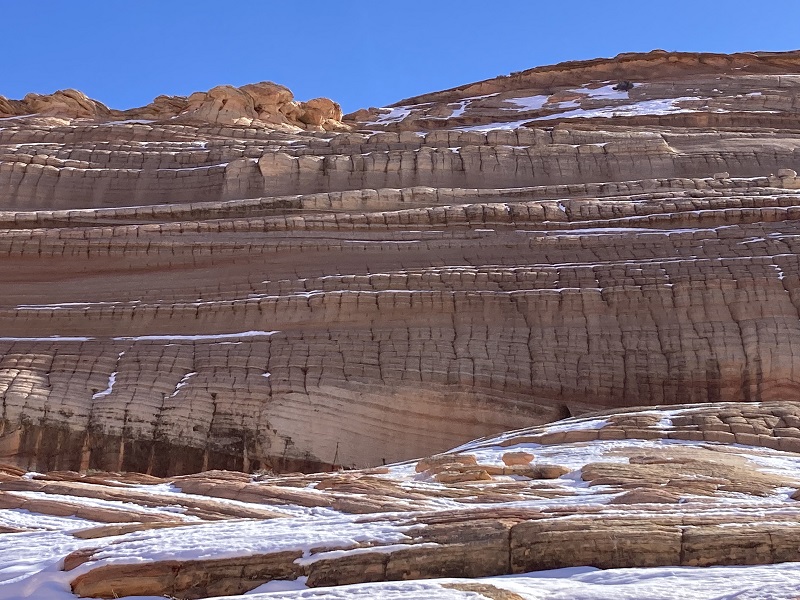
After we hiked up a rocky slope to the saddle the route then went across slickrock nearly all the rest of the way. There was some icy snow lying on north-facing slopes. We had our microspikes along in case we needed them but were generally able to skirt around slick areas and didn’t need the spikes until later.
the route goes toward the upper right across the rocks
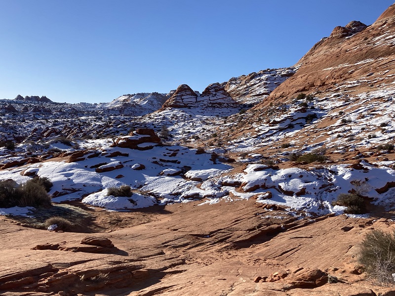
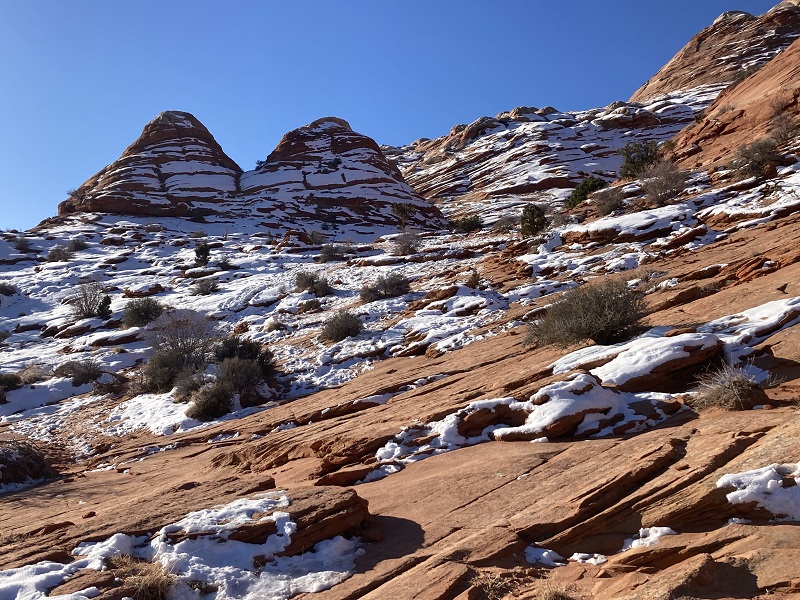
A notable landmark the BLM describes is a pair of twin buttes that hikers should aim for.
we headed toward the twin buttes in the center
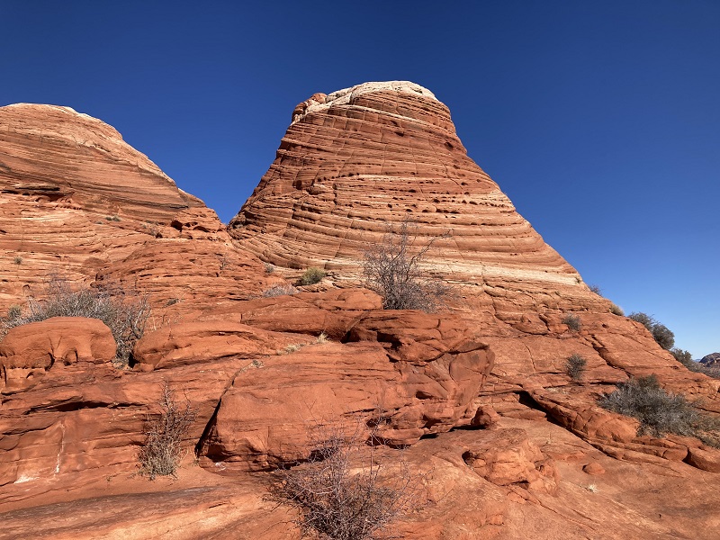
we hiked around the right (west) side of the buttes per the route directions
After hiking around the right side of the buttes we took a rest and snack break in the warm sunshine on the other side.
there was no snow on the sunny side of the buttes
While we were resting two solo hikers passed us and then a friendly guide from Kanab, UT with a party of six young Asian hikers. After the break we headed south toward another landmark, a dark crack in a distant cliff face below which we would eventually find the Wave. There was no trail, just cross country hiking.
we headed toward a dark vertical crack in the distant cliff face in the center of the photo
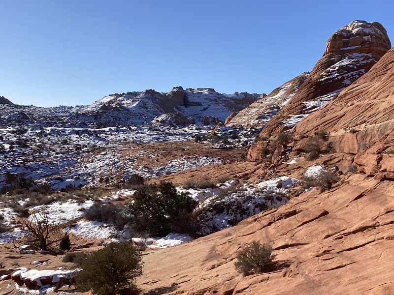
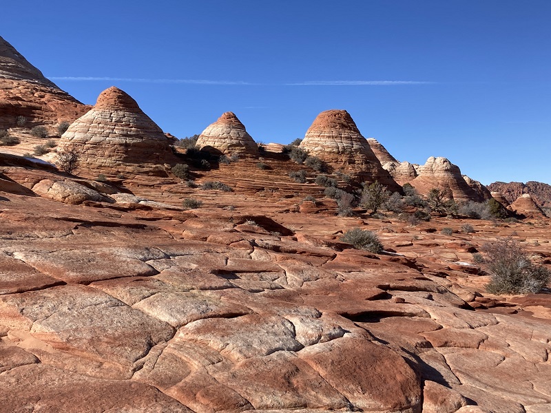
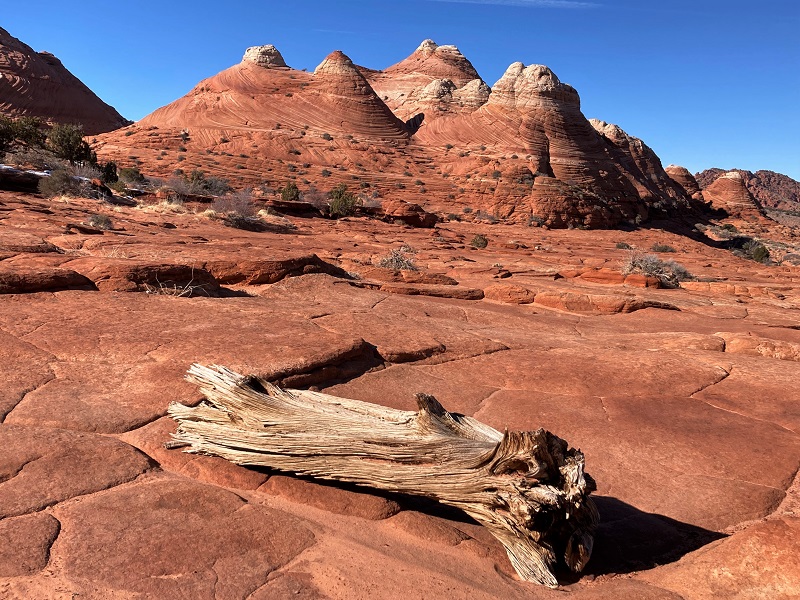
scenic rocky buttes to the east
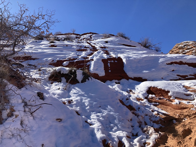
The route eventually crossed Sand Cove Wash and then went up a steep sandy hill toward the Wave. This slope was mostly covered with slippery crusted snow which made its ascent a little tricky.
getting closer. we are about to cross sand cove wash here and ascend the snowy slope on the other side up to the wave.
the snowy and icy slope was a little tricky but doable
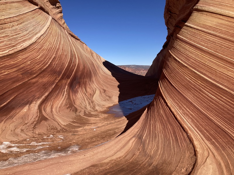
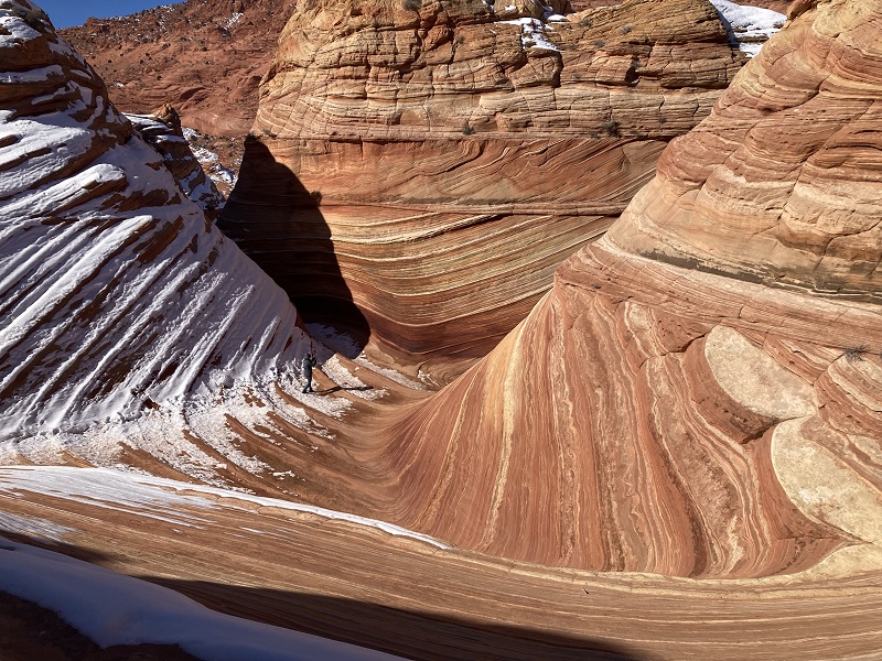
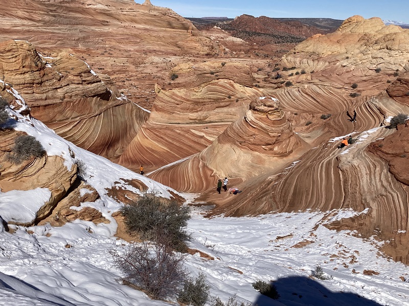
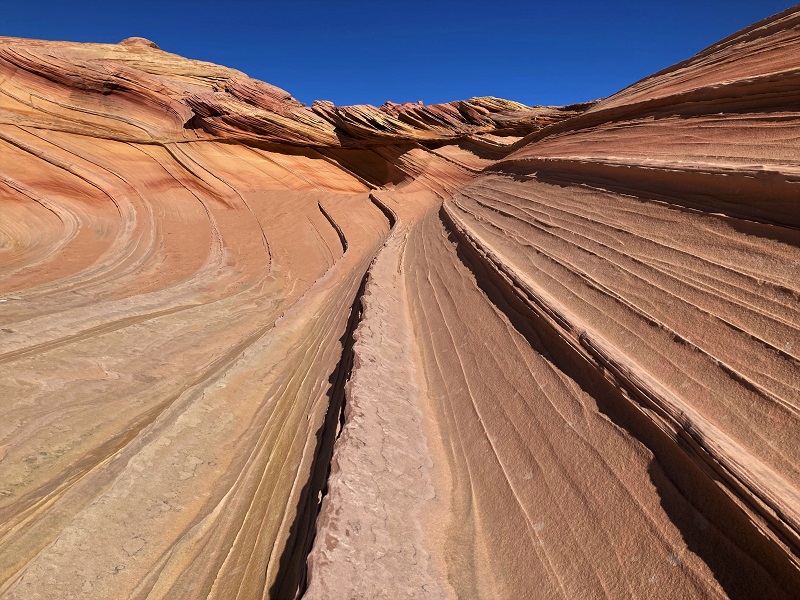
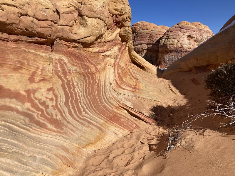
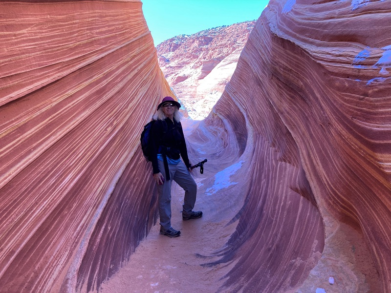
Minutes later we entered the narrow western branch of the Wave in a climactic and exciting moment, after a years-long wait! The colorful swirling layered sandstone almost glistened in the bright morning sunlight.
entering the western branch of the wave
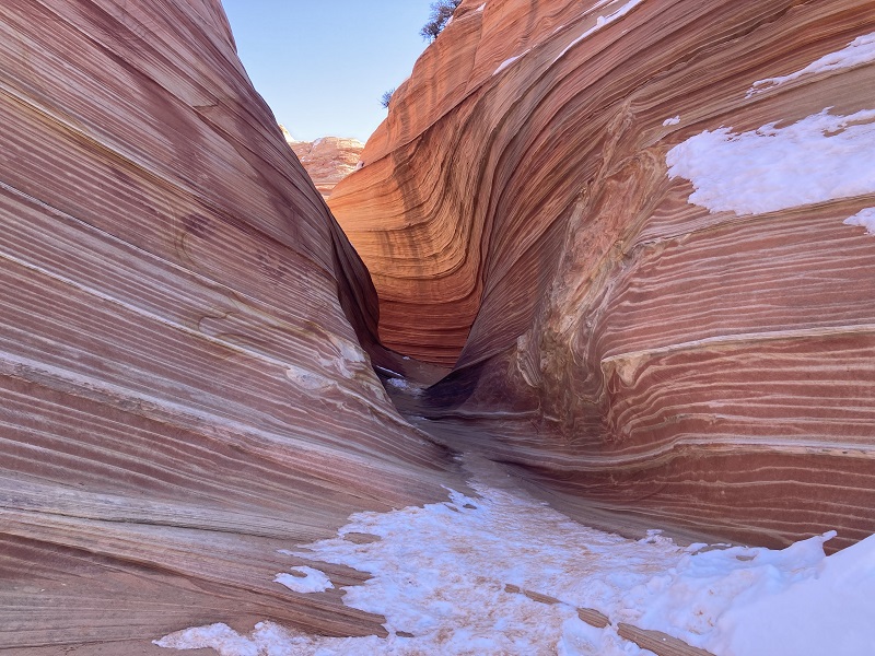
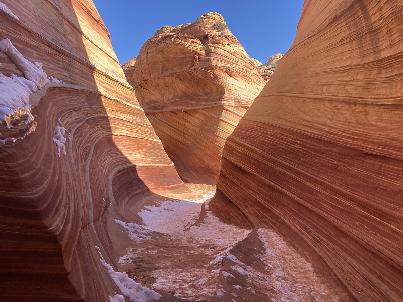
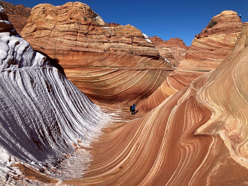
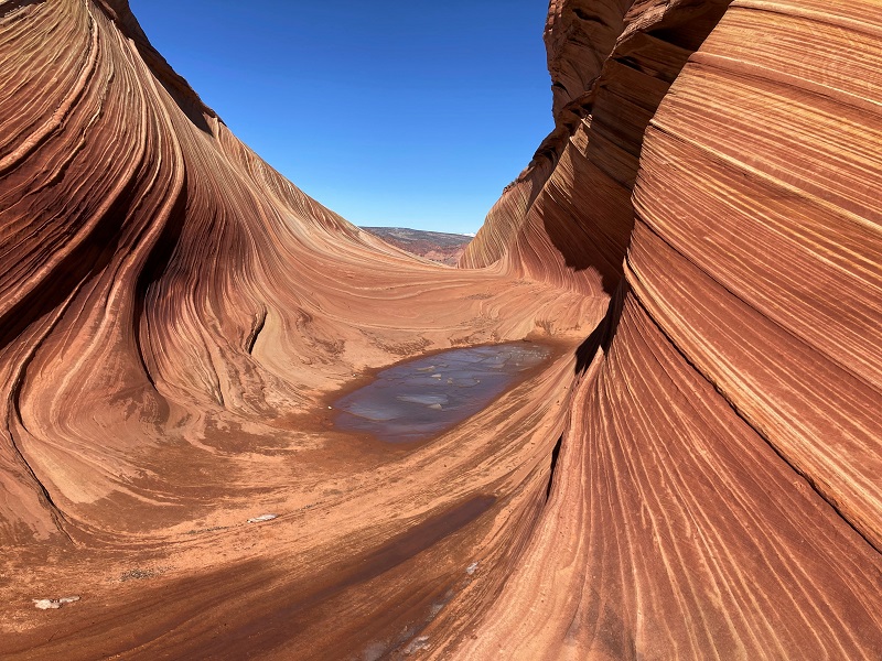
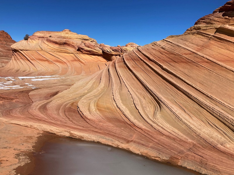
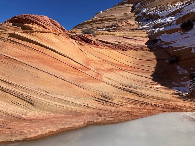
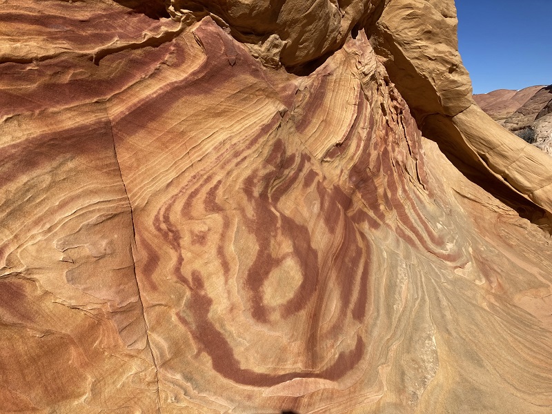
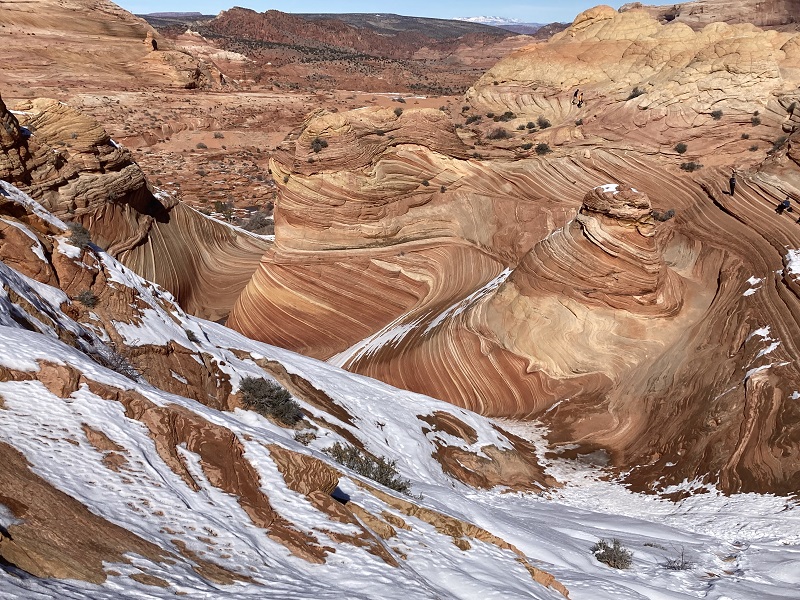
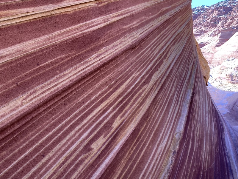
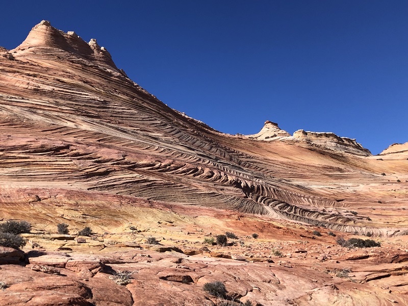
The Wave has three branches, the narrow one we entered from the west, another to the north that had a frozen pool of water in it the day we visited, and a broad one to the southeast which is the most famous one featured in ubiquitous photos in books and calendars. There was some snow on the western side of this branch today. The Wave is indeed a marvel of nature and it was a thrill to finally be here!
the northern branch of the wave
the main section of the wave
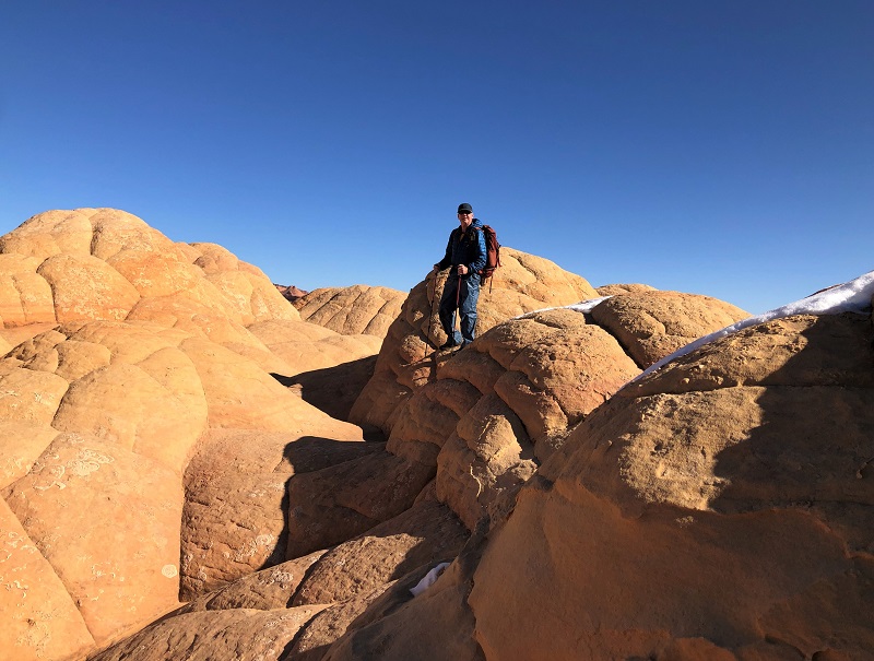
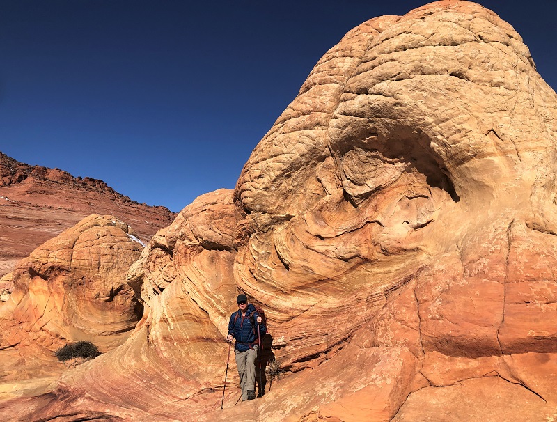
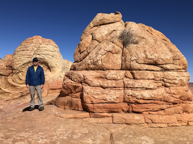
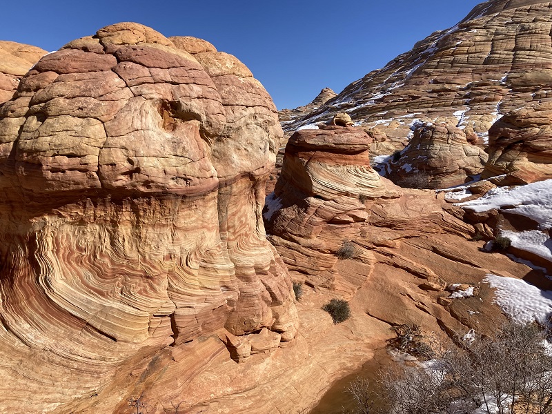
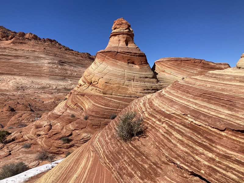
After taking a few photos we climbed up onto some colorful golden brain rock to the northeast to look around while we waited for the party of Asians to finish taking their photos in the Wave.
hiking up onto the rocks above the wave
this fellow was looking down into the wave from above
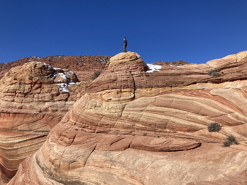
climbing around on the brain rock
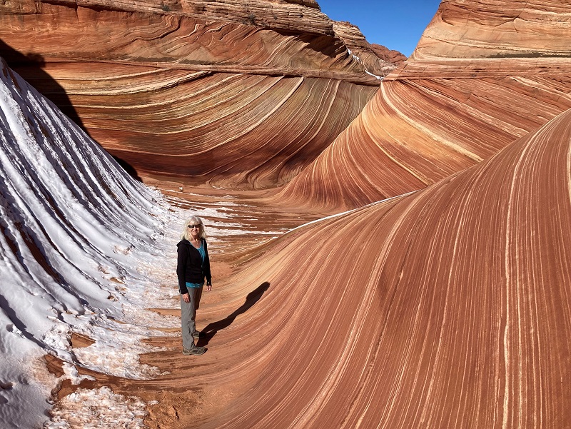
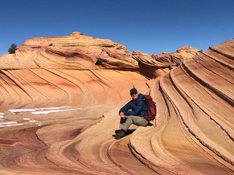
Then we returned to the southeast branch of the Wave to eat some lunch and take our turn getting some photos of ourselves in the Wave.
back at the wave. the narrow western branch we entered is the shaded notch at the left.

the northern branch
A scattering of other hikers were arriving, including another guide from Kanab with a couple of clients. A fellow from New York was taking photos of a younger female companion in a pink flowing dress in the Wave, and an Asian girl took photos of a teddy bear she placed there. I suspect this world famous location has seen it all when it comes to visitors’ photos. We decided to hike on to another scenic spot called the Second Wave located about a third of a mile to the southwest.
looking back down at the wave as we climbed above it
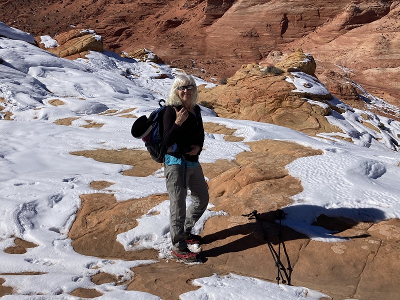
We went up a tricky snow-covered slope and soon had to don our microspikes to navigate the rest of the way.
other cool formations along the way
teresa with her spikes on and ready to navigate snowier terrain
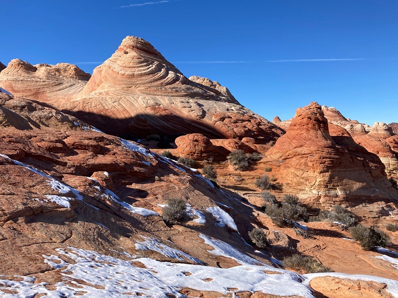
The Second Wave is certainly a scenic formation but less spectacular than the real Wave.
the second wave
interesting cliffs above to the south
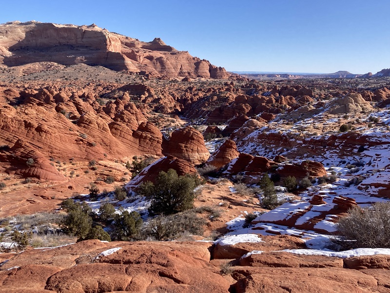
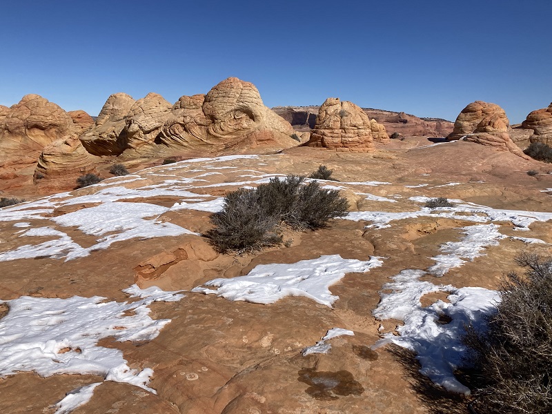
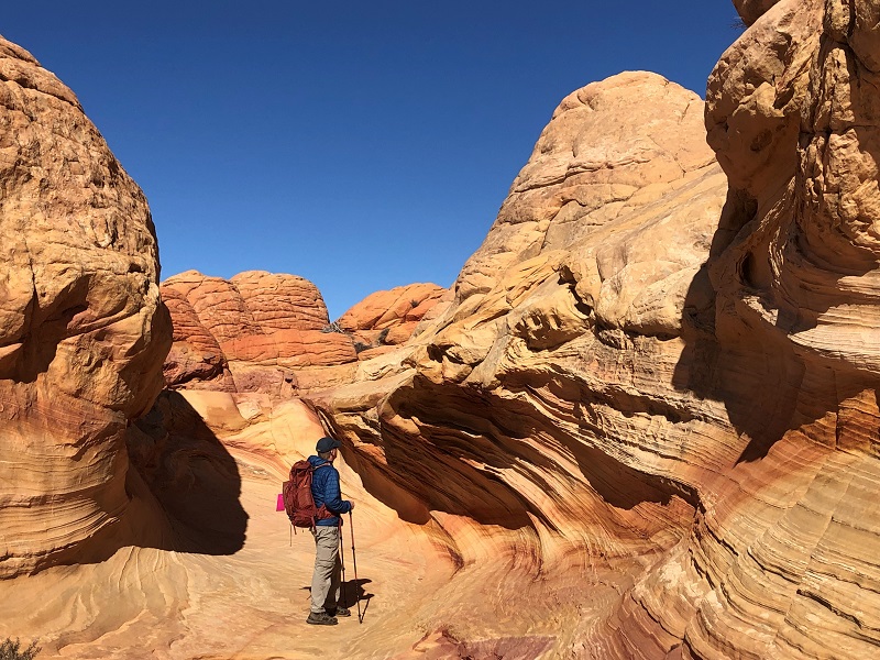
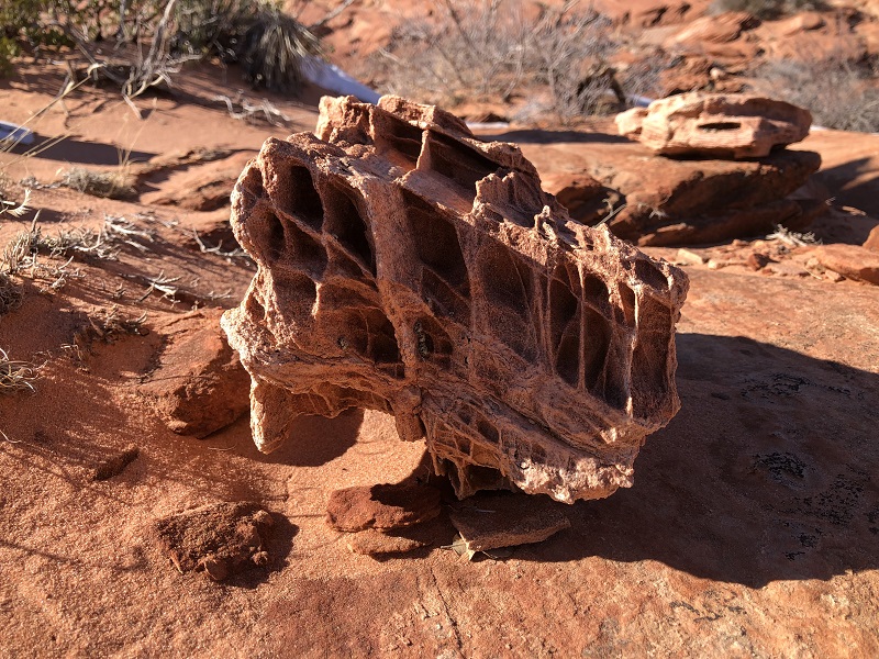
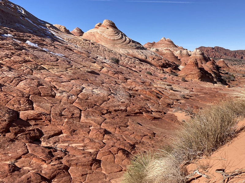
There were numerous other interesting colorful formations that we explored on our way back to the Wave.
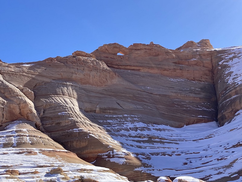
top rock arch is visible high above
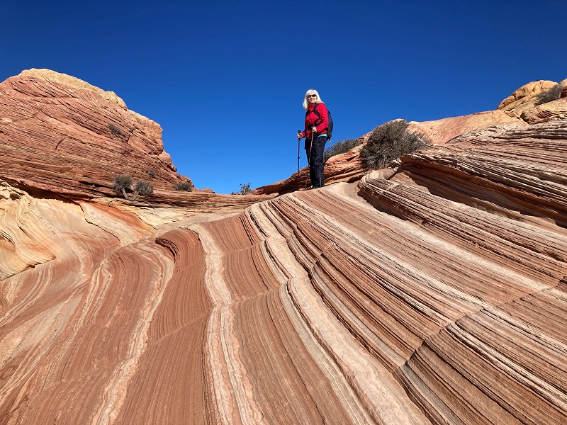
the pink tag attached to my pack is our precious hiking permit
on our way back down to the wave
When we hiked back through the Wave we were gently scolded for using trekking poles and potentially scratching the rocks with them by a young woman who was a female guide and BLM safety scout.
going back out through the west branch of the wave
We proceeded to hike around and explore on our descent back down into Sand Cove Wash.
We encountered terrain too steep to navigate and had to return down the sandy slope near where we had come up. The snow on north-facing slopes limited our exploration of the North Coyote Buttes area a little today but we were nevertheless very thankful to have beautiful clear weather with no wind. The temperature warmed to the mid thirties and it felt very pleasant in the bright warm sunshine.
a very cool rock we hiked past
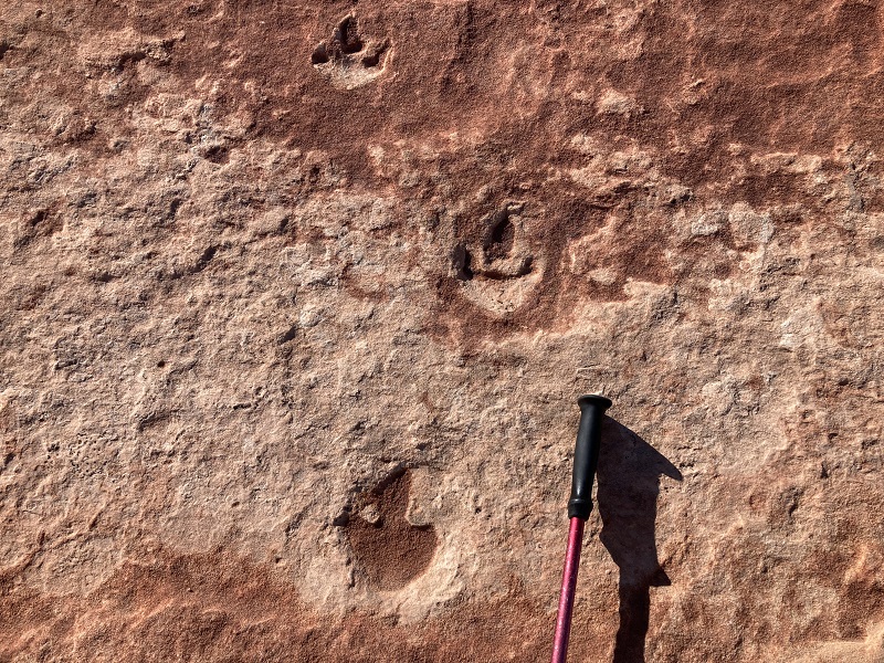
After crossing Sand Cove Wash we climbed up a slope to the northwest and found an area with dinosaur tracks that the Kanab guide had directed us toward. There are said to be about 300 of the small hand-sized tracks in the sandstone.
dinosaur tracks
Then we bushwhacked back to the return route and made our way back toward the trailhead. The rock formations along the way were quite scenic in the golden afternoon sunlight.
interesting layers in the slope above
colorful scenery in the late afternoon sun on the way back
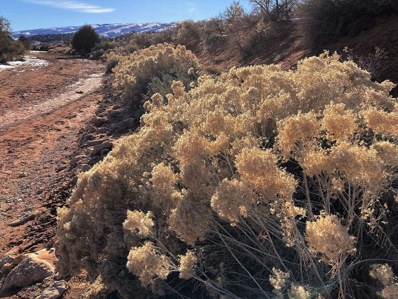
a shimmering bush along the drainage as we neared the trailhead
We tramped back to the trailhead about an hour before sundown and cleaned some mud off our boots as best we could before departing. The road had actually improved a little with recent sunny days and we made it back to the highway without incident with our sturdy jeep. I’m not sure how our Tacoma would have done in the mud with its all season highway tires but I’m glad we didn’t have to find out.
driving out on the muddy road
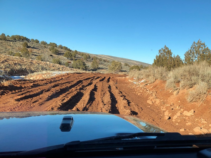
i'm glad we had the jeep for this spot
Upon returning to Page we took the jeep through a carwash to clean off the mud before returning it. Then we went out for dinner to celebrate our long awaited visit to the Wave!