WHEELER GEOLOGIC AREA BACKPACK
August 9-10, 2020
By Tim Briese
First day: 10.2 miles, 1800’ elevation gain
Second day: 8.9 miles, 1200’ elevation gain
Total: 19.1 miles, 3000’ elevation gain
The Wheeler Geologic Area is a fascinating scenic area in the San Juan Mountains that was once Colorado’s first national monument but is now part of the La Garita Wilderness. To visit it was long on my bucket list but I was deterred by challenging access – either a 14 mile very rough 4WD road or an 8 mile one way trail. In the end I decided that a one night backpack would be the way to go. It would break up the long hike and afford the opportunity to see the rock formations in both evening and morning sunlight.
My son-in-law Rod and I left home about 4 am and drove to Wagon Wheel Gap on Highway 149, and just west of town turned right onto the Pool Table Road and followed this excellent gravel road about ten miles to the trailhead at the Hanson’s Mill camp area. The elevation here is about 10,800’. The road to this point was excellent and could be driven with a passenger car. At this point a rough 4WD road continued to Wheeler, as did the Wheeler Trail #790 which started on the north side of the road. There were 2 or 3 other vehicles there, and one fellow walked over and told us there would be a motocross race on part of the road today. About 9 am we took off and started hiking up the nice trail, gently gaining about 100’ in the first half mile. We immediately noted lots of dead beetle-killed trees in the area.
the trail was excellent
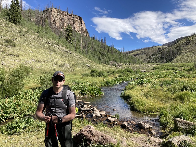
The trail gradually descended to a crossing of East Bellows Creek at 10,400’ at about 2.4 miles.
at the crossing of east bellows creek
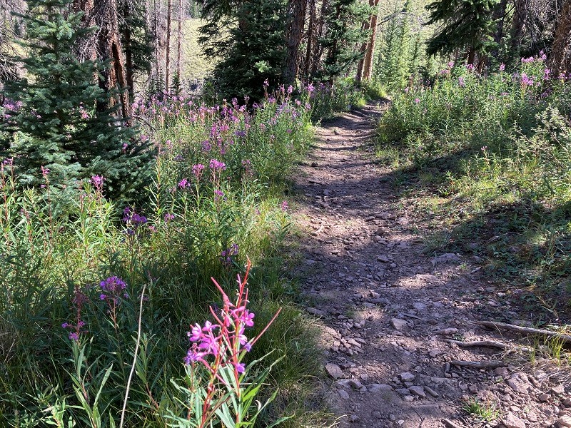
It was easy crossing the creek on some rocks in this dry year and we continued up the valley before turning west and ascending up a side drainage. The trail went through great expanses of open meadow and became rockier in some places.
the trail rolled through this sort of terrain much of the way
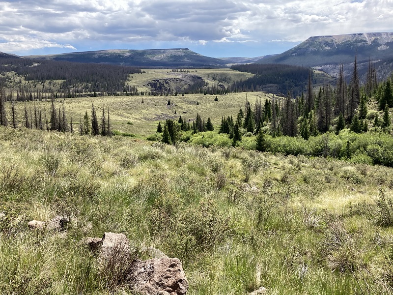
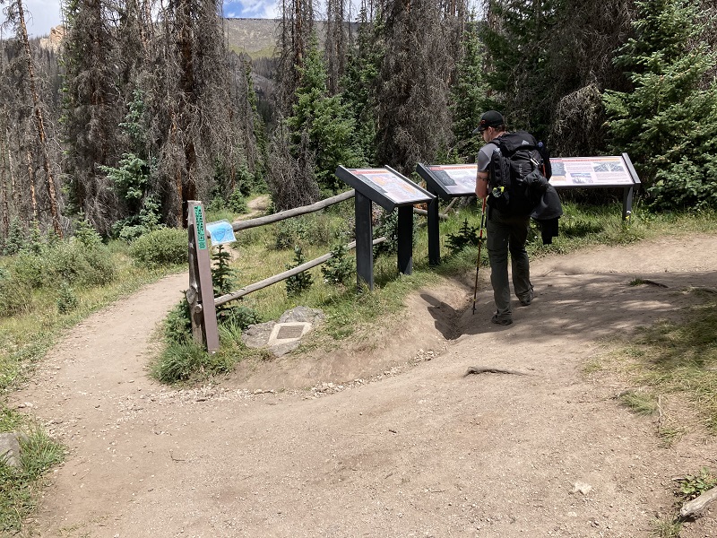
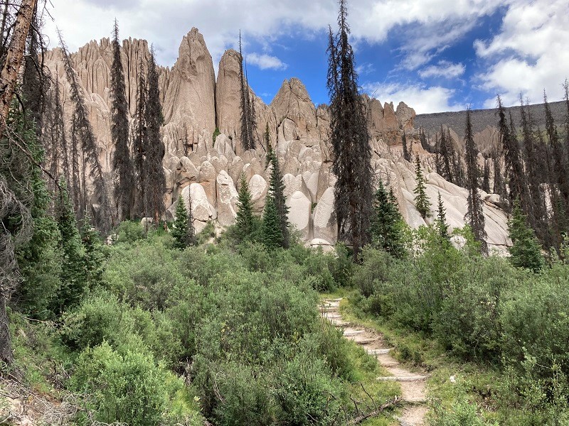
The trail gradually climbed to about 11,300’ before gently descending a bit and eventually intersecting the 4WD road. We hiked 6.1 miles to reach this point. We walked the road about a mile to its end, passed by a couple of ATV’s along the way, with views of the rock formations of the geologic area as we approached. From the end of the road there is a trail that climbs about 300’ in 0.7 miles to the best viewpoint of the area.
interpretive signs at the parking area at the end of the road
There were several other people here today, most of whom had driven up with ATV’s, a few with 4WD vehicles, and some of whom hiked. We asked many of them about the difficulty of the road and as one would expect got various answers, from "It was awful, it took us about 3 hours one way!" to "It wasn’t bad, we did it in an hour and a half." I concluded that I was glad we hiked.
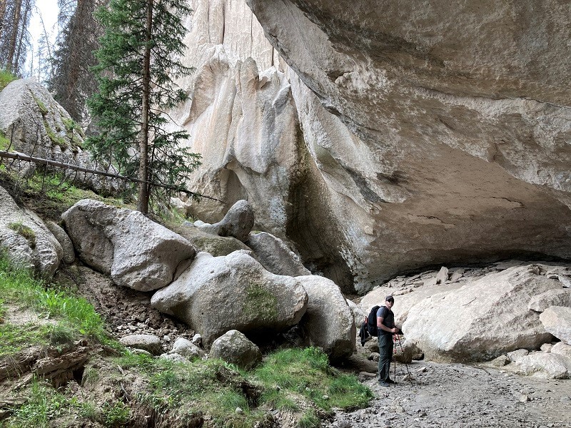
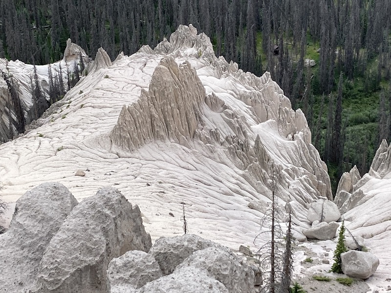
Shortly after we left the parking area we crossed a little creek and hiked up to a junction. A left turn takes one up to the best viewpoint as we found out later and most folks went that way. We hiked to the right and got close to the base of the formations and explored for a while.
on the trail approaching the formations
some interesting rocks along the trail
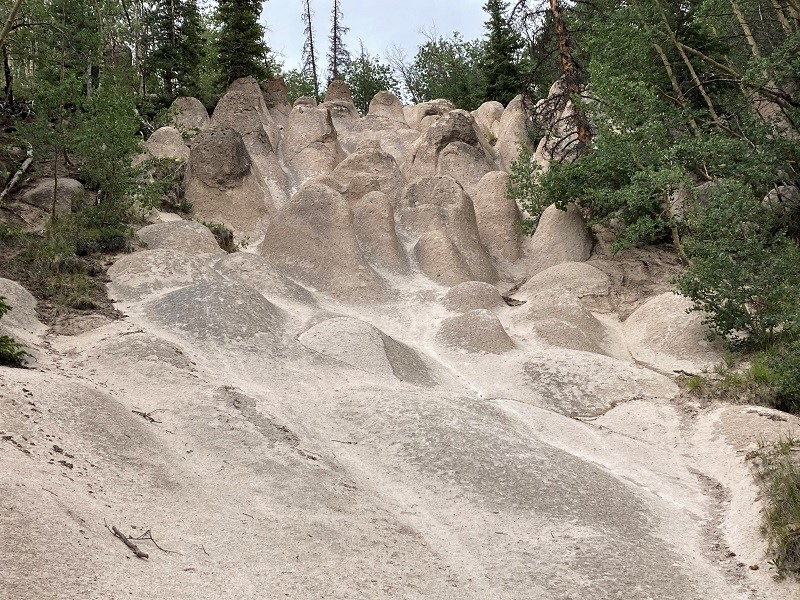
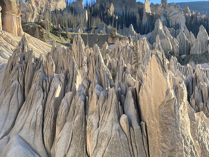
exploring in the formations
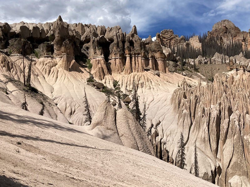
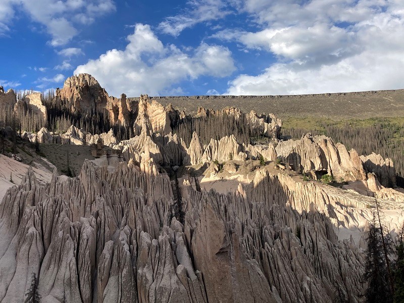
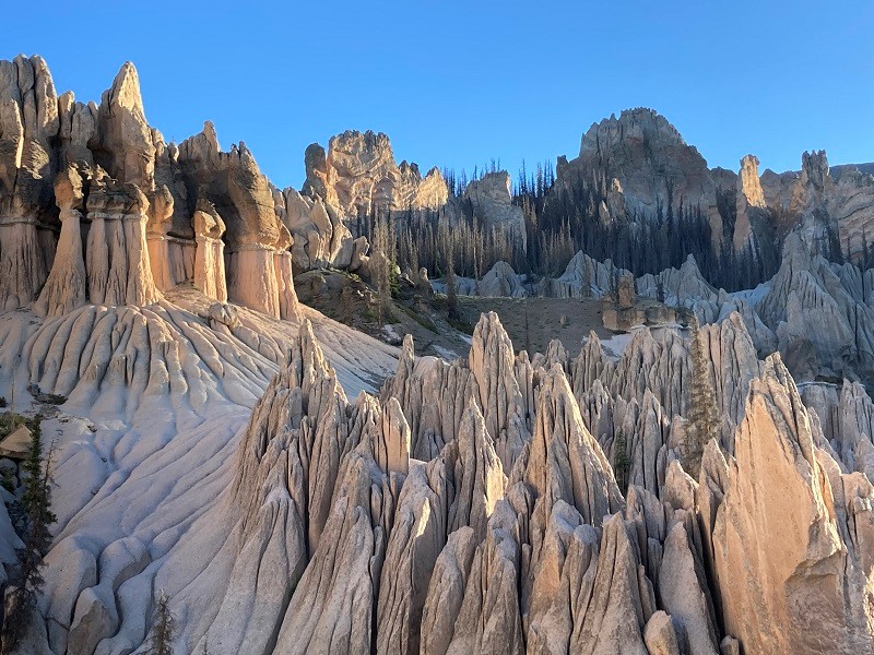
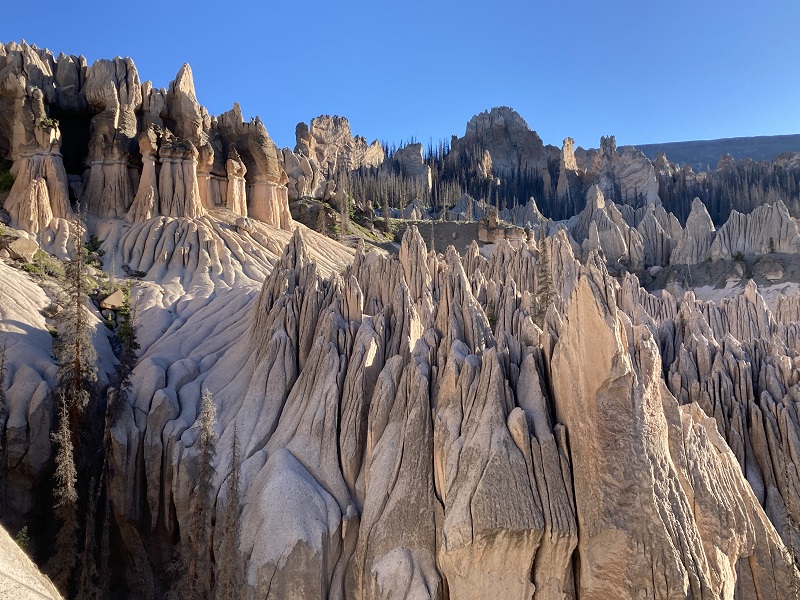
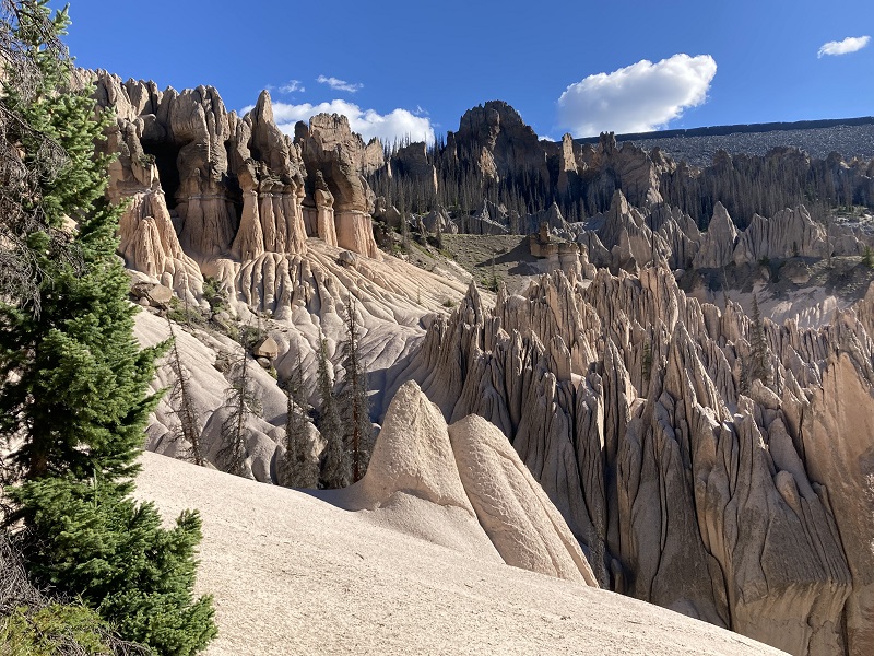
We could have continued on a loop hike for a couple of miles all the way around the formations but a fellow who did it convinced us that it wasn’t worth it as it went through dead trees much of the way with limited views of the rocks. Instead we backtracked a bit and went uphill on the left fork of the trail and soon came to the prime viewpoint of the whole area, complete with a nice wooden bench. It was a beautiful sight, even with the sunlight partly obscured by clouds.
view of some of the formations from the main viewpoint
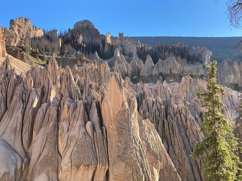
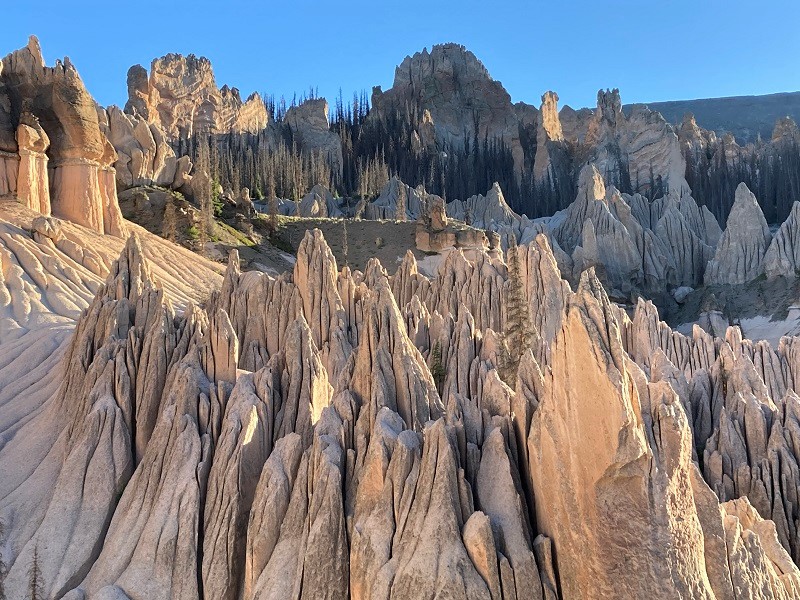
We found a great camping spot about 50 yards south of the viewpoint in the woods, one of the relatively few good camping spots we saw. While I started setting up camp Rod hiked a half mile back down to the creek to get water for both of us. After resting a while we decided to hike on up the steep trail beyond the viewpoint about a half mile and discovered more great views up there from a huge gently sloping slab of rock.
a view from above
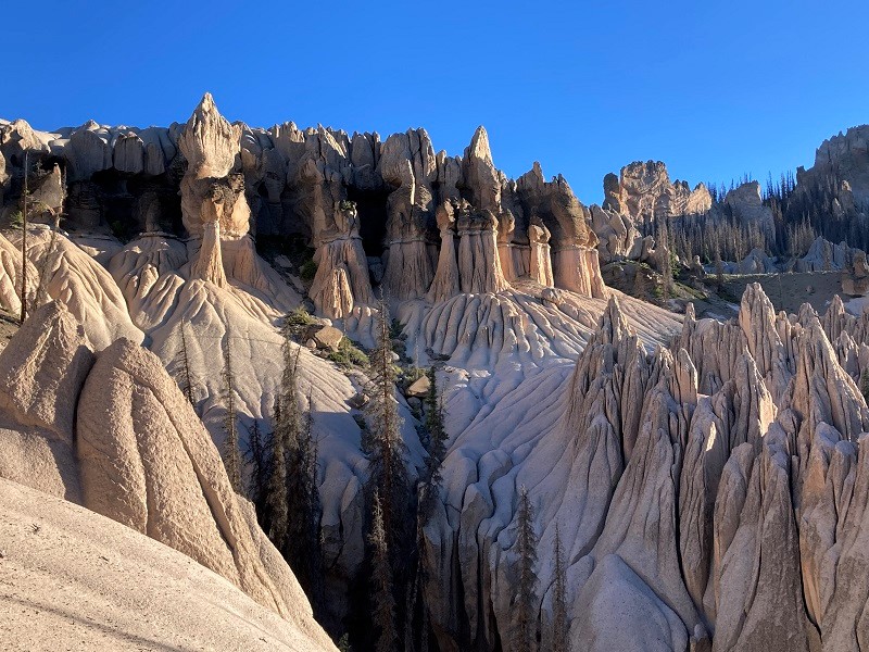
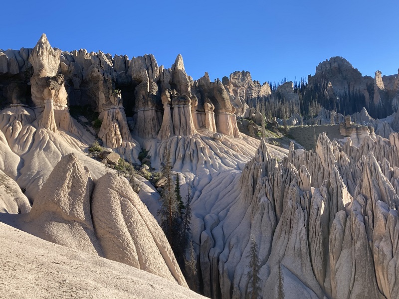
Back at camp that evening I was very tired but we sat and feasted our eyes on the sight of the formations in some late sunlight for quite a while before finally pulling away and going to bed about 730.
late sun on the rocks
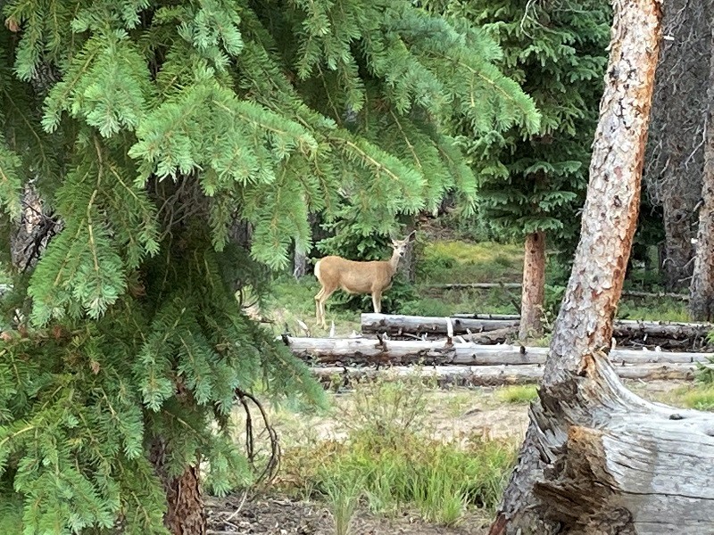
a visitor at camp
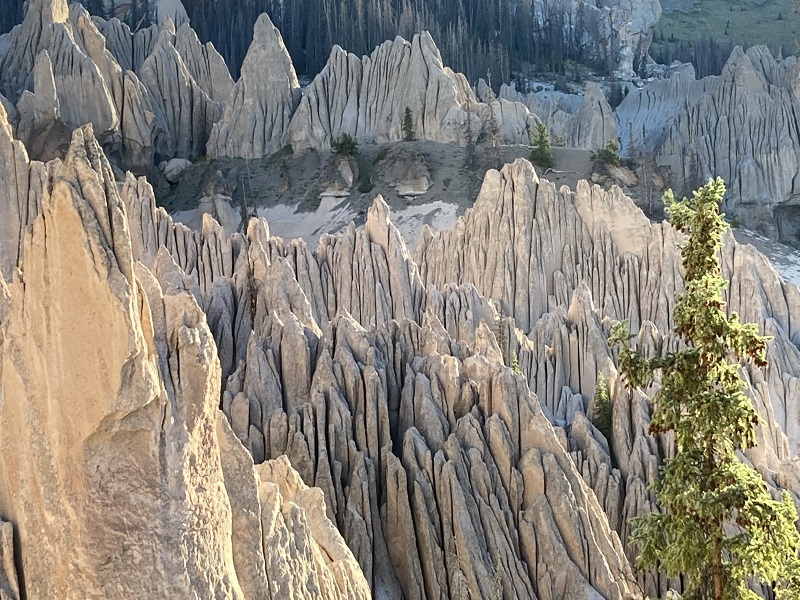
It was a chilly 38 degrees in the morning, hardly surprising at 11,400’, and we rose early before sunrise to watch the early light on the rock formations. It was truly the magnificent spectacle we hoped for, and then some. We had coffee and breakfast at the bench and enjoyed the unfolding play of color and light on the rocks for over an hour. It was an exhilarating display of Nature.
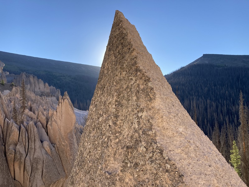

Three fellows who had camped down by the parking area hiked up to see the view and were amazed. One guy said he had wanted to see this for years, like me, and remarked that it looked like Utah. Rod and I left them and hiked back up to the upper viewing area where we went the evening before for more views and photos.
there were nice views from the slabs above too

Then we went back to the main viewpoint for a while again before packing up camp.
the light and colors gradually changed as the sun rose higher

After one last look we took off about 940 am and headed back down the trail. What a blessing to camp so close to the best view of the whole place, and spend a lot of time there both in the evening and in the morning grandeur!
We loaded up with water at the creek and about 10 am left the parking area and clipped a mile back on the road and then on the trail back to the trailhead. We got there about 125 pm and loaded up and headed for home. This was an unforgettably wonderful adventure.